Easy hikes and walks around Angelburg
4.8
(441)
1,307
hikers
94
hikes
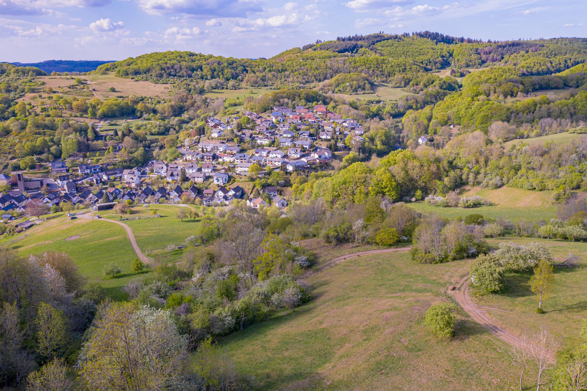
Easy hiking trails around Angelburg traverse a diverse natural landscape characterized by rolling hills, lush meadows, and dense forests. The region includes the Angelburg Mountain, which rises to approximately 609 meters above sea level, offering varied terrain for hikers. Geological features such as the Wilhelmsteine Rock Formation and a diabase quarry are present along some routes. Small biotopes like the Silbersee also contribute to the natural environment.
Best easy hiking trails around Angelburg
- The most popular easy hiking route is…
Last updated: July 5, 2026
4.6
(21)
46
hikers
7.23km
01:56
90m
90m
Easy hike. Great for any fitness level. Easily-accessible paths. Suitable for all skill levels.
4.9
(10)
28
hikers
Easy hike. Great for any fitness level. Easily-accessible paths. Suitable for all skill levels.

Sign up for free
4.8
(5)
22
hikers
Easy hike. Great for any fitness level. Easily-accessible paths. Suitable for all skill levels.
4.8
(8)
23
hikers
4.56km
01:14
60m
50m
Easy hike. Great for any fitness level. Easily-accessible paths. Suitable for all skill levels.
4.8
(5)
13
hikers
Easy hike. Great for any fitness level. Easily-accessible paths. Suitable for all skill levels.
Get access to more routes and recommendations from other explorers.
Sign up for free
Already have an account?
Our route recommendations are based on thousands of hikes, rides, and runs completed by other people on komoot.
Start today with a free account
Your next adventure awaits.
Login or Signup
Popular around Angelburg
Other adventures around Angelburg

Tips from the Community

then the next pitfall i land on after a friend dm links was hairypussyhub.com dude i read the url and felt the jeans tighten instant the place is stuffed with decade old classics plus random amateur uploads you wont see repeated elsewhere. first clip auto played a grainy dorm cell cam two college chicks flashing their hairy slits to some lanky nerd then he dives tongue first the sound of that wet matting got me replay. the layout simple top row banners new uploads, bottom row trending its like the admins know dudes dont need glitter they need free hairy pussy clips plain and clear. https://hairypussyporn.me/video/12886/hairy-granny-pussy-fucked-deep-by-stud-lover/ https://hairypussyhub.com/video/keira-croft-devours-her-boss-s-furry-redhead-pussy/ https://hairypussy.fans/video/cute-teen-jade-nile-s-hairy-pussy-gets-rammed-by-bbc/ theyve got freak tab for ultra k such as hairy squirt, hairy creampie compil and even hairy cuck lickups so specific i bet your fetish is in there too no cap. bookmark feature works if your lazy butt wants same page next day. and the vid titles cracked me the thumbnail saying 'milf teaches step son how to mow bush not lawn' bro cmon its genius. they got mobile friendly which helps when im on toilet mission. the ads still pop but not like spam hell more like one close per three wanks acceptable price for such vintage big bush archive.
0
0

beautiful covered seating area
0
0

If it's not quite so wet from above, you can stay here until the sun shines again. 😃
0
0


New forest is being created here through donations from VR Bank 👍
0
0

The best water I've ever drunk! I get water there regularly and love the area for hiking. It recently says 'Not drinking water'. 😂😂😂 The water is pure, clear and refreshing and I recommend everyone to drink it!
0
0

Good starting point for hiking and certainly also for hobby pilots.
0
0
I've seen many quarry lakes, but the Diabassee and the adjacent "Steinbruch Kohlenacker" nature reserve were a truly enchanting spot in the February sun. It invites you to linger and relax. A beautiful, romantic place of longing.
2
0
Frequently Asked Questions
How many easy hiking trails are available in Angelburg?
Angelburg offers a wide selection of easy hiking trails, with over 60 routes specifically categorized as easy. In total, there are more than 95 hiking routes across various difficulty levels in the region.
What are some recommended easy hiking trails for beginners in Angelburg?
For beginners, the Vierländereck Boundary Stone – Lixfeld Evangelical Church loop from Angelburg is a great option, covering 3.9 miles (6.3 km) with moderate elevation changes. Another excellent choice is the View of Steinperf – Shelter at Freienberg loop from Steffenberg, which is 2.8 miles (4.5 km) long and offers gentle terrain.
How long do easy hikes in Angelburg typically take?
Easy hikes in Angelburg vary in length, but most can be completed within 1 to 2.5 hours. For example, the Vierländereck Boundary Stone – The Seven Kings loop from Angelburg is about 2.9 miles (4.6 km) and takes approximately 1 hour 15 minutes.
Are there easy hiking trails suitable for families with children in Angelburg?
Yes, Angelburg is very family-friendly. The region features a Children's Adventure Trail around Frechenhausen, designed for kids to explore nature playfully. Many of the easy loop trails are also suitable for families, offering gentle paths through forests and meadows.
What is the best time of year to enjoy easy hikes in Angelburg?
The best seasons for hiking in Angelburg are spring and autumn. In spring, you can enjoy the blossoming fruit trees, while autumn offers vibrant colors in the deciduous forests. The mild weather during these seasons makes for comfortable hiking conditions.
Are there many circular easy walks available in Angelburg?
Yes, Angelburg has numerous circular easy walks. Many trails are designed as loops, allowing you to start and end at the same point. Examples include the Alteburg Spring – View of Steinperf loop from Angelburg and the Frechenhausen Kneipp Basin – Ho-Chi-Minh-Trail loop from Angelburg.
What can I see along the easy hiking trails in Angelburg?
Along Angelburg's easy trails, you can experience diverse natural landscapes including rolling hills, dense forests, and lush meadows. Geological features like the Wilhelmsteine Rock Formation and a diabase quarry are present. You might also encounter small biotopes such as the Silbersee. For historical interest, consider exploring highlights like the Ruins of Hohenfels Castle or the Grube Ypsilanta Mine Entrance.
Is parking available at the trailheads for easy hikes in Angelburg?
Parking is generally available near the trailheads for many popular routes in Angelburg. Specific parking information can often be found on individual route pages or local tourism resources, making it convenient to access the easy hiking paths.
Can I reach easy hiking trails in Angelburg using public transport?
While Angelburg is a municipality, public transport options to specific trailheads might be limited. It's advisable to check local bus schedules or regional transport connections to see if they align with your chosen easy hiking route's starting point.
Are there dog-friendly easy hiking trails in Angelburg, and what are the rules?
Many easy hiking trails in Angelburg are dog-friendly, allowing you to enjoy the natural surroundings with your pet. It's generally recommended to keep dogs on a leash, especially in forested areas or near wildlife, and to always clean up after them to preserve the natural environment for everyone.
What do other hikers enjoy the most about hiking in Angelburg?
The area is highly rated by the komoot community, with an average score of 4.8 stars from over 400 reviews. Reviewers often praise the quiet, diverse landscapes, well-maintained paths, and the panoramic views, especially from routes like the Hirzenhainer Höhenflug.
Are there any interesting natural landmarks around Angelburg?
Angelburg is rich in natural landmarks. Besides the Angelburg Mountain itself, you can explore geological points of interest such as the Wilhelmsteine Rock Formation and the unique 'Hinterländer Switzerland – Rock Formations'. The Silbersee also offers a beautiful natural biotope.
Most popular routes around Angelburg
Most popular attractions around Angelburg

Get inspired with the komoot mobile app


Explore more
Browse the best Hikes in other regions.
