Easy hikes and walks in Forest Of Bowland Aonb
4.5
(3996)
32,588
hikers
586
hikes
Easy hiking trails in Forest Of Bowland Aonb traverse a diverse landscape of gritstone fells, peat moorland, and deeply incised valleys. The region is characterized by expansive uplands, often covered in heather and blanket bog, contrasting with ancient woodlands along rivers like the Hodder and Ribble. Traditional stone-built farms and villages dot the lower slopes, adding to the area's character. This Area of Outstanding Natural Beauty offers varied terrain for hikers seeking accessible routes.
Best easy hiking trails in Forest Of Bowland Aonb
- The most popular easy hiking route is The Ribble Valley Jubilee Trail, a 3.0 miles (4.8 km) trail that takes 1 hour 18 minutes to complete. This route offers gentle gradients through the scenic Ribble Valley.
- Another top favourite among local hikers is Longridge Fell loop – Forest of Bowland, an easy 3.6 miles (5.8 km) path. This loop provides views over the surrounding fells and countryside.
- Local hikers also love the Pendle Sculpture Trail Loop from Barley, a 3.9 miles (6.3 km) trail leading through woodland and open fields, often completed in about 1 hour 49 minutes.
- Hiking in Forest Of Bowland Aonb is defined by gritstone fells, peat moorland, and ancient woodlands. The network offers options for different ability levels, with many easy trails suitable for all.
- The routes in Forest Of Bowland Aonb are highly rated by the komoot community with an average score of 4.5 stars from more than 3,400 reviews. More than 30,000 hikers have used komoot to explore Forest Of Bowland Aonb's varied terrain.
Last updated: July 7, 2026
4.6
(13)
65
hikers
4.76km
01:18
70m
70m
Embark on the Ribble Valley Jubilee Trail, an easy hiking route that guides you through the gentle rolling countryside and wooded river valleys of the Forest of Bowland AONB. This picturesque loop covers 3.0 miles (4.8 km) with a modest elevation gain of 219 feet (67 metres), making it perfect for a relaxed outing. You can expect to complete the hike in about 1 hour and 17 minutes, enjoying a mix of woodland paths and open fields. Keep an eye out for St Peter and St Paul's Church and scenic views of the River Ribble as you go.
Planning your visit to this section of the Ribble Valley Jubilee Trail is straightforward. The route is generally accessible, and you won't encounter any specific warnings regarding snow, road closures, or permits. Parking is available in the local area, providing a convenient starting point for your hike. To ensure smooth navigation, digital mapping is a helpful tool to have on hand. This easy trail is suitable for most times of day, offering a pleasant experience whenever you choose to go.
This trail offers a wonderful opportunity to immerse yourself in the natural beauty of the Ribble Valley, an area renowned for its characteristic gentle rolling countryside. As part of the Forest of Bowland Area of Outstanding Natural Beauty, the route highlights the region's charming blend of woodlands and open fields. It provides a taste of the serene landscapes that make this part of England so appealing for outdoor activities.
4.5
(10)
46
hikers
5.84km
01:37
100m
100m
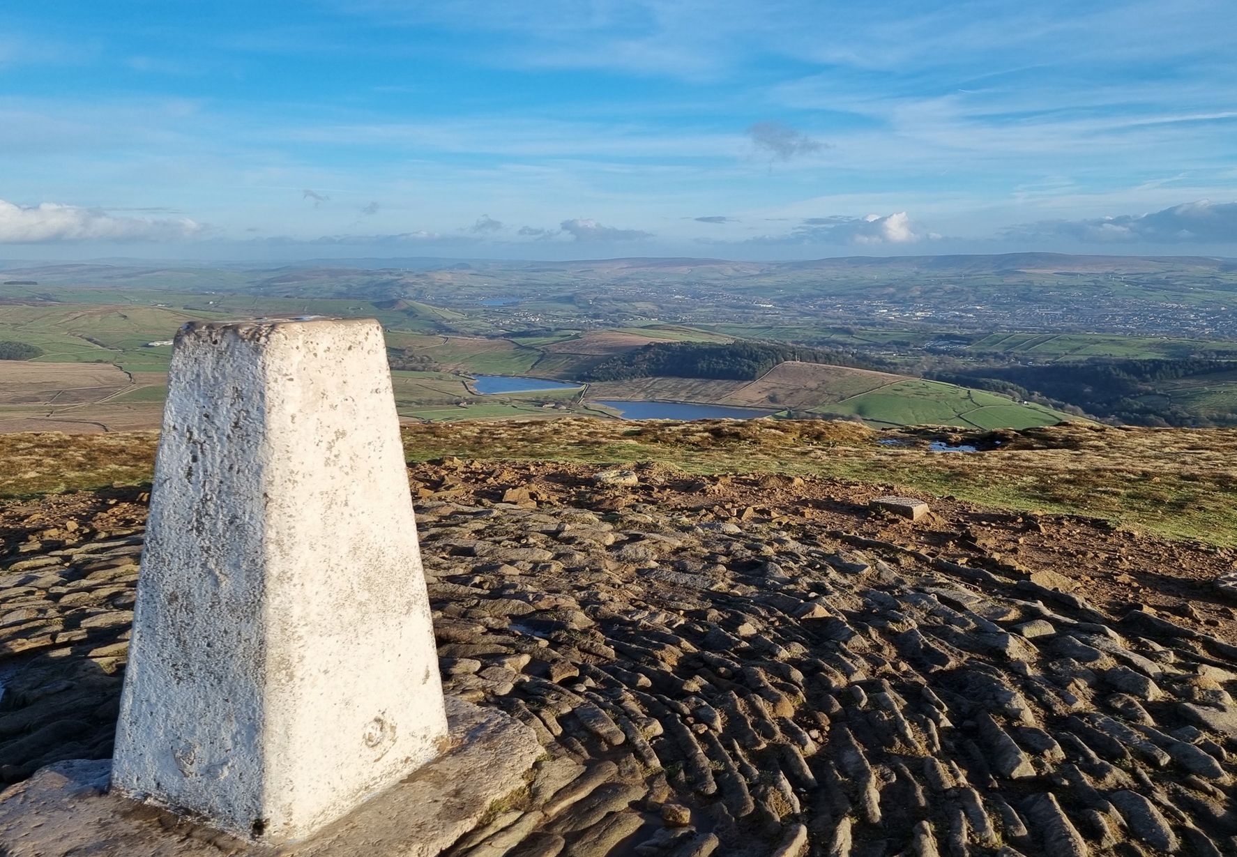
Embark on an easy 3.6-mile (5.8 km) hike around the Longridge Fell loop, a route that typically takes about 1 hour and 36 minutes to complete. With an elevation gain of 321 feet (98 metres), this trail offers a rewarding experience across varied terrain, including forests, open hillsides, and fields. From the trig pillar at the summit, you can enjoy expansive panoramic views that, on clear days, stretch to the Fylde Coast, the Yorkshire Dales, Pendle Hill, and even as far as the Lake District and Snowdonia. You will traverse well-established footpaths and tracks, passing through areas cloaked in conifers like Larch and Pine, with some sections revealing disused quarry sites.
While many routes on Longridge Fell are suitable for all skill levels and feature easily accessible paths, it is wise to prepare for potentially muddy and boggy conditions, especially in wooded areas or after wet weather. The fell is criss-crossed with numerous tracks, footpaths, and lanes, allowing you to customize your route if you wish to explore further. This particular loop offers a manageable challenge for most hikers, providing a pleasant outing without requiring extensive fitness or specialized gear, though sturdy footwear is always recommended.
Longridge Fell holds the unique distinction of being Britain's most southerly named fell, standing alone amidst lower land much like Pendle Hill, which contributes to its exceptional views. Its distinctive "cuesta" geological formation, characterized by a steep northern flank and gentler southern slopes, also makes it a popular spot for hang-gliders and paragliders when conditions are right. The presence of a trig point at its summit is a notable feature for hikers, marking a high point with far-reaching vistas across the landscape.

Sign up for free
4.4
(8)
45
hikers
6.32km
01:50
150m
160m
Embark on an easy hike along the Pendle Sculpture Trail Loop from Barley, a 3.9-mile (6.3 km) route that takes about 1 hour and 49 minutes to complete. You will gain 504 feet (154 metres) in elevation as you explore the picturesque landscape. The trail winds through Aitken Wood, where you will discover unique sculptures and ceramic plaques hidden among the trees. Enjoy views of the scenic Lower and Upper Black Moss reservoirs, with Pendle Hill visible in the distance. This circular path offers a gentle journey through art and nature.
Starting your adventure from the charming village of Barley is convenient, as parking is readily available there. This easy route is suitable for various fitness levels, making it a great choice for families. Be prepared for potentially muddy sections, especially after rain, so wearing stout footwear is a good idea. The path offers a pleasant outdoor experience throughout much of the year. Consider visiting during drier months for the most comfortable walking conditions.
This trail offers a unique blend of art, history, and the natural beauty of the Forest of Bowland AONB. The approximately 25 sculptures and ten ceramic plaques you encounter are inspired by the infamous Pendle Witches and local folklore. This artistic element sets the route apart, providing a cultural layer to your outdoor activity. It's a notable way to experience the region's heritage while enjoying a refreshing walk.
3.3
(6)
9
hikers
4.27km
01:06
20m
30m
Embark on the Dunsop Bridge & River Hodder loop for an easy 2.7-mile (4.3 km) hike through the tranquil Forest of Bowland. This pleasant route features picturesque waterside paths along the River Hodder, offering views of sheep-filled pastures and distant fells. You'll encounter traditional stone-built farms and drystone walls as you follow the generally flat terrain, with only 80 feet (24 metres) of elevation gain. The trail is largely accessible, taking about 1 hour and 6 minutes to complete, and includes charming features like a Victorian Iron Bridge over the river. Expect a peaceful atmosphere perfect for a leisurely stroll.
The village of Dunsop Bridge serves as an ideal starting and ending point for your hike. It is known for its easily accessible footpaths and tracks, making it suitable for all skill levels. You can find amenities like the Puddleducks Tea Room in the village, which is a popular spot for walkers. While the route is generally flat, be aware that some field sections might be muddy, especially after rain.
This area is notable for its connection to the "Centre of Britain," as certified by the Ordnance Survey, adding a unique historical context to your walk. As you explore, you might spot a large pipe bridge or even some flimsy-looking suspension bridges, adding character to the landscape. The well-maintained stiles and footpaths, particularly on Duchy of Lancaster land, ensure a pleasant experience as you enjoy the verdant river valleys and ancient woodlands.
4.3
(3)
14
hikers
4.99km
01:21
60m
60m
Embark on an easy hike around the Abbeystead Reservoir loop, a 3.1-mile (5.0 km) route with a gentle 204 feet (62 metres) of elevation gain, taking about 1 hour and 20 minutes to complete. This trail offers picturesque views of the reservoir, the River Wyre, and the surrounding Forest of Bowland countryside. You will discover the beautiful, horseshoe-shaped weir, which creates a continuous cascade of water, especially vibrant with wildflowers in spring or rich foliage in autumn. While the paths are generally accessible, be aware that sections through Hinberry Wood can become muddy after rainfall.
This easy route is suitable for most fitness levels, making it a great choice if you are looking for a relaxing outdoor experience. The trail uses a variety of surfaces, including paved sections, natural paths, and gravel, ensuring a varied walk. Since the trail can get muddy in places, especially after rain, wearing appropriate footwear will make your visit more comfortable. Plan your visit to enjoy the tranquil atmosphere and natural sounds of the area.
The Abbeystead Reservoir itself has a rich history, constructed in 1855 to power downstream mills along the River Wyre. The impressive weir, designed by James Mansergh, is a notable example of Edwardian engineering. As you follow the loop, you will pass through Hinberry Wood, known for its birdlife, and the immaculate estate village of Abbeystead. Portions of the route also follow the well-marked Wyre Way footpath, offering a glimpse into this longer regional trail.
Get access to more routes and recommendations from other explorers.
Sign up for free
Already have an account?
Our route recommendations are based on thousands of hikes, rides, and runs completed by other people on komoot.
Start today with a free account
Your next adventure awaits.
Login or Signup
Popular around Forest Of Bowland Aonb


Other adventures in Forest Of Bowland Aonb


Tips from the Community

TP4535 - Longridge Fell | Trig Point | TrigpointingUK | TrigpointingUK https://share.google/z9V3FwjJe70qzF6sy
0
0

This is marked as an intermediate walk which, in the main is accurate. The walk starts with a steep incline, well covered in the walk description. What is less documented is the subsequent decent which can be challenging for the novice/ intermediate walker. The path down is narrow and the potential fall severe. Please be aware. Other than that, the walk offers wonderful views after the initial climb and relatively sedate walk after decent.
0
0


Lovely place, easy to park there. Also quite good place to finish the hike as plenty of places to get food and drinks.
0
0

I believe the bridge was originally an aqueduct.
2
0
The actual centre of the British Isles is roughly 4 miles from the village but it is a pretty village to visit on the banks of the River Hodder.
0
1
Friendly and nice cafe. Very helpful with directions etc…
1
0
Frequently Asked Questions
How many easy hiking trails are available in the Forest of Bowland AONB?
There are over 250 easy hiking trails in the Forest of Bowland AONB, offering a wide variety of landscapes from riverside paths to gentle fells. These routes are suitable for most abilities.
What kind of terrain can I expect on easy hikes in the Forest of Bowland AONB?
Easy hikes in the Forest of Bowland AONB feature diverse terrain, including gentle paths through ancient woodlands, serene riverside strolls along the Hodder and Ribble, and routes across lower gritstone fells and peat moorland. You'll also encounter traditional stone-built farms and villages.
Are there any easy circular walks in the Forest of Bowland AONB?
Yes, many easy routes in the Forest of Bowland AONB are circular. For example, the Longridge Fell loop – Forest of Bowland offers views over the surrounding fells, and the Dunsop Bridge & River Hodder loop provides a pleasant riverside experience.
What can I see along the easy hiking trails in the Forest of Bowland AONB?
Along easy hiking trails, you can discover various natural and man-made attractions. Highlights include several reservoirs like Lower Ogden Reservoir and Abbeystead Reservoir Dam, as well as picturesque villages and ancient woodlands. The Pendle Sculpture Trail Loop from Barley also offers unique artistic installations.
Are easy hikes in the Forest of Bowland AONB suitable for families?
Absolutely. Many easy hikes are ideal for families, featuring gentle gradients and shorter distances. Routes like The Ribble Valley Jubilee Trail are perfect for a family outing, offering accessible paths through scenic areas.
Can I bring my dog on easy hikes in the Forest of Bowland AONB?
Yes, many easy trails in the Forest of Bowland AONB are dog-friendly. However, please keep dogs on a lead, especially when passing through farmland with livestock or during bird nesting seasons in moorland areas, to protect wildlife and farm animals.
What is the best time of year to go on easy hikes in the Forest of Bowland AONB?
The Forest of Bowland AONB is beautiful year-round. Spring brings bluebells to ancient woodlands, while summer offers pleasant weather for open fells. Autumn showcases vibrant heather and foliage, and winter can provide crisp, clear views, though some paths may be muddy or icy. Always check local conditions before heading out.
Where can I find parking for easy hikes in the Forest of Bowland AONB?
Many villages and popular trailheads within the Forest of Bowland AONB offer designated parking areas. Villages like Slaidburn, Chipping, and Dunsop Bridge are good starting points with parking facilities, often near local amenities.
Are there any easy routes that pass by water features like lakes or rivers?
Yes, the region is rich in water features. The Dunsop Bridge & River Hodder loop follows the scenic River Hodder, and the Abbeystead Reservoir loop – Forest of Bowland offers pleasant walks around the reservoir.
What do other hikers enjoy most about easy hiking in the Forest of Bowland AONB?
The area is highly rated by the komoot community, with an average score of 4.5 stars from over 3,500 reviews. Hikers often praise the tranquil, unspoiled landscapes, the variety of easy-to-follow paths, and the opportunity to experience diverse natural features like gritstone fells and ancient woodlands.
Are there any cafes or pubs near easy hiking trails in the Forest of Bowland AONB?
Yes, many easy trails start or pass through picturesque villages like Slaidburn, Chipping, and Dunsop Bridge, which offer charming pubs and cafes. These provide excellent spots for refreshments before or after your hike.
What wildlife might I spot on an easy hike in the Forest of Bowland AONB?
The Forest of Bowland is a significant area for wildlife, particularly birds. On easy hikes, especially in moorland or woodland areas, you might spot various bird species like curlew, lapwing, or even birds of prey. The blanket bogs also support rare plants.
Most popular routes in Forest Of Bowland Aonb
Most popular attractions in Forest Of Bowland Aonb

Get inspired with the komoot mobile app


Explore more
Browse the best Hikes in other regions.
