
Routes

Planner

Features

Updates

App

Login or Signup

Get the App

Login or Signup

Routes
Hikes
United States
Michigan
Cheboygan County

Mackinaw State Forest - Gaylord Unit

Routes
Hikes
United States
Michigan
Cheboygan County

Mackinaw State Forest - Gaylord Unit

Easy hikes and walks in Mackinaw State Forest - Gaylord Unit

4.8

(20)

282

hikers

71

hikes

Easy hiking trails in Mackinaw State Forest - Gaylord Unit traverse a landscape characterized by diverse ecosystems, including dense hardwood groves, tranquil lakes, and open meadows. The region features rolling hills and valleys, notably the scenic Sturgeon River valley. Hikers can explore varied forest terrain, cedar swamps, and areas with unique sinkhole lakes.

Best easy hiking trails in Mackinaw State Forest - Gaylord Unit

  • The most popular easy hiking route is Deadman's Hill Trail, a 3.0 miles (4.9 km) trail that takes 1 hour 25 minutes to complete. This route offers panoramic views of the Jordan River Valley.
  • Another top favourite among local hikers is McCune Nature Preserve Trail, an easy 3.3 miles (5.3 km) path. This trail winds through diverse forests, meadows, and cedar swamps, featuring Minnehaha Creek.
  • Local hikers also love the Pine Baron Pathway: Highline, Relic Pine, and Twin Hemlock Loop, a 4.2 miles (6.8 km) trail leading through varied forest terrain, often completed in about 1 hour 43 minutes.
  • Hiking in Mackinaw State Forest - Gaylord Unit is defined by diverse forest ecosystems, rolling hills, and river valleys. The network offers options for different ability levels, with a focus on easy hiking trails.
  • The routes in Mackinaw State Forest - Gaylord Unit are highly rated by the komoot community with an average score of 4.8 stars from over 10 reviews. More than 300 hikers have used komoot to explore Mackinaw State Forest - Gaylord Unit's varied terrain.

Last updated: July 7, 2026

4.3

(3)

18

hikers

#1.

Deadman's Hill Trail

4.90km

01:26

120m

120m

The Deadman's Hill Trail offers a varied and scenic experience, guiding you through hardwood forests and along ridges with sections of packed dirt and pine needles. You'll be treated to spectacular panoramic views of the Jordan River Valley, with the river's sparkling waters visible below. The route also includes a visit to an observation deck at a River Study Area, where a spring feeds the clear river.

This easy 3.0 miles (4.9 km) loop involves an initial downhill section followed by a gradual incline on the return, with a total elevation gain of 380 feet (116 metres), taking about 1 hours and 25 minutes to complete. The trailhead is at the top of Deadman's Hill, where vault toilets are available, and dogs are welcome on a leash. It's particularly popular in autumn for its vibrant fall colors.

Deadman's Hill holds a poignant history, named after a logger who tragically died here in 1910, a legend recounted by a sign at the hill. It's one of the most beloved viewing points in the Lower Peninsula and serves as a trailhead for both this loop and the longer Jordan River Pathway.

Navigate with device

Send to Phone

Save

Easy

5.0

(1)

5

hikers

The McCune Nature Preserve Trail offers a delightful journey through varied ecosystems, making it a top choice for a relaxing outdoor experience in Emmet County. You'll meander through vibrant hardwood forests, past impressive red pine plantations, and alongside the crystal-clear Minnehaha Creek, which gracefully bisects the preserve. The paths are generally flat and well-maintained, providing a serene backdrop for spotting local wildlife like deer and various bird species.

Accessing the preserve is simple, with well-marked trails that ensure easy navigation for all visitors. This family-friendly and dog-friendly route is suitable for year-round enjoyment; in winter, the ungroomed trails become an inviting space for snowshoeing and cross-country skiing. With a gentle 120 feet (37 metres) of elevation gain over 3.3 miles (5.3 km), expect to spend about 1 hour and 22 minutes on this easy hike.

What truly sets this trail apart is its ecological diversity, showcasing everything from lush cedar swamps to open meadows, all centered around the pristine, spring-fed Minnehaha Creek. This extensive frontage along the creek, known for its brook trout fishery, provides a unique natural feature. The preserve's commitment to well-maintained trails and its welcoming atmosphere make it a standout option for a peaceful immersion in nature.

Easy
guide_signup
Let us show you the way with the komoot mobile app
With a free komoot account, you can easily find, customize, and navigate endless outdoor adventures.

Sign up for free

The Pine Baron Pathway: Highline, Relic Pine, and Twin Hemlock Loop offers a serene journey through a dense forest near Gaylord, Michigan. You'll meander through a beautiful mix of hardwoods and pines, with the Twin Hemlock Loop providing a particularly scenic section winding through mature hardwood trees. The terrain is mostly gently rolling to flat, making for a very comfortable and easy 4.2-mile (6.8 km) hike that takes about 1 hour and 43 minutes, with only 54 feet (17 metres) of elevation gain.

Planning your visit is straightforward, as the trailhead is less than three miles from Gaylord and offers ample parking. The entire Pine Baron Pathway system is exceptionally well-marked, with clear maps at every intersection and signs directing you back to the parking area, so you can relax and enjoy the scenery. Benches are conveniently placed along the loops for rests or trailside picnics.

Originally developed in 1978 as a cross-country ski trail, this pathway remains popular for winter activities but transforms into a delightful hiking and mountain biking spot in warmer months. Its easy difficulty and proximity to Gaylord make it a fantastic option for families or anyone seeking a quick, accessible nature outing. Keep an eye out for abundant wildlife as you explore the peaceful wooded areas.

Easy

2

hikers

6.75km

01:48

70m

70m

The Wildwood Hills Pathway offers a delightful escape into Northern Michigan's upland forests, winding through heavily wooded ridges and gentle rolling terrain. You'll find yourself on wide, well-maintained paths that often follow abandoned two-tracks and old railroad beds, making for an easy and pleasant stroll. Keep an eye out for wildlife as you pass through the serene forest, and enjoy the quiet beauty of this natural setting.

This easy 4.2-mile (6.8 km) hiking route involves a modest 224 feet (68 metres) of elevation gain and typically takes about 1 hour and 47 minutes to complete. The pathway is part of a larger multi-use system, popular with hikers, mountain bikers, and cross-country skiers. While specific parking for this route isn't detailed, the overall system is well-mapped, ensuring easy navigation.

Originally developed in the 1970s for Nordic skiers, the Wildwood Hills Pathway system is a local gem along the hilly border of Cheboygan and Emmet Counties. It's known for its extensive loop options and the opportunity for dispersed camping, making it a versatile choice for outdoor enthusiasts. The trail's accessibility and varied terrain make it a great option for beginner hiking or a relaxed day out.

Easy

This section of the North Country Trail, from Kipp Road to Valley Road, offers a unique glimpse into the resilience of nature and trail maintenance efforts. While currently rerouted onto existing roads and two-tracks due to extensive ice storm damage, you'll still find yourself immersed in Michigan's mixed forests and pine plantations. It's an easy 3.4-mile (5.4 km) hike with 514 feet (157 metres) of elevation gain, taking about 1 hour and 31 minutes, making it a straightforward option for a quick outdoor escape.

When planning your visit, be aware that this reroute is temporary and expected to last until at least late spring or early summer of 2026. This means the experience involves more road walking than the original, more challenging singletrack. Parking is generally available near the Kipp Road trailhead, but checking for any updated conditions or specific North Country Trail Kipp Road trailhead parking information before you go is always a good idea.

Historically, this segment was known for its challenging

Easy
Sign up for free to see 67 more hikes in Mackinaw State Forest - Gaylord Unit.

Get access to more routes and recommendations from other explorers.

Sign up for free

Already have an account?

Our route recommendations are based on thousands of hikes, rides, and runs completed by other people on komoot.

Start today with a free account

Your next adventure awaits.

Login or Signup

Popular around Mackinaw State Forest - Gaylord Unit
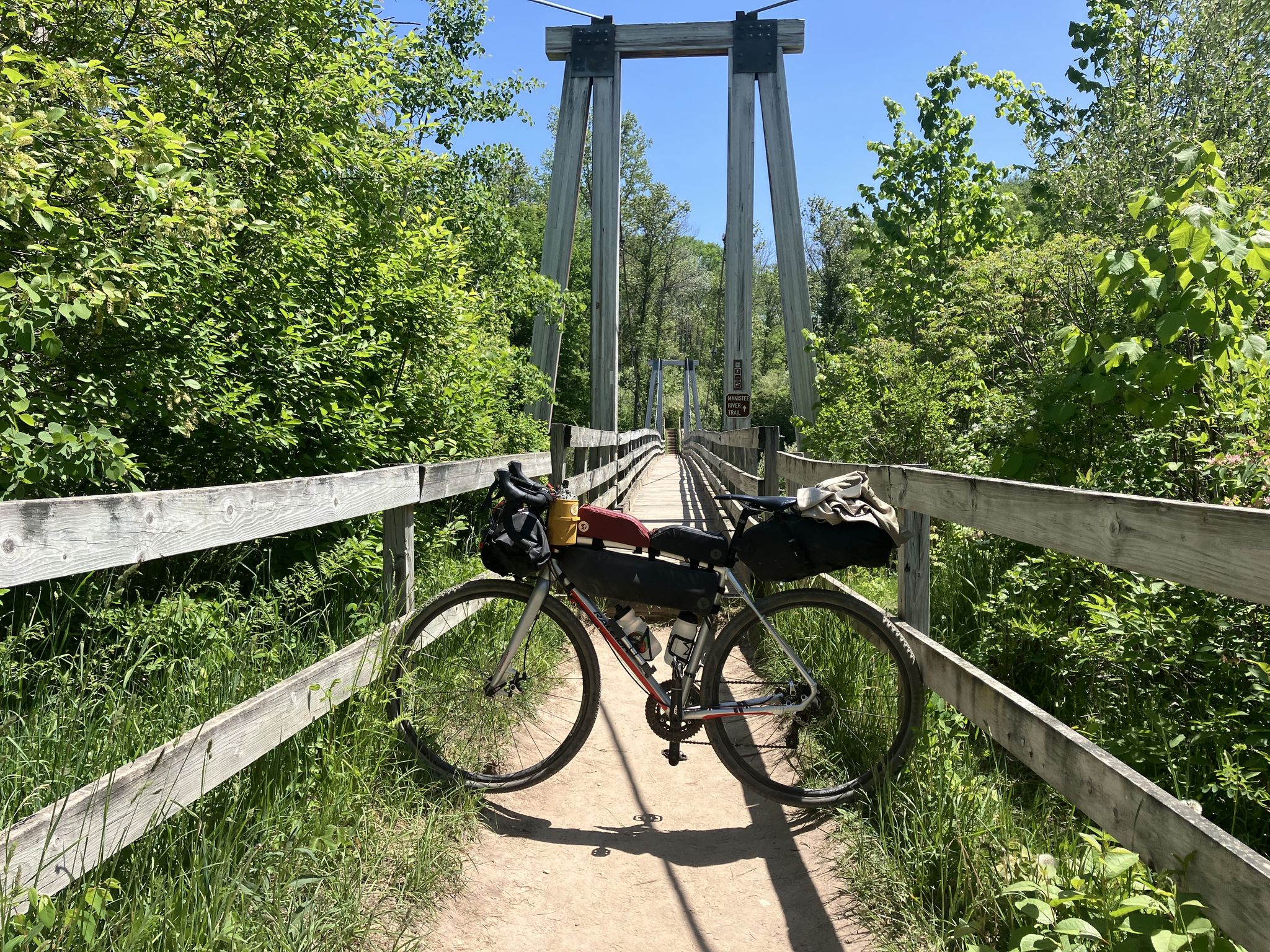
Bikepacking the Manistee River – A Reckoning on Returning

Other adventures in Mackinaw State Forest - Gaylord Unit

Bikepacking the Manistee River – A Reckoning on Returning

Mountain Biking Collection by

Matt Medendorp

Frequently Asked Questions

How many easy hiking trails are available in Mackinaw State Forest - Gaylord Unit?

The Mackinaw State Forest - Gaylord Unit offers a wide selection of easy hiking trails. There are over 50 easy routes available, making it a great destination for relaxed walks and beginner-friendly adventures.

What kind of landscapes can I expect on easy hikes in this region?

Easy hikes in the Mackinaw State Forest - Gaylord Unit traverse diverse landscapes. You'll find dense hardwood groves, tranquil lakes, and open meadows. The region is characterized by rolling hills and valleys, including the scenic Sturgeon River valley, and features varied forest terrain, cedar swamps, and unique sinkhole lakes.

Are there any easy loop trails in the Mackinaw State Forest - Gaylord Unit?

Yes, there are several easy loop trails. For example, the Deadman's Hill Trail is a 3.0-mile loop offering panoramic views. Another option is the Pine Baron Pathway: Highline, Relic Pine, and Twin Hemlock Loop, which is 4.2 miles and leads through varied forest terrain.

Are the easy hiking trails in Mackinaw State Forest - Gaylord Unit suitable for families with children?

Many of the easy hiking trails are well-suited for families. Paths like the McCune Nature Preserve Trail, which winds through diverse forests and meadows, offer gentle terrain and engaging natural features for all ages to enjoy.

What are the best seasons for easy hiking in the Mackinaw State Forest - Gaylord Unit?

The Mackinaw State Forest - Gaylord Unit is beautiful year-round. Spring brings fresh greenery, while summer offers lush forests. Autumn is particularly stunning, with spots like Deadman's Hill providing panoramic views of vibrant fall foliage. Even winter can be enjoyed on suitable trails, offering a serene, snow-covered landscape.

Can I bring my dog on the easy hiking trails?

Generally, dogs are welcome on trails in the Mackinaw State Forest - Gaylord Unit, but it's always best to check specific trail regulations before you go. Ensure your dog is on a leash and that you clean up after them to preserve the natural environment for everyone.

Are there any scenic viewpoints along the easy trails?

Yes, one of the most notable scenic viewpoints is Deadman's Hill. The Deadman's Hill Trail offers panoramic views of the Jordan River Valley, especially spectacular during the autumn foliage season.

What kind of wildlife might I encounter on an easy hike?

The forest is home to a rich diversity of wildlife. Hikers might spot white-tailed deer, wild turkey, and various bird species. The region is also known for its free-ranging elk herds, offering unique viewing opportunities.

What do other hikers say about the easy trails in Mackinaw State Forest - Gaylord Unit?

The easy trails in Mackinaw State Forest - Gaylord Unit are highly rated by the komoot community, with an average score of 4.8 stars. Hikers often praise the diverse ecosystems, well-maintained paths, and the serene escape offered by the forest.

Are there any trails that feature water elements like creeks or lakes?

Yes, the region features tranquil lakes and creeks. The McCune Nature Preserve Trail, for instance, winds through areas featuring Minnehaha Creek. You can also find fascinating sinkhole lakes with clear, turquoise waters within the forest.

What is the typical duration for an easy hike in this area?

The duration for easy hikes varies, but many popular routes can be completed within a couple of hours. For example, the Deadman's Hill Trail typically takes about 1 hour 25 minutes, while the Pine Baron Pathway: Highline, Relic Pine, and Twin Hemlock Loop takes around 1 hour 43 minutes.

Most popular routes in Mackinaw State Forest - Gaylord Unit

Hiking in Mackinaw State Forest - Gaylord Unit

Store rating

Get inspired with the komoot mobile app

With a free komoot account, you can easily find, customize, and navigate endless outdoor adventures.

or

Join komoot Now

Store rating

Nearby adventure guides

Things to Do around Ponshewaing

Things to Do around Brutus

background

Get ready to conquer new peaks

Sign up for Free

Explore
RoutesRoute plannerFeaturesHikesMTB TrailsRoad cycling routesBikepackingSitemap
Download the app
Follow Us on Socials

© komoot GmbH

Privacy Policy


