Easy hikes and walks in Tioga State Forest
4.7
(6)
155
hikers
26
hikes
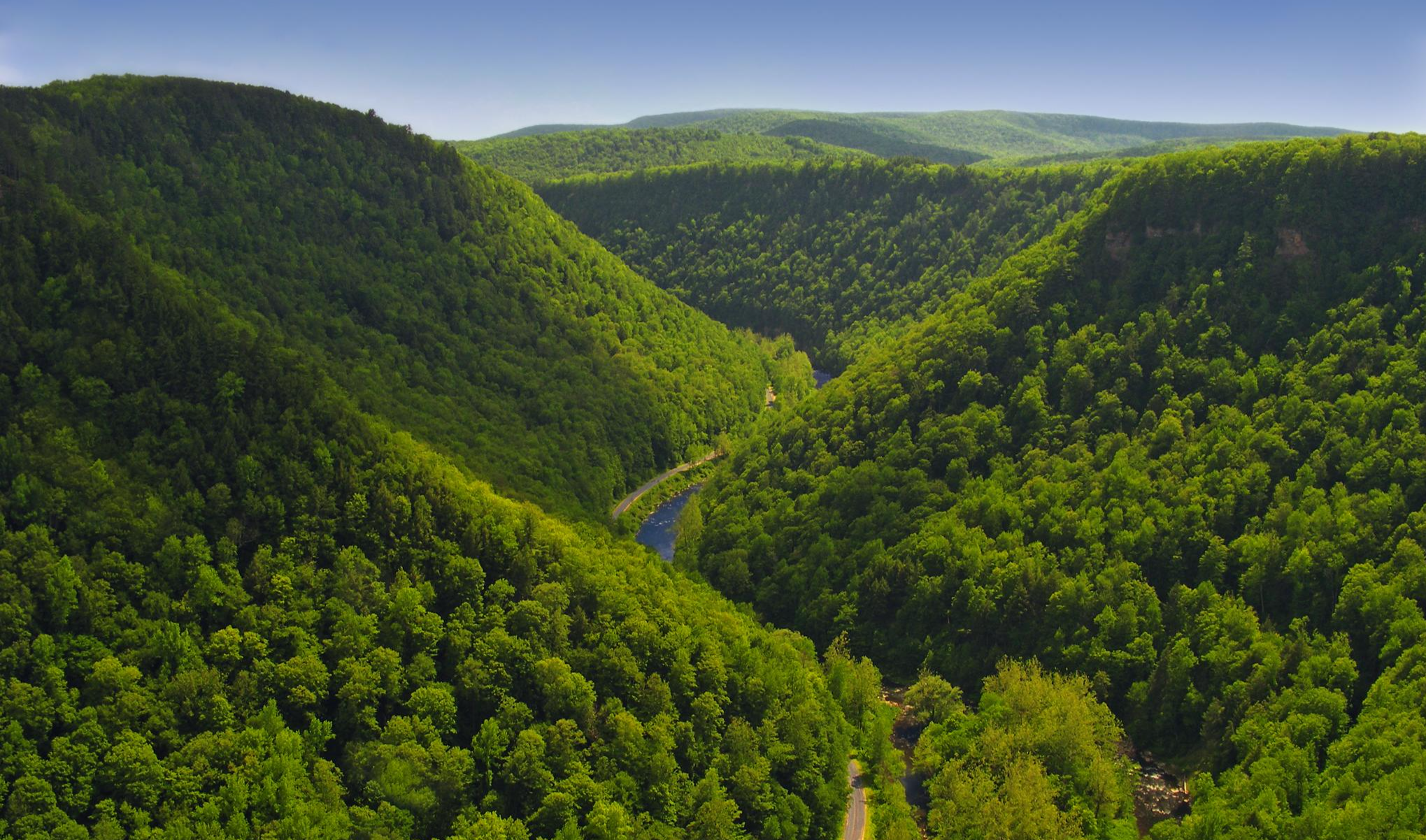
Easy hiking trails in Tioga State Forest traverse a landscape characterized by forested rolling hills, deep gorges, and numerous stream valleys. This extensive area in north-central Pennsylvania offers diverse ecosystems for outdoor exploration. The terrain includes features such as the Pine Creek Gorge, often referred to as Pennsylvania's Grand Canyon, with depths up to 1,000 feet.
Best easy hiking trails in Tioga State Forest
- The most popular easy hiking route is Barbour Rock via West Rim Trail, a 2.5…
Last updated: July 7, 2026
1
hikers
4.09km
01:13
180m
20m
Easy hike. Great for any fitness level. Easily-accessible paths. Suitable for all skill levels.
1.02km
00:17
0m
30m
Easy hike. Great for any fitness level. Easily-accessible paths. Suitable for all skill levels.

Sign up for free
1.06km
00:24
100m
0m
Easy hike. Great for any fitness level. Easily-accessible paths. Suitable for all skill levels.
975m
00:16
20m
20m
Easy hike. Great for any fitness level. Easily-accessible paths. Suitable for all skill levels.
1
hikers
5.28km
01:47
250m
260m
Easy hike. Great for any fitness level. Easily-accessible paths. Suitable for all skill levels.
Get access to more routes and recommendations from other explorers.
Sign up for free
Already have an account?
Our route recommendations are based on thousands of hikes, rides, and runs completed by other people on komoot.
Start today with a free account
Your next adventure awaits.
Login or Signup
Popular around Tioga State Forest
Other adventures in Tioga State Forest

Tips from the Community

Gillespie Point is a popular hiking destination. The trail leading up to it is part of the Mid-State Trail, so follow the orange blaze. This will take you to a scenic overlook with panoramic views of the surrounding area, including Pine Creek and the canyon.
0
0

Great bike and hiking trails. with a great view of the mountains. hier is a informations house and a bathroom to find. from here you can start your hiking or cycling adventure .
0
0
it is a beautiful atmosphere to see the canyon from below.
0
0
Frequently Asked Questions
How many easy hiking trails are available in Tioga State Forest?
Tioga State Forest offers a variety of trails, with over 10 designated as easy. In total, there are 26 routes available for hiking, catering to various ability levels.
What kind of terrain can I expect on easy hikes in Tioga State Forest?
Easy hikes in Tioga State Forest typically traverse forested rolling hills and stream valleys. While generally less strenuous, some paths may include gentle inclines or uneven surfaces. The region is known for its rugged topography, even on easier routes, offering a true remote outdoor experience.
Are there any easy trails with scenic viewpoints in Tioga State Forest?
Yes, several easy trails lead to stunning viewpoints. For instance, the Barbour Rock via West Rim Trail and the shorter Barbour Rock Trail both provide direct access to the accessible Barbour Rock overlook, offering panoramic views of the iconic Pine Creek Gorge, often called Pennsylvania's Grand Canyon.
Are easy hiking trails in Tioga State Forest suitable for families with children?
Yes, many easy trails are suitable for families. Routes like the Barbour Rock Trail are short and offer rewarding views, making them ideal for younger hikers. The diverse landscape ensures there are accessible options for various family activity levels.
Can I bring my dog on the easy hiking trails in Tioga State Forest?
Tioga State Forest is generally dog-friendly, but it's always best to check specific trail regulations. Most state forest trails allow leashed dogs. Ensure your pet is well-behaved and that you clean up after them to preserve the natural environment.
What is the best time of year to enjoy easy hikes in Tioga State Forest?
Spring, summer, and fall all offer unique experiences for easy hikes. Spring brings wildflowers and flowing streams, while summer provides lush greenery. Autumn is particularly popular for its vibrant fall foliage, especially around the Pine Creek Gorge. Winter hiking is also possible, but trails may be snow-covered or icy, requiring appropriate gear.
Are there any waterfalls accessible via easy trails in Tioga State Forest?
While the region is known for its water features, including streams and swimming holes, the Sand Run Falls Trail West offers an easy approach to the area where Sand Run Falls is located. The full Sand Run Falls Trail is moderate, but this segment provides an easier way to experience the forest's water scenery.
Are there any loop trails among the easy hiking options?
Yes, there are loop options for easy hikes. The Mount Tom Loop is a short, easy trail that takes you through forested terrain, perfect for a quick circular walk. Another option is the Gillespie Point Loop via Mid-State Trail, which, despite a significant climb, is rated as easy overall and offers rewarding views.
What is the typical length and duration of easy hikes in Tioga State Forest?
Easy hikes in Tioga State Forest vary in length, from short walks under a mile to a few miles. For example, the Barbour Rock Trail is about 0.6 miles and takes under 20 minutes, while Barbour Rock via West Rim Trail is 2.5 miles and typically takes over an hour. These trails are designed to be completed without extensive effort.
Where can I find parking for easy hiking trails in Tioga State Forest?
Parking is generally available at trailheads and popular access points throughout Tioga State Forest. For trails leading to prominent features like Barbour Rock, designated parking areas are usually provided. Due to the forest's remote character, it's advisable to check specific trail information for parking details before your visit.
What other attractions are near the easy hiking trails in Tioga State Forest?
Beyond the trails, you can explore the Tioga State Forest itself, visit the Darling Run Visitor Center for information, or experience the dramatic views from Colton Point State Park, which overlooks the Pine Creek Gorge. The West Rim Trail also offers continuous panoramic views, though its full length is a more strenuous endeavor.
Are there any public transport options to access easy hiking trails in Tioga State Forest?
Tioga State Forest is a large, remote area, and public transportation options are very limited. Access to trailheads typically requires a personal vehicle. It's best to plan for driving to your chosen starting point, as cell service can also be limited in parts of the forest.
Most popular routes in Tioga State Forest
Most popular attractions in Tioga State Forest

Get inspired with the komoot mobile app


Explore more
Browse the best Hikes in other regions.
