Easy hikes and walks in Maroon Bells-Snowmass Wilderness
4.8
(75)
2,287
hikers
170
hikes
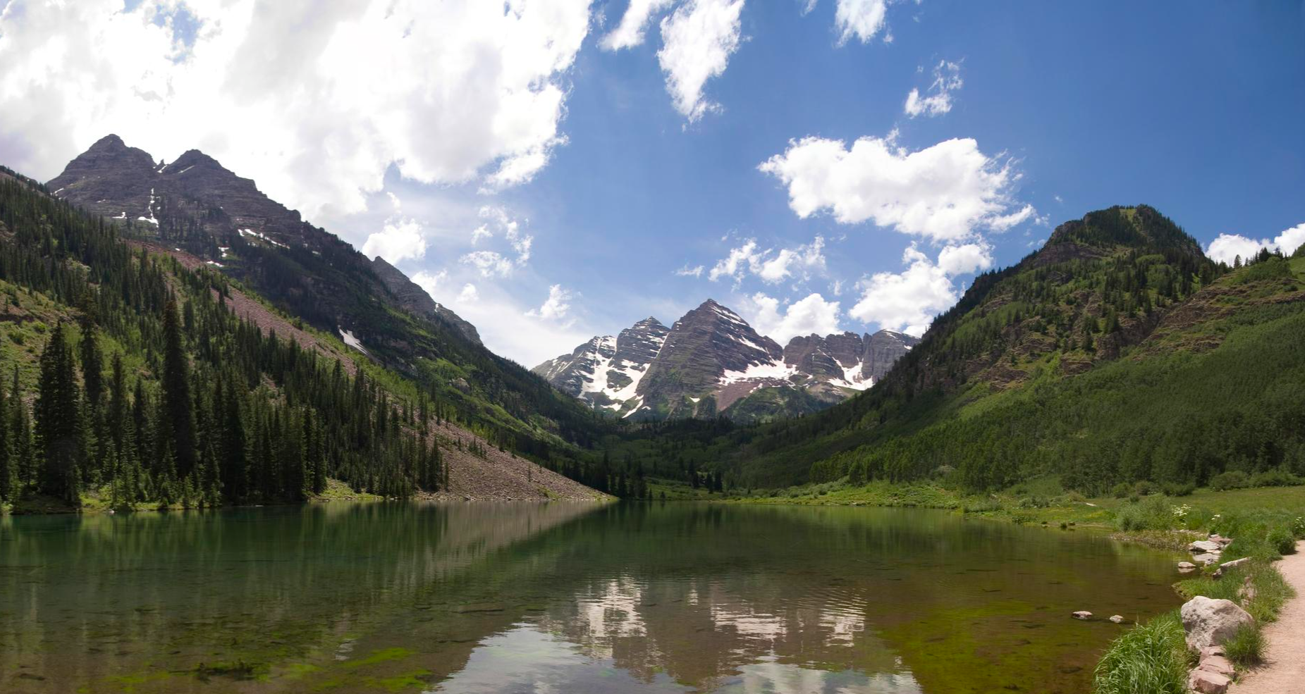
Easy hiking trails in Maroon Bells-Snowmass Wilderness traverse a vast area of the Rocky Mountains in Colorado, characterized by high-altitude terrain and diverse natural features. The region features iconic bell-shaped peaks, extensive aspen and conifer forests, and numerous alpine lakes nestled within glacial valleys. Hikers can explore meadows that bloom with wildflowers in midsummer, offering varied scenery across the wilderness.
Best easy hiking trails in Maroon Bells-Snowmass Wilderness
- The most popular easy hiking route is Deer Creek Trail #568, a 2.8 miles (4.5 km) trail that takes 1 hour 18 minutes to complete. This path offers gentle gradients through forested areas.
- Another top favourite among local hikers is Conundrum Creek Trail, an easy 1.8 miles (3.0 km) path. This route follows the creek, providing a tranquil experience through the wilderness.
- Local hikers also love the Emerald Lake Trail, a 0.5 miles (0.9 km) trail leading through varied terrain, often completed in about 13 minutes.
- Hiking in Maroon Bells-Snowmass Wilderness is defined by alpine lakes, extensive forests, and high mountain passes. The network offers options for different ability levels, including many easy hiking trails.
- The routes in Maroon Bells-Snowmass Wilderness are highly rated by the komoot community with an average score of 4.8 stars from over 60 reviews. More than 2,200 hikers have used komoot to explore Maroon Bells-Snowmass Wilderness's varied terrain.
Last updated: July 7, 2026
1
hikers
2.95km
00:53
150m
10m
Embark on an easy hike along the Conundrum Creek Trail, a peaceful route that follows the flowing waters of Conundrum Creek. You will find yourself immersed in lush, forested terrain, with stands of vibrant aspen trees providing a serene atmosphere. As you progress, catch glimpses of the majestic surrounding peaks through the canopy. This accessible trail covers 1.8 miles (3.0 km) with a gentle elevation gain of 490 feet (149 metres), making it a quick outdoor escape that typically takes around 53 minutes to complete.
Planning your visit to the Conundrum Creek Trail is straightforward. You can generally find parking available directly at the trailhead, making access convenient for a quick outing. Before heading out, it is always wise to check local conditions, particularly for any seasonal advisories that might affect your hike. This ensures you are prepared for the current environment and can enjoy your time on the trail without unexpected issues. Consider starting your hike earlier in the day to fully experience the tranquility of the creek and forest.
The Conundrum Creek Trail is nestled within the expansive Maroon Bells-Snowmass Wilderness, an area renowned for its pristine natural beauty. This specific route offers a taste of the wilderness experience without requiring a full-day commitment. The constant presence of Conundrum Creek adds a soothing auditory element to your journey, enhancing the sense of being truly connected with nature. It serves as an excellent introduction to the region's diverse ecosystems and offers a refreshing break from daily routines.
4.55km
01:18
170m
10m
Hike the easy 2.8-mile Deer Creek Trail #568, gaining 557 feet with panoramic views of the East River valley and Gothic Mountain.

Sign up for free
873m
00:13
10m
0m
An easy 0.5-mile hike in Gunnison National Forest, leading to the peaceful Emerald Lake in just 13 minutes.
1.90km
00:33
0m
140m
The Devils Punch Bowl via Schofield Pass Road offers a surprisingly easy way to experience one of Colorado's most dramatic landscapes. This 1.2-mile (1.9 km) hike, with virtually no elevation gain and taking only about 33 minutes, leads you to the spectacular Devil's Punchbowl waterfall, famous for its colorful, round plunge pools. You'll traverse rocky sections of the infamous Schofield Pass Road, soaking in breathtaking views of Crystal Canyon and the surrounding rugged terrain, making it a high-reward, low-effort adventure.
Planning your visit requires checking road conditions, as Schofield Pass Road is known for its challenging nature and can be subject to rock slides or lingering snow well into the summer. While the hike itself is easy, the approach to the trailhead might require a high-clearance 4x4 vehicle, depending on where you start. This short route is best enjoyed during warmer months when the waterfall is active and the road is clear, offering a quick scenic escape.
Beyond the natural beauty of the Devil's Punchbowl, this trail provides glimpses of Colorado's rich history, including the historic Crystal Mill and the remnants of the old silver mining town of Crystal. The area's notoriety for its challenging road conditions for vehicles adds an interesting layer to the experience, allowing hikers to appreciate the rugged beauty without the extreme demands of driving it. It's a perfect option for a quick, scenic stop in a historically significant and visually stunning region.
8
hikers
4.74km
01:19
80m
80m
Hike the easy 2.9-mile River Run Trail in White River National Forest, exploring the historic Ashcroft Ghost Town along Castle Creek.
Get access to more routes and recommendations from other explorers.
Sign up for free
Already have an account?
Our route recommendations are based on thousands of hikes, rides, and runs completed by other people on komoot.
Start today with a free account
Your next adventure awaits.
Login or Signup
Popular around Maroon Bells-Snowmass Wilderness
Other adventures in Maroon Bells-Snowmass Wilderness

Frequently Asked Questions
How many easy hiking trails are available in Maroon Bells-Snowmass Wilderness?
There are over 45 easy hiking trails in the Maroon Bells-Snowmass Wilderness, offering a variety of scenic routes suitable for all skill levels. In total, the region features more than 160 hiking routes.
What is the best time of year to visit Maroon Bells-Snowmass Wilderness for easy hikes?
The best time for hiking in Maroon Bells-Snowmass Wilderness is typically from July through September. During this period, trails and mountain passes are generally free of snow and accessible. From early October to late June, many areas can be snow-covered and inaccessible.
Are there any easy loop trails in Maroon Bells-Snowmass Wilderness?
While many trails offer out-and-back options, the region also features some easy loop opportunities. For example, the Emerald Lake Trail is a short 0.9 km route that can be enjoyed as part of a larger loop around the lake area, providing varied terrain and beautiful views.
What natural features can I expect to see on easy hikes in Maroon Bells-Snowmass Wilderness?
Easy hikes in Maroon Bells-Snowmass Wilderness often lead through extensive aspen and conifer forests, offering vibrant scenery, especially in the fall. You can also encounter glistening alpine lakes such as Crater Lake, Thomas Lakes, and Avalanche Lake, nestled within glacial valleys. Midsummer brings meadows bursting with wildflowers.
Are there any family-friendly easy hikes in the area?
Yes, many easy trails are suitable for families. The Emerald Lake Trail is a very short and accessible option, perfect for younger children. The Conundrum Creek Trail also offers a tranquil experience along the creek, with gentle gradients suitable for families.
What do other hikers say about the easy trails in Maroon Bells-Snowmass Wilderness?
The easy trails in Maroon Bells-Snowmass Wilderness are highly rated by the komoot community, with an average score of 4.8 stars from over 60 reviews. Hikers often praise the stunning natural beauty, well-maintained paths, and the opportunity to experience iconic landscapes like the Maroon Bells with minimal effort.
Are there any easy trails that lead to notable landmarks or points of interest?
Absolutely. The Conundrum Creek Trail, while longer in its entirety to the hot springs, offers an easy initial section that follows the scenic creek. For a unique natural monument, the Conundrum Hot Springs are a popular destination, though the full trail to them is more challenging and requires permits for overnight stays.
What kind of wildlife can I spot on easy hikes?
The Maroon Bells-Snowmass Wilderness is home to various wildlife. On easy hikes, you might have the opportunity to observe native Bighorn Sheep, elk, deer, and moose, especially during quieter times of day or in less crowded areas.
Are there any easy trails with minimal elevation gain?
Yes, several easy trails feature minimal elevation gain, making them ideal for a relaxed walk. The Emerald Lake Trail, for instance, has only about 5 meters of ascent. The Devils Punch Bowl via Schofield Pass Road also offers a predominantly downhill experience.
How long do easy hikes typically take in Maroon Bells-Snowmass Wilderness?
The duration of easy hikes varies depending on the trail length. Shorter routes like the Emerald Lake Trail can be completed in about 15 minutes. Longer easy trails, such as Deer Creek Trail #568 or River Run Trail, typically take around 1 hour and 20 minutes to complete.
Is parking available for easy hiking trails in Maroon Bells-Snowmass Wilderness?
Parking availability can vary by trailhead and time of year. Popular areas, especially near the Maroon Bells, may have limited parking and require reservations or shuttle use during peak seasons. It's advisable to check specific trailhead information or local visitor resources for current parking regulations and options before your visit.
Most popular routes in Maroon Bells-Snowmass Wilderness
Most popular attractions in Maroon Bells-Snowmass Wilderness

Get inspired with the komoot mobile app


Explore more
Browse the best Hikes in other regions.
