Easy hikes and walks in St. Louis County
5.0
(34)
1,026
hikers
107
hikes
Easy hiking trails in St. Louis County offer diverse landscapes for outdoor activities. The region features riverine environments, extensive forests, and varied woodlands, providing a range of natural features. Hikers can experience limestone bluffs overlooking rivers, densely forested rolling hills, and unique geological formations. The terrain includes undulating landscapes with elevation changes, alongside flatter paths.
Best easy hiking trails in St. Louis County
- The most popular easy hiking route is Elys Peak via Superior Hiking Trail, a 3.3 miles…
Last updated: May 12, 2026
5.0
(1)
4
hikers
5.30km
01:29
110m
90m
Embark on an easy hike along the Elys Peak via Superior Hiking Trail, a route that guides you through a mix of deciduous and pine forests. This 3.3-mile (5.3 km)…
2
hikers
7.12km
01:50
40m
40m
Embark on the Big Aspen Trail for an easy hiking experience through the Superior National Forest. This route spans 4.4 miles (7.1 km) and involves a gentle elevation gain of…

Sign up for free
1
hikers
1.49km
00:23
10m
0m
Embark on an easy hike along The Lakewalk: Brighton Beach Park, a short and accessible route that offers continuous views of Lake Superior. This pleasant stroll covers 0.9 miles (1.5…
2.01km
00:36
60m
60m
Embark on the Ely's Peak Loop Trail for an easy 1.2 miles (2.0 km) hike through diverse landscapes, where you will gain 199 feet (61 metres) in elevation. The route…
2.47km
00:38
10m
20m
Embark on an easy hike along Waabizheshikana: The Marten Trail, a route that offers picturesque views of the St. Louis River. This trail is a gentle 1.5 miles (2.5 km)…
1.56km
00:24
20m
0m
Embark on an easy hike around the Pickerel Lake Loop, a 1.0-mile (1.6 km) path that takes you through diverse scenery. You will experience a gentle elevation gain of 58…
742m
00:12
0m
10m
The Norberg Lake Loop offers you a true wilderness experience, winding through rugged and rocky terrain with rolling hills, roots, and larger rocks. You will hike among tall white and…
5.0
(3)
31
hikers
4.90km
01:17
30m
30m
Embark on an easy hike along the Blind Ash Bay Trail, a 3.0-mile (4.9 km) route that winds through a vibrant boreal forest. You will gain a gentle 106 feet…
25
hikers
3.17km
00:56
90m
90m
Embark on an easy hike along the Chester Park Loop, a scenic route that follows the picturesque Chester Creek. You will encounter many waterfalls as the creek makes its way…
4.0
(1)
17
hikers
5.15km
01:30
130m
130m
Embark on the Ely's Peak Loop Trail, an easy 3.2 miles (5.2 km) hike that takes about 1 hours and 29 minutes to complete. You will encounter a mix of…
Get access to more routes and recommendations from other explorers.
Sign up for free
Already have an account?
Our route recommendations are based on thousands of hikes, rides, and runs completed by other people on komoot.
Start today with a free account
Your next adventure awaits.
Login or Signup
Popular around St. Louis County

Easy hikes around Duluth

Easy hikes in Voyageurs National Park

Easy hikes around Hermantown

Easy hikes around Proctor

Easy hikes in Bear Island State Forest

Easy hikes around Rice Lake

North Country Trail – 4,800 Miles along the edge of northern U.S.
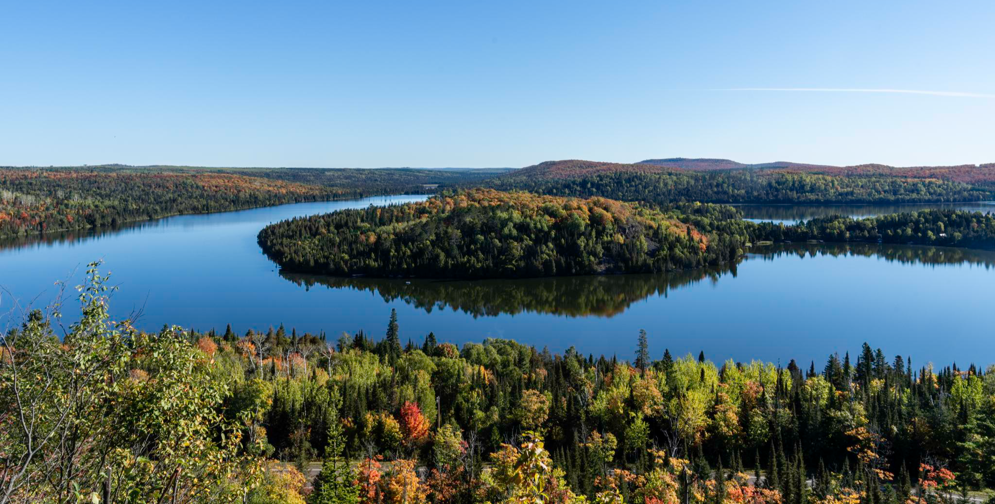
Superior Hiking Trail — Where the forest meets the lake

Mesabi Trail — Riding Minnesota’s Iron Range

Easy hikes in St. Louis County


Tips from the Community


A flashlight on your helmet or bike will come in handy to avoid puddles on the trail.
0
0
Although Minnesota enjoys a network of trails that span the entire state, the Superior Hiking Trail itself is 310 miles long, beginning at the Minnesota-Wisconsin border south of Duluth near Jay Cooke State Park and ending where it intersects the Border Route Trail just south of the US-Canadian border.
3
0

route not known in kamoot map but you can cross to another trail at midway
0
0

Blind Ash Bay, at the very tip of this lollipop loop trail before heading back, provides a post card view of Kabetogama Lake. Great for birding, this area is also frequented by deer and other wildlife.
0
0

The tunnel through Ely’s Peak is a fascinating feature of the DWP Trail near Duluth. This 520-foot tunnel was carved more than a century ago for the mining industry and the railroad. Today, you can hike through the dark and spooky tunnel, or climb on the rocks around it.
1
0
Ely’s Peak is a rewarding hike that offers spectacular views of Duluth and beyond. The trail is part of the Superior Hiking Trail, a network of trails that spans the entire length of Minnesota. You can enjoy the scenery of forests, wildflowers, and rock formations along the way. The hike is moderately challenging but suitable for most skill levels. Ely’s Peak is a great way to experience the beauty and history of Duluth.
2
0
East Chester Creek Trail is a hidden gem in Duluth, Minnesota. This trail is part of the Superior Hiking Trail, a network of trails that spans the entire length of the state. The trail follows the creek for 1.5 miles, offering scenic views of the water and the forest. You’ll encounter some steep sections and rocky terrain, but nothing too difficult. The trail is well-marked and easy to follow. East Chester Creek Trail is a great way to experience nature and adventure in Duluth. You can make a loop via West Chester Creek Trail.
2
0
Frequently Asked Questions
How many easy hiking trails are available in St. Louis County?
St. Louis County offers over 60 easy hiking trails, providing a wide range of options for exploring its diverse landscapes and natural features.
What kind of natural features can I expect to see on easy hikes in St. Louis County?
Easy hikes in St. Louis County showcase a variety of natural features, including scenic river views, extensive forests, and unique geological formations. You can find trails along limestone bluffs overlooking the Meramec and Mississippi Rivers, through dense woodlands, and past springs and rock formations, offering a taste of the Ozarks.
Are there any easy loop trails in St. Louis County?
Yes, there are several easy loop trails. For example, the Ely's Peak Loop Trail is a popular 1.2-mile route through varied woodlands. Another option is the Pickerel Lake Loop, which offers a gentle 1-mile walk.
What do other hikers enjoy most about easy trails in St. Louis County?
The easy trails in St. Louis County are highly rated by the komoot community, with an average score of 4.9 stars. Hikers often praise the quiet woodlands, scenic river views, and well-maintained paths that make for enjoyable and accessible outdoor experiences.
Are there easy trails suitable for families with children?
Many easy trails in St. Louis County are family-friendly, offering shorter distances and gentle elevation changes. Parks like Dr. Edmund A. Babler Memorial State Park and Faust Park provide picturesque and less strenuous options perfect for a family outing. The Norberg Lake Loop is a very short and flat option, ideal for young children.
Can I bring my dog on easy hiking trails in St. Louis County?
Many parks and trails in St. Louis County are dog-friendly, but it's always best to check specific park regulations before you go. Generally, dogs are welcome on leash. For example, trails in Rockwoods Reservation and Greensfelder County Park are popular choices for hikers with canine companions.
Are there any easy trails with scenic viewpoints in St. Louis County?
Yes, St. Louis County offers easy trails with beautiful viewpoints. Castlewood State Park's River Scene Trail is renowned for its stunning views of the Meramec River from limestone bluffs. You can also find viewpoints like the Hawk Ridge Bird Observatory and Beaver Pond Overlook, which provide picturesque vistas.
What are some interesting landmarks or attractions near easy hiking trails?
Near easy hiking trails, you can explore various landmarks and attractions. Highlights include the historic Cliff Cave in Cliff Cave County Park, the unique rock formations and springs in Rockwoods Reservation, and the opportunity for wildlife viewing at Lone Elk Park. You can also visit the Hull-Rust Mine or the Canal Park.
When is the best time of year to enjoy easy hikes in St. Louis County?
Spring and fall are generally the best times for easy hikes in St. Louis County. In spring, you'll see wildflowers and lush greenery, while fall offers vibrant foliage. Summer can be warm and humid, but shaded forest trails provide relief. Winter hiking is also possible, especially on clear, dry days.
Are there easy trails accessible by public transport in St. Louis County?
While many trailheads in St. Louis County are best accessed by car, some areas within the greater St. Louis metropolitan region may have limited public transport options. It's recommended to check local transit schedules and routes for specific parks or trail access points if you plan to use public transport.
Where can I find easy trails with opportunities to see wildlife?
Lone Elk Park is an excellent choice for wildlife viewing, where you can often spot elk and bison. Other parks like Powder Valley Nature Area and Rockwoods Reservation also offer opportunities to see deer and various bird species along their easy trails.
Are there any easy trails that are part of a larger greenway system?
Yes, some easy trails are integrated into larger greenway systems. Cliff Cave County Park, for instance, is part of the Mississippi River Greenway, offering extensive paths. Columbia Bottom Conservation Area also features paved trails that are part of the Missouri River Greenway, connecting to broader networks.
Most popular routes in St. Louis County
Most popular attractions in St. Louis County

Get inspired with the komoot mobile app


Didn’t find what you were looking for?
Check out more Hikes throughout St. Louis County below and find the perfect route in your destination.
Explore more
Browse the best Hikes in other regions.
