The best MTB trails in San Miguel County
5.0
(2)
160
riders
9
rides
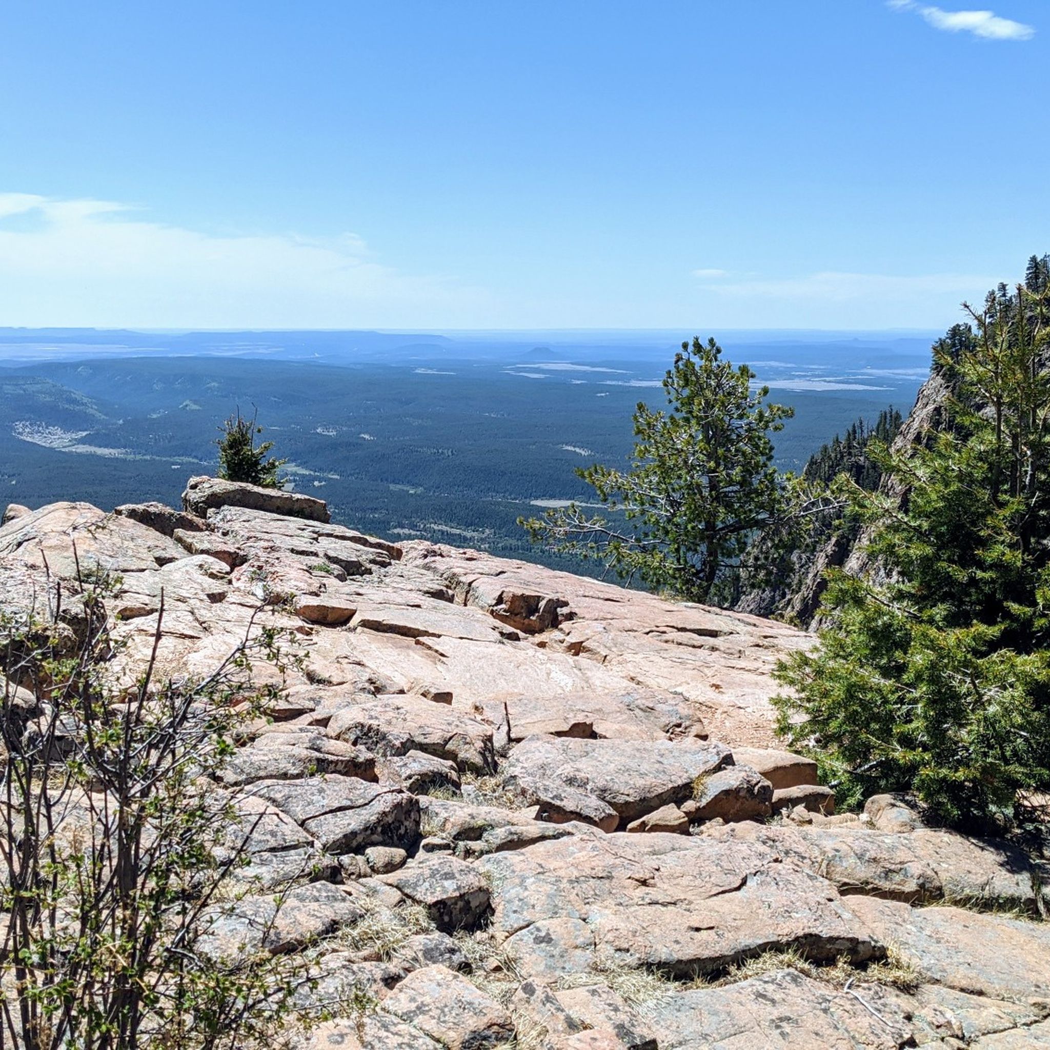
Mountain biking in San Miguel County offers a diverse landscape for riders. The region features varied terrain with significant elevation changes, as evidenced by routes climbing over 2,000 feet. Trails often lead through forested areas, providing scenic vistas and challenging ascents. The area's geography supports a range of mountain biking experiences, from easier loops to more demanding, longer rides.
Best mountain bike trails in San Miguel County
- The most popular mountain bike trail is Cairn Me Up and Jagged Axe…
Last updated: October 10, 2026
5.0
(2)
54
riders
9.98km
01:03
240m
240m
Easy mountain bike ride. Great for any fitness level. Suitable for all skill levels.
4
riders
13.7km
01:38
610m
610m
Moderate mountain bike ride. Good fitness required. Suitable for all skill levels.

12.6km
01:30
470m
470m
Moderate mountain bike ride. Good fitness required. Advanced riding skills necessary.
46
riders
20.7km
02:10
520m
520m
Hard mountain bike ride. Good fitness required. Advanced riding skills necessary. Some portions of the route may require you to push your bike.
22
riders
10.5km
01:08
290m
290m
Moderate mountain bike ride. Great for any fitness level. Advanced riding skills necessary.
17
riders
20.1km
02:02
430m
430m
Hard mountain bike ride. Good fitness required. Advanced riding skills necessary. Some portions of the route may require you to push your bike.
9
riders
11.4km
01:03
170m
170m
Hard mountain bike ride. Great for any fitness level. Advanced riding skills necessary. Some portions of the route may require you to push your bike.
8
riders
11.8km
01:16
320m
320m
Hard mountain bike ride. Good fitness required. Advanced riding skills necessary. Some portions of the route may require you to push your bike.
Our route recommendations are based on thousands of hikes, rides, and runs completed by other people on komoot.
Start today with a free account
Your next adventure awaits.
Popular around San Miguel County



Other adventures in San Miguel County

Tips from the Community

The Winsor Trail is a 6.1-mile singletrack primarily used for downhill mountain biking, hiking, and trail running that begins near the Santa Fe Ski Area. The entire trail features a 2,513 ft descent with an average -7.2% grade, making it a challenging black diamond trail that is popular for both shuttled descents and the occasional out-and-back ride. This particular section of the trail from the Aspen Peak to FR 102 is a very, very popular section with downhill riders, bikers coming back uphill from completing the Upper Rio en Medio Trail, for example, and hikers, so please be cautious and courteous, especially on blind corners.
0
0
The Upper Rio en Medio Trail is a popular, challenging 1.9-mile trail located near Santa Fe, New Mexico. It features a mix of steep grades, tight switchbacks, rock gardens, creek crossings, and scenic waterfalls, making it ideal for experienced mountain bikers seeking a backcountry adventure. This downhill-only trail begins near the Santa Fe Ski Area, following the river with a tough initial section before transitioning into smoother, faster segments. As you draw closer to Aspen Ranch, there are several alternative paths you can take if you want to change things up. At Aspen Ranch you have a few options: you can continue down the Lower Rio en Medio trail for a truly epic backcountry experience that takes you all the way down to the base of the mountains (shuttling cars is a must, unless you want an even more epic day), or, if you haven't shuttled a car to Aspen Ranch), you can turn back uphill to Ski Santa Fe on the Aspen Ranch Road (Forest Road 412), which you can connect to Pacheco Canyon (Forest Road 102) and either back up to the paved road or to the Winsor Trail. Although riding on trails is usually preferable, the Winsor Trail is usually ridden as a downhill trail and is very popular with hikers, making it for a sometimes trying uphill experience. Regardless of what you do at the end of the Upper Rio en Medio Trail, it's a truly fabulous section of backcountry downhill riding in the mountains above Santa Fe.
0
0
Chips and Salsa is a popular downhill only trail in the Glorieta Adventure Camps Trail System. It runs adjacent to the longer, more challenging Jagged Axel trail, making it a more doable option for the intermediate rider, or those looking for a mellower day out. It is often combined with Cairn Me Up Trail to make the popular "Chips and Salsa loop."
0
0
Glorieta Adventure Camps is a private retreat and summer camp with public access for their 20 miles+ of singletrack mountain biking and hiking trails. The main trailhead and access point for this trail system is the Baptist Bypass Trailhead is right off of 35 NM-50, Glorieta, NM. The trails are free and open to the public, and e-bikes are allowed. Visitors are encouraged to stay on designated trails and avoid the main campus. To check trail statuses visit the Glorieta Adventure Camps website: https://glorieta.org/trails/
0
0
Alamos Vista is a fantastic trail on Tesuque Peak. You can ride it uphill or downhill, although downhill is recommended; riding up Aspen Vista and down Alamos Vista is a fantastic loop. Alamos Vista is steep and technical but not crazily so. The trail features tight, twisty turns through an aspen stand, making for a fantastic, scenic ride. Hikers also frequent this trail, so it's essential to stay alert and be courteous. The trail begins at the top of the Quad chairlift, intersecting with Gayway, and descends to the Aspen Vista trailhead and parking area.
0
0
Aspen Vista is a classic Santa Fe mountain bike trail, renowned for its stunning scenery. Although it is not a technical trail, this dirt forest road is steep, can be loose, and the elevation gain makes it quite challenging. As you climb 6 miles to the top of Ski Santa Fe, you get breathtaking views along the way over the mountains through the aspens. At the top, you can either turn around or opt for a thrilling descent down Alamos Vista—a steep, loose, and technical trail where a full-suspension bike is essential, or you can turn around and ride down the way you came.
0
0

At 12,047 feet, Tesuque Peak is one of the tallest mountains in the Sangre de Cristo Range in New Mexico. The peak reaches above treeline, and you get to share the summit with some radio and cell towers.
0
0
At 12,047 feet, Tesuque Peak is one of the tallest mountains in the Sangre de Cristo Range in New Mexico. The peak reaches above treeline, and you get to share the summit with some radio and cell towers.
0
0
Frequently Asked Questions
How many mountain bike trails are available in San Miguel County?
San Miguel County features a selection of 5 mountain bike trails, offering a range of experiences from easy to difficult. These routes are highly rated by the komoot community, with an average score of 5.0 stars.
Are there easy mountain bike trails suitable for beginners in San Miguel County?
Yes, San Miguel County offers trails suitable for beginners. The Cairn Me Up and Jagged Axe Loop is an easy 6.2-mile route that provides a great introduction to the area's varied terrain.
What is the typical length and duration of mountain bike trails in San Miguel County?
Trail lengths in San Miguel County vary significantly. You'll find routes like the easy Cairn Me Up and Jagged Axe Loop at around 6.2 miles, taking about an hour, up to more challenging routes like the Mountainbike loop from Glorieta, which is over 21 miles and can take more than three hours to complete.
Are there any family-friendly mountain biking options in San Miguel County?
For families looking for a less strenuous ride, the Cairn Me Up and Jagged Axe Loop is an excellent choice. It's an easy route, making it suitable for those with varying skill levels, including younger riders or those new to mountain biking.
What kind of scenic viewpoints can I expect along the mountain bike trails?
The trails in San Miguel County often lead through forested areas and offer open vistas. For specific scenic highlights, consider visiting Tecolotito mesas vista, New Mexico, which provides expansive views of the mesas characteristic of the region.
Are there loop mountain bike trails in San Miguel County?
Yes, many of the mountain bike trails in San Miguel County are designed as loops, offering a continuous riding experience without retracing your path. Examples include the Aspen Vista and Alamos Vista loop and the Aspen Ranch Loop.
What do other mountain bikers enjoy most about San Miguel County?
The komoot community rates mountain biking in San Miguel County highly, with an average score of 5.0 stars. Riders often praise the diverse landscape, significant elevation changes, and the experience of riding through scenic forested areas and aspen forests.
What historical sites or attractions can I explore near the mountain bike trails?
San Miguel County is rich in history. You can visit the Pecos National Historical Park Visitor Center or explore the Pecos National Historical Park near Santa Fe. Another notable site is the Mission Nuestra Señora de los Ángeles de Porciúncula, offering a glimpse into the region's past.
Are there any challenging mountain bike trails for experienced riders?
Experienced riders will find challenging options in San Miguel County. The Chips and Salsa loop from Glorieta and the Mountainbike loop from Glorieta are both rated as difficult, featuring significant elevation gains and longer distances to test your skills.
What is the terrain like on mountain bike trails in San Miguel County?
The terrain in San Miguel County is quite varied, characterized by significant elevation changes, forested sections, and open vistas. You'll encounter everything from smoother paths on easier loops to more technical sections on difficult routes, often winding through beautiful aspen forests.
Can I find mountain bike routes that offer a mix of views and forest riding?
Absolutely. Many routes in San Miguel County combine both. For example, the Aspen Vista and Alamos Vista loop provides excellent views while traversing through characteristic aspen forests, offering a balanced and scenic ride.
Most popular routes in San Miguel County
Most popular attractions in San Miguel County

Get inspired with the komoot mobile app


Didn’t find what you were looking for?
Check out more MTB trails throughout San Miguel County below and find the perfect route in your destination.
Explore more
Browse the best MTB trails in other regions.
