The best gravel rides around Pigna
3.4
(8)
74
riders
4
rides
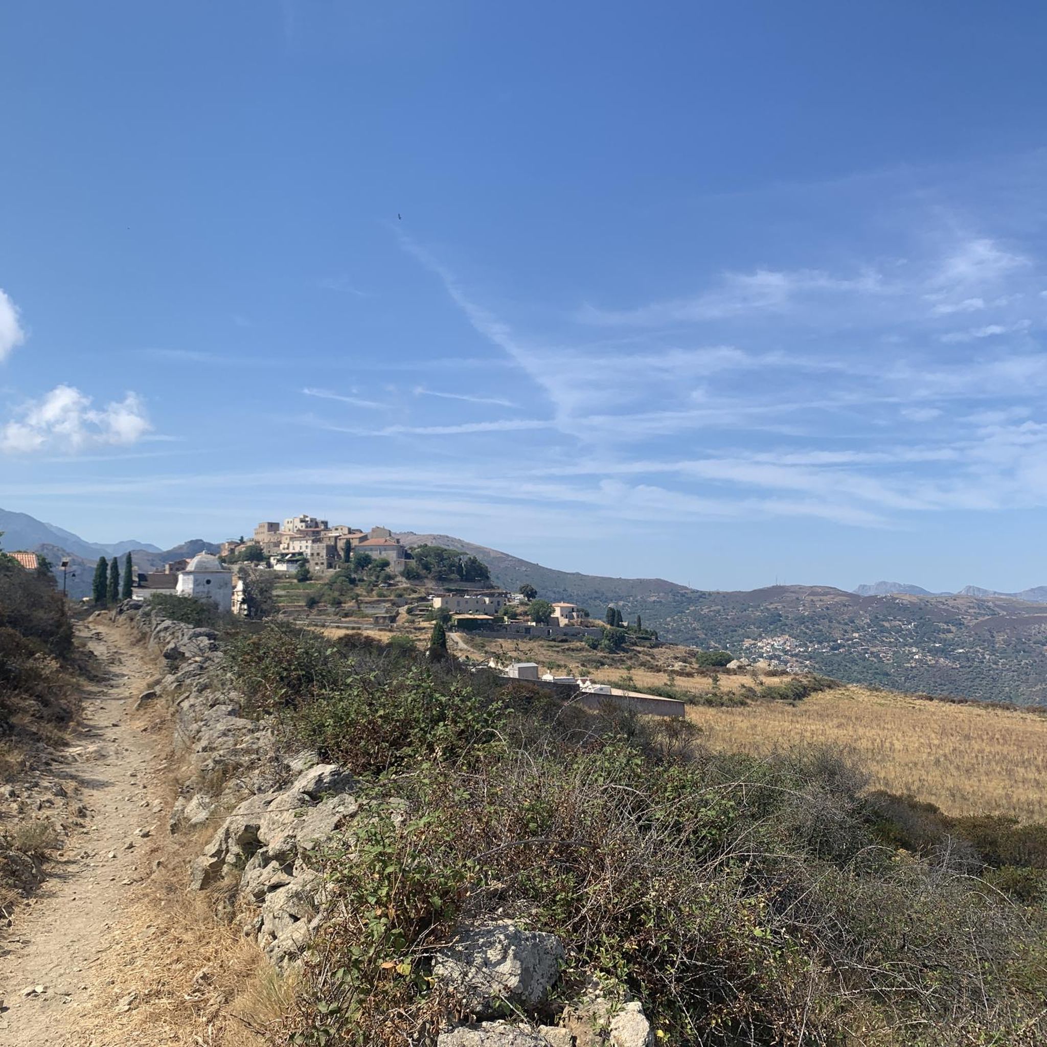
Gravel biking around Pigna offers diverse terrain in the Balagne region of Corsica, characterized by significant elevation changes and varied surfaces. The area features a mix of paved sections, unpaved roads, dirt tracks, and rocky paths, providing engaging challenges for gravel bikers. Routes often ascend to vantage points, delivering panoramic views of the surrounding mountains and the Mediterranean Sea. The terrain also includes Mediterranean flora such as maquis, olive groves, and vineyards, alongside wooded sections and forest trails.
Best gravel…
Last updated: May 24, 2026
3.5
(4)
28
riders
50.4km
03:32
910m
910m
Hard gravel ride. Very good fitness required. Mostly paved surfaces. Suitable for all skill levels.
32
riders
46.5km
03:19
960m
960m
Hard gravel ride. Very good fitness required. Mostly paved surfaces. Suitable for all skill levels.

Sign up for free
4.7
(3)
9
riders
21.6km
01:39
490m
490m
Hard gravel ride. Very good fitness required. Mostly paved surfaces. Suitable for all skill levels.
2.0
(1)
5
riders
18.2km
01:21
430m
430m
Moderate gravel ride. Good fitness required. Mostly paved surfaces. Suitable for all skill levels.
Our route recommendations are based on thousands of hikes, rides, and runs completed by other people on komoot.
Start today with a free account
Your next adventure awaits.
Login or Signup
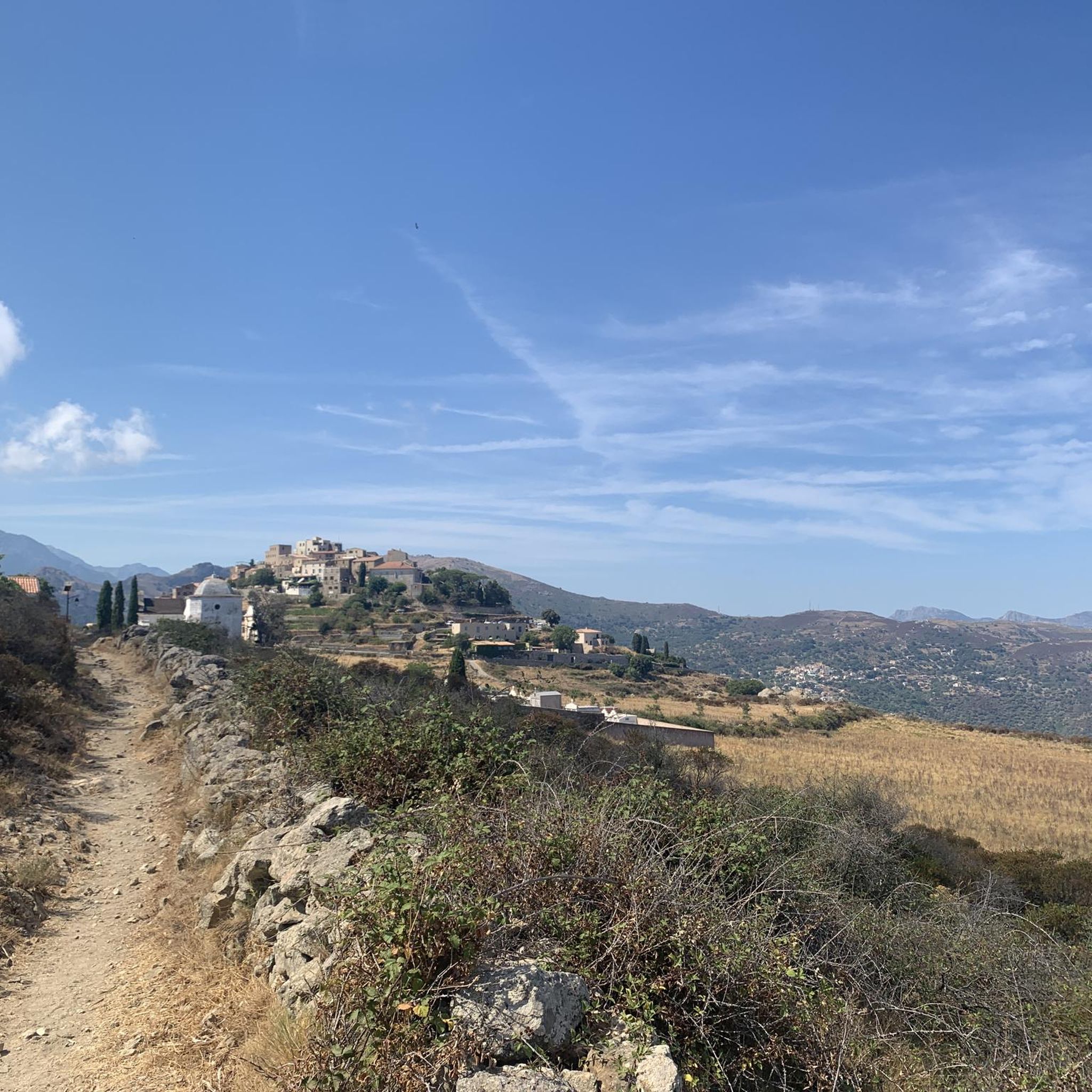
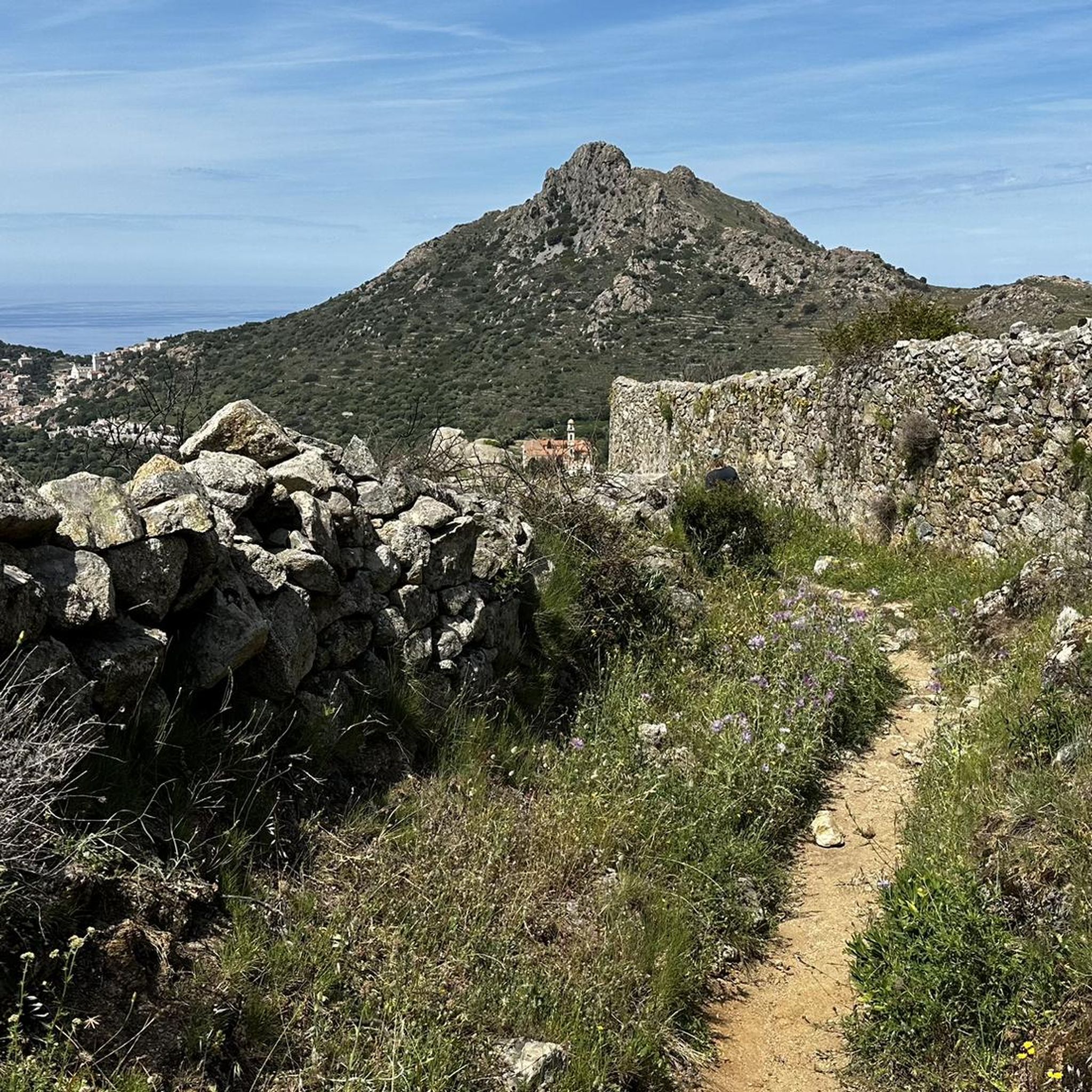
Tips from the Community


The charming little village of Occiglioni is worth a detour for many reasons. Its stone streets, typical of the Corsican maquis, give it a certain charm, and the shaded cafés are ideal for a refreshing break. Don't forget to enjoy the views from the village terraces.
0
0

The pass itself has a provisional pass sign at the junction to a fenced antenna system, but the D 151 towards Montegrosso as a mountain road climbs by about 15 meters in altitude over the next undulating 800 meters.
1
0
For those who are planning a detour to the Forêt Domaniale de Bonifatu or who are thinking of driving past Calvi and heading southwest over the Col de Marsolino, it even represents a shortcut via a beautiful hillside road. Which brings us to the most important point: the most beautiful panorama of the bay of Calvi and the ridge towards Monte Cinto is probably from the road over the Col de Salvi. This means that on the D 151 leading over the pass, despite the very moderate traffic volume, you may well come across a coach that is too big for the road, which is mostly only one and a half lanes wide.
1
1
The Col de Salvi is a quiet, very worthwhile connection option for racing cyclists who are heading towards Calvi from the (north)east via the Col de San Colombano or the Bocca di a Battaglia.
1
0
The municipalities of Lunghignano and Montemaggiore merged in 1972 to form the municipality of Saint-Rainier-de-Balagne. Saint-Rainier-de-Balagne was merged with Cassano on 1 January 1973 to form the municipality of Montegrosso, named after the Monte Grosso mountain range.
1
0
Montegrosso consists of the villages of Montemaggiore/Montemaiò as the main town (381 m), Cassano/Cassani (300 m) and Lunghignano/Lunghignani (340 m). The municipality is located at about 400 meters above sea level and borders Lavatoggio to the north, Cateri and Avapessa to the northeast, Muro to the east, Zilia to the southeast, Calenzana to the southwest, Calvi to the west and Lumio to the northwest.
1
0
Montegrosso (Corsican: Montegrossu) is a municipality on the French island of Corsica. It belongs to the region of Corsica, the department of Haute-Corse, the arrondissement of Calvi and the canton of Calvi. Depending on the district, the residents call themselves Montemaggiorais, Lunghignanais, Cassanais, Montemaiuracci, Lunghignaninchi or Cassaninchi.
1
0
Frequently Asked Questions
What kind of terrain can I expect on gravel bike trails around Pigna?
The gravel biking experience around Pigna features diverse terrain, moving from paved sections to unpaved roads, dirt tracks, and rocky paths. You'll encounter a mix of smooth tarmac and rough, uneven roads, perfectly suited for gravel bikes. The region is known for its significant elevation changes, offering sustained climbs and rewarding descents through fragrant Corsican 'maquis', olive groves, vineyards, and wooded sections.
Are there any easy or family-friendly gravel bike routes in the Pigna area?
While many routes around Pigna are rated as difficult due to significant elevation changes, the region offers options for different ability levels. For those seeking a less strenuous ride, it's best to look for routes with lower elevation gain and shorter distances. Currently, the guide highlights more challenging options, but komoot's route planner can help you find easier segments or create custom, family-friendly routes.
What are some of the more challenging gravel bike routes around Pigna?
For experienced gravel bikers seeking a challenge, routes like the View of Giunchetu Bay – Speloncato loop from Aregno stand out. This trail covers 38.9 miles (62.7 km) with significant elevation gain, often taking over 5 hours to complete. Another demanding option is the Montemaggiore - Col de Salvi - Cateri – Montemaggiore loop from Lumio, a 29.1-mile (46.9 km) route with over 900 meters of elevation gain.
Are there any circular gravel bike routes available near Pigna?
Yes, many of the gravel bike routes around Pigna are designed as loops, allowing you to start and finish in the same location. Examples include the Montemaggiore - Col de Salvi - Cateri – Montemaggiore loop from Lumio and the View of San Antonino – View of Corbara loop from Muro. These circular routes offer varied scenery and connect charming villages.
What kind of views or viewpoints can I expect on these gravel trails?
Pigna's elevated position and the surrounding Balagne region offer breathtaking panoramic views. Gravel routes frequently ascend to vantage points, providing stunning backdrops of the surrounding mountains, the Aregno plain, and the sparkling Mediterranean Sea. You might even catch distant sights of the village of Algajola and the coastline. Many routes are specifically chosen for their scenic overlooks, such as the View of La Pietra Island.
What cultural landmarks or attractions can I see along the gravel bike routes?
Gravel biking routes often connect Pigna with other picturesque hilltop villages like Sant' Antonino (considered one of France's most beautiful villages) and Corbara. You can explore historic alleys, stone houses, and experience Corsican village life. The trails also lead through areas rich in natural and historical treasures, where you might encounter old oil mills, churches, and traditional craft workshops, reflecting the region's heritage. The Montemaggiore - Col de Salvi - Cateri area is also a notable highlight.
Is it possible to bring my dog on gravel bike trails around Pigna?
While the guide doesn't specify dog-friendly routes, many natural trails in Corsica are generally accessible for dogs, provided they are well-behaved and kept under control, especially around livestock or in protected areas. It's always advisable to check local regulations or specific route details on komoot for any restrictions before heading out with your canine companion. Ensure your dog is fit enough for the varied terrain and elevation changes.
What is the best time of year for gravel biking in Pigna?
The Balagne region, including Pigna, is ideal for gravel biking during spring and autumn when temperatures are milder and the landscapes are lush. Spring brings blooming flora, while autumn offers pleasant weather and vibrant colors. Summer can be very hot, making early morning or late afternoon rides preferable. Winter can be cooler and wetter, but many routes remain rideable, especially those at lower elevations.
Are there options for parking near the gravel bike trails in Pigna?
Pigna and the surrounding villages often have public parking areas, which can serve as convenient starting points for gravel bike routes. For example, routes starting from Lumio, Muro, or Aregno would typically have parking available within those villages. It's recommended to check specific village parking options when planning your route, especially during peak tourist seasons.
Can I access gravel bike trails in Pigna using public transport?
While Pigna itself is a small hilltop village, the Balagne region has some public transport connections, primarily buses, that link larger towns like Calvi or L'Île-Rousse with smaller villages. However, direct access to specific trailheads via public transport might be limited. Cyclists often use a car to reach a suitable starting point in one of the villages, such as Aregno or Lumio, where many routes begin.
How many gravel bike routes are available in the Pigna area?
There are over 10 gravel bike routes available around Pigna, offering a range of distances and difficulties. These routes are highly rated by the komoot community, with an average score of 4.5 stars from over 20 reviews, and have been explored by more than 200 gravel bikers.
What do other gravel bikers enjoy most about the Pigna region?
The area is highly rated by the komoot community, with an average score of 4.5 stars. Reviewers often praise the diverse terrain, the stunning panoramic sea views, and the unique experience of cycling through olive groves and ancient paths connecting picturesque hilltop villages. The combination of challenging rides and rich cultural heritage is frequently highlighted.
Most popular attractions around Pigna

Get inspired with the komoot mobile app


Explore more
Browse the best Gravel rides in other regions.
