The best gravel rides around Baralle
4.8
(5)
43
riders
10
rides
Gravel biking around Baralle takes place in a predominantly flat agricultural area within the Pas-de-Calais department of northern France. The terrain is characterized by open fields and quiet country roads, with elevations ranging from 44 to 78 meters (144–256 ft). These rural paths offer a serene experience through the French countryside, suitable for gravel cycling.
Best gravel bike trails around Baralle
- The most popular gravel bike trail is Passerelle d'Hem-Lenglet – Marais des Courbettes loop from Aubigny-au-Bac, a 38.6 miles (62.2 km) trail that takes 4 hours 49 minutes to complete, traversing rural landscapes and marshlands.
- Another top favourite among local gravel bikers is Cantaing-sur-Escaut Lock – Folly Park loop from Sailly-lez-Cambrai, a moderate 25.7 miles (41.4 km) path that explores waterways and parkland.
- Local gravel bikers also love the Étang des Argales – Small, bumpy single loop from Arleux, a 34.9 miles (56.2 km) trail leading through varied terrain including a pond area, often completed in about 3 hours 39 minutes.
- Gravel biking around Baralle is defined by open agricultural fields, quiet country lanes, and rural paths, offering options for moderate and difficult ability levels.
- The routes in Baralle are highly rated by the komoot community with an average score of 4.6 stars from over 7 reviews. More than 45 gravel bikers have used komoot to explore Baralle's varied terrain.
Last updated: July 3, 2026
5.0
(1)
10
riders
62.2km
04:04
290m
290m
Moderate gravel ride. Good fitness required. Mostly paved surfaces. Suitable for all skill levels.
4.0
(1)
2
riders
41.5km
02:31
210m
220m
Moderate gravel ride. Good fitness required. Mostly paved surfaces. Suitable for all skill levels.

Sign up for free
5.0
(1)
9
riders
62.4km
04:16
430m
430m
Hard gravel ride. Good fitness required. You may need to push your bike for some segments of this route.
7
riders
69.9km
04:03
240m
240m
Moderate gravel ride. Good fitness required. Mostly paved surfaces. Suitable for all skill levels.
5.0
(1)
3
riders
33.1km
02:15
120m
120m
Hard gravel ride. Good fitness required. You may need to push your bike for some segments of this route.
Get access to more routes and recommendations from other explorers.
Sign up for free
Already have an account?
Our route recommendations are based on thousands of hikes, rides, and runs completed by other people on komoot.
Start today with a free account
Your next adventure awaits.
Login or Signup



Tips from the Community

Wancourt was captured on 12 April 1917 after very heavy fighting and the advance was continued on the following days. The cemetery, called at first Cojeul Valley Cemetery, or River Road Cemetery, was opened about ten days later; it was used until October 1918, but was in German hands from March 1918 until 26 August, when the Canadian Corps recaptured Wancourt. At the Armistice, the cemetery contained 410 graves, but was very greatly increased in the following years when graves were brought in from a number of small cemeteries and isolated positions on the battlefields south-east of Arras. The cemetery now contains 1936 burials and commemorations of the First World War. 829 of the burials are unidentified but there are special memorials to 76 casualties known or believed to be buried among them, and to 20 who were buried in Signal Trench Cemetery whose graves were destroyed in later battles.
9
0
Hibers Trench Cemetery, situated just north-west of Wancourt near Arras, was begun in April 1917 by the 50th (Northumbrian) Division shortly after the area was captured by British forces at the Battle of Arras. The cemetery contains 136 graves, six of which are unidentified, and also includes three Canadian graves added later in 1918. The simple design is by G.H. Goldsmith and reflects the understated dignity of this memorial. Its position on the Wancourt-Arras road makes it a silent witness to the fierce fighting that took place here, and the presence of personal inscriptions on some of the headstones emphasises the human story behind the numbers. A place of peace, remembrance and reflection.
10
0
Tigris Lane Cemetery is located in Wancourt, near Arras, and was named after a nearby trench. The cemetery was established in May 1917 by the 14th (Light) Division, shortly after the village was captured on 12 April 1917, and reused during its recapture by the Canadian Corps in August 1918. It contains the graves of 119 First World War soldiers, nine of whom are unidentified. Most of the graves belong to British (86) and Canadian (33) soldiers, underlining the international commitment to the region. The sober design is by G.H. Goldsmith and its location close to the TGV railway line emphasises the contrasts between past and present in this quiet place of remembrance.
9
0


The menhir is located in the marsh of Aubigny-au-Bac, on a footpath leading to Brunémont. It is a block of Landenian sandstone 2.90 m high (including 1.48 m above ground) by 2.15 m wide and 0.70 m thick. It is said to have been sunk to about 2.40 m. Shaped like a horse's head, it is associated with a prehistoric megalith despite the absence of evidence.
0
0

Frequently Asked Questions
What is the general terrain like for gravel biking around Baralle?
The terrain around Baralle is primarily characterized by open agricultural fields, quiet country lanes, and rural paths. The elevation is generally flat, ranging from 44 to 78 meters (144–256 ft), offering a serene experience through the French countryside.
Are there any challenging gravel bike routes in the Baralle area?
While many routes are moderate, there is at least one difficult gravel biking option available. The area offers a mix of terrain suitable for various skill levels, including paths with varied surfaces and some elevation changes.
What kind of scenic views or natural features can I expect on these gravel trails?
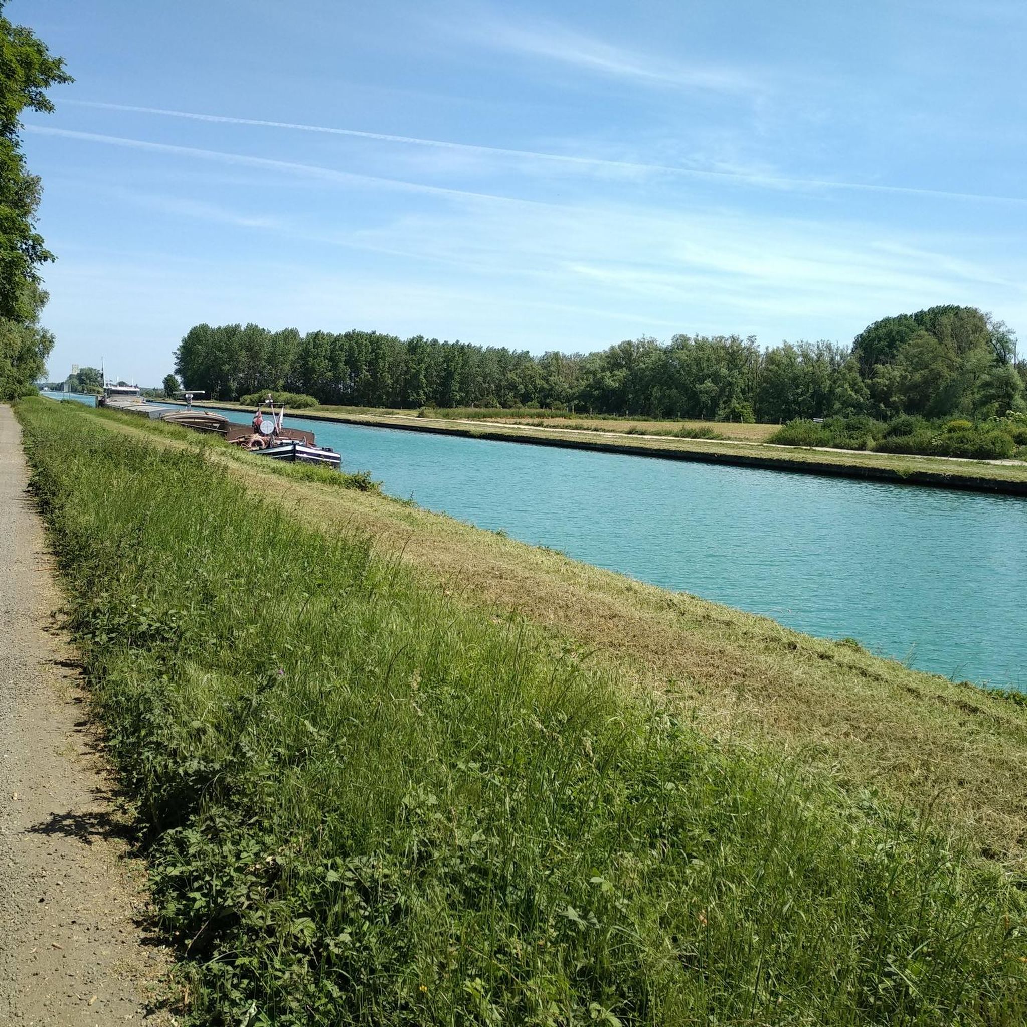
Gravel biking around Baralle offers views of open agricultural fields and rural French scenery. You can also explore marshlands, waterways, and pond areas on routes like Passerelle d'Hem-Lenglet – Marais des Courbettes loop from Aubigny-au-Bac. The region's natural beauty is often found in its quiet, less-developed rural areas.
Are there any historical landmarks or interesting points of interest near the gravel biking routes?
Yes, the area around Baralle has several interesting historical and natural landmarks. You might encounter sites like The Menhir of Lécluse or the Devil's Stone, The Big Rock, or the stone that grows. These offer a glimpse into the region's past and unique geological features.
What do other gravel bikers say about the trails in Baralle?
The gravel biking routes around Baralle are highly rated by the komoot community, with an average score of 4.6 stars from over 7 reviews. Many appreciate the quiet rural paths and the varied terrain that includes agricultural fields, marshlands, and waterways.
Are there any family-friendly gravel bike routes around Baralle?
The rural paths and quiet country lanes around Baralle can be suitable for families, especially those comfortable with moderate distances. Routes like Cantaing-sur-Escaut Lock – Folly Park loop from Sailly-lez-Cambrai explore waterways and parkland, which might be enjoyable for a family outing.
What is the best time of year for gravel biking in Baralle?
The Pas-de-Calais region, where Baralle is located, generally offers pleasant conditions for cycling during spring, summer, and early autumn. These seasons typically provide more favorable weather for exploring the open fields and rural paths.
Are there any loop routes available for gravel biking?
Yes, many of the gravel biking routes around Baralle are designed as loops. For example, you can explore the Étang des Argales – Small, bumpy single loop from Arleux, which takes you through varied terrain including a pond area.
Where can I find parking when starting a gravel bike ride in Baralle?
As Baralle is a farming village, parking options are typically found in the village center or near starting points of routes in surrounding towns. It's advisable to check specific route descriptions for recommended parking areas, especially when starting from nearby communes like Aubigny-au-Bac or Sailly-lez-Cambrai.
Can I reach Baralle by public transport for gravel biking?
While Baralle itself is a small commune, nearby larger towns like Cambrai, Douai, and Arras are more accessible by public transport. From these towns, you might need to cycle or arrange local transport to reach specific gravel trailheads around Baralle. Always check regional public transport schedules for the most up-to-date information.
Are there any cafes or places to eat along the gravel bike routes?
Baralle is a small farming village, so dedicated cafes directly on the trails are limited. However, you can find amenities in nearby towns such as Cambrai, Douai, or Arras, which are within cycling distance and offer more options for refreshments and meals before or after your ride.
What is the longest gravel bike route available in the Baralle area?
One of the longer routes you can explore is the Passerelle d'Hem-Lenglet – Paradise loop from Épinoy, which covers approximately 54.6 kilometers (33.9 miles) and offers a substantial ride through the rural landscape.
Most popular attractions around Baralle

Get inspired with the komoot mobile app


Explore more
Browse the best Gravel rides in other regions.
