The best gravel rides around Layhill
4.0
(1)
35
riders
6
rides
Gravel biking around Layhill, Maryland, offers access to varied terrain, from hard-surface trails within local parklands to more extensive gravel networks in wider Montgomery County. The region features wooded areas, stream valleys, and tranquil green spaces, providing a scenic backdrop for cycling. The landscape includes a mix of rolling hills and mixed gravel and paved surfaces. This area provides diverse landscapes for gravel cyclists seeking different challenges.
Best gravel bike trails around Layhill
- The most popular gravel bike trail is…
Last updated: May 24, 2026
4.0
(1)
12
riders
142km
08:15
530m
530m
Hard gravel ride. Very good fitness required. Mostly paved surfaces. Suitable for all skill levels.
8
riders
Moderate gravel ride. Good fitness required. Mostly paved surfaces. Suitable for all skill levels.

Sign up for free
5
riders
52.0km
03:02
380m
380m
Moderate gravel ride. Good fitness required. Mostly paved surfaces. Suitable for all skill levels.
7
riders
24.9km
01:34
200m
200m
Moderate gravel ride. Good fitness required. Mostly paved surfaces. Suitable for all skill levels.
2
riders
49.5km
02:57
350m
350m
Moderate gravel ride. Good fitness required. Mostly paved surfaces. Suitable for all skill levels.
Our route recommendations are based on thousands of hikes, rides, and runs completed by other people on komoot.
Start today with a free account
Your next adventure awaits.
Login or Signup

Tips from the Community

As you ride onto the wide canal bend, you’re met with serene water views—Widewater is a beautiful lake that serves as habitat for many bird and wildlife species. It’s an ideal spot to pause, do some birdwatching, and soak in the calm before continuing your journey along the Potomac and the Chesapeake & Ohio canal.
0
0

In the visitor center there is a (free) museum with the history of Washington. There are also 2 small souvenir shops that can be visited without a ticket. A free ticket is required for a tour of the Capitol. Please note that no food or liquids are allowed during the visit. To enter the visitor center you must go through the security check.
0
0

Lake Needwood provides a peaceful escape with its calm waters and surrounding trails nestled in the heart of Maryland. It’s a popular spot for kayaking, fishing, and picnics, offering a natural retreat close to the city.
0
0

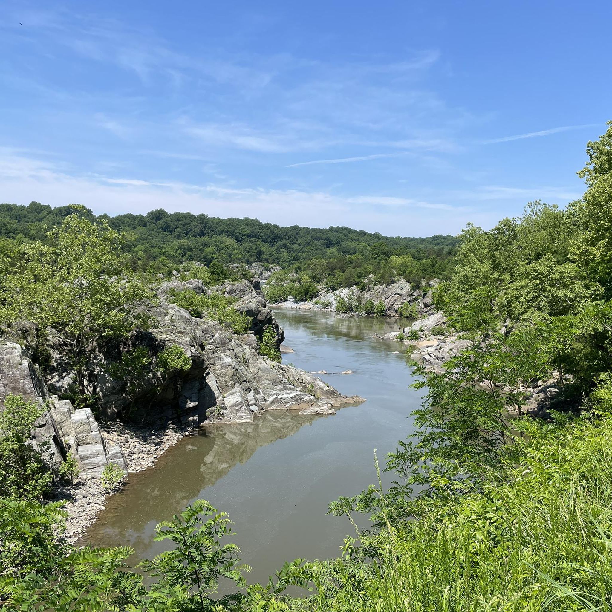
Enjoy easy access to the Great Falls, a popular destination for photographers, hikers, and expert kayakers. Though not exceptionally tall, the falls surge with force as the Potomac River carves through ancient, metamorphic rock.
1
0
Lock 21, aka Swains Lock, is a lock house and campsite. It was built in the 1830s and transported items such as grain and coal between Georgetown and Cumberland. It was named after the Swain family and John Swain, who helped build the canal, and Jesse Swain, the lockkeeper. The family lived here until 2006.
1
0
Lock 22, aka Pennyfield Lock, was built between 1829 and 1831, and the name came from the misspelling of the Pennifield family name. It has been restored and offers overnight stays to recreate the rustic feeling from that period.
1
0

Located at mile 14.3 on the C&O Canal Towpath in Potomac, Maryland, Great Falls Park is a must-visit highlight for hikers, cyclists, and history buffs alike. A short boardwalk leads to the Olmsted Island overlook, where the Potomac River dramatically crashes over jagged rocks—one of the most scenic views near D.C. For hikers, the popular Billy Goat Trail offers three segments, with Section A featuring challenging rock scrambles and breathtaking river views. The historic Great Falls Tavern, built in 1829, now serves as a visitor center and launch point for seasonal mule-drawn canal boat rides. The towpath itself is flat and easy to navigate, ideal for walking or biking. Amenities include restrooms, picnic spots, and interpretive exhibits. Parking is available at the visitor center (fee required), or you can park for free at nearby Swains Lock and walk or ride 2.5 miles to the falls.
1
0
Peirce Mill, built in 1829 by Isaac Peirce on Rock Creek, once used water to power this mill that processed corn, wheat, and rye until its turbine shaft broke in 1897. Situated on a 960-acre plantation operated with slave labor, the mill became part of Rock Creek Park in 1890 through an Act of Congress. By the early 1900s, park managers enhanced the site with roads, bridges, and a dam. The New Deal legislation gave Rock Creek Park to the National Park Service in 1933, and the mill was restored. Today, visitors can explore the site, which includes parking, a visitor center, bathrooms, and a picnic area, as part of Rock Creek Park’s year-round attractions.
1
0
Frequently Asked Questions
What kind of terrain can I expect on gravel bike trails around Layhill?
Gravel biking around Layhill offers a mix of terrain. While Layhill itself features hard-surface and paved trails like the Matthew Henson Trail, it serves as a gateway to broader Montgomery County gravel networks. You'll find routes with mixed gravel and pavement, rolling climbs, and quiet backroads, often winding through wooded parklands and along streams.
Are there any beginner-friendly gravel routes in the Layhill area?
Yes, there are moderate options suitable for those looking for less challenging rides. For instance, the Lake Needwood Southeast Shore – Rock Creek Trail loop from Twinbrook is a moderate 14.6-mile path featuring natural scenery along Lake Needwood and the Rock Creek Trail. Another moderate choice is the Lake Needwood – Rock Creek Trail loop from Rockville, which covers about 15.7 miles.
What are some more challenging gravel bike routes near Layhill?
For experienced gravel bikers seeking a challenge, the area offers more difficult routes. The Beach Drive in Rock Creek Park – Horseshoe Bend at Great Falls loop from Rockville is a demanding 53.1-mile trail exploring woodlands and stream-side paths within Rock Creek Park. Another difficult option is the Lake Needwood Southeast Shore – Rock Creek Trail loop from Glenmont, spanning 30.5 miles with significant elevation gain.
Are there any loop trails for gravel biking around Layhill?
Yes, many of the gravel routes in the Layhill area are designed as loops, allowing you to start and end at the same point. Examples include the Great Falls – Horseshoe Bend at Great Falls loop from North Bethesda, a 31.7-mile route, and the Lake Needwood Southeast Shore – Rock Creek Trail loop from Twinbrook.
What natural features or landmarks can I see along the gravel bike trails?
The trails often pass through wooded parklands and along streams. You can explore areas around Lake Needwood and its Southeast Shore, or ride sections of the Rock Creek Trail. The Matthew Henson Trail, accessible from Layhill, features a scenic wooden boardwalk through wooded areas.
What do other gravel bikers say about the trails in Layhill?
The gravel biking routes around Layhill are highly regarded by the komoot community, holding an average rating of 5.0 stars. Riders often praise the diverse landscapes, from tranquil green spaces to challenging mixed-surface paths, and the scenic beauty of the wooded areas and stream-side routes.
Are there any specific parks or areas known for gravel biking near Layhill?
While Layhill has local parks, dedicated gravel biking opportunities are more extensive in wider Montgomery County. Notable areas include Rock Creek Regional Park, which offers miles of trails through woodlands, and the C&O Canal Towpath for a flatter, scenic gravel experience. The Matthew Henson Trail is also a popular hard-surface option directly accessible from Layhill.
Is the Matthew Henson Trail suitable for gravel biking?
The Matthew Henson Trail is a 4.2-mile, 8-foot-wide hard-surface trail that winds through wooded areas and parkland. While not traditional gravel, its hard surface makes it suitable for gravel bikes, offering a smooth and scenic ride through natural settings.
What is the best time of year for gravel biking in Layhill, Maryland?
Layhill's natural features, including wooded parklands and streams, make for pleasant riding in spring and fall when temperatures are mild and the foliage is vibrant. Summer can be warm, but shaded trails offer relief. Winter riding is possible, but conditions may vary, so checking local weather and trail status is advisable.
Are there family-friendly options for gravel biking near Layhill?
For families, the local parks in Layhill, such as Layhill Village Neighborhood Park and Layhill Local Park, offer tranquil settings and easier paths suitable for casual rides. The Matthew Henson Trail, with its hard surface and scenic route, is also a good option for families looking for a smooth ride through nature.
Can I bring my dog on the gravel bike trails around Layhill?
Many parks and trails in Montgomery County, including those accessible from Layhill, are dog-friendly. However, specific regulations regarding leashes and waste disposal may apply. It's always best to check the rules for individual parks or trails, such as the Matthew Henson Trail or Rock Creek Regional Park, before heading out with your canine companion.
Are there any facilities or attractions near the trails for a post-ride stop?
Layhill's proximity to other regional attractions means you can combine your ride with other activities. Brookside Gardens, a 50-acre public garden, is just a short drive away. Wheaton Regional Park also offers various amenities, including a lake, train, and carousel, providing options for relaxation or further exploration after your ride.
Most popular attractions around Layhill

Get inspired with the komoot mobile app


Explore more
Browse the best Gravel rides in other regions.
