The best gravel rides around Brentwood
5.0
(4)
223
riders
7
rides
Gravel bike trails around Brentwood, California, are situated in the East Bay region of Contra Costa County, offering diverse terrain for cyclists. The area features a mix of paved roads, gravel paths, and dirt hills, providing varied experiences. Nearby Mount Diablo State Park contributes challenging climbs and scenic trails, while regional preserves and shorelines offer additional riding opportunities. The landscape includes agricultural areas, wetlands, and rolling hills, characteristic of the Sacramento Valley foothills.
Best gravel bike trails around Brentwood
- The…
Last updated: July 5, 2026
5.0
(4)
104
riders
This popular gravel biking route takes you from the urban energy of Dupont Circle to the natural splendor of Great Falls, offering a diverse and engaging ride. You'll spend much…
58
riders
Moderate gravel ride. Good fitness required. Mostly paved surfaces. Suitable for all skill levels.

Sign up for free
36
riders
49.4km
02:55
250m
250m
Moderate gravel ride. Good fitness required. Mostly paved surfaces. Suitable for all skill levels.
18
riders
Easy gravel ride. Great for any fitness level. Mostly paved surfaces. Suitable for all skill levels.
7
riders
Moderate gravel ride. Good fitness required. Mostly paved surfaces. Suitable for all skill levels.
Get access to more routes and recommendations from other explorers.
Sign up for free
Already have an account?
Our route recommendations are based on thousands of hikes, rides, and runs completed by other people on komoot.
Start today with a free account
Your next adventure awaits.
Login or Signup



Tips from the Community

Truly impressive and worth seeing
0
0

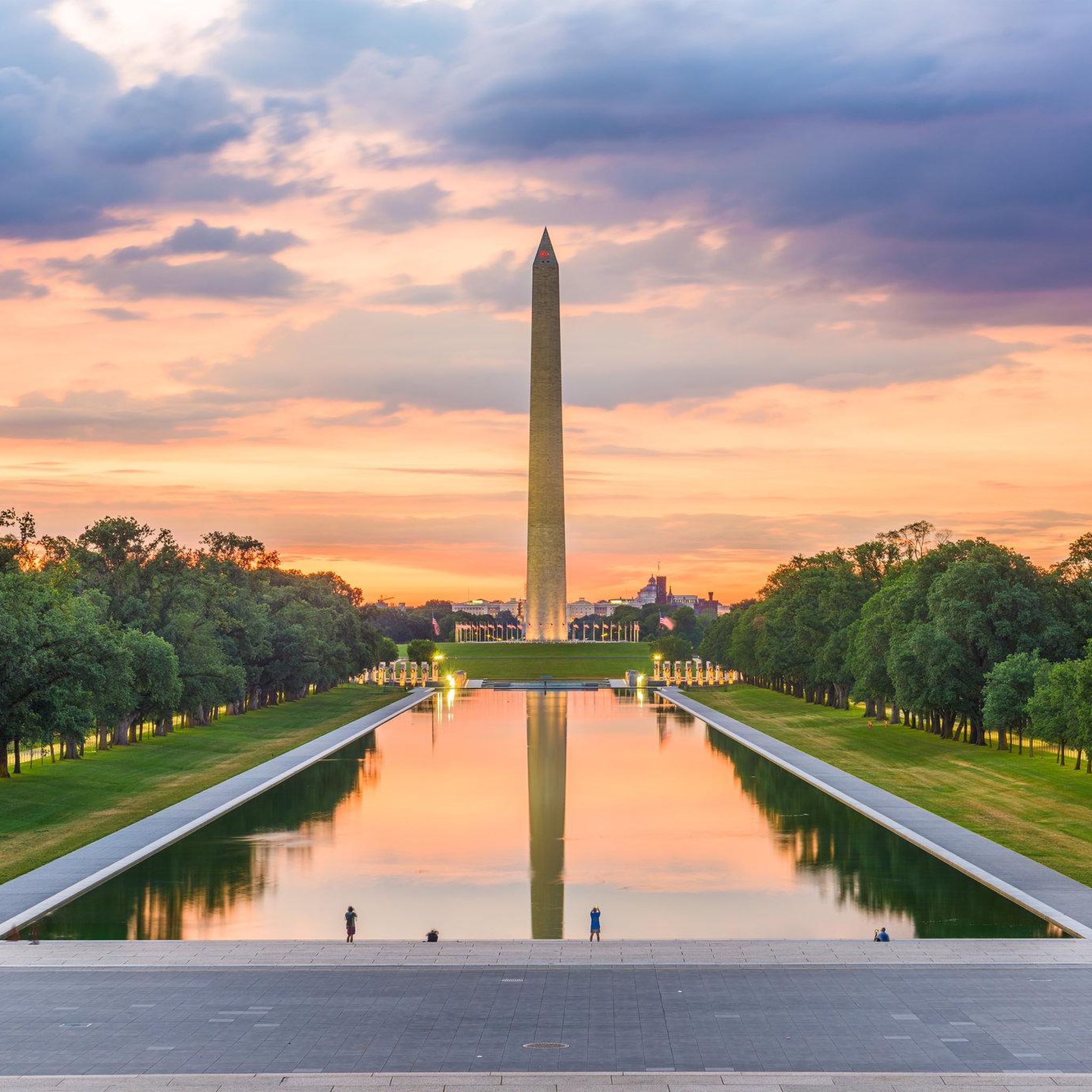
one of the sights in the National Mall
1
0
The National Mall is a wonderful place in Washington. Naturally, it is very popular.
0
0


Enjoy easy access to the Great Falls, a popular destination for photographers, hikers, and expert kayakers. Though not exceptionally tall, the falls surge with force as the Potomac River carves through ancient, metamorphic rock.
1
0

Located at mile 14.3 on the C&O Canal Towpath in Potomac, Maryland, Great Falls Park is a must-visit highlight for hikers, cyclists, and history buffs alike. A short boardwalk leads to the Olmsted Island overlook, where the Potomac River dramatically crashes over jagged rocks—one of the most scenic views near D.C. For hikers, the popular Billy Goat Trail offers three segments, with Section A featuring challenging rock scrambles and breathtaking river views. The historic Great Falls Tavern, built in 1829, now serves as a visitor center and launch point for seasonal mule-drawn canal boat rides. The towpath itself is flat and easy to navigate, ideal for walking or biking. Amenities include restrooms, picnic spots, and interpretive exhibits. Parking is available at the visitor center (fee required), or you can park for free at nearby Swains Lock and walk or ride 2.5 miles to the falls.
1
0

A memorial dedicated to President Abraham Lincoln, featuring a colossal statue. Set in a beautiful park, it's a real crowd-puller.
1
0

The Capital Crescent Trail follows the north shoreline of the Potomac river downstream into Washington, D.C. Currently the trail is around 7 miles long, but there is an extension planned for the near future.
0
1
Frequently Asked Questions
What kind of terrain can I expect on gravel bike trails around Brentwood?
Gravel biking in Brentwood offers a diverse mix of terrain. You'll find paved roads, gravel paths, and dirt hills, providing varied experiences. The region is characterized by agricultural landscapes, regional park trails, and access to the East Bay hills, including areas near Mount Diablo State Park.
Are there any challenging gravel routes for experienced riders near Brentwood?
Yes, for experienced riders seeking a challenge, the proximity to Mount Diablo State Park offers demanding gravel routes with significant elevation gains. While some ascents are paved, you can incorporate substantial dirt sections, such as those leading up Wall Point Road and Summit Trail.
Are there any family-friendly gravel biking options in the Brentwood area?
For a more relaxed, family-friendly experience, consider the Marsh Creek Regional Trail. This paved trail stretches approximately 6 miles, offering picturesque views of wetlands and grasslands. The Big Break Regional Shoreline also features a 3-mile paved path along the Delta shoreline, excellent for easy biking and birdwatching, and it connects to the Marsh Creek Regional Trail.
What are some scenic viewpoints or natural features to look out for on Brentwood's gravel trails?
Brentwood's trails offer several scenic highlights. Round Valley Regional Preserve provides stunning views, while the Marsh Creek Regional Trail meanders through wetlands and wooded areas. The Big Break Regional Shoreline offers diverse natural environments including marshes and waterways. For expansive vistas, the higher elevations of Mount Diablo State Park provide breathtaking sights, often above the clouds.
Are there any circular gravel bike routes available in Brentwood?
Yes, for those preferring a loop, the Delta de Anza and Mokelumne Trail Loop in Contra Loma Regional Park is an easy touring option. It features paved paths, reservoir views, and canal-side riding, making for a pleasant circular ride.
What do other gravel bikers enjoy most about the trails in Brentwood?
The gravel biking routes around Brentwood are highly rated by the komoot community, with an average score of 5.0 stars. Riders often praise the varied terrain, from agricultural landscapes to regional park trails, and the accessibility to the diverse East Bay hills, which cater to different ability levels.
Can I access gravel bike trails near Brentwood using public transport?
While specific public transport connections to trailheads can vary, many regional parks and trails in the East Bay, including those accessible from Brentwood, are often served by local bus routes. It's advisable to check the specific transit authority websites for routes serving areas like Round Valley Regional Preserve or the Marsh Creek Regional Trail.
Where can I find parking for gravel biking trails around Brentwood?
Most regional parks and preserves in the Brentwood area, such as Round Valley Regional Preserve and Big Break Regional Shoreline, offer designated parking facilities at their trailheads. For routes within or near Mount Diablo State Park, various parking areas are available, though some may require a fee.
Are there any hidden gem gravel routes in the Brentwood area?
While specific 'hidden gems' are often discovered by local exploration, the agricultural landscapes surrounding Brentwood offer many quiet, less-trafficked roads and paths that can be excellent for gravel biking. Exploring the network of roads through the Sacramento Valley foothills can reveal peaceful and scenic routes away from more popular areas.
What is the best time of year for gravel biking in Brentwood?
The East Bay region, including Brentwood, generally offers good gravel biking conditions for much of the year. Spring and fall provide pleasant temperatures, while winter can be suitable on drier days. Summers can be hot, so early morning or late afternoon rides are recommended during those months.
Are there any specific routes that offer a good mix of paved and unpaved sections?
Many routes in the Brentwood area naturally offer a mix of surfaces. For example, rides incorporating sections of the Marsh Creek Regional Trail often connect to unpaved paths in nearby preserves or agricultural roads, providing a varied experience. Similarly, routes around Mount Diablo State Park combine paved ascents with substantial dirt sections.
How many gravel bike trails are available in the Brentwood area on komoot?
Komoot currently features 5 gravel bike routes around Brentwood, all rated as moderate difficulty. These routes offer diverse experiences, from scenic loops to more challenging rides.
Most popular attractions around Brentwood

Get inspired with the komoot mobile app


Explore more
Browse the best Gravel rides in other regions.
