The best running trails around Bourguignon-Lès-Morey
104
runners
11
runs
Jogging routes around Bourguignon-Lès-Morey are set within the Haute-Saône department of France, characterized by a diverse landscape. The village is situated against the Roche de Morey, offering views over a valley where the Rigollette river flows. The terrain is hilly but generally not excessively steep, featuring a mix of agricultural land and forests. Joggers can experience varied surfaces, including steep village streets and grassy alleys, alongside more extensive paths through natural areas.
Best jogging routes around Bourguignon-Lès-Morey
- The most popular…
Last updated: July 2, 2026
38
runners
17.5km
02:08
380m
380m
Hard run. Very good fitness required. Mostly paved surfaces. Suitable for all skill levels.
35
runners
12.2km
01:31
280m
280m
Moderate run. Good fitness required. Mostly paved surfaces. Suitable for all skill levels.

Sign up for free
4
runners
10.1km
01:11
270m
270m
Moderate run. Good fitness required. Mostly paved surfaces. Suitable for all skill levels.
3
runners
8.81km
00:55
80m
80m
Moderate run. Good fitness required. Mostly paved surfaces. Suitable for all skill levels.
3
runners
11.3km
01:15
110m
110m
Moderate run. Good fitness required. Mostly paved surfaces. Suitable for all skill levels.
Get access to more routes and recommendations from other explorers.
Sign up for free
Already have an account?
Our route recommendations are based on thousands of hikes, rides, and runs completed by other people on komoot.
Start today with a free account
Your next adventure awaits.
Login or Signup

Tips from the Community

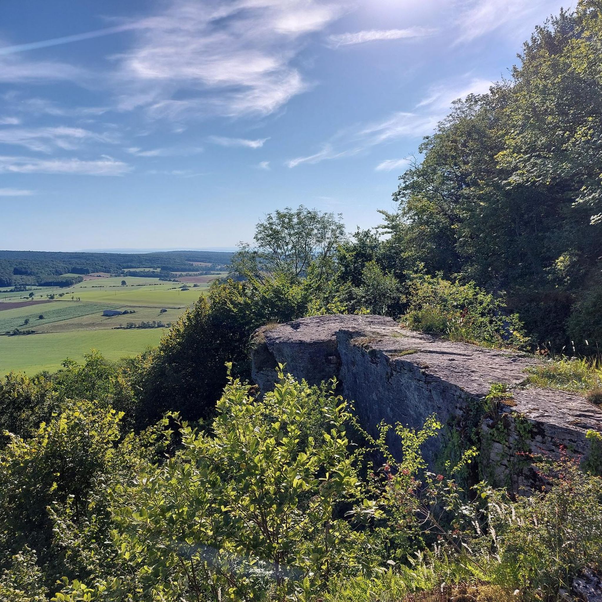
Tucked away in the woods is this rock that is easy to walk on and offers a beautiful view over the country and the village of Molay. Caution is advised, there are no railings, only your own prudence as a fall protection.
2
0
Frequently Asked Questions
What kind of terrain can I expect on the running routes around Bourguignon-Lès-Morey?
The running routes in Bourguignon-Lès-Morey feature a diverse landscape. You'll encounter hilly, undulating terrain, a mix of extensive forests, and open agricultural fields. Within the village, there are steep streets and grassy alleys. Many routes, especially those around the Roche de Morey, have minimal paved sections, offering a more natural running experience.
Are there any easy or beginner-friendly running trails in the area?
While many routes in Bourguignon-Lès-Morey involve moderate to difficult elevation changes, there are options suitable for various fitness levels. For instance, the Running loop from Genevrières is a moderate 8.7 km path with relatively lower elevation gain, making it a good choice for those seeking a less strenuous run.
What natural features or landmarks can I see while jogging around Bourguignon-Lès-Morey?
Joggers can enjoy breathtaking panoramas from the summit of the Roche de Morey, overlooking a valley where the Rigollette river meanders. The area is rich in natural beauty, with forests that transform with the seasons. In spring, you might even spot unusual wild orchids on Mount Lawn Rock. Additionally, you can explore the ancient prehistoric and archaeological site above the village, dating back to 4000 B.C.
Are there any circular running routes available?
Yes, many of the running routes around Bourguignon-Lès-Morey are designed as loops. Popular options include the La Grosse Roche loop from Suaucourt, the La Grosse Roche loop from Bourguignon-lès-Morey, and the La Grosse Roche loop from La Roche-Morey, all offering varied distances and challenges.
What is the best time of year to go running in Bourguignon-Lès-Morey?
The region offers beautiful scenery throughout the year as the forests and agricultural lands transform with the seasons. Spring is particularly appealing for the chance to see wild orchids on Mount Lawn Rock. The moderate elevation gains and varied terrain make it suitable for running in most seasons, though checking local weather conditions is always advisable.
Are there any organized running events in Bourguignon-Lès-Morey?
Yes, Bourguignon-Lès-Morey is known for its trail running events, such as the 'Course Nature de la Montagne de la Roche' and the 'Trail de la Montagne de la Roche'. These events typically feature routes of 9 to 17 kilometers with moderate elevation gains and minimal paved sections, highlighting the natural beauty and heritage of the Montagne de la Roche.
What are the typical distances and elevation gains for running routes here?
Running routes in Bourguignon-Lès-Morey vary in length and elevation. For example, the La Grosse Roche loop from Suaucourt is 17.5 km with over 380m of elevation gain, while the Running loop from Fouvent-Saint-Andoche is 11.3 km with around 112m of elevation gain. You'll find options ranging from moderate to difficult, catering to different endurance levels.
Is Bourguignon-Lès-Morey a good place for trail running?
Absolutely. With its hilly terrain, extensive forests, and minimal paved sections, Bourguignon-Lès-Morey is an excellent destination for trail running. The varied paths, technical ascents, and rapid descents, especially around the Montagne de la Roche, provide a challenging and rewarding experience for trail runners.
Are the running routes around Bourguignon-Lès-Morey suitable for families?
The region offers a tranquil environment with extensive paths, making it suitable for active exploration. While some routes are challenging, there are also moderate options that families who enjoy outdoor activities can explore together. It's advisable to check the specific route details for distance and elevation to ensure it matches your family's fitness level.
What is the general difficulty level of running routes in this area?
The running routes around Bourguignon-Lès-Morey are generally categorized as moderate to difficult. They feature undulating hilly terrain and notable elevation gains, particularly on routes like the La Grosse Roche loop from Bourguignon-lès-Morey, which has nearly 400m of ascent over 14.3 km. There are fewer easy routes, making it more appealing for those seeking a good workout.
Where can I learn more about the history and heritage of Bourguignon-Lès-Morey?
Beyond the running trails, you can delve into the region's past by visiting the Maison du Patrimoine in Bourguignon-Lès-Morey. This heritage house showcases archaeological findings from the ancient fortified settlement above the village, offering insights into the Neolithic and Iron Ages.
Most popular routes around Bourguignon-Lès-Morey

Get inspired with the komoot mobile app


Explore more
Browse the best Running Trails & Routes in other regions.
