The best running trails around Rouvray-Sainte-Croix
5.0
(1)
125
runners
28
runs
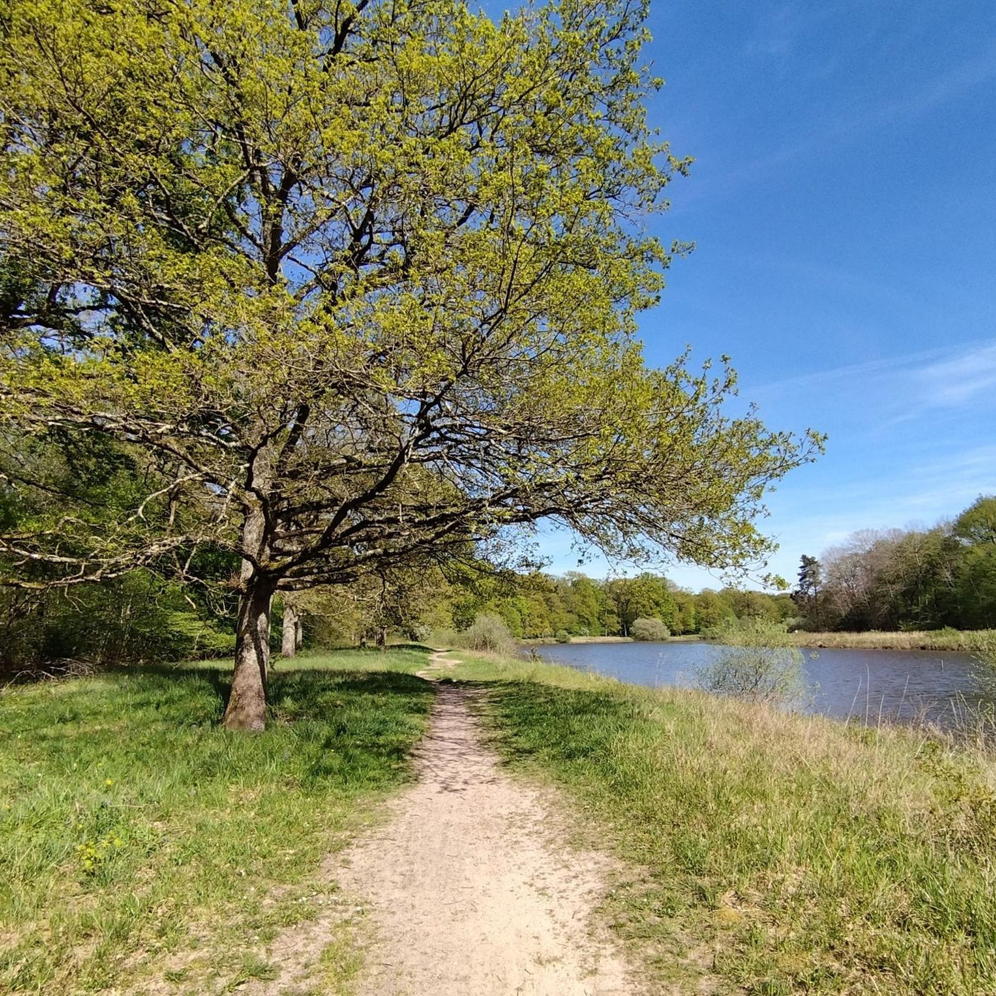
Jogging routes around Rouvray-Sainte-Croix are situated within the Natura 2000 zone "Beauce et vallée de la Conie," an area recognized for its ecological significance. The region features diverse terrains, including wetlands, dry grasslands, and wooded areas, providing varied running surfaces. The Conie River, a cyclic tributary of the Loir, flows through the landscape, offering scenic paths alongside water features. This natural environment supports a range of outdoor activities, including running.
Best jogging routes around Rouvray-Sainte-Croix
- The most popular jogging route…
Last updated: June 27, 2026
18
runners
7.73km
00:48
20m
20m
Moderate run. Good fitness required. Mostly paved surfaces. Suitable for all skill levels.
6
runners
9.64km
01:00
30m
30m
Moderate run. Good fitness required. Mostly paved surfaces. Suitable for all skill levels.

Sign up for free
4
runners
5.62km
00:35
20m
20m
Moderate run. Good fitness required. Mostly paved surfaces. Suitable for all skill levels.
3
runners
15.2km
01:34
40m
40m
Hard run. Very good fitness required. Mostly paved surfaces. Suitable for all skill levels.
2
runners
6.65km
00:45
10m
10m
Moderate run. Good fitness required. Mostly paved surfaces. Suitable for all skill levels.
Get access to more routes and recommendations from other explorers.
Sign up for free
Already have an account?
Our route recommendations are based on thousands of hikes, rides, and runs completed by other people on komoot.
Start today with a free account
Your next adventure awaits.
Login or Signup
Popular around Rouvray-Sainte-Croix
Tips from the Community

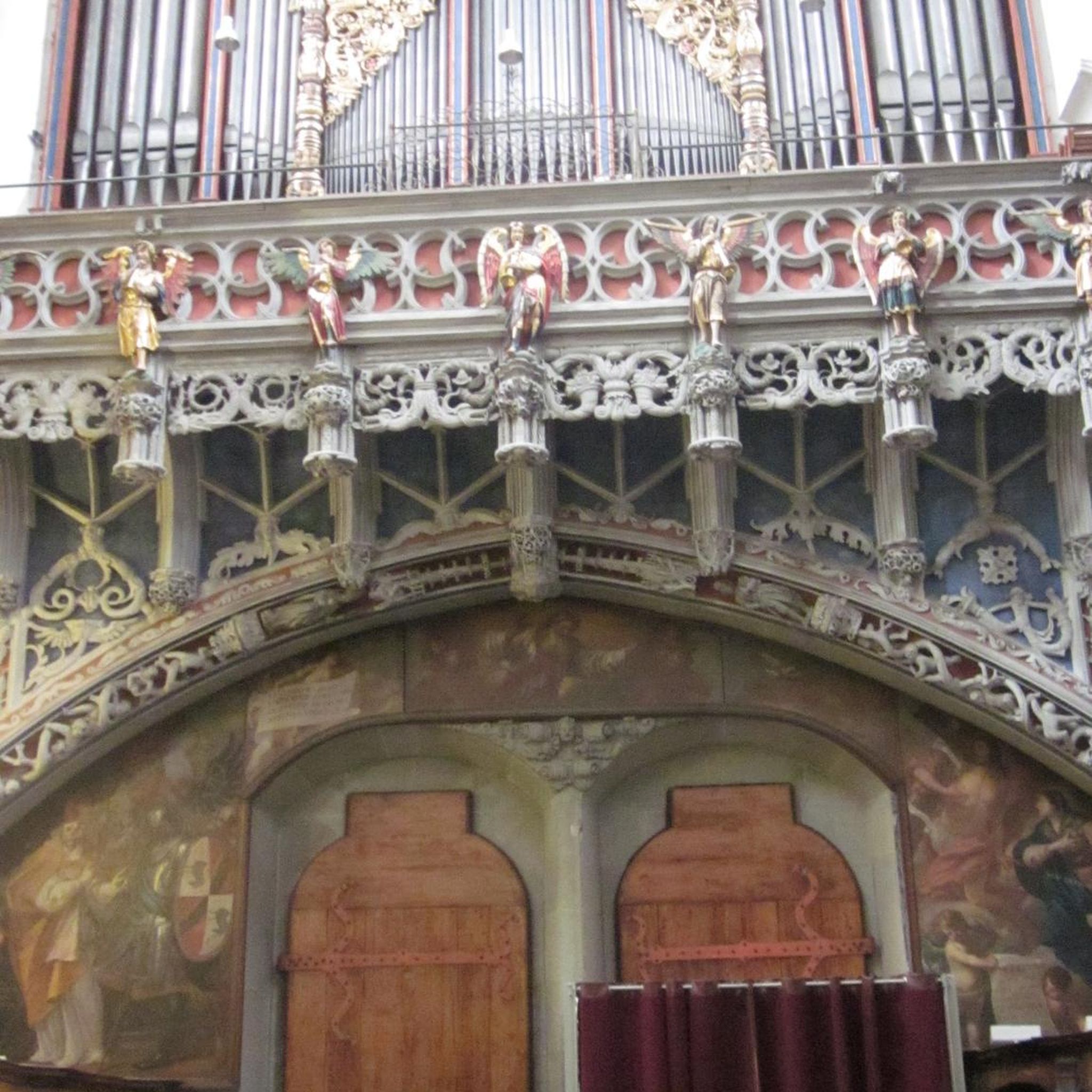
The Saint André church (13th-15th-16th centuries) In the 7th century, the Benedictine abbey of Bonneval created a priory-curate. Its existence is confirmed by a bull from Pope Gregory second half of the 16th century. In 1793 the church was desecrated and transformed into wine and spirits warehouses. In 1801, the church was returned to worship and changed diocese: from the diocese of Chartres, to which it belonged before the Revolution, it passed to the diocese of Orléans, notably for reasons of distance: Chartres is 48 km from Patay then that Orléans is only 27 km away. The church is 30 m long and 17 m wide. The oldest parts are located near the large porch (13th century). One of the pillars of the nave is decorated with a vestige of Danse Macabre from the mid-15th century. A small masonry door on the right communicated with the old priory, of which ruins remain to the south of the church. The choir dates from the 14th century; the apse wall was decorated with paintings at the end of the 19th century, the chapels were then redeveloped and equipped with new stained glass windows. The keystones of the large nave were made from casts taken from the figurines which adorn the Thesis Room of the University of Orléans, built in 1411. The bell tower, located to the north of the choir, would be an old watchtower. Its pinnacles and eight openings were made after the Wars of Religion. The four bells were melted in 1868. The largest was cracked by a Prussian shell in 1870 and was recast in 1871. Since that year, Ernestine (809 kg, 1 m 12 in diameter at the base, sounding the F), Gabrielle (550 kg, 0.981 m in diameter, sounding the ground), Anne (398 kg, 0.573 m in diameter) and Marie (222 kg, 0.724 m in diameter, sounding the C) give rhythm to the daily life of the small town of Patay, old Beauceron railway junction. On August 15, 1944, an ammunition train was blown up at Patay station. The station was blown up, except for the carriage shed, and all the windows in the town were shattered. Luckily, a providential storm limited the damage. The only two stained glass windows that survived the explosion are those on the right side aisle which date from 1930 and relate the communion of Joan of Arc in the Patay church in 1429. The church was listed as a Historic Monument in 1925 by decree of October 6, 1925.
0
0
Frequently Asked Questions
How many running routes are available around Rouvray-Sainte-Croix?
There are over 20 running routes available around Rouvray-Sainte-Croix, offering a variety of distances and experiences for joggers.
What kind of terrain can I expect on the jogging trails in this region?
The jogging trails in Rouvray-Sainte-Croix, located within the Natura 2000 zone "Beauce et vallée de la Conie," feature diverse terrains. You can expect to run through wetlands, dry grasslands, and wooded areas, providing varied scenery and different running surfaces.
Are there any family-friendly running options in Rouvray-Sainte-Croix?
While specific 'family-friendly' designations aren't provided, many of the moderate routes, such as the Running loop from Coinces (5.6 km), are suitable for families looking for a pleasant outdoor activity. The varied landscapes offer engaging backdrops for all ages.
Can I bring my dog on the running routes around Rouvray-Sainte-Croix?
The natural environment of Rouvray-Sainte-Croix, with its diverse landscapes and wooded sections, is generally suitable for running with dogs. However, always ensure your dog is on a leash and respect local regulations, especially within the Natura 2000 protected areas to protect local flora and fauna.
Are there circular running routes available?
Yes, many of the routes are designed as loops, offering convenient circular running experiences. Examples include Le Lac loop from Coinces and the Running loop from Saint-Péravy-la-Colombe, allowing you to start and finish at the same point.
What are some points of interest or landmarks I might see while running?
While running, you might encounter various points of interest. For example, the Saint-André Church of Patay loop from Patay passes by the historic Saint-André Church of Patay. Other notable landmarks in the broader area include the Aerotrain test track and the Lignerolles Mill.
What is the best season for running in Rouvray-Sainte-Croix?
The diverse landscapes of Rouvray-Sainte-Croix make it appealing for running throughout the year. Spring and autumn offer pleasant temperatures and vibrant scenery, while summer provides lush green views. Even winter can be enjoyable, with crisp air and unique natural beauty, especially in the wooded areas.
Are there running options for different fitness levels?
Yes, the routes cater to various fitness levels. While most are classified as moderate, offering a good challenge for regular runners, there are also some more difficult options for those seeking a greater workout. The shortest routes, like the Running loop from Villeneuve-sur-Conie (5.1 km), are suitable for a quicker run.
How do other runners rate the trails in Rouvray-Sainte-Croix?
The running routes in Rouvray-Sainte-Croix are highly rated by the komoot community, with an average score of 5.0 stars. Runners often praise the varied terrain and the peaceful, natural environment of the area.
Are there any longer running trails for endurance training?
For those looking for longer runs, routes like Le Lac loop from Coinces, at 9.6 km, provide a good distance for endurance training, allowing you to explore more of the region's diverse landscapes.
What makes the natural environment of Rouvray-Sainte-Croix unique for running?
The region's uniqueness stems from its location within the Natura 2000 zone "Beauce et vallée de la Conie." This means runners can experience a rich ecological environment, including wetlands, dry grasslands, and wooded areas, often alongside the scenic Conie River. It's a chance to observe diverse flora and fauna, such as specific bird species, in a protected natural setting.
Can I find routes that follow water features?
Yes, the Conie River, a cyclic tributary of the Loir, winds through the Beauce region. Its course includes wetlands and wooded areas, providing scenic routes for those who enjoy jogging alongside water features and experiencing the unique riparian environment.
Where can I find information about public transport or parking near the running trails?
While specific public transport details to individual trailheads are not readily available, Rouvray-Sainte-Croix is a small commune. For general information on reaching the area or parking options, it's advisable to consult local resources such as the Loiret tourism website or local municipal information for parking facilities in the villages where routes often start, like Coinces or Saint-Péravy-la-Colombe.
Most popular routes around Rouvray-Sainte-Croix
Most popular attractions around Rouvray-Sainte-Croix

Get inspired with the komoot mobile app


Explore more
Browse the best Running Trails & Routes in other regions.
