The best walks and hikes around Quemigny-Sur-Seine
4.8
(24)
123
hikers
24
hikes
Hiking around Quemigny-Sur-Seine offers diverse landscapes, from serene river valleys to rolling hills and expansive forests. The region is characterized by its varied topography, including the upper valley of the Seine River where it begins as a small stream, and hills reaching altitudes of up to 422 meters. This blend of natural features provides a picturesque backdrop for exploration, with trails winding through wooded areas and along waterways.
Best hiking trails around Quemigny-Sur-Seine
- The most popular hiking route is Rochefort-sur-Brévon…
Last updated: May 14, 2026
4.8
(6)
33
hikers
Moderate hike. Good fitness required. Easily-accessible paths. Suitable for all skill levels.
4.8
(4)
15
hikers
9.25km
02:37
200m
200m
Moderate hike. Good fitness required. Easily-accessible paths. Suitable for all skill levels.

Sign up for free
4.3
(3)
13
hikers
14.2km
03:57
270m
270m
Moderate hike. Good fitness required. Easily-accessible paths. Suitable for all skill levels.
4.3
(3)
12
hikers
12.6km
03:30
230m
230m
Moderate hike. Good fitness required. Easily-accessible paths. Suitable for all skill levels.
4
hikers
4.88km
01:23
100m
110m
Easy hike. Great for any fitness level. Easily-accessible paths. Suitable for all skill levels.
Get access to more routes and recommendations from other explorers.
Sign up for free
Already have an account?
Our route recommendations are based on thousands of hikes, rides, and runs completed by other people on komoot.
Start today with a free account
Your next adventure awaits.
Login or Signup
Popular around Quemigny-Sur-Seine

Tips from the Community

Historical monument from the 15th century
0
0
There are numerous picnic areas with tables and benches
0
0

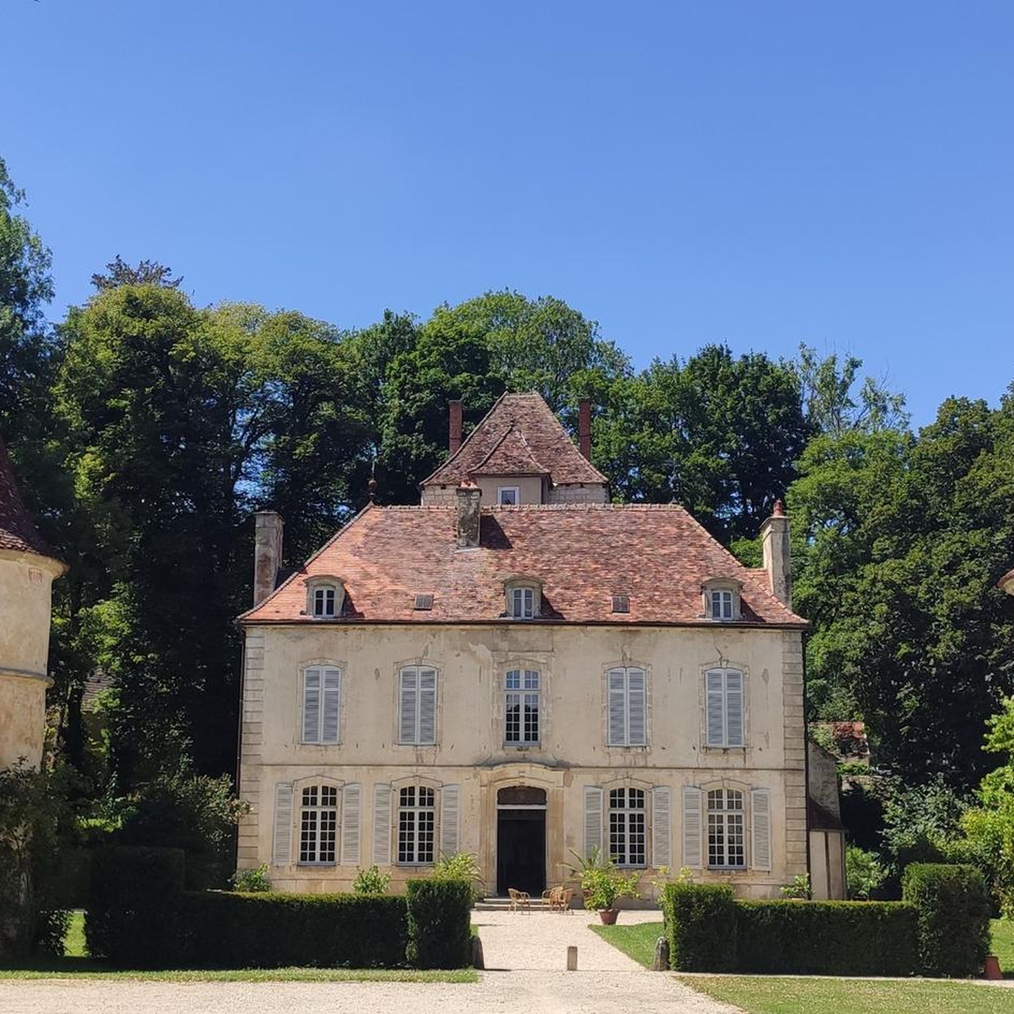
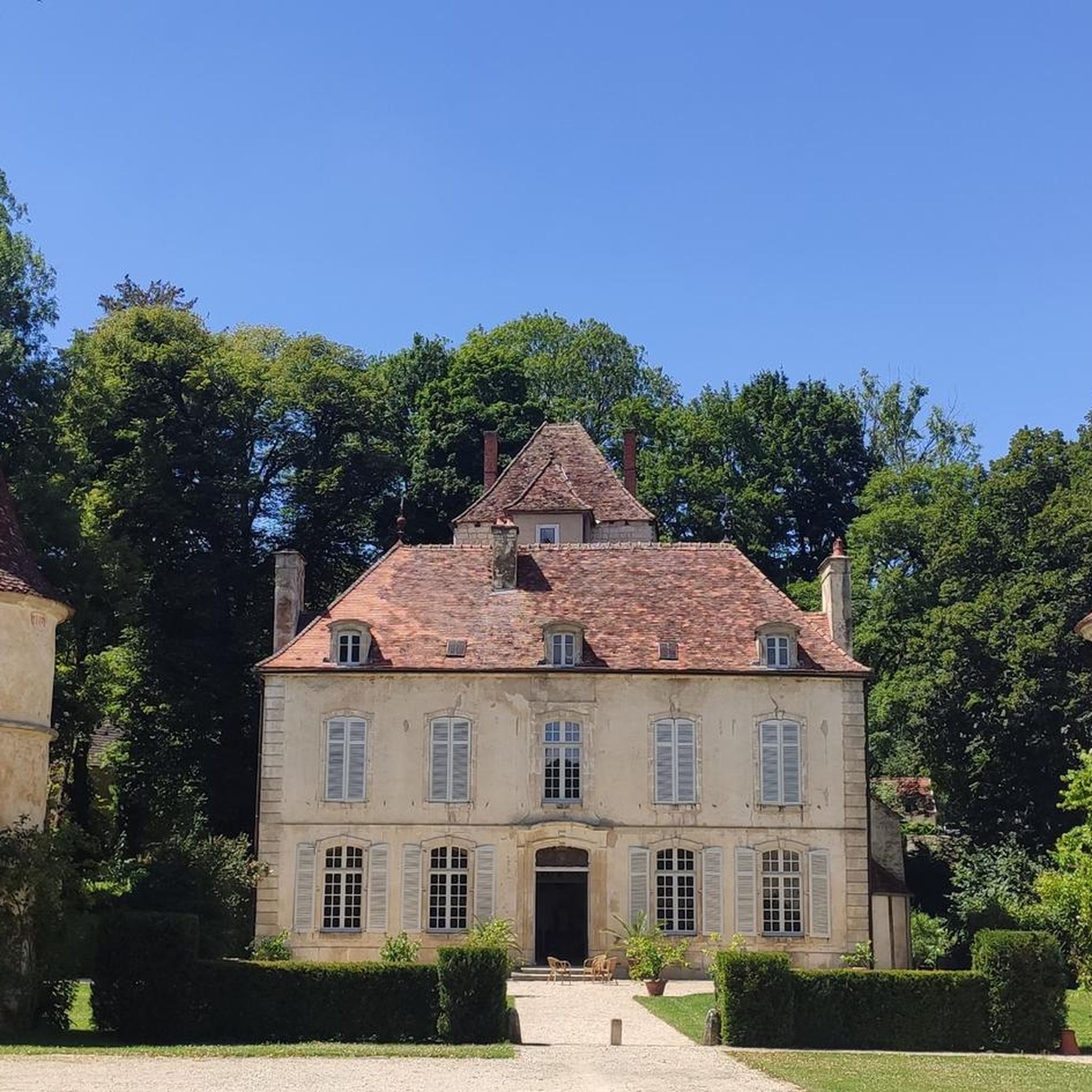
This village is located in lush greenery in the heart of the National Forest Park, in a preserved valley. You will not find more than 40 inhabitants in the town. You can admire its very beautiful castle, which is private and therefore not open to visitors.
0
0

This village is located in lush greenery in the heart of the National Forest Park, in a preserved valley. You will not find more than 40 inhabitants in the town. You will be able to admire its very beautiful castle, which is private and therefore not open to visitors.
1
0


Château sitting above Rochefort-sur-Brévon. Not open to the public
0
0
Frequently Asked Questions
What kind of terrain can I expect on hiking trails around Quemigny-sur-Seine?
The region offers a diverse landscape, from serene river valleys where the Seine begins as a small stream, to rolling hills and expansive forests. You'll find varied topography, with some hills reaching up to 422 meters, providing a mix of gentle strolls along riverbanks and more challenging ascents through wooded areas.
Are there any easy hiking routes suitable for beginners or casual walkers?
Yes, there are several easy routes. For a pleasant, shorter walk, consider the Château de Quemigny-sur-Seine loop from Quemigny-sur-Seine. This easy 4.8 km trail offers a gentle introduction to the area's scenery.
What are some notable natural features or landmarks to look out for while hiking?
The region is rich in natural and historical sights. You can explore the upper valley of the Seine River, near its source, and discover charming bridges like Pont Brémur or the Stone Bridge over the Seine at Vaurois. The area also features dense woodlands and rolling hills that offer scenic viewpoints.
Are there any historical sites or castles accessible from the hiking trails?
Absolutely. Hiking in this area often combines natural beauty with historical insights. You can find ruins like Villaines-en-Duesmois Castle or the private Rocheprise Castle. The village of Rochefort-sur-Brévon, which is a starting point for several hikes, also has historical significance.
Are there any long-distance hiking trails that pass through Quemigny-sur-Seine?
Yes, the famous GR®2, also known as the Seine trail, traverses the region. This long-distance route follows the banks of the Seine from its source. The eastern part of the GR®2 around Quemigny-sur-Seine is generally considered relatively easy to traverse, making it accessible for many hikers. You can find more information about the GR2 on the Burgundy Tourism website.
What do other hikers say about the trails in Quemigny-sur-Seine?
The hiking routes in Quemigny-sur-Seine are highly rated by the komoot community, with an average score of 4.7 stars from nearly 20 reviews. Hikers often praise the varied terrain, from quiet woodlands to picturesque river valleys, and the well-maintained paths.
Are there any circular hiking routes available?
Yes, many of the trails are designed as loops. For example, you can enjoy the Rochefort-sur-Brévon – Rochefort-sur-Brevon loop from Rochefort-sur-Brévon, which is a moderate 9.3 km route exploring the natural environment. Another option is the Source of the Coquille – Ferme de la Pothière loop from Étalante, a 12.6 km trail through varied terrain.
What is the best time of year to go hiking in Quemigny-sur-Seine?
The region's diverse landscapes, including forests and river valleys, make it enjoyable for hiking across multiple seasons. Spring and autumn offer pleasant temperatures and beautiful foliage, while summer provides lush greenery. Even winter can be appealing for those seeking quiet, serene walks, though conditions may vary.
Are there any family-friendly hiking options?
The varied topography means there are options for different ability levels. Shorter, easier routes like the Château de Quemigny-sur-Seine loop from Quemigny-sur-Seine are generally suitable for families looking for a gentle outdoor experience.
Can I bring my dog on the hiking trails?
While specific regulations can vary by trail or protected area, generally, many outdoor trails in France are dog-friendly, especially if kept on a leash. It's always recommended to check local signage or specific trail rules before heading out with your pet to ensure a pleasant experience for everyone.
How many hiking trails are there in the Quemigny-sur-Seine area?
There are over 20 hiking routes available around Quemigny-sur-Seine, offering a wide range of choices for different preferences and fitness levels. These include 6 easy, 15 moderate, and 1 difficult trail.
Are there any trails that explore the source of a river?
Yes, the region is notable for being in the upper valley of the Seine River, near its source. You can find trails that explore the beginnings of rivers, such as the Source of the Coquille – Cirque de la Coquille loop from Aignay-le-Duc, which offers a moderate 13.8 km hike through this unique natural environment.
Most popular attractions around Quemigny-Sur-Seine

Get inspired with the komoot mobile app


Explore more
Browse the best Hikes in other regions.
