The best cycling routes in Cuyamaca Rancho State Park
5.0
(6)
168
riders
16
rides
Touring cycling in Cuyamaca Rancho State Park features routes through diverse landscapes, including extensive pine, fir, and oak forests interspersed with expansive meadows. The park is situated within the Cuyamaca and Laguna Mountains, featuring granitic peaks and elevations up to 6,512 feet. Creeks and streams, such as sections of the Sweetwater River, flow through the park, adding to the varied terrain. These routes provide options for cyclists to explore an alpine environment uncommon in Southern California.
Best touring cycling routes…
Last updated: October 1, 2026
7
riders
95.4km
06:25
1,580m
1,580m
Hard bike ride. Very good fitness required. Mostly paved surfaces. Suitable for all skill levels.
8
riders
Hard bike ride. Very good fitness required. Mostly paved surfaces. Suitable for all skill levels.

1
riders
44.3km
02:48
600m
880m
Hard bike ride. Very good fitness required. You may need to push your bike for some segments of this route.
5.0
(2)
9
riders
42.3km
02:55
770m
770m
Hard bike ride. Very good fitness required. Mostly paved surfaces. Suitable for all skill levels.
5.0
(1)
27
riders
24.6km
02:28
440m
440m
Moderate bike ride. Good fitness required. Mostly paved surfaces. Suitable for all skill levels.
Get access to more routes and recommendations from other explorers.
Already have an account?
Our route recommendations are based on thousands of hikes, rides, and runs completed by other people on komoot.
Start today with a free account
Your next adventure awaits.
Tips from the Community

The road into William Heise County Park winds through oak woodlands with a steady elevation gain. Once inside, you’ll find shaded picnic spots, restrooms, and a cool forest setting—a big change from the exposed roads around Julian. The park is part of the Cleveland National Forest, and during the right season, you’ll see a variety of wildflowers that are part of the local ecosystem.
0
0
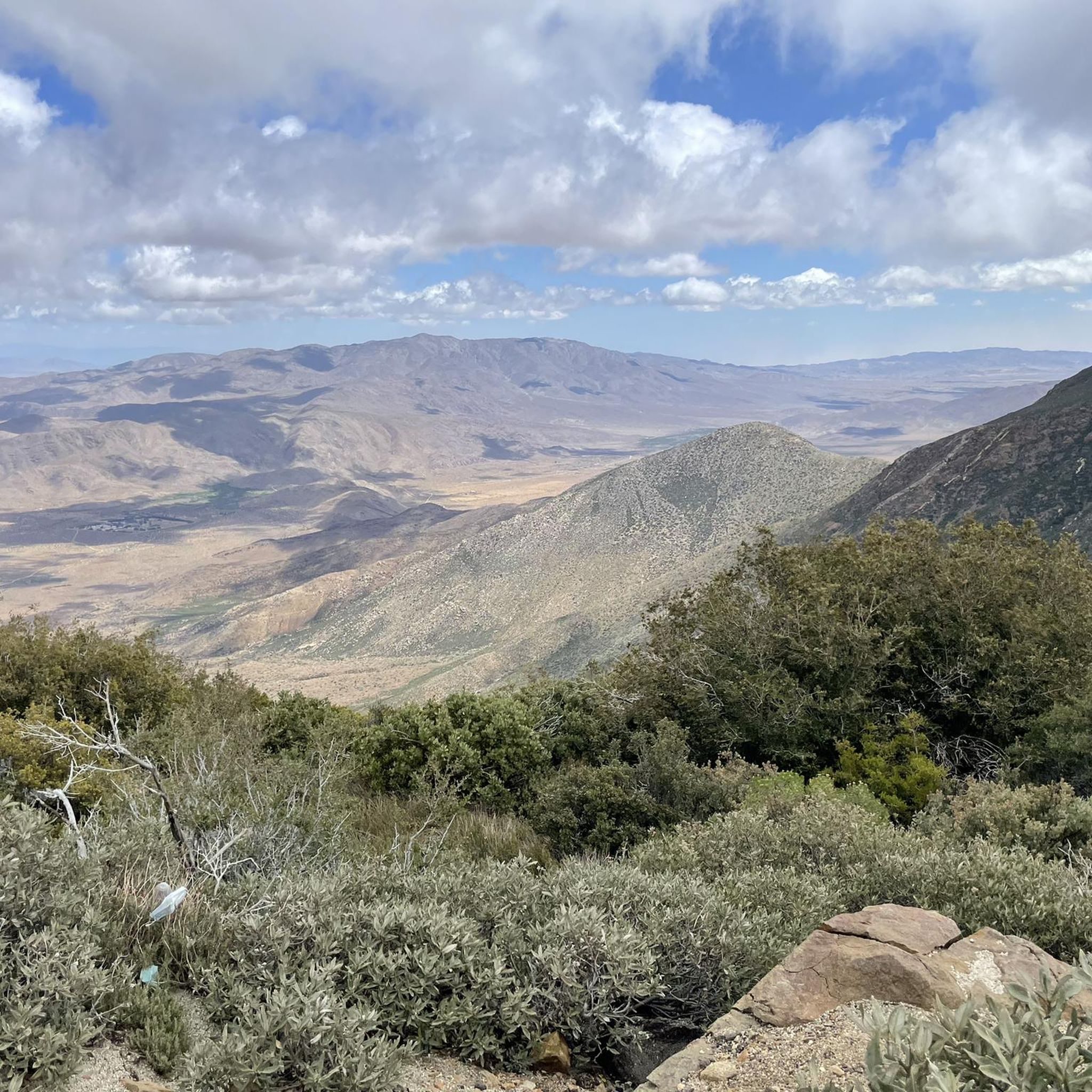
A quick and easy stop with big views for minimal effort. Inspiration Point sits right off Highway 79, just south of Julian. From the overlook, you get sweeping views over the desert below and the distant peaks beyond—especially dramatic in the late afternoon light.
0
0
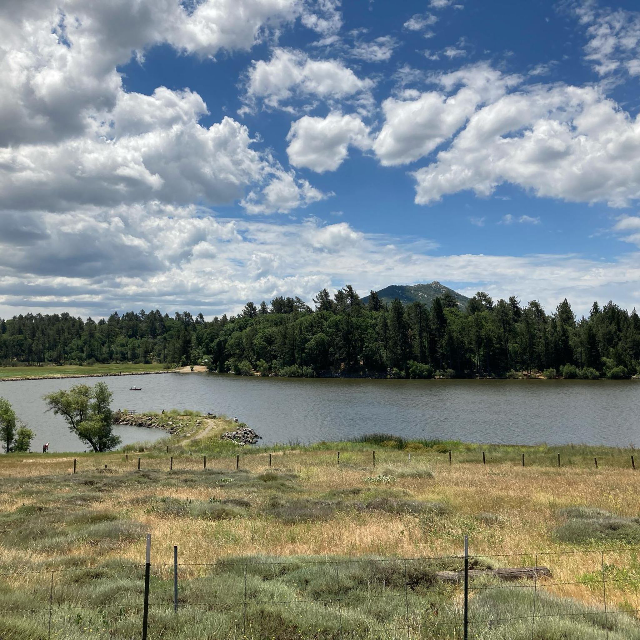
A quiet pull-off spot just off the highway, surrounded by tall pines and cooler air. The pond itself is small but scenic—a nice excuse to stop, stretch your legs, and enjoy a quick breather before continuing the climb. Not much traffic back here, so it feels like a peaceful break from the road.
0
0

Great spot to rest have a snack and refill water.
0
0

Agua Dulce Trail's steep gradients and technical sections make it better suited for intermediate to advanced riders. Bring plenty of water and be prepared for both the climb and thrilling descents. The effort is well worth it for the adventure and views!
0
0

Laguna Summit is a prominent mountain pass along Sunrise Highway (State Route 79). As one of the highest points along this scenic route, it offers panoramic views of the surrounding landscapes, including the Anza-Borrego Desert to the east and the Pacific Ocean to the west.
0
0
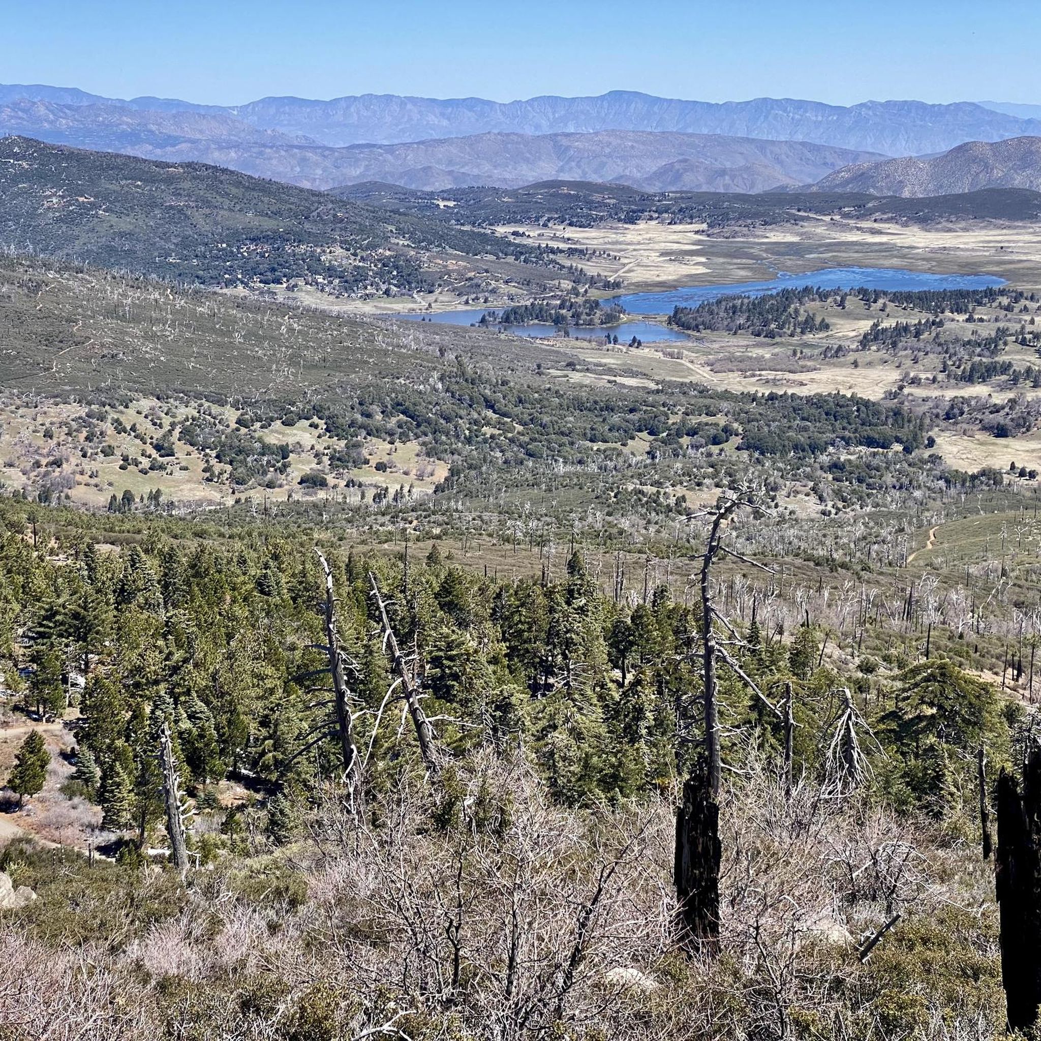
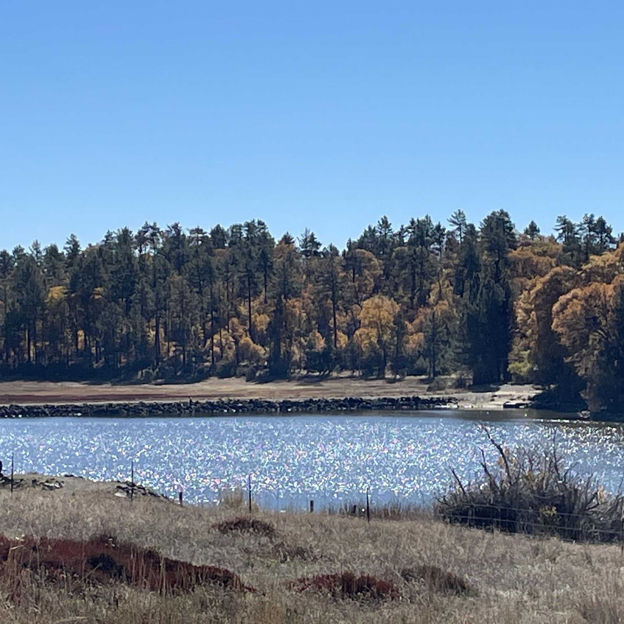
Lake Cuyamaca is a picturesque 110-acre reservoir nestled in the Cuyamaca Mountains. Created in the 1880s to supply water to the city of San Diego, it now serves as a recreational haven for fishing, boating, and picnicking.
0
0

This is a great first stop entering the Cleveland National Forest or Mount Laguna area. You can find helpful maps and information to plan your day hikes here. You can also buy an adventure pass here, which is handy since you need to display either a National Parks pass or an adventure pass to park at most of the trailheads in this area.
0
0
Frequently Asked Questions
How many touring cycling routes are available in Cuyamaca Rancho State Park?
There are 16 touring cycling routes available in Cuyamaca Rancho State Park, offering a variety of experiences for different skill levels. These routes range from moderate to difficult, traversing diverse landscapes.
What kind of terrain can I expect on touring cycling routes in Cuyamaca Rancho State Park?
You can expect a diverse landscape, including extensive pine, fir, and oak forests interspersed with expansive meadows. Routes often feature granitic peaks and can include both paved surfaces and unpaved segments like fire roads. The park's varied elevation creates an alpine environment uncommon in Southern California.
Are there options for less experienced touring cyclists?
Yes, while many routes are challenging, there are 3 moderate touring cycling routes available. These offer a good introduction to the park's scenery without the significant elevation gains of the more difficult trails.
What natural features or landmarks can I see while touring cycling in the park?
The park offers breathtaking natural features. You can encounter prominent peaks like Cuyamaca Peak and Stonewall Peak, which provide panoramic views. Creeks and streams, including sections of the Sweetwater River, flow through the park. You might also explore areas like the Azalea Glen Trail.
Are there any historical sites or other attractions near the touring cycling routes?
Yes, the park has several points of interest. You can visit the Stonewall Mine exhibit, which offers a glimpse into the region's gold rush history. Other notable sites include the Rock with Morteros and the Dyar House Ruins. Lake Cuyamaca, located nearby, also offers recreational opportunities.
Can I find waterfalls or other water features along the routes?
Yes, the park features creeks and streams, including sections of the Sweetwater River with picturesque cascades and pools. Green Valley Falls is a notable spot with seasonal waterfalls and relaxing pools, accessible via an easy hike, making it a great stop for families.
Are there any challenging touring cycling routes for experienced riders?
Absolutely. The park is known for its challenging routes. For instance, the Storm Canyon Overlook – Kwaaymii Point loop from Boulder Creek is a difficult 59.5-mile path featuring substantial climbing through the park's mountainous landscape. Another demanding option is the Kwaaymii Point – Lake Cuyamaca loop from Stonewall Peak, covering 56.4 miles with over 1,000 meters of elevation gain.
What is the best time of year to go touring cycling in Cuyamaca Rancho State Park?
The park's diverse microclimates mean conditions can vary. Generally, spring and fall offer pleasant temperatures for cycling. Summers can be warm, especially at lower elevations, while winters can bring cooler temperatures and occasional snow at higher elevations. Always check local weather conditions before your ride.
Are there any circular touring cycling routes in the park?
Yes, many of the touring cycling routes in Cuyamaca Rancho State Park are designed as loops. Examples include the Storm Canyon Overlook – Kwaaymii Point loop from Cuyamaca Meadow Natural Preserve and the Cold Spring Trail – Fire road to prison road, really nice. The gate may be closd loop from Oakzanita Peak, which takes you through forested areas and fire roads.
What do other touring cyclists say about the routes in Cuyamaca Rancho State Park?
The touring cycling routes in Cuyamaca Rancho State Park are highly rated by the komoot community, with an average score of 5.0 stars from more than 5 reviews. Cyclists often praise the varied terrain, scenic views, and the challenging yet rewarding climbs found throughout the park.
Is parking available for touring cyclists at Cuyamaca Rancho State Park?
Yes, parking is generally available at various trailheads and visitor access points within Cuyamaca Rancho State Park. Specific parking areas may vary depending on the starting point of your chosen route. It's advisable to check the park's official website for detailed information on parking facilities and any potential fees.
Are there any amenities or facilities within the park for cyclists?
The park offers amenities such as visitor centers and campgrounds. The park's visitor center provides cultural insights, and two family campgrounds, Paso Picacho and Green Valley, offer picnic tables, fire rings, and restrooms, which can be useful for longer touring trips.
Most popular routes in Cuyamaca Rancho State Park
Most popular attractions in Cuyamaca Rancho State Park

Get inspired with the komoot mobile app


Explore more
Browse the best Cycling routes in other regions.
