The best cycling routes in Point Au Roche State Park
5.0
(2)
41
riders
4
rides
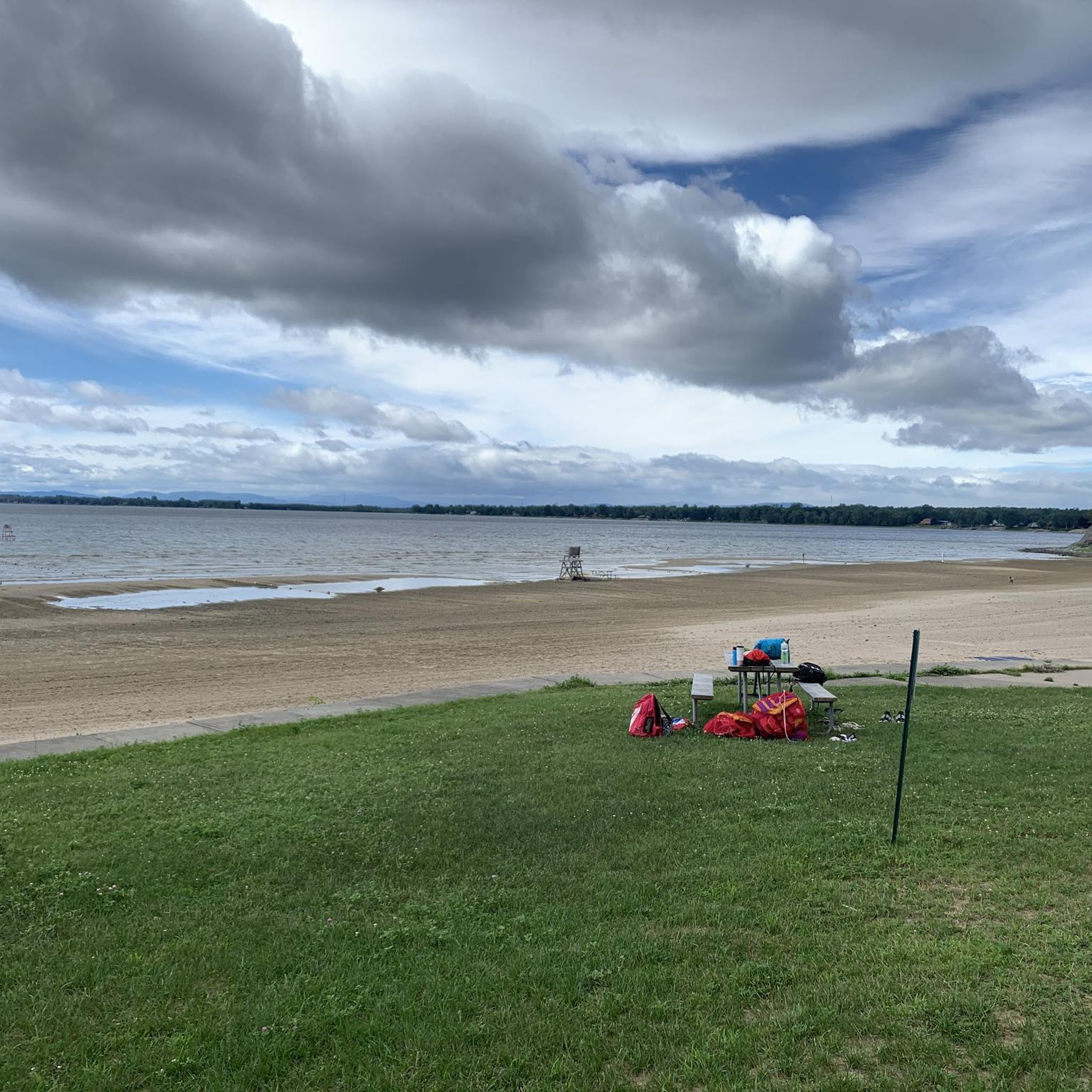
Touring cycling routes in Point Au Roche State Park are situated on the northwestern shore of Lake Champlain, encompassing 856 acres of diverse terrain. The park features a mix of open fields, dense forests, and marshlands, providing varied landscapes for cyclists. Its position offers views of Lake Champlain, Vermont's Green Mountains, and New York's High Peaks. The area includes well-maintained trails and paved paths suitable for different cycling preferences.
Best touring cycling routes in Point Au Roche State Park
- The…
Last updated: May 16, 2026
2
riders
10.8km
00:38
60m
60m
Easy bike ride. Great for any fitness level. Mostly paved surfaces. Suitable for all skill levels.
6
riders
Moderate bike ride. Good fitness required. Mostly paved surfaces. Suitable for all skill levels.

Sign up for free
4
riders
16.8km
00:59
70m
70m
Easy bike ride. Great for any fitness level. Mostly paved surfaces. Suitable for all skill levels.
5.0
(1)
19
riders
52.7km
03:05
210m
210m
Moderate bike ride. Good fitness required. Mostly paved surfaces. Suitable for all skill levels.
5.0
(1)
10
riders
Easy bike ride. Great for any fitness level. Mostly paved surfaces. Suitable for all skill levels.
Our route recommendations are based on thousands of hikes, rides, and runs completed by other people on komoot.
Start today with a free account
Your next adventure awaits.
Login or Signup
Popular around Point Au Roche State Park


Tips from the Community

It’s not the Hudson River….it’s Lake Champlain and the Saranac River.
0
0

A great place to start a ride. Stop at the Food co-op to stock up on snacks. Have coffee at Chapter One!
0
0

Just the place to stop for a bit of everything, from groceries to snacks, housewares, extra gear, and so on. It doesn't hurt that there's a beautiful view of the coast right on the other side of the road, too.
0
0

Over millennia, sediment deposited by the Ausable River created a fertile delta used historically for agriculture and timber. Ausable Marsh is managed by the DEC, it supports activities like wildlife observation, photography, fishing, trapping, hunting, and canoeing, crucial for nesting and feeding habitats of diverse waterfowl species.
0
0
Cycling in Plattsburgh offers a blend of history and activities for visitors to explore. Trinity Park, nestled in downtown Plattsburgh, features a War Memorial, benches, picnic tables, and bicycle racks, providing a serene spot to rest and enjoy the surroundings. Nearby, the War of 1812 Graves near Municipal Beach commemorate 13 unknown American soldiers who succumbed to cholera in 1812, offering a poignant reminder of local history.
0
0
Clyde A. Lewis Park stands on the historic grounds of the former Plattsburgh Air Force Base, honoring Cold War innovations and the legacy of Clyde A. Lewis. Lewis, a decorated Major in the Army Air Corps during World War II, earned numerous accolades for his service before championing the establishment of the Air Force Base in Plattsburgh in 1952. Today, the park features two impressive aircraft monuments—an FB-111 Aadvark and an F-47E Stratojet—symbolizing the enduring partnership between the United States Air Force and Plattsburgh. Located near the Air Force Base Museum and War of 1812 Museum, the park welcomes visitors free-of-charge, with donations encouraged for maintenance and upkeep.
0
0
Champlain Valley Trail is part of the Empire State Trail, it covers a 6-mile stretch from Waterford to Halfmoon, and it's an ideal path for both recreational riders and those interested in exploring New York State's canal heritage.
0
0
Frequently Asked Questions
How many touring cycling routes are available in Point Au Roche State Park?
Point Au Roche State Park offers a selection of touring cycling routes. Our guide features 4 distinct routes, ranging from easy to moderate difficulty, providing options for various skill levels.
Are there easy touring cycling routes suitable for beginners or families?
Yes, the park features easy routes perfect for beginners and families. For instance, the Bike loop from Cumberland Bay State Park is an easy 6.7-mile (10.8 km) trail that offers a pleasant ride through the local landscape with minimal elevation gain. Additionally, the park has a dedicated 1.4-mile paved bike path, ideal for easy riding and suitable for all fitness levels.
What kind of terrain can I expect on the touring cycling routes?
The touring cycling routes in Point Au Roche State Park offer diverse terrain. You'll find a mix of open fields, dense forests, and marshlands. Many routes feature mostly well-paved surfaces, while others might include packed gravel roads, especially on scenic loops like the 'Point Au Roche Family Ride' mentioned in regional research. The park's extensive network of over 15 miles of trails winds through varied landscapes, including along the shoreline.
Are there any circular touring cycling routes in the park?
Yes, many of the touring cycling options in and around Point Au Roche State Park are designed as scenic loops. For example, the Bike loop from Cumberland Bay State Park is a popular circular route. The park's trails also integrate into broader cycling networks, allowing for various loop configurations.
What are the best viewpoints or natural features to see while cycling?
Cyclists can enjoy stunning panoramic views of Lake Champlain, Vermont's Green Mountains to the east, and New York's High Peaks to the west. The Long Point Trail, for instance, offers exceptional vistas winding through hardwood forests and along steep cliff edges. The park's diverse terrain, including marshlands and forests, also provides opportunities to appreciate varied natural habitats.
Is there parking available for cyclists at Point Au Roche State Park?
Yes, Point Au Roche State Park is well-equipped with facilities, including parking areas for visitors. Specific access points and parking details can often be found on park maps or by checking the official park website for current information.
When is the best time of year to go touring cycling in Point Au Roche State Park?
The park is enjoyable for touring cycling throughout the warmer months. Spring and fall are particularly pleasant, offering comfortable temperatures and vibrant scenery, with fall foliage being a highlight. These seasons are also excellent for birdwatching, as the park is a significant stop on the Atlantic flyway.
Are there any facilities like picnic areas or a nature center along the routes?
Point Au Roche State Park is very well-equipped for visitors. It features numerous picnic areas, grills, and pavilions, making it ideal for a break during your ride. There's also a staffed Nature Center that offers educational programs year-round, enriching your understanding of the local ecosystem.
How does Point Au Roche State Park connect to larger cycling networks?
Point Au Roche State Park serves as a significant point along the larger Champlain Bikeway. This extensive network spans 1,600 miles across the Champlain region of New York, Vermont, and Quebec, allowing touring cyclists to easily incorporate the park into longer journeys and offering a scenic and restful spot for a break.
What do other touring cyclists say about the routes in Point Au Roche State Park?
The touring cycling routes in Point Au Roche State Park are highly rated by the komoot community, with an average score of 5.0 stars from over 2 reviews. More than 36 touring cyclists have used komoot to explore the park's varied terrain, often praising the stunning lakeside views and well-maintained paths.
Are there any longer, more challenging touring routes for experienced cyclists?
For experienced cyclists seeking a longer journey, the park and surrounding area offer moderate routes. The Downtown Plattsburg – Champlain Valley Trail loop from Cumberland Bay State Park is a moderate 26.4-mile (42.4 km) path providing an extended ride with varied scenery. Another option is the Stanhope Hill – Fort Sainte Anne loop from North Hero, a 32.8-mile (52.7 km) trail through the broader Lake Champlain region.
What wildlife might I encounter while cycling in Point Au Roche State Park?
Point Au Roche State Park's diverse habitats, including forests, marshlands, and shoreline, support a rich variety of wildlife. Cyclists may have opportunities for birdwatching, especially during migration seasons. Keep an eye out for various bird species, and you might also spot smaller mammals native to the region.
Are there paved paths suitable for all fitness levels?
Yes, Point Au Roche State Park offers a dedicated 1.4-mile paved bike path within its boundaries. This path is ideal for easy riding and is suitable for cyclists of all fitness levels, including those looking for a smooth, accessible route.
What attractions are available within Point Au Roche State Park besides cycling?
Beyond its excellent cycling opportunities, Point Au Roche State Park offers several attractions. Visitors can relax at a protected sandy beach, utilize picnic facilities and playgrounds, or explore Deep Bay, which provides 60 designated mooring sites for boaters. The Nature Center also offers educational programs.

Get inspired with the komoot mobile app


Explore more
Browse the best Cycling routes in other regions.
