The best road cycling routes in Fort Frederica National Monument
4.8
(53)
76
riders
3
rides
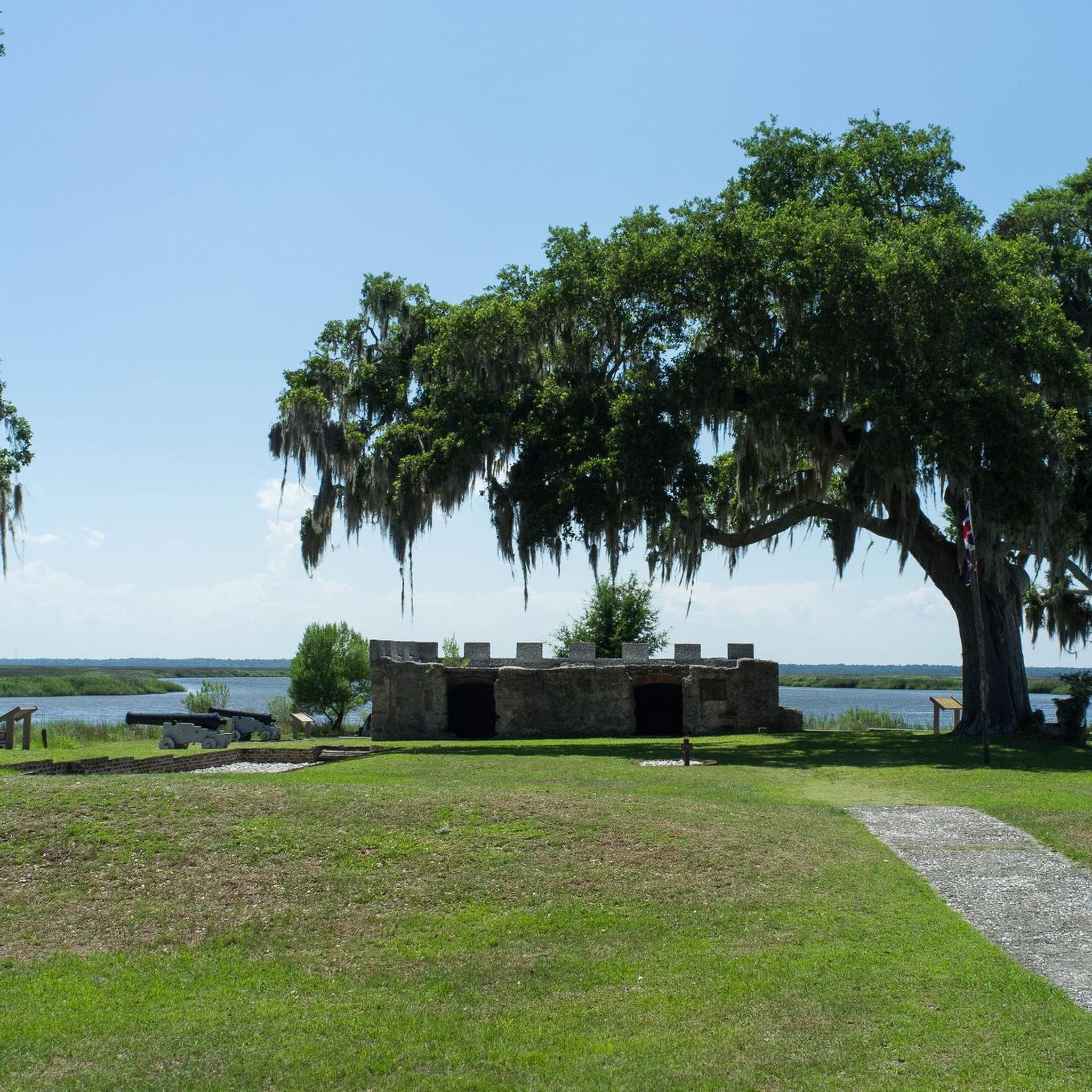
Road cycling in Fort Frederica National Monument centers around the extensive network of paved bike paths on St. Simons Island, Georgia. The region is characterized by mostly flat terrain, maritime forests, and coastal marshlands, providing accessible routes for various skill levels. While cycling is not permitted within the monument grounds, it serves as a central point for exploring the island's historical sites and natural beauty by bike. The island features over 30 miles of designated bike paths, often running parallel…
Last updated: October 5, 2026
4.8
(53)
17
riders
35.1km
01:38
40m
40m
Easy road ride. Great for any fitness level. Mostly well-paved surfaces and easy to ride.
17
riders
Moderate road ride. Good fitness required. Mostly well-paved surfaces and easy to ride.

6
riders
19.6km
00:56
20m
20m
Easy road ride. Great for any fitness level. Mostly well-paved surfaces and easy to ride.
6
riders
Easy road ride. Great for any fitness level. Mostly well-paved surfaces and easy to ride.
7
riders
22.6km
01:11
20m
20m
Easy road ride. Great for any fitness level. Mostly well-paved surfaces and easy to ride.
Our route recommendations are based on thousands of hikes, rides, and runs completed by other people on komoot.
Start today with a free account
Your next adventure awaits.
Popular around Fort Frederica National Monument

Tips from the Community

The Sidney Lanier Bridge is Georgia’s tallest cable-stayed bridge, soaring 486 feet over the Brunswick River and stretching nearly 7,780 feet in length. Completed in 2003, it replaced an older lift bridge to improve access for large cargo ships heading to the Port of Brunswick. Named after poet Sidney Lanier, the bridge hosts an annual 5K run with panoramic views of the Golden Isles, making it both a vital transportation link and a local landmark.
0
0

Always carry a spare tubular and a can of Vittoria PitStop!
0
0

there are always busy local fishermen to watch. you can see huge ships and beautiful birds up close. There are a lot of nice little shops and two playgrounds close by.
0
0

The Marshes of Glynn Overlook Park has great views over the marshlands and rivers of Brunswick. This park provides a fishing pier, picnic tables, and an educational pavilion donated by the Georgia Department of Natural Resources. Visitors can read the park's information panels, have a picnic, or go fishing. There are no restrooms at this park, so plan accordingly.
0
0
Iguanas is a popular spot for visitors to grab a bite at. They serve up drinks, seafood, and classic southern coastal dishes. Open every day from 11 a.m. to 10 p.m., they are highly reviewed. Come hungry after a ride because you will get served a decent-sized portion of food, and there is a large variety of local cuisine to choose from.
0
0
The St. Simons Island Pier, at the end of Mallery Street, is all lit up with outdoor lights, making it very picturesque in the evening. The pier has great views over Simons Sound and is a great spot for dolphin spotting. This pier is one of only three ocean piers on the Georgia coast; the other two are Jekyll Island Pier and Tybee Island Ocean Pier.
0
0
The historical Bloody Marsh Battle Site got its name from the events of July 7th, 1742. British troops ambushed Spanish forces and defeated them. The battle here ended Spain's claims to Georgia's territory. Today, this area is managed by the National Park Service and is open seven days a week from 8:30 a.m. to 4:00 p.m., excluding holidays.
0
0
Myrtle Street Public Beach Access brings visitors down to the beach via a set of wooden stairs. There are nice views of the beach from the top of the stairs as well. This is a popular spot for people to walk their dogs and watch the sunset.
0
0
Frequently Asked Questions
How many road cycling routes are available in the Fort Frederica National Monument area?
The Fort Frederica National Monument area, primarily St. Simons Island, offers an extensive network of paved bike trails. Komoot features over 4 road cycling routes, with many more options available across the island's 30+ miles of designated paths.
What is the typical terrain and difficulty level for road cycling routes around Fort Frederica National Monument?
The region is characterized by mostly flat terrain, making it accessible for various skill levels. Many routes are considered easy, such as the Fort Frederica – St. Simons Island Light loop. There are also moderate options, like the Jekyll Island Beach Park – The Horton House loop, which extends to a neighboring island.
Are there any family-friendly road cycling routes near Fort Frederica National Monument?
Yes, St. Simons Island is very family-friendly for cycling due to its mostly flat terrain and extensive network of paved trails. Routes like the St. Simons Island Light – Bloody Marsh Site loop are easy and suitable for all skill levels, offering a pleasant experience for families.
What historical sites and natural attractions can I see while cycling in the area?
Road cycling routes frequently lead to or pass by significant historical attractions and natural beauty. You can explore sites like the Bloody Marsh National Monument, the St. Simons Island Light, and the Fort Frederica National Monument (though cycling is not permitted within its immediate grounds). The routes also showcase diverse landscapes including maritime forests, marshlands, and the scenic Avenue of the Oaks.
Where can I park my car when planning a road cycling trip around Fort Frederica National Monument?
Fort Frederica National Monument itself provides bike racks and a repair station near the Visitor Center, making it a convenient starting or ending point for rides. Parking is generally available at various access points to the island's extensive trail system, including near popular attractions and public parks.
Is public transport available to access the road cycling routes?
While St. Simons Island has some local transportation options, the most common way to access the cycling routes is by car, with parking available at various points. For specific public transport details, it's best to check local transit services for St. Simons Island.
What is the best time of year to go road cycling in Fort Frederica National Monument?
The Fort Frederica National Monument area offers pleasant cycling conditions for much of the year. Spring and fall generally provide the most comfortable temperatures. Summers can be hot and humid, while winters are typically mild, making it a year-round destination for many cyclists.
Are there any loop trails for road cyclists in the Fort Frederica National Monument area?
Yes, many of the road cycling routes are designed as loops, allowing you to start and end at the same point. Examples include the Bloody Marsh Site – St. Simons Island Light loop and the Bicycle Tire Blowout – Fort Frederica loop, offering convenient circular journeys.
What do other road cyclists enjoy most about cycling in Fort Frederica National Monument?
The area is highly rated by the komoot community, with an average score of 5.0 stars. Reviewers often praise the extensive network of paved trails, the flat and accessible terrain, and the opportunity to combine historical exploration with scenic rides through maritime forests and marshlands.
Are dogs allowed on the road cycling trails around Fort Frederica National Monument?
Many of the multi-use paved trails on St. Simons Island are dog-friendly, provided dogs are kept on a leash. However, specific regulations can vary, so it's always best to check local signage or the rules for particular sections of the trail or parks you plan to visit.
Where can I find cafes or restaurants along the cycling routes?
St. Simons Island offers numerous cafes and restaurants, particularly in its more developed areas. Many routes will pass through or near commercial districts where you can find dining options. It's advisable to plan your route and check for establishments along your chosen path.
Are there any permits required for road cycling in the Fort Frederica National Monument area?
No specific permits are generally required for road cycling on the public trails and roads around Fort Frederica National Monument. However, cycling is not permitted within the immediate grounds of the monument itself. For detailed information on activities within the monument, you can visit the National Park Service website.
Most popular routes in Fort Frederica National Monument

Get inspired with the komoot mobile app


Explore more
Browse the best Road cycling routes in other regions.
