The best mountain hikes around Cray
4.8
(6)
69
hikers
5
hikes
Mountaineering routes around Cray are situated within the Brecon Beacons National Park, characterized by its Old Red Sandstone peaks and glacial valleys. The region features prominent summits such as Pen y Fan and Corn Du, which are the highest points in South Wales. Terrain includes open moorland, steep ascents, and U-shaped valleys, offering varied conditions for mountaineering. The landscape is shaped by ancient geological processes, providing a distinct environment for outdoor activities.
Best mountaineering routes around Cray
- The most popular…
Last updated: May 24, 2026
4.5
(2)
36
hikers
6.43km
02:25
440m
440m
Moderate mountaineering route. Good fitness required. Easily-accessible paths. Suitable for all skill levels.
5.0
(3)
20
hikers
17.8km
06:22
1,020m
1,020m
Hard mountaineering route. Very good fitness required. Easily-accessible paths. Suitable for all skill levels.

Sign up for free
7
hikers
18.8km
06:23
930m
930m
Hard mountaineering route. Very good fitness required. Easily-accessible paths. Suitable for all skill levels.
5.0
(1)
5
hikers
8.30km
02:50
450m
450m
Moderate mountaineering route. Good fitness required. Easily-accessible paths. Suitable for all skill levels.
1
hikers
Easy mountaineering route. Great for any fitness level. Easily-accessible paths. Suitable for all skill levels.
Our route recommendations are based on thousands of hikes, rides, and runs completed by other people on komoot.
Start today with a free account
Your next adventure awaits.
Login or Signup
Tips from the Community

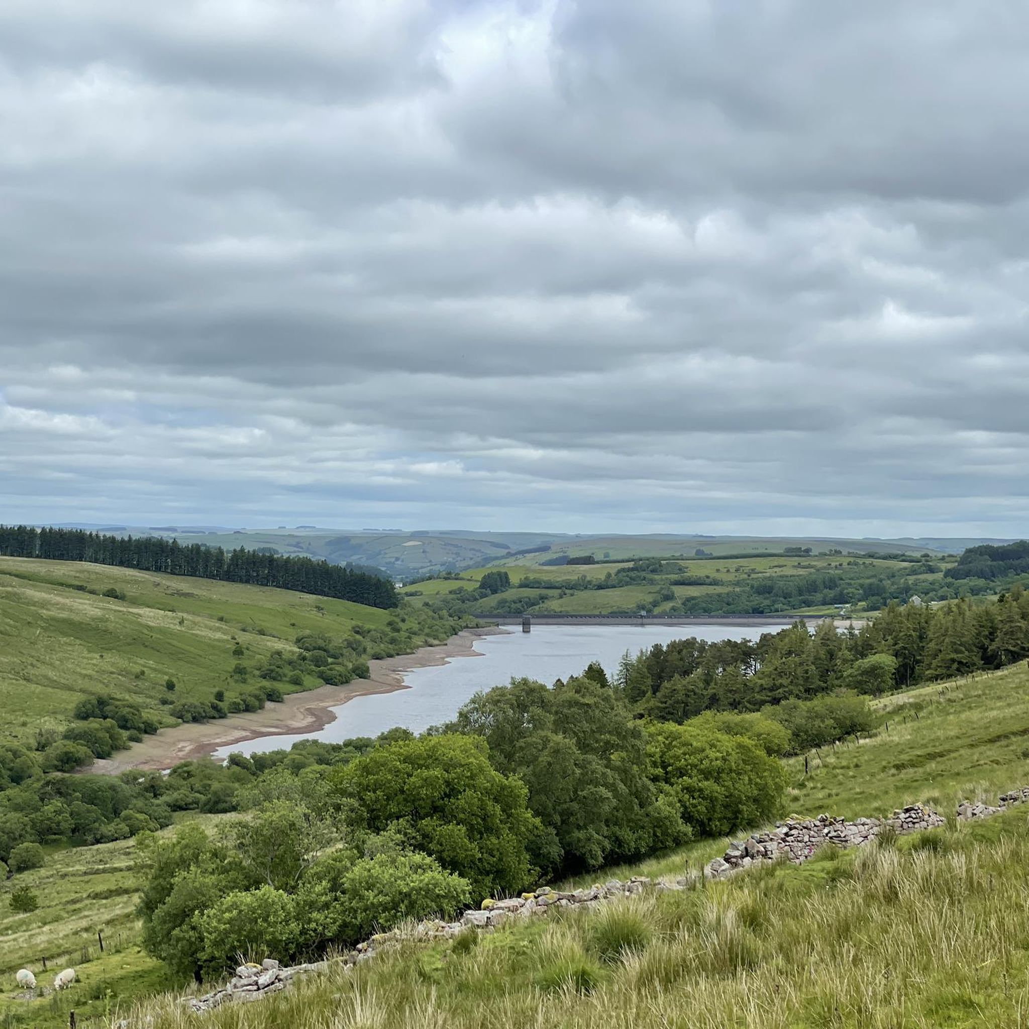
If you are lucky enough to get a nice day there are views for miles
0
0

This is the col between Corn Du and Craig Gwaun Taf. Not only is it a fine viewpoint, but it is also the parting of the ways. Turn right at the marker stone you will follow the crowds down to the Storey Arms, turn left to Craig Gwaun Taf and you arfe likely to have the airy path all to yourself.
0
0
This is the ridge route to Pen y Fan from the north. A fine route that steepens sharply near the top.
0
0
This is the start of the climb to Pen Y Fan by the main route from Storey Arms.
0
0
Cribyn is the smallest of the Brecon's 'big Three, but it is a shapely top and should be included in any climb up here.
0
0

There’s a lay-by for vehicles just at the start. It’s far enough away from Pen Y Fan to not get busy
0
0

When coming off the mountain to go down towards the car park it’s quite a steep scramble and can be slippery
0
0

Frequently Asked Questions
What kind of terrain can I expect on mountaineering routes around Cray?
Mountaineering routes around Cray are primarily situated within the Brecon Beacons National Park. You'll encounter terrain characterized by Old Red Sandstone peaks, such as Pen y Fan and Corn Du summit, along with glacial valleys and expansive open moorland. Expect varied conditions, including steep ascents and U-shaped valleys, shaped by ancient geological processes.
Are there any easy mountaineering routes suitable for beginners near Cray?
Yes, there are options for various skill levels. For those looking for a more moderate introduction, consider the Pen y Fan Summit loop from Beacons Reservoir. This route is about 4 miles (6.5 km) and offers a direct ascent to the summit of Pen y Fan, providing a rewarding experience without extreme difficulty.
What are some challenging mountaineering routes in the Brecon Beacons near Cray?
For experienced mountaineers seeking a challenge, the region offers several demanding routes. The Pont ar Daf Trailhead – Pen y Fan Summit loop from Beacons Reservoir is a difficult 11.3-mile (18.2 km) path with significant elevation gain. Another challenging option is the Corn Du summit – Pen y Fan loop from Beacons Reservoir, which covers 11.8 miles (18.9 km) through high mountain passes.
Are there any notable landmarks or viewpoints along the mountaineering trails?
Absolutely. The routes offer stunning views and pass by significant landmarks. You can reach prominent peaks like Pen y Fan, Corn Du summit, and Fan Brycheiniog summit and stone shelter. For panoramic vistas, the Fan Frynych Trig Point is a popular viewpoint.
What is the best time of year for mountaineering in the Brecon Beacons near Cray?
While mountaineering is possible year-round, the best time generally depends on your experience and preferences. Spring and autumn offer pleasant temperatures and vibrant landscapes. Summer provides longer daylight hours, though it can be busier. Winter mountaineering is possible but requires appropriate gear and experience due to potentially harsh conditions, including snow and ice on higher peaks.
Are there any circular mountaineering routes available?
Yes, many of the routes are designed as loops, allowing you to start and finish at the same point. Examples include the Pen y Fan Summit loop from Beacons Reservoir and the more extensive Llyn y Fan Fach – Narrow Path Below Picws Du loop from Fforest Fawr, which offers a different perspective of the area.
What do other mountaineers say about the routes around Cray?
The mountaineering routes in this area are highly regarded by the komoot community, with an average rating of 4.8 stars from over 6 reviews. Users often praise the dramatic landscapes, the challenge of the ascents, and the well-defined trails leading to iconic summits like Pen y Fan.
Is public transport available to access the trailheads near Cray?
Access to some trailheads in the Brecon Beacons National Park can be challenging without a car. While there are some bus services connecting larger towns, direct public transport to remote trailheads for mountaineering routes is limited. It's advisable to check local bus schedules in advance or consider driving and parking at designated areas.
Are there any pubs or cafes near the mountaineering routes for refreshments?
While the immediate vicinity of the most remote trailheads might not have direct amenities, the Brecon Beacons National Park area has several villages and towns within a reasonable driving distance that offer pubs, cafes, and accommodation. After a day on the mountains, you can find places to refuel and relax in nearby communities.
What is the typical length and elevation gain for mountaineering routes in this area?
The routes vary significantly. For instance, a moderate route like the Pen y Fan Summit – Pont ar Daf Trailhead loop from Beacons Reservoir covers about 7.6 miles (12.2 km) with an elevation gain of around 796 meters. More challenging routes can extend to over 11 miles (18 km) with over 1000 meters of ascent, requiring a full day to complete.
Are there any specific permits required for mountaineering in the Brecon Beacons near Cray?
Generally, no specific permits are required for hiking or mountaineering on public rights of way or open access land within the Brecon Beacons National Park. However, always respect private land, follow the Countryside Code, and be aware of any local restrictions or temporary closures, especially during lambing season or military training exercises.
Most popular attractions around Cray

Get inspired with the komoot mobile app


Explore more
Browse the best Mountain Hikes & Routes in other regions.
