The best running trails around Cannonville
5.0
(2)
350
runners
1
run
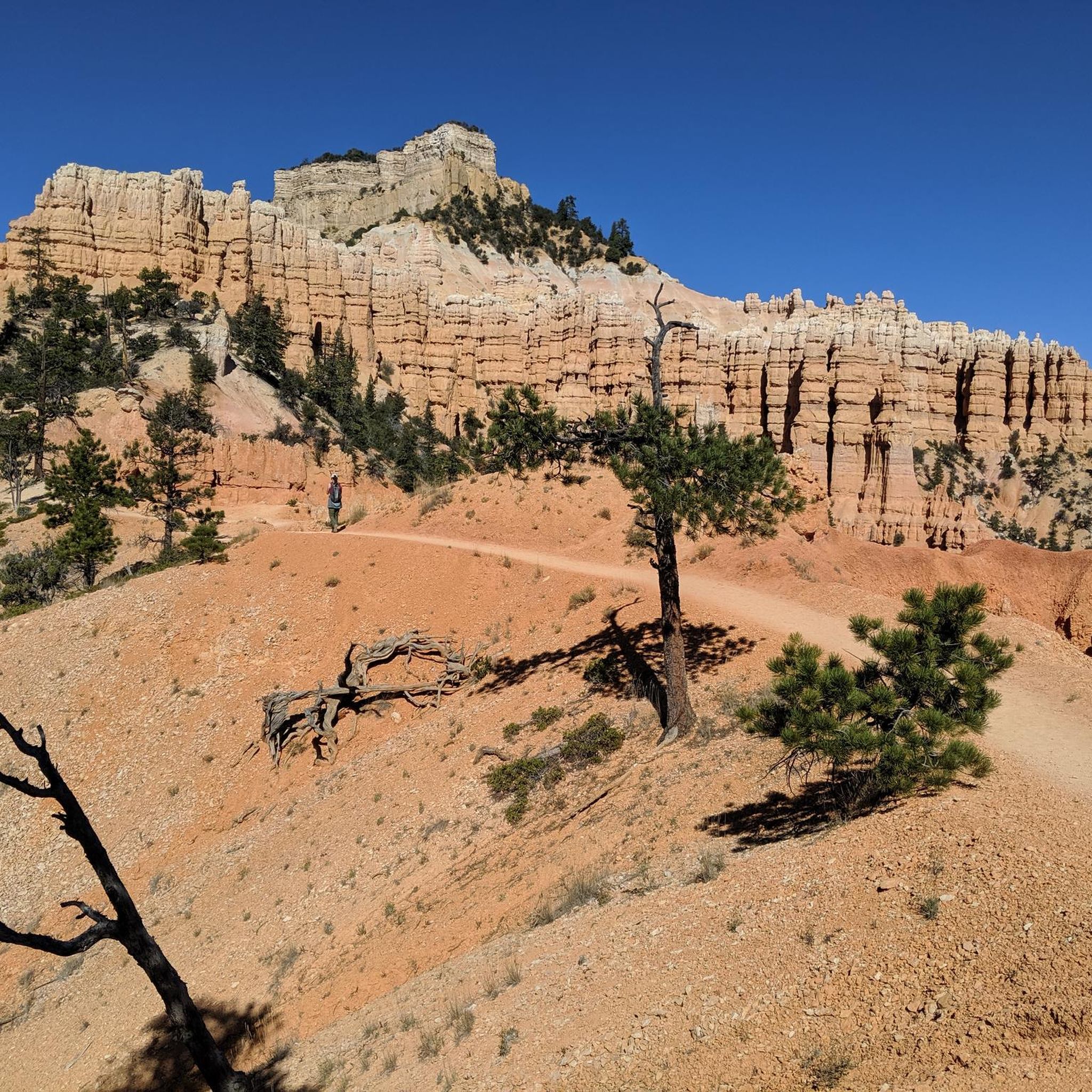
Jogging around Cannonville offers access to a landscape characterized by unique geological formations, including monolithic stone spires and vibrant rock formations. The region serves as a gateway to Kodachrome Basin State Park and the Grand Staircase-Escalante National Monument, providing diverse terrain for running. Runners can explore a mix of flat paths, box canyons, and routes with varied elevation, set against a backdrop of sandstone formations and desert scenery. The area's physical features include layered rock formations, cliffs, and plateaus, offering…
Last updated: July 1, 2026
186
runners
6.42km
00:55
260m
260m
Moderate run. Good fitness required. Mostly paved surfaces. Suitable for all skill levels.
5.0
(2)
120
runners
12.2km
01:41
400m
400m
Hard run. Very good fitness required. Mostly paved surfaces. Suitable for all skill levels.

Sign up for free
27
runners
12.5km
01:46
470m
470m
Hard run. Very good fitness required. Mostly paved surfaces. Suitable for all skill levels.
17
runners
9.84km
01:22
360m
350m
Hard run. Very good fitness required. Mostly paved surfaces. Suitable for all skill levels.
Our route recommendations are based on thousands of hikes, rides, and runs completed by other people on komoot.
Start today with a free account
Your next adventure awaits.
Login or Signup
Popular around Cannonville
Tips from the Community

A stunningly beautiful hike in Bryce Canyon. The Navajo Peekaboo Loop is a popular and challenging hike in Bryce Canyon National Park, connecting two of the most famous trails in the Bryce Amphitheater. Impressive, narrow switchbacks lead steeply down into the canyon and past rock formations with imaginative names like Thor's Hammer and Wall Street.
0
0
A stunningly beautiful hike in Bryce Canyon. The Navajo Peekaboo Loop is a popular and challenging hike in Bryce Canyon National Park, connecting two of the most famous trails in the Bryce Amphitheater. Impressive, narrow switchbacks lead steeply down into the canyon and past rock formations with imaginative names like Thor's Hammer and Wall Street.
0
0
A stunningly beautiful hike in Bryce Canyon. The Navajo Peekaboo Loop is a popular and challenging hike in Bryce Canyon National Park, connecting two of the most famous trails in the Bryce Amphitheater. Impressive, narrow switchbacks lead steeply down into the canyon and past rock formations with imaginative names like Thor's Hammer and Wall Street.
0
0

Beautiful to see and to walk in
0
0

The Rim Trail encircles the Bryce Canyon Amphitheater and gives spectacular views into the canyon. The trail is 5.5 miles in length, starting at Fairyland Point in the north and extending to Bryce Point farther south in the park. There are many benches located along the path for a quick stop to enjoy a picnic while taking in some of the greatest views on this planet.
0
0

Lower Inspiration Point is a fantastic spot over Bryce Amphitheater, with views of the dense clusters of hoodoos known as the Silent City. The short, unpaved trail from the parking area leads to a fenced overlook with sweeping views to the north. It’s a quieter alternative to the park’s busier viewpoints and is especially stunning at sunrise or after dark under the starry sky.
0
0

Rim Trailhead (North) is a great starting point for a run or a walk along Bryce Canyon’s famous rim. The trail gives you wide views over the hoodoos right from the start, with a mostly flat and runnable surface if you head toward Fairyland Point. Expect big views, soft dirt underfoot, and plenty of reasons to pause and take it all in.
0
0
Peek-a-Boo Arch is a small, door-shaped arch with almost perfect geometry. It’s just a short detour if you’re running in the Sand Dunes area—a quick scramble off the main path gets you there. Worth the stop for the cool rock formation, the views through the arch, and a good spot to catch your breath or snap a photo before continuing your run or hike.
0
0
Frequently Asked Questions
What kind of terrain can I expect on running routes around Cannonville?
The running routes around Cannonville offer a diverse range of terrain. You'll find everything from easy, flat paths suitable for a relaxed jog, to more challenging routes with varied elevation gain through box canyons and sandstone formations. Areas like Kodachrome Basin State Park feature unique monolithic stone spires and vibrant rock formations, while Grand Staircase-Escalante National Monument provides layered rock formations, cliffs, and plateaus.
Are there any easy running routes for beginners or families in Cannonville?
Yes, Cannonville offers several options suitable for beginners and families. Within Kodachrome Basin State Park, the Nature Trail is a short, family-friendly half-mile path that is flat and well-graded on gravel. The Grand Parade Trail, approximately 1.8 to 1.9 miles long, is also mostly flat and ideal for a relaxed jog through distinctive box canyons.
Can I bring my dog on the running trails near Cannonville?
While specific dog-friendly trail regulations can vary, generally, dogs are permitted on trails in many parts of the Grand Staircase-Escalante National Monument and Kodachrome Basin State Park, often on a leash. It's always best to check the specific park or trail regulations before heading out with your canine companion. Remember to bring plenty of water for both you and your dog, especially in the desert environment.
What are some notable landmarks or viewpoints I can see while running in the area?
The region is rich with stunning natural landmarks. In Kodachrome Basin State Park, you'll encounter unique stone spires known as sand pipes and colorful rock formations. The Panorama Trail offers impressive sandstone formations and caves, while the Angel's Palace Trail provides breathtaking vistas from atop a butte. Near Bryce Canyon, routes like Queens Garden Trail – Sunset Point loop and Two Bridges (Navajo Loop Trail) – South Hall loop navigate through distinctive rock formations and offer panoramic views, including sights like Sunset Point and Thor’s Hammer (hoodoo).
Are there any loop running routes available in Cannonville?
Yes, several loop running routes are available. For instance, the Queens Garden Trail – Sunset Point loop from Bryce Canyon Lodge is a popular 4.0-mile (6.4 km) loop. Another favorite is the Mammoth Spire Overlook – Kodachrome Basin State Park loop, which is a moderate 6.2-mile (9.9 km) path. Within Kodachrome Basin State Park, the Panorama Trail and Angel's Palace Trail are also designed as loops, offering varied distances and scenery.
What is the best time of year to go running in Cannonville?
The mild weather during spring and fall significantly enhances Cannonville's appeal as an outdoor destination for running. These seasons typically offer comfortable temperatures, making them ideal for exploring the trails. Summer can be hot, so early morning or late evening runs are recommended, while winter can bring colder temperatures and potential snow at higher elevations.
Are there any specific permits or fees required to access running trails in Kodachrome Basin State Park or Grand Staircase-Escalante National Monument?
Yes, Kodachrome Basin State Park requires an entrance fee. For current fee information and any specific regulations, it's advisable to check the official Utah State Parks website or visit the park's visitor center upon arrival. Grand Staircase-Escalante National Monument generally has fewer permit requirements for day use, but it's always good practice to check for any specific area restrictions or permits, especially for backcountry travel. You can find more information about Kodachrome Basin State Park at visitutah.com.
What are the public transport and parking options for accessing running routes around Cannonville?
Public transport options directly to trailheads from Cannonville are limited, so personal vehicles are generally recommended for accessing most running routes. Kodachrome Basin State Park has designated parking areas for visitors. For trails within Grand Staircase-Escalante National Monument, access often involves driving on unpaved roads, and parking is typically available at trailheads. Always ensure your vehicle is suitable for the road conditions, especially on routes like Cottonwood Canyon Road.
Are there any running routes that offer views of Bryce Canyon's unique 'hoodoos'?
While Cannonville is a base camp for exploring Bryce Canyon, several running routes provide stunning views of its famous 'hoodoos'. The Queens Garden Trail – Sunset Point loop from Bryce Canyon Lodge and the Two Bridges (Navajo Loop Trail) – South Hall loop from Bristlecone Point are excellent choices, leading through canyons and rock spires, offering close-up and panoramic views of these distinctive geological formations.
What is the Red Canyon Bicycle Trail, and is it suitable for running?
The Red Canyon Bicycle Trail is a paved path spanning almost 13 miles, often referred to as 'Little Bryce' due to its scenic red canyons. It offers a beautiful, gradual incline and fun downhill sections, making it very suitable for running. It's a great option for those looking for a smoother, less technical running surface with spectacular scenery, and it's accessible from the general area around Cannonville.
Are there any running routes that follow a creek or through a slot canyon?
Yes, the Willis Creek Hike, accessible from Cannonville, leads through a slot canyon with a pleasant creek. Its relatively flat and easy nature makes it suitable for running for several miles, offering a unique experience through a narrow canyon with water features.
What is the typical difficulty level of running routes around Cannonville?
Running routes around Cannonville cater to various fitness levels. You'll find easy, flat paths perfect for a leisurely jog, such as the Nature Trail in Kodachrome Basin. Moderate routes, like the Mammoth Spire Overlook – Kodachrome Basin State Park loop, involve some elevation gain and varied terrain. For more experienced runners, there are difficult routes, such as the Two Bridges (Navajo Loop Trail) – South Hall loop, which features significant elevation changes and covers a longer distance.
What do other runners enjoy most about running in Cannonville?
Runners frequently praise the unique and inspiring backdrops provided by the diverse geological features. The constantly changing scenery, from the rock chimneys of Kodachrome Basin to the expansive, colorful formations of the Grand Staircase-Escalante, is a major highlight. The variety of trails, accommodating all levels from easy to more challenging, also receives positive feedback, ensuring everyone can find a suitable path to explore the natural beauty.
Most popular routes around Cannonville
Most popular attractions around Cannonville

Get inspired with the komoot mobile app


Explore more
Browse the best Running Trails & Routes in other regions.
