The best running trails around Arizona City
3.0
(3)
18
runners
6
runs
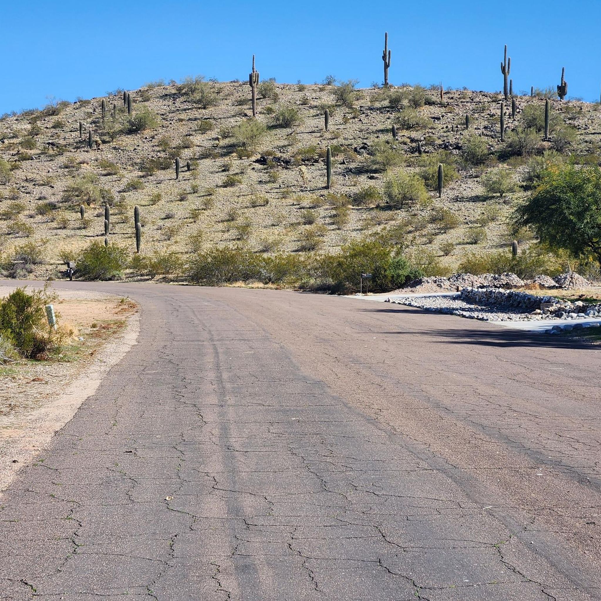
Jogging routes around Arizona City traverse a landscape characterized by desert terrain, unique rock formations, and native saguaro cacti. The region offers a mix of flat paths and more challenging trails with elevation changes. Runners can experience both natural desert scenery and views of distant mountains. This diverse topography provides varied running experiences for different fitness levels.
Best jogging routes around Arizona City
- The most popular jogging route is Bolt Trail, a 3.4 miles (5.5 km) trail that takes…
Last updated: June 27, 2026
5
runners
5.53km
00:45
260m
260m
Moderate run. Good fitness required. Mostly paved surfaces. Suitable for all skill levels.
1
runners
5.82km
00:41
110m
110m
Moderate run. Good fitness required. Mostly paved surfaces. Suitable for all skill levels.

Sign up for free
3
runners
Hard run. Very good fitness required. Mostly paved surfaces. Suitable for all skill levels.
1.0
(1)
5
runners
13.5km
01:43
230m
240m
Moderate run. Good fitness required. Mostly paved surfaces. Suitable for all skill levels.
3
runners
5.22km
00:39
90m
90m
Moderate run. Good fitness required. Mostly paved surfaces. Suitable for all skill levels.
Our route recommendations are based on thousands of hikes, rides, and runs completed by other people on komoot.
Start today with a free account
Your next adventure awaits.
Login or Signup
Popular around Arizona City
Tips from the Community

Great view from the Casa Grande Mountain Park over the surrounding valley. The trail to get up to the viewpoint is moderately challenging and crosses multiple paths, so make sure you have enough water and a GPS or map.
0
0
At 2,350 feet, this is the high point of the Casa Grande Mountains. There is a great view into the Table Top Wilderness in the distance. The trail to the top is not too challenging, so it is definitely worth the effort to get the views.
1
1

from the parking lot "Hanna Road Trailhead" in about 45 minutes.
0
0
Frequently Asked Questions
What kind of terrain can I expect on running routes around Arizona City?
Running routes around Arizona City primarily feature desert terrain, characterized by unique rock formations and native saguaro cacti. You'll find a mix of flat paths and more challenging trails with elevation changes, offering varied experiences from moderate to difficult. The region is part of the larger Sonoran Desert landscape, providing scenic views of the desert and distant mountains.
Are there running routes suitable for beginners or those looking for an easier jog?
While the guide highlights moderate to difficult routes, the broader Arizona City area, being part of the Sonoran Desert, offers options for various fitness levels. Many local parks and canal paths, similar to the Arizona Canal Path or Scottsdale Greenbelt in the wider Phoenix area, provide flatter, paved surfaces ideal for easier jogs or beginners. For specific routes in Arizona City, always check the difficulty rating.
What are some popular running trails in the Arizona City area?
Among the local favorites are the Bolt Trail, a moderate 3.4-mile route with varied terrain, and the Penny Lane and North Loop Trail, a 3.6-mile path offering desert landscapes and open views. For a more challenging experience, the Casa Grande Mountain Lookout loop from Casa Grande 2 Electronic Site is a popular difficult option, covering 6.4 miles through desert hills.
Are there any circular running routes available?
Yes, the Casa Grande Mountain Lookout loop from Casa Grande 2 Electronic Site is a notable circular route. It's a challenging 6.4-mile trail that takes you through desert hills, offering a complete loop experience.
What natural features or landmarks can I see while running in Arizona City?
The running routes in Arizona City are set within the Sonoran Desert, meaning you'll encounter iconic saguaro cacti, unique rock formations, and expansive desert landscapes. While specific landmarks on these routes are not detailed, the general region is known for its stunning desert vistas and views of distant mountains.
Is it possible to run with dogs on trails around Arizona City?
Many outdoor areas in Arizona, including state parks and preserves, are dog-friendly, often requiring dogs to be on a leash. While specific dog policies for the routes directly in Arizona City are not provided, it's generally advisable to check local regulations for each trail or park before bringing your dog. Always ensure your pet is well-hydrated, especially in the desert climate.
Are there family-friendly running options in Arizona City?
For families, routes with less elevation gain and smoother surfaces are often preferred. While the featured routes range from moderate to difficult, the broader Pinal County area and similar desert regions often have multi-use paths or park trails that are suitable for families. Look for trails described as flat or paved for a more family-friendly experience.
What is the best time of year to go jogging in Arizona City?
The cooler months, typically from fall through spring (October to April), are ideal for jogging in Arizona City. During these seasons, temperatures are more moderate and pleasant. Summer months can be extremely hot, making early morning or late evening runs essential, with a strong emphasis on hydration and sun protection.
Are there any places to eat or stay near the running trails in Arizona City?
Arizona City, while a smaller community, offers local amenities. For a wider selection of cafes, pubs, and accommodation, nearby larger towns in Pinal County would provide more options. It's always a good idea to check local listings for current establishments in Arizona City itself.
What are the parking options for these running routes?
Specific parking details for each route are not provided in the guide. However, most trailheads in Arizona's parks and preserves typically offer designated parking areas. It's recommended to check the specific trail or park's official website or komoot route details for up-to-date information on parking availability and any potential fees.
How many running routes are available in the Arizona City area on komoot?
Komoot features a selection of running routes around Arizona City, with a total of 4 routes currently listed in this guide. These include a mix of moderate and difficult options, allowing runners to explore the diverse desert landscape.
What is the typical duration for these running routes?
The running routes around Arizona City vary in length and duration. For example, the Bolt Trail typically takes about 45 minutes to complete, while the longer Casa Grande Mountain Lookout loop can take around 1 hour and 28 minutes, depending on your pace.
Most popular routes around Arizona City

Get inspired with the komoot mobile app


Explore more
Browse the best Running Trails & Routes in other regions.
