The best waterfall hikes and walks around Parco regionale Sassi di Roccamalatina e di Sant’Andrea
4.4
(3459)
11,022
hikers
1
hike
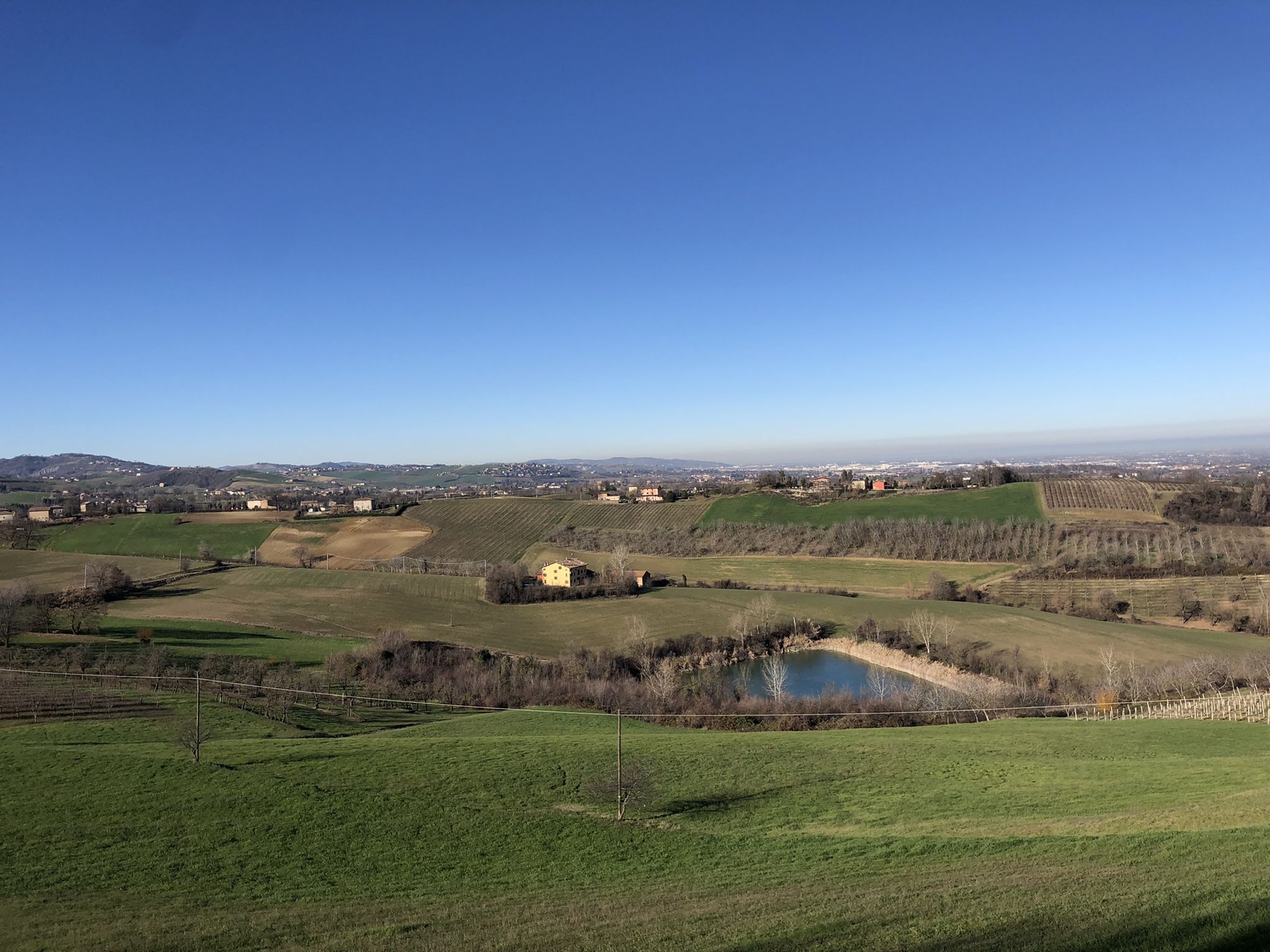
Waterfall hiking trails around Parco regionale Sassi di Roccamalatina e di Sant’Andrea traverse a landscape defined by unique geological formations and diverse ecosystems. The park features towering sandstone monoliths, over 70 meters high, alongside dense woodlands, rocky outcrops, and meandering streams. The Panaro River valley contributes to varied terrain, which includes ancient chestnut groves and rolling hills. This ecological diversity supports a range of plant species and wildlife.
Best waterfall hiking trails around Parco regionale Sassi di Roccamalatina e di…
Last updated: October 24, 2026
4.5
(2)
4
hikers
18.4km
05:36
600m
600m
Hard hike. Very good fitness required. Mostly walkable paths. Sure-footedness required.
3.0
(1)
11
hikers
2.73km
01:01
170m
160m
Moderate hike. Mostly walkable paths. Sure-footedness required.

4.8
(13)
40
hikers
14.3km
04:28
480m
480m
Moderate hike. Good fitness required. Mostly walkable paths. Sure-footedness required.
3.0
(2)
5
hikers
Moderate hike. Good fitness required. Mostly walkable paths. Sure-footedness required.
Our route recommendations are based on thousands of hikes, rides, and runs completed by other people on komoot.
Start today with a free account
Your next adventure awaits.
Popular around Parco regionale Sassi di Roccamalatina e di Sant’Andrea
Other adventures around Parco regionale Sassi di Roccamalatina e di Sant’Andrea

Tips from the Community

Beautiful view of Montese along the Apennine bike tour.
4
0

Dirt road leading to the Bucamante waterfalls
0
0
From here you can appreciate the round tower of Monfestino which rises above the vegetation
0
0
Old path partly made of pebbles to make it less humid and passable
0
0
Panorama of the town of Ricco
0
0
Small pools to cool off in the hot weather
0
0
Be careful that the section is partly damaged and the protections are not very solid
0
0
From here a great view of the surrounding hills. Nice place to stop for a picnic
0
0
Frequently Asked Questions
How many waterfall hiking trails are available in Parco regionale Sassi di Roccamalatina e di Sant’Andrea?
There are at least 3 dedicated waterfall hiking trails around Parco regionale Sassi di Roccamalatina e di Sant’Andrea, offering diverse experiences for hikers. The park features a broader network of over 100 kilometers of trails, many of which traverse areas with streams and varied terrain where waterfalls might be present depending on the season.
What kind of terrain and natural features can I expect on waterfall hikes in the park?
Waterfall hikes in the park will lead you through a landscape characterized by unique geological formations, including towering sandstone monoliths over 70 meters high. You'll encounter dense woodlands, rocky outcrops, and meandering streams. The Panaro River valley also contributes to varied terrain, which includes ancient chestnut groves and rolling hills, supporting a rich diversity of plant and animal life.
Are there any challenging waterfall hikes for experienced hikers?
Yes, for experienced hikers seeking a challenge, the CAI 442 from Montese to Monte Cimone viewpoint is a difficult route. It spans 11.4 miles (18.4 km) with significant elevation gain, typically taking around 5 hours 35 minutes to complete, and offers panoramic views.
Can I find family-friendly waterfall trails in the park?
While the guide focuses on specific waterfall trails, the park itself offers a range of routes suitable for various fitness levels. For a moderate option that could be suitable for families with older children, consider La Talpa – View of Montese loop from Montese. This 4.1-mile (6.6 km) path takes about 2 hours and offers scenic views.
Are dogs allowed on the waterfall hiking trails?
The Parco regionale Sassi di Roccamalatina e di Sant’Andrea is generally dog-friendly, but it's important to keep your dog on a leash, especially in areas with wildlife or near other hikers. Always check specific trail regulations before heading out, as some protected areas might have stricter rules.
What are some notable natural attractions to see near the waterfall trails?
Beyond the waterfalls themselves, you can explore iconic natural monuments such as the Sassi di Roccamalatina and the Sasso di Sant'Andrea, which are towering sandstone monoliths. Other highlights include the Zio Teofilo Fallen Tree and the Sulitura Water Spring.
Are there any historical sites or villages accessible from the waterfall trails?
Yes, the park is rich in history. You can discover the ancient Romanesque Trebbio Parish Church, medieval villages like Castellino delle Formiche and Castellaro, and examples of rural architecture in locations such as La Grilla. Along the Rio Tregenda and Rio delle Vallecchie, you might also find remains of ancient mills, like the Mulino della Riva.
What is the best time of year to visit for waterfall hiking in this region?
The park can be enjoyed year-round, but autumn and spring are particularly recommended for their stunning natural spectacles. In spring, you'll see vibrant wildflowers and fuller waterfalls from snowmelt and rain, while autumn offers spectacular foliage, especially in the ancient chestnut groves.
Are there circular routes available for waterfall hikes?
Yes, there are circular routes that allow you to start and end in the same location. An example is the La Talpa – Bosco Matto loop from Montese, an 8.9-mile (14.3 km) trail that leads through varied terrain and can be completed in about 4 hours 28 minutes.
Where can I park when visiting the waterfall trails in Parco regionale Sassi di Roccamalatina e di Sant’Andrea?
Parking is generally available near the main trailheads and villages within and around the park, such as Montese. It's advisable to check specific starting points for routes you plan to hike, as parking options can vary. Look for designated parking areas in towns like Montese or near popular attractions like the Sassi di Roccamalatina.
Is public transport an option to reach the waterfall hiking areas?
While the region is best explored by car for maximum flexibility, some areas of Parco regionale Sassi di Roccamalatina e di Sant’Andrea may be accessible via local bus services connecting to nearby towns. It's recommended to research specific bus routes and schedules to Montese or other villages that serve as trailheads, as public transport options can be limited, especially on weekends.
What do other hikers say about the trails in Parco regionale Sassi di Roccamalatina e di Sant’Andrea?
The trails in Parco regionale Sassi di Roccamalatina e di Sant’Andrea are highly rated by the komoot community, with an average score of 4.5 stars from over 1400 reviews. Hikers often praise the diverse terrain, the impressive geological formations, and the well-maintained network of paths that cater to various ability levels.
Most popular routes around Parco regionale Sassi di Roccamalatina e di Sant’Andrea
Most popular attractions around Parco regionale Sassi di Roccamalatina e di Sant’Andrea

Get inspired with the komoot mobile app


Explore more
Browse the best Hikes in other regions.
