The best waterfall hikes and walks in Sant Julià de Lòria
4.5
(1170)
10,293
hikers
10
hikes
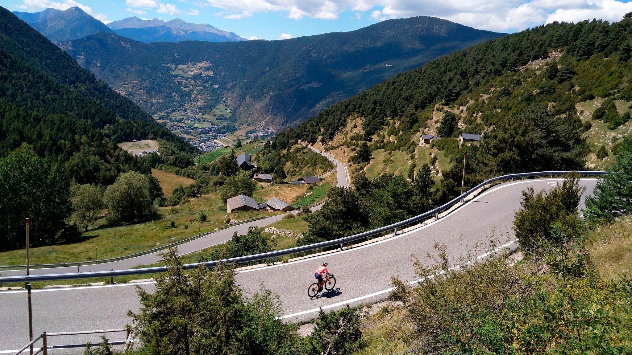
Waterfall hiking trails in Sant Julià de Lòria are set within Andorra's southernmost parish, characterized by diverse mountainous terrain, high-mountain views, and picturesque valley vistas. The region features significant elevations like the Coll de la Gallina and Port de la Rabassa, offering varied landscapes including alpine pastures, green valleys, and forests. Hikers can explore areas close to the Vall del Madriu-Perafita-Claror Natural Park, a UNESCO World Heritage Site, which contributes to the area's natural beauty.
Best waterfall hiking trails in Sant Julià de Lòria
- The most popular waterfall hiking route is Lakes of Pera and Peaks of Sirvent, Perafita and Monturull, a 6.5 miles (10.4 km) trail that takes 3 hours 57 minutes to complete. This route offers views of the Pera lakes and surrounding peaks.
- Another top favourite among local hikers is Estany de la Pera – Estany Gran de la Pera loop from Estació d'esquí nòrdic d'Aransa, a moderate 8.0 miles (12.9 km) path. This loop trail explores the area around Estany de la Pera and Estany Gran de la Pera.
- Local hikers also love the Estany Gran de la Pera – Estany de la Pera loop from Caseta forestal de la Font de les Pollineres, a 3.1 miles (5.0 km) trail leading through the lake district, often completed in about 1 hour 42 minutes.
- Hiking in Sant Julià de Lòria is defined by high mountains, alpine pastures, and green valleys. The network offers options for different ability levels, from moderate to difficult.
- The routes in Sant Julià de Lòria are highly rated by the komoot community with an average score of 4.5 stars from over 600 reviews. More than 6000 hikers have used komoot to explore Sant Julià de Lòria's varied terrain.
Last updated: July 7, 2026
5.0
(4)
31
hikers
10.4km
03:57
680m
680m
Moderate hike. Good fitness required. Mostly accessible paths. Sure-footedness required.
4.9
(12)
140
hikers
Moderate hike. Good fitness required. Mostly accessible paths. Sure-footedness required.

Sign up for free
5.0
(3)
60
hikers
14.4km
04:23
500m
500m
Moderate hike. Good fitness required. Mostly accessible paths. Sure-footedness required.
8
hikers
Moderate hike. Great for any fitness level. Mostly accessible paths. Sure-footedness required.
23
hikers
24.5km
08:21
1,190m
1,190m
Hard hike. Very good fitness required. Mostly accessible paths. Sure-footedness required.
Get access to more routes and recommendations from other explorers.
Sign up for free
Already have an account?
Our route recommendations are based on thousands of hikes, rides, and runs completed by other people on komoot.
Start today with a free account
Your next adventure awaits.
Login or Signup
Popular around Sant Julià de Lòria
Other adventures in Sant Julià de Lòria

Tips from the Community

One of the most magical places in the eastern Pyrenees, surrounded by alpine meadows, fir trees, and the two lakes that give it its name. At almost 2,350 meters above sea level, the refuge offers food, accommodation, and postcard-perfect views. It's a gateway to the Perafita pass and the cross-border routes with Andorra. By mountain bike, the climb from Cap del Rec is demanding but spectacular: a wide track, rocky sections, and sustained gradients. The best approach is to take it easy, maintain a steady cadence, and savor the final reward: the reflection of the mountains in the lakes, with the sound of the wind and cows as your only companions.
0
0

The views of the northern slope of the Cadí mountain range, although distant, are impressive.
0
0

Aerial ridge that is on the border between Andorra and the southern slope of this system that falls to the Cerdanya valley and Seu d'Urgell. At the foot on one side the valleys of Pedrafita and on the other, the ponds of the Pera.
0
0

Rising at an altitude of 2,357 m, the Estanys de la Pera shelter is located on the southern slope of the port of Perafita, next to the Estanys de la Pera. The facility, inaugurated in 1957, is a crossing point for the GR 11.10, one of the variants of the trans-Pyrenean trail par excellence, which connects Cerdanya with the Principality of Andorra. The building follows the same architectural pattern as the Sant Jordi and Serra d'Ensija refuges, with an entrance door for the three facilities. It is an ideal place for hiking in the summer and downhill skiing and snowshoeing in the winter, with mountain profiles that are mostly quite rounded, ideal for practicing 'this mountain discipline. Summer is an ideal time to go there with children, as access is quite quick and easy. SERVICES AT THE SHELTER: - Shower with hot water - Biomass stove - Internet (with usage restrictions) - Blankets - Food and drinks - toilet MATERIAL IN THE ABSENCE OF THE GUARD: 4 seats, 2 mattresses, 1 table, 1 bench, 1 wood stove and firewood. light
0
0
Cross-border mountain pass that connects Cerdanya with Andorra. From this pass we can follow the ridge of the Pic de Perafita and Monturull towards the SW, the ridge of the Serra de Sirvent to the Tossa Plana de Lles towards the E. or, go down towards the Vall de Madriu - Perafita - Claror, already on the Andorran side, towards the NW.
0
0
At an altitude of 2,357 m, the Estanys de la Pera refuge is located on the southern slope of the Perafita pass, next to the Pera lakes. The facility, inaugurated in 1957, is a crossing point for the GR 11.10, one of the variants of the great trans-Pyrenean trail par excellence, which connects Cerdanya with the Principality of Andorra. The building follows the same architectural pattern as the Sant Jordi and Serra d’Ensija refuges, with one entrance for all three facilities. It is an ideal place for hiking in the summer and ski mountaineering and snowshoeing in the winter, with mostly quite rounded mountain profiles, ideal for practicing this mountain discipline. Summer is an ideal time to go there with children, as access is quite quick and easy. SERVICES AT THE SHELTER: - Shower with hot water - Biomass stove - Internet (with restrictions on use) - Blankets - Food and drinks - Toilet EQUIPMENT IN THE ABSENCE OF THE GUARD: 4 seats, 2 mattresses, 1 table, 1 bench, 1 wood stove and wood for a fire. Light.
1
0

Located at 2760 meters of altitude.
1
0
Pico de Perfaita, bordering Andorra, at an altitude of 2,756 meters
1
0
Frequently Asked Questions
How many waterfall hiking trails are available in Sant Julià de Lòria?
Sant Julià de Lòria offers a selection of 10 dedicated waterfall hiking trails. These routes vary in length and difficulty, providing options for different preferences.
What is the general difficulty level of waterfall hikes in Sant Julià de Lòria?
The waterfall hikes in Sant Julià de Lòria primarily range from moderate to difficult. There are 7 moderate routes and 3 difficult routes, ensuring a good challenge for most hikers.
What do other hikers say about the waterfall trails in Sant Julià de Lòria?
The trails in Sant Julià de Lòria are highly regarded by the komoot community, boasting an average rating of 4.5 stars from over 600 reviews. More than 6,000 hikers have explored the region's diverse terrain, often praising the stunning high-mountain views, alpine pastures, and green valleys.
What kind of terrain can I expect on waterfall hikes in Sant Julià de Lòria?
You can expect diverse mountainous terrain, featuring high-mountain views, picturesque valley vistas, alpine pastures, and forests. Some routes may also lead you past beautiful lakes, such as those found on the Lakes of Pera and Peaks of Sirvent, Perafita and Monturull trail.
Are there any circular waterfall hiking routes in the area?
Yes, there are several circular routes available. For example, the Estany de la Pera – Estany Gran de la Pera loop from Estació d'esquí nòrdic d'Aransa is a popular moderate loop, and the Estany Gran de la Pera – Estany de la Pera loop from Caseta forestal de la Font de les Pollineres offers a shorter, moderate option through the lake district.
Are the waterfall hiking trails in Sant Julià de Lòria suitable for families?
While many trails in Sant Julià de Lòria are moderate to difficult, some sections or shorter routes might be suitable for families with older children or those accustomed to hiking. For a more leisurely experience, consider exploring areas like the Juberri Gardens, which feature waterfalls and unique sculptures in a natural setting, though it's not a traditional hike.
Can I bring my dog on the waterfall hiking trails?
Many outdoor areas in Andorra are dog-friendly, but specific rules can vary by trail or protected area. It's always best to check local signage or the specific route details for any restrictions regarding dogs, especially in natural parks or around sensitive wildlife areas. Always keep your dog on a leash and clean up after them.
What are some notable natural features or landmarks I might see near waterfall hikes?
Near the hiking trails, you can discover several significant natural features and landmarks. These include mountain passes like Coll de la Gallina and Port de la Rabassa, offering spectacular views. You might also encounter the Roca de Pimes Refuge or the historic Sant Serni de Nagol Church, depending on your chosen route.
What is the best time of year to go waterfall hiking in Sant Julià de Lòria?
Sant Julià de Lòria benefits from a mild climate, making spring, summer, and early autumn ideal for waterfall hiking. During spring, snowmelt enhances waterfall flows, while summer and autumn offer pleasant temperatures and vibrant foliage. Always check weather conditions before heading out, especially at higher elevations.
Are there options for public transport to reach the waterfall hiking trails?
While Sant Julià de Lòria is well-connected, direct public transport to the exact trailheads for all waterfall hikes might be limited, especially for more remote routes. It's advisable to check local bus schedules for connections to key villages or starting points, and consider combining with a short taxi ride or personal vehicle for final access.
Are there any longer, more challenging waterfall hikes for experienced hikers?
Yes, for experienced hikers seeking a challenge, the region offers difficult routes such as the Monturull Peak – Estany Gran de la Pera loop from Estació d'esquí nòrdic d'Aransa. This extensive 24.6 km trail involves significant elevation changes and provides a rewarding high-mountain experience.
What is the average duration of waterfall hikes in Sant Julià de Lòria?
The duration of waterfall hikes varies significantly. Shorter, moderate loops like the Estany Gran de la Pera – Estany de la Pera loop can be completed in under 2 hours, while longer, more challenging routes such as the Monturull Peak – Estany Gran de la Pera loop can take over 8 hours to complete.
Are there any viewpoints along the waterfall hiking trails?
Yes, the region is known for its numerous accessible viewpoints. While specific viewpoints directly on waterfall trails may vary, the general area of Sant Julià de Lòria offers spots like those at Riu Runer, Prats Gavats, Coll de Jou, Canòlich, Sant Serni de Nagol, and Coll de la Plana, which provide panoramic views of the surrounding peaks, fauna, and flora.
Most popular routes in Sant Julià de Lòria
Most popular attractions in Sant Julià de Lòria

Get inspired with the komoot mobile app


Explore more
Browse the best Hikes in other regions.
