The best waterfall hikes and walks in Riserva Naturale Val Di Mello
4.6
(4109)
24,812
hikers
2
hikes
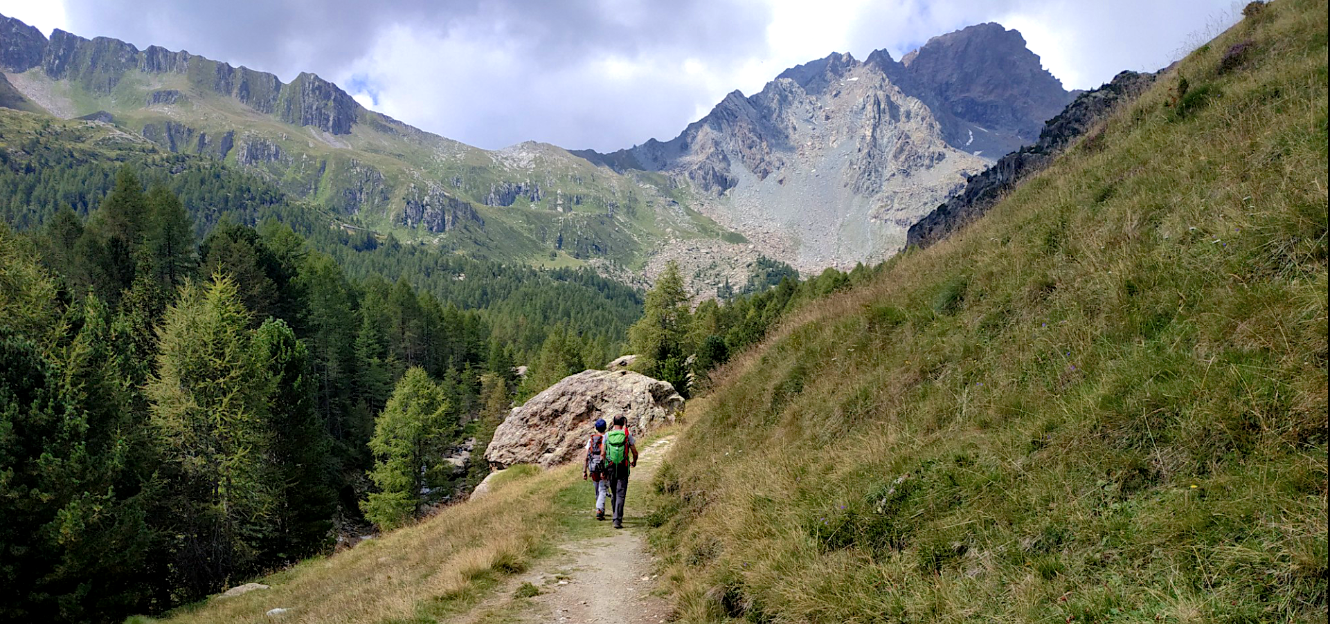
Waterfall hiking trails in Riserva Naturale Val Di Mello are situated within a glacial valley in the Italian Alps, characterized by dramatic granite cliffs and lush alpine meadows. The Mello stream meanders through the valley, forming clear, emerald-hued pools and several waterfalls, including the prominent Cascata del Ferro. The terrain ranges from accessible, almost flat paths near the valley entrance to more challenging climbs through dense forests. Towering peaks, such as Monte Disgrazia, define the skyline, contributing to the varied…
Last updated: July 7, 2026
5.0
(5)
27
hikers
8.46km
02:55
220m
510m
Moderate hike. Good fitness required. Mostly accessible paths. Sure-footedness required.
4.7
(24)
80
hikers
10.4km
03:32
450m
440m
Moderate hike. Good fitness required. Mostly accessible paths. Sure-footedness required.

Sign up for free
5.0
(2)
5
hikers
7.73km
03:28
570m
580m
Hard hike. Good fitness required. Sure-footedness, sturdy shoes and alpine experience required.
5.0
(1)
5
hikers
12.0km
04:36
590m
590m
Hard hike. Good fitness required. Sure-footedness, sturdy shoes and alpine experience required.
Our route recommendations are based on thousands of hikes, rides, and runs completed by other people on komoot.
Start today with a free account
Your next adventure awaits.
Login or Signup
Popular around Riserva Naturale Val Di Mello
Other adventures in Riserva Naturale Val Di Mello

Tips from the Community

Difficult descent on the last kilometer
0
0

pleasant path, almost entirely asphalted, the waterfall is worth a swim
0
0

the majesty of Pizzo Badile
0
0

The pictures look very beautiful. Unfortunately, the bridge was already dismantled in July 2025. The valley was still an experience.👍👍👍👌
2
0

The stone slab path, also called “La Plotta”, winds up the mountain here. Once you reach the top, you will be rewarded with breathtaking views of the Sciora group and Pizzo Badile.
2
0

At this small stall you can buy regional products, including chestnuts and honey.
0
0
There are plenty of sweet chestnuts growing here. You can learn more about the trees and their fruits on an information board that is part of the chestnut educational trail.
2
0

This stone bridge over the Maira bears witness to the rural heritage of Promontogno. A rustic structure that is quite charming in the mountainous environment of the village.
0
0
Frequently Asked Questions
How many waterfall hiking trails are there in Riserva Naturale Val Di Mello?
Riserva Naturale Val Di Mello offers a selection of waterfall hiking trails, with a focus on moderate to difficult routes. While the guide highlights specific tours, the region is rich with paths leading to various cascades and water features, including the prominent Cascata del Ferro. You can explore several options, such as the Day hike from Stampa to Castasegna via Soglio, to discover the valley's aquatic beauty.
Are there easy waterfall hikes suitable for beginners in Val di Mello?
While many trails in Val di Mello involve moderate to difficult ascents, the valley entrance near San Martino offers an almost flat, accessible path for about 25 minutes, leading towards picturesque spots like Lago di Qualido and the Bidet della Contessa. These sections provide a gentle introduction to the region's stunning waterways and are suitable for beginners or those seeking a leisurely walk.
What are some family-friendly waterfall trails in Riserva Naturale Val Di Mello?
For families, the initial, flatter sections of the Val di Mello valley are ideal. Starting from San Martino, the accessible path towards Lago di Qualido and the Bidet della Contessa offers beautiful views of the Mello stream and its clear pools without significant climbs. These areas provide a safe and enjoyable experience for all ages to appreciate the natural beauty.
Can I bring my dog on waterfall hikes in Val di Mello?
Riserva Naturale Val Di Mello is generally welcoming to dogs, but it's always recommended to keep them on a leash, especially in protected areas to safeguard local wildlife and ensure the safety of other hikers. Be mindful that some trails may have challenging terrain or narrow sections. Always carry water for your dog and clean up after them.
Are there any circular waterfall hikes in the region?
Yes, there are circular options that allow you to experience the diverse landscapes of Val di Mello, including its waterfalls. For instance, the Loop from Bondo via Castasegna and Soglio is a moderate 6.5-mile (10.4 km) path that navigates through varied terrain, offering views of the valley's features. Another option is the Castasegna Village Center – Cama Waterfall with Tunnel loop from Soglio, which leads through mountain villages and towards waterfall features.
What are the typical lengths and durations of waterfall hikes in Val di Mello?
Waterfall hikes in Val di Mello vary in length and duration depending on the chosen route and your pace. For example, the Day hike from Stampa to Castasegna via Soglio is about 5.3 miles (8.5 km) and typically takes around 2 hours 55 minutes. More extensive loops, like the Castasegna Village Center – Cama Waterfall with Tunnel loop from Soglio, can be up to 7.7 miles (12.4 km) and take approximately 4 hours 11 minutes.
Where can I park when visiting the waterfall trails in Val di Mello?
Parking is typically available at the entrance to Riserva Naturale Val Di Mello, often near San Martino. During peak seasons, these areas can fill up quickly, so arriving early is advisable. Some areas may have paid parking, and it's always good to check local signage for specific regulations.
Is public transport available to reach the waterfall hikes in Val di Mello?
Public transport options to Riserva Naturale Val Di Mello are limited but available. Buses often connect the main towns in the valley, such as San Martino, which serves as a primary access point for the reserve. It's recommended to check local bus schedules in advance, especially during off-peak seasons, as services may be less frequent.
What is the best time of year to experience the waterfalls in Riserva Naturale Val Di Mello?
The best time to experience the waterfalls in Val di Mello is typically from late spring to early autumn (May to October). During spring, snowmelt ensures powerful cascades, and the valley is lush with wildflowers. Summer offers warm weather for hiking and enjoying the clear waters, while autumn brings vibrant foliage. Winter offers a different, serene experience with snow and ice, but access to some trails might be limited.
What should I wear for waterfall hiking in Val di Mello?
For waterfall hiking in Val di Mello, wear sturdy hiking boots with good grip, as trails can be uneven and potentially slippery near water features. Layered clothing is advisable due to changing alpine weather, including a waterproof jacket. Don't forget sun protection, a hat, and plenty of water. A backpack for essentials and snacks is also recommended.
Are there any cafes or places to eat near the waterfall trails?
Yes, scattered throughout Val di Mello are charming mountain huts, known as 'baite,' and refuges like Rifugio Luna Nascente. These establishments offer spots to relax and enjoy traditional local cuisine, providing a welcome break after exploring the waterfall trails. You'll find options for refreshments and meals, particularly near the more frequented areas of the valley.
Can I go wild swimming near the waterfalls in Val di Mello?
Val di Mello is famous for its incredibly clear and often emerald-hued waters, particularly in the Mello Stream, Lago di Qualido, and the Bidet della Contessa. While these natural pools are inviting, always exercise caution. The water can be very cold, and currents can be strong, especially near waterfalls. Always assess conditions and prioritize safety if considering a dip.
What natural attractions can I see along the waterfall hiking trails in Val di Mello?
Along the waterfall hiking trails in Val di Mello, you'll encounter a wealth of natural attractions. Beyond the cascades themselves, you can admire the dramatic granite formations and glacial carvings, the pristine Mello Stream, and picturesque lakes such as Lago di Qualido and the iconic Bidet della Contessa. The entire Val di Mello Nature Reserve is a protected area, offering stunning views of towering peaks like Monte Disgrazia and rich biodiversity.
What do other hikers say about the waterfall trails in Riserva Naturale Val Di Mello?
The waterfall trails in Riserva Naturale Val Di Mello are highly rated by the komoot community, with an average score of 4.6 stars from over 400 reviews. Hikers often praise the stunning natural beauty, the dramatic granite cliffs, and the crystal-clear waters of the Mello stream and its pools. Many appreciate the diverse landscapes, from lush alpine meadows to dense forests, and the opportunities to witness majestic waterfalls like Cascata del Ferro.
Most popular routes in Riserva Naturale Val Di Mello
Most popular attractions in Riserva Naturale Val Di Mello

Get inspired with the komoot mobile app


Explore more
Browse the best Hikes in other regions.
