The best running trails around La Basse-Vaivre
57
runners
20
runs
Jogging around La Basse-Vaivre offers routes through the natural setting of the Haute-Saône region. The area is characterized by the Coney River and its canal, providing flat, even paths often favored by runners. With altitudes ranging between 227 and 268 meters, the terrain includes relatively flat sections along waterways and gentle inclines, suitable for various running experiences. This rural environment, part of the upper Saône watershed, features natural beauty and preserved landscapes for outdoor activity.
Best jogging routes around La…
Last updated: July 6, 2026
5
runners
11.5km
01:13
110m
110m
Moderate run. Good fitness required. Mostly paved surfaces. Suitable for all skill levels.
4
runners
5.71km
00:36
50m
50m
Moderate run. Good fitness required. Mostly paved surfaces. Suitable for all skill levels.

Sign up for free
2
runners
6.32km
00:41
110m
110m
Moderate run. Good fitness required. Mostly paved surfaces. Suitable for all skill levels.
3
runners
7.39km
00:47
110m
110m
Moderate run. Good fitness required. Mostly paved surfaces. Suitable for all skill levels.
5
runners
Moderate run. Good fitness required. Mostly paved surfaces. Suitable for all skill levels.
Get access to more routes and recommendations from other explorers.
Sign up for free
Already have an account?
Our route recommendations are based on thousands of hikes, rides, and runs completed by other people on komoot.
Start today with a free account
Your next adventure awaits.
Login or Signup


Tips from the Community

Very beautiful view of Passavant from the top of the viaduct.
2
0


In Selles, a nice little country town between Canal des Vosges and Coney. Another curiosity for lovers of good artisanal bread as we do more of these days.... The bakery makes its bread the old-fashioned way with the same recipe as in the 1930s. Enough to take you on a journey to a totally unknown culinary country, with unprecedented taste quality. The pastry cakes are on the same model: EXCELLENTISSIME! They also have a small convenience store with drinks...
4
0
A freight activity existed until 1991: coal was transported from Jussey for the activity of the Rochère glassworks... I ran in short pants after this train that we heard whistling from my grandparents' house from the carpentry in the 1970s We now pass over the viaduct at a height of more than 20 m via a superb cycle path which has rehabilitated this old line via the "Charles the Bold" route which joins CORRE towards the West and Epinal towards the East. The Charles the Bold Véloroute route takes, in France, the route of the V50 (In 2022, for legal reasons, the v50 must change its name. It becomes THE BLUE WAY Moselle-Saône by bike Luxembourg-Lyon) of Apach (57 Moselle) to Lamarche-sur-Saône (21 Côte d’Or). The Charles the Bold cycle route then reaches Dijon while the Voie Bleue heads towards Lyon. Have a nice trip to all!
4
0
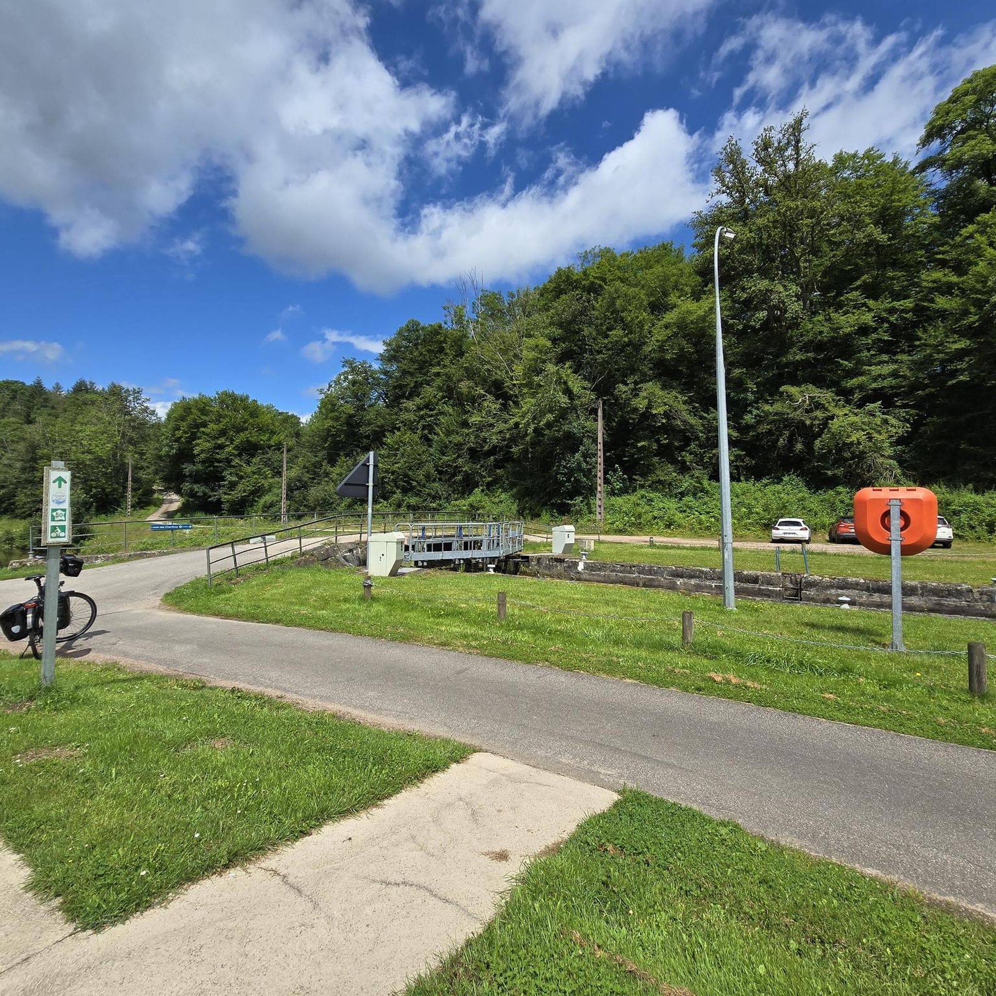
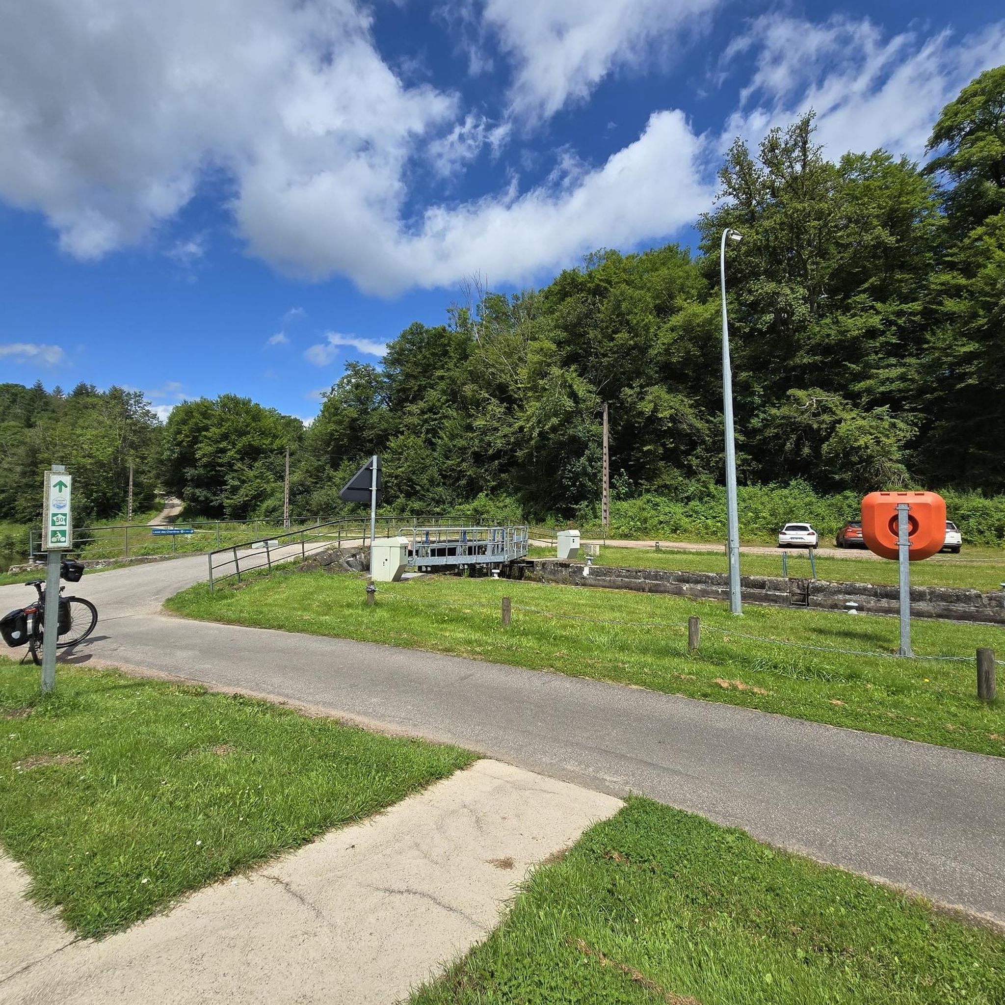
After 1871, the decision was taken to establish a north-south connection from the Moselle to the Saône on the western slope of the Vosges: construction of the Canal de l'Est, which would be completed in 1886. At the entrance to the village of Selles , the canal doubles the river: stone bridge over the river, metal swing bridge over the canal. The rotating bridge, with simple mechanics (articulated metal deck and pivot allowing its rotation), is still operated manually in 1994 by an employee of the navigation service who lives in the small neighboring house
2
0
An essential crossroads to reach the illustrious town of Passavant la Rochère with its 15th century art glassworks, the oldest art glassworks in France...
4
0

Viaduct which connected Jussey to Epinal via Darnieulles by train, built between 1883 and 1886. The passage and establishment of a station in Passavant-la-Rochère was very important because of its large number of industrial establishments (and in particular the oldest art glassworks and crystal works in Europe, still in activity) . This specific area required the construction of a viaduct because the ground there was marshy. It was destroyed in 1944 by the Germans then rebuilt by German prisoners but the line ended up being decommissioned in 1951.
2
0
Frequently Asked Questions
How many running routes are available in La Basse-Vaivre?
There are over 20 running routes around La Basse-Vaivre, offering a variety of experiences. The majority, 18 routes, are classified as moderate, while 2 are considered more difficult, catering to different fitness levels.
What kind of terrain can I expect on the jogging trails around La Basse-Vaivre?
The terrain around La Basse-Vaivre is quite varied. You'll find relatively flat sections, particularly along the Coney River and its canal, which are ideal for easy runs. There are also gentle inclines and declines, as the area's altitude ranges between 227 and 268 meters, providing a mix of challenges for your workout.
Are there any circular running routes in La Basse-Vaivre?
Yes, many of the running routes in the area are circular, allowing you to start and finish at the same point. For example, the Running loop from Passavant-la-Rochère is a popular 7.2-mile (11.5 km) option, and the Running loop from Martinvelle offers a moderate 3.5-mile (5.7 km) path with scenic views.
What are some scenic points or landmarks I might see while running?
The region offers several points of interest. You might encounter the Selles Swing Bridge, or enjoy views from the Ormoy-Richecourt bridge. The Canal des Vosges and its related features like the Canal breakthrough in Montmotier also offer picturesque settings for your run.
Are there routes suitable for beginners or those looking for an easier run?
While there are no routes explicitly labeled 'easy' in our guide, the region's varied topography includes many sections along the Coney River and canal that are relatively flat and well-suited for less strenuous runs. The 18 moderate routes often feature gentle elevation changes, making them accessible for many runners. A good option to consider is the Swing Bridge Near Selles – Selles Swing Bridge loop from La Basse-Vaivre, which has minimal elevation gain.
Can I bring my dog on the running trails in La Basse-Vaivre?
Generally, the rural and natural environment of La Basse-Vaivre is welcoming to dogs. However, it's always recommended to keep your dog on a leash, especially when passing through agricultural areas or near wildlife, and to respect local regulations that may apply to specific trails or protected areas.
Are there family-friendly jogging options in the area?
Yes, the numerous moderate routes with varied terrain, especially those along the river and canal, can be very suitable for families. These paths often provide a safer and more enjoyable experience for all ages. The Running loop from Hurecourt, for example, is a moderate 4.6-mile (7.4 km) trail through a rural landscape that many families might enjoy.
What are the typical distances for running routes in this area?
The running routes around La Basse-Vaivre vary in length. You can find shorter options like the Running loop from Martinvelle at 3.5 miles (5.7 km), up to longer trails such as the Running loop from Passavant-la-Rochère, which is 7.2 miles (11.5 km).
What do other runners enjoy the most about jogging in La Basse-Vaivre?
Runners frequently praise the natural beauty and tranquility of the area. The presence of the Coney River and its canal provides peaceful, scenic paths, and the varied rural landscape offers a refreshing escape. Many appreciate the mix of flat sections and gentle inclines, making it suitable for different running preferences.
Are there any routes that follow the river or canal?
Absolutely. The Coney River and an adjacent canal define much of the northern and western boundaries of La Basse-Vaivre. These waterways naturally form flat, towpath-like routes that are excellent for jogging, offering tranquil and visually appealing paths through the landscape. The Swing Bridge Near Selles – Selles Swing Bridge loop from La Basse-Vaivre is an example of a route that utilizes these features.
Is there public transport access to the running trails?
La Basse-Vaivre is a rural commune, and direct public transport to specific trailheads might be limited. It's generally advisable to plan for personal transportation, such as a car, to access the various starting points of the running routes. For broader information on getting around the Haute-Saône region, you might find resources on the local tourism website: hautesaonetourisme.com.
Where can I find parking near the running routes?
As a rural area, parking is generally available in or near the villages where routes begin, such as Passavant-la-Rochère, Martinvelle, Hurecourt, or La Basse-Vaivre itself. Look for designated parking areas in village centers or near public spaces, or consider parking responsibly along quiet roadsides where permitted.
Most popular attractions around La Basse-Vaivre

Get inspired with the komoot mobile app


Explore more
Browse the best Running Trails & Routes in other regions.
