The best mountain hikes around Montvalezan
4.8
(11)
26
hikers
6
hikes
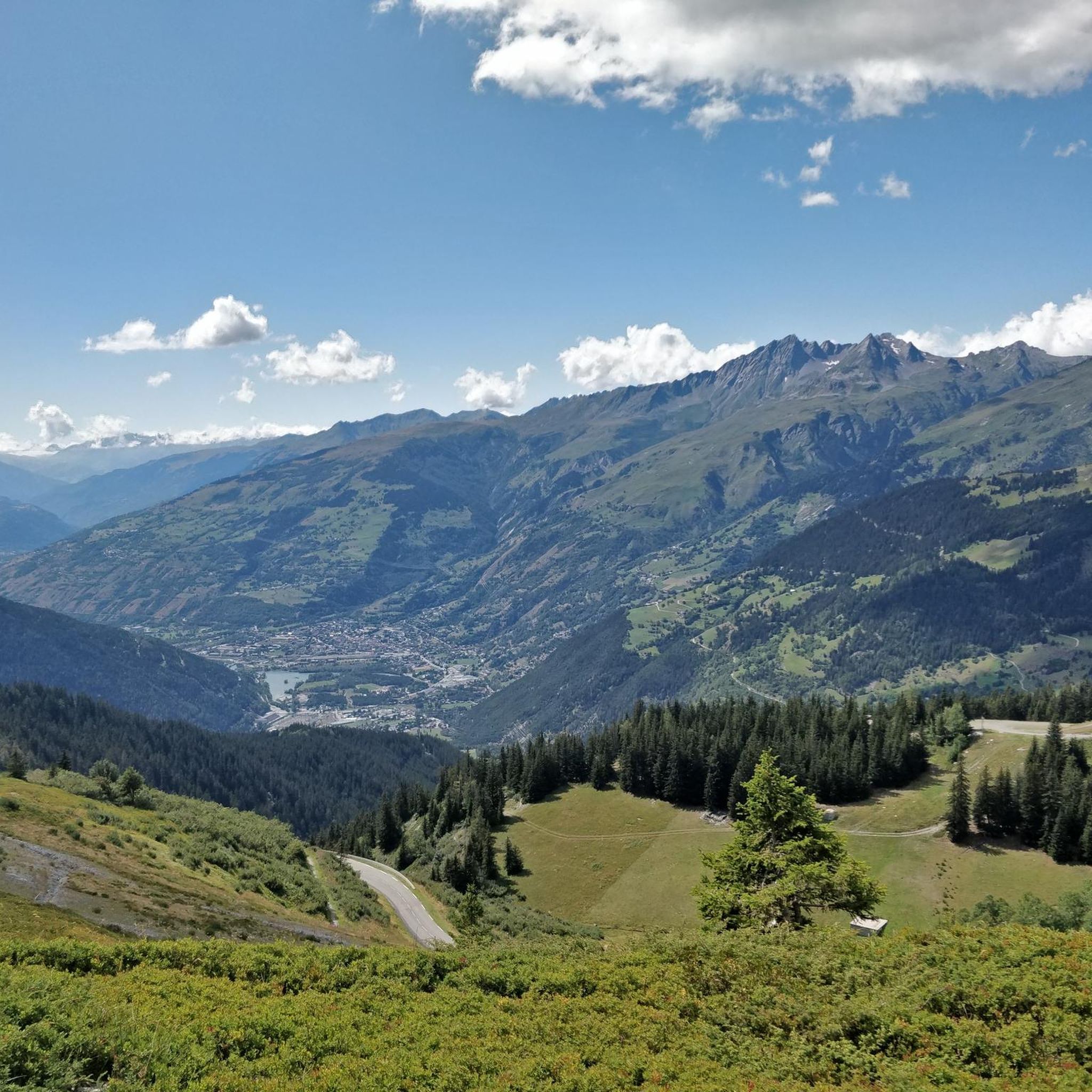
Mountaineering around Montvalezan offers routes through high alpine terrain, characterized by significant elevation gains and panoramic views of valleys and lakes. The region features challenging ascents towards prominent peaks and glaciers, alongside moderate trails through mountain landscapes. These routes provide opportunities to explore the varied topography of the French Alps.
Best mountaineering routes around Montvalezan
- The most popular mountaineering route is View of Pian de la Lière – View of the Valley and Lake loop from Promise, a 9.0 miles (14.6 km) trail that takes 6 hours 57 minutes to complete. This difficult route offers extensive views of the valley and a lake.
- Another top favourite among local mountaineers is Start from Deffeyes hut – Testa del Rutor loop from Rifugio Albert Deffeyes, a difficult 9.1 miles (14.7 km) path. This route provides a challenging loop starting from a mountain hut, leading towards Testa del Rutor.
- Local mountaineers also love the Stunning view to Mont Pourri – Le Monal loop from Sainte-Foy-Tarentaise, a 5.7 miles (9.2 km) trail leading through mountain scenery with views of Mont Pourri, often completed in about 2 hours 59 minutes.
- Mountaineering around Montvalezan is defined by high mountain passes, glacial landscapes, and alpine lakes. The network offers options for both moderate and difficult ability levels.
- The routes in Montvalezan are highly rated by the komoot community with an average score of 4.8 stars from over 13 reviews. More than 60 mountaineers have used komoot to explore Montvalezan's varied terrain.
Last updated: July 6, 2026
5.0
(2)
5
hikers
14.6km
08:07
970m
970m
Hard mountaineering route. Very good fitness required. Sure-footedness, sturdy shoes and alpine experience required.
5.0
(3)
6
hikers
5.45km
02:38
470m
470m
Moderate mountaineering route. Good fitness required. Mostly accessible paths. Sure-footedness required.

Sign up for free
4.5
(2)
7
hikers
9.18km
02:59
390m
390m
Moderate mountaineering route. Good fitness required. Easily-accessible paths. Suitable for all skill levels.
3
hikers
Hard mountaineering route. Very good fitness required. Sure-footedness, sturdy shoes and alpine experience required.
4.3
(3)
4
hikers
Moderate mountaineering route. Good fitness required. Mostly accessible paths. Sure-footedness required.
Our route recommendations are based on thousands of hikes, rides, and runs completed by other people on komoot.
Start today with a free account
Your next adventure awaits.
Login or Signup

Tips from the Community

Nestled at 2,505 meters, Lake Marlou is a splendid mountain biking destination departing from the Arc 2000 resort or the Col de la Chal. The site is a wonderful place to take a break.
0
0


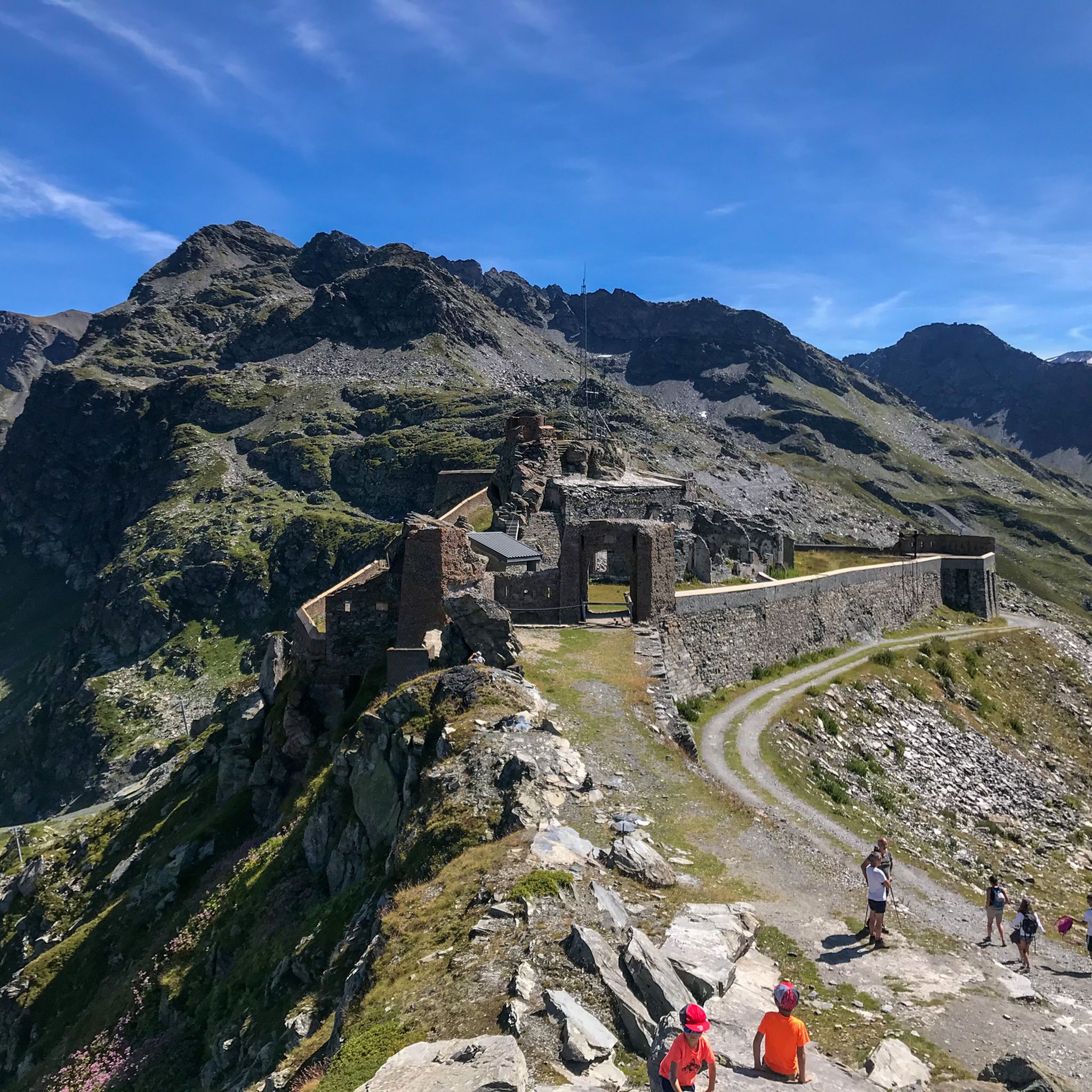
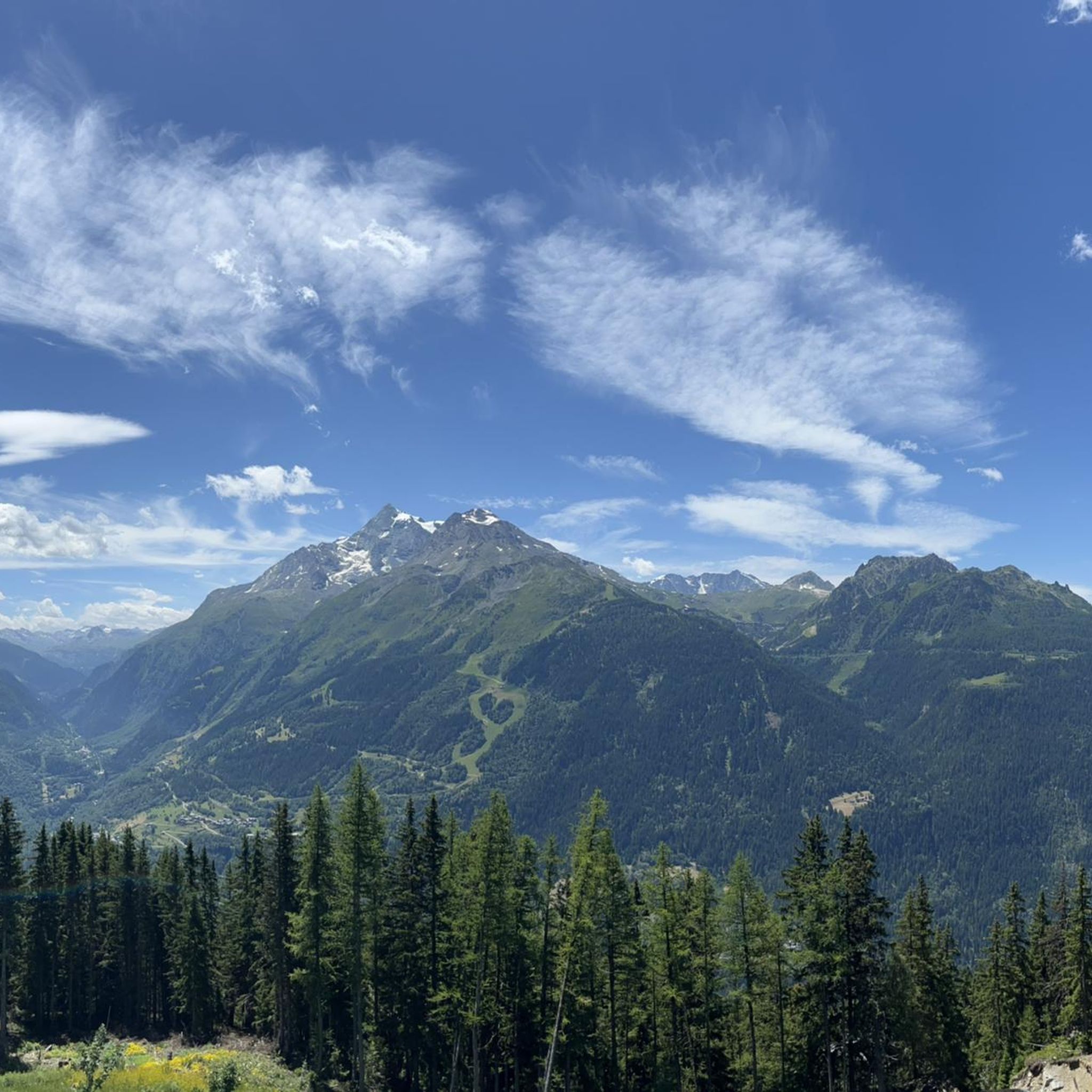
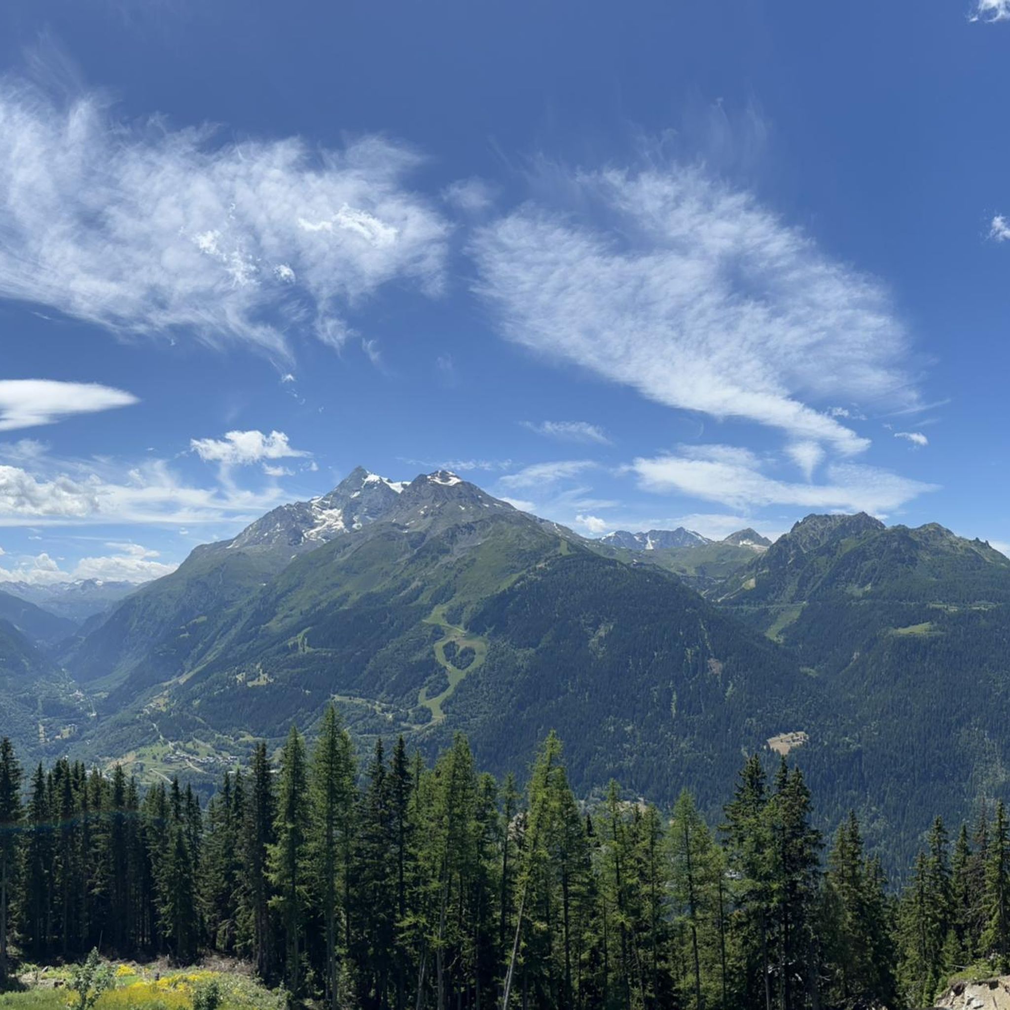
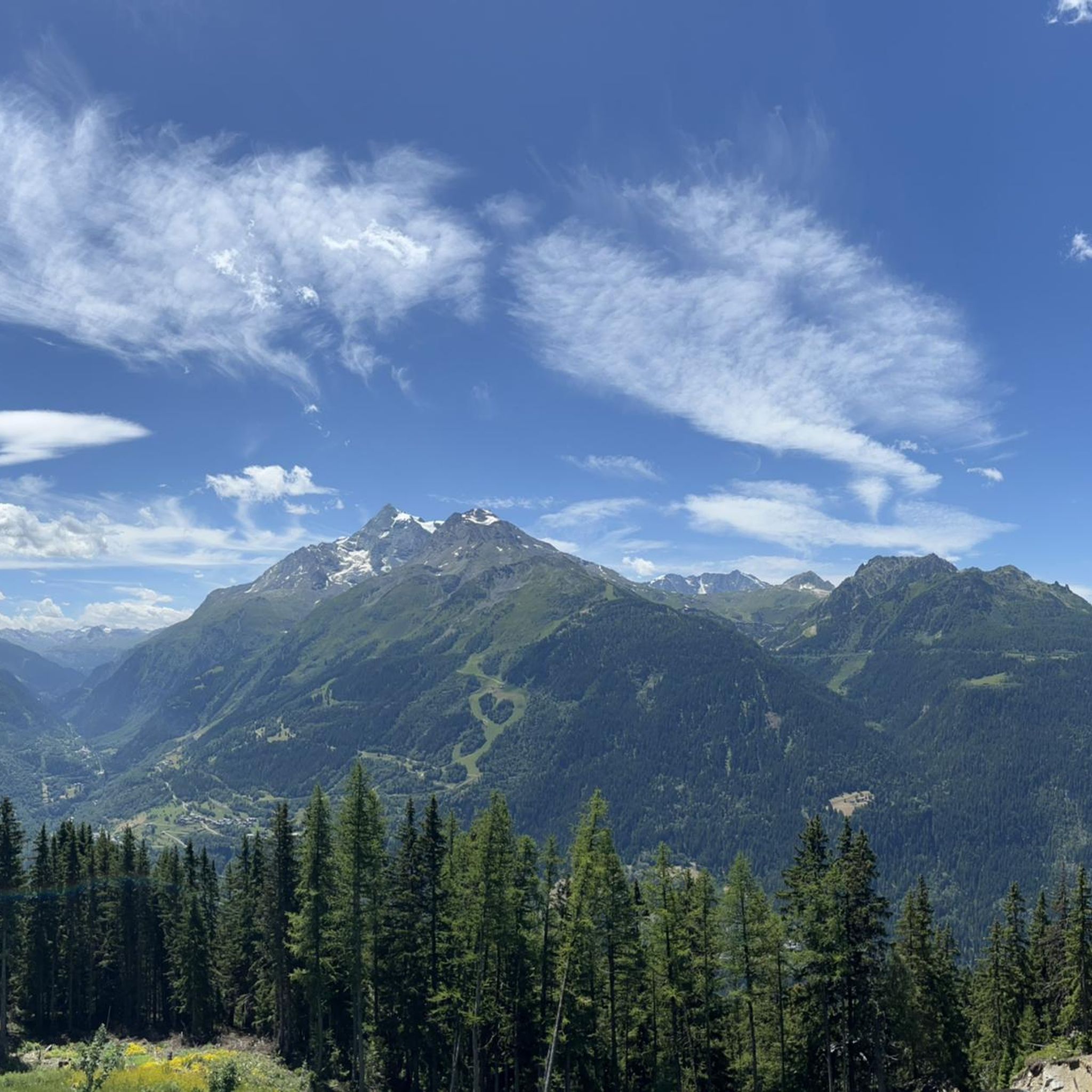
Perched in the Alps, this viewpoint offers a magnificent panorama of snow-capped mountains, alpine forests and small villages nestled in the valley bottom. The view extends over majestic peaks and green slopes.
1
0


There is a legend that hovers around the Rutor glacier which tells that the place now occupied by the glacier was once a large green meadow where the cows of a rich farmer grazed. One day God wanted to test his goodness and sent him a beggar to ask for some milk to feed his family. The rich farmer, instead of giving him some of his milk, mocked the beggar and, out of insult, ordered his workers to pour the buckets of fresh milk on the lawn. The beggar reacted by casting a curse on him that made it snow for days on end. Accompanying the snow was also a very cold wind which caused the green pastures to turn into ice. Thus the Rutor glacier was born.
1
0

The Alberto Deffeyes refuge is a refuge located in the municipality of La Thuile (AO), in the La Thuile valley, in the Graian Alps, at 2,500 meters above sea level. It was built in 1953 and dedicated to Albert Deffeyes. It is located at the foot of the Testa del Rutor peak and the Rutor glacier in a basin particularly rich in alpine lakes. It is the stopping point of the Alta via della Valle d'Aosta n. 2. It also offers the possibility of climbing almost overlooking the adjacent lake with various routes from grade 5c to 7a. http://www.rifugiodeffeyes.it/
0
0
On this link you will find all the information on the Deffeyes Refuge http://www.rifugiodeffeyes.it/
0
0
Frequently Asked Questions
What are the typical difficulty levels for mountaineering routes around Montvalezan?
Mountaineering around Montvalezan primarily offers moderate and difficult routes. There are 4 moderate and 4 difficult routes listed in this guide, characterized by significant elevation gains and high alpine terrain. For example, the View of Pian de la Lière – View of the Valley and Lake loop from Promise is a difficult route with over 1000 meters of elevation gain.
Are there any beginner-friendly mountaineering routes in Montvalezan?
While there are no routes classified as 'easy' in this selection, some of the moderate routes could be suitable for those with some mountaineering experience looking to progress. For instance, the Stunning view to Mont Pourri – Le Monal loop from Sainte-Foy-Tarentaise is a moderate option, offering beautiful views without the extreme demands of the most difficult trails.
How long do mountaineering routes around Montvalezan typically take to complete?
The duration of routes varies significantly based on distance, elevation, and your pace. For example, the 9.0-mile (14.6 km) View of Pian de la Lière – View of the Valley and Lake loop from Promise typically takes around 7 hours. Shorter routes like the 5.7-mile (9.2 km) Stunning view to Mont Pourri – Le Monal loop from Sainte-Foy-Tarentaise can be completed in about 3 hours.
What is the best season for mountaineering in Montvalezan?
The best season for mountaineering in Montvalezan is generally from late spring to early autumn (June to September). During this period, snowmelt has typically cleared higher trails, and weather conditions are more stable, offering better visibility and safer passage. Always check local weather forecasts and trail conditions before heading out.
Are there any circular mountaineering routes available in Montvalezan?
Yes, several routes in the Montvalezan area are designed as loops, allowing you to start and finish at the same point. Examples include the challenging Start from Deffeyes hut – Testa del Rutor loop from Rifugio Albert Deffeyes and the scenic View of the Valley and Lake – View of Rifugio and Glacier loop from La Joux.
What natural attractions or landmarks can I see along the mountaineering routes?
The mountaineering routes around Montvalezan offer stunning views of alpine lakes and mountain huts. You might encounter highlights such as Alberto Deffeyes Hut, Lac du Verney, or Lago dei Seracchi. These routes often provide panoramic vistas of the surrounding valleys and peaks like Mont Pourri.
Can I spot wildlife while mountaineering in Montvalezan?
The high alpine environment around Montvalezan is home to various wildlife. Keep an eye out for chamois, ibex, and marmots, especially in quieter areas and during early morning or late afternoon. Birdwatchers might also spot eagles or other raptors soaring above the peaks.
What should I wear for mountaineering in Montvalezan during summer?
Even in summer, mountain weather can change rapidly. It's advisable to wear layers, including moisture-wicking base layers, an insulating mid-layer, and a waterproof and windproof outer shell. Sturdy mountaineering boots, a hat, gloves, sunglasses, and sun protection are also essential. Always pack extra warm clothing, even if the forecast is good.
Are there any hidden gem mountaineering routes in the Montvalezan area?
While all routes offer unique experiences, exploring trails that lead to less frequented huts or lakes can provide a sense of discovery. Consider routes that venture towards areas like Rifugio degli Angeli or Lake Sans Fond for a potentially quieter experience away from the most popular trails.
What do other mountaineers enjoy most about the routes in Montvalezan?
The mountaineering routes in Montvalezan are highly rated by the komoot community, with an average score of 4.8 stars from over 13 reviews. Reviewers often praise the extensive views of valleys and lakes, the challenging nature of the ascents, and the opportunity to explore varied alpine topography, including glaciers and high mountain passes.
Are there options for mountaineering near La Rosière, close to Montvalezan?
Yes, the region offers routes accessible from nearby areas like La Rosière. For example, the Lake Retour loop from Office de Tourisme de La Rosière is a difficult mountaineering route that starts directly from La Rosière, providing another excellent option for exploring the high mountains.
Most popular routes around Montvalezan
Most popular attractions around Montvalezan

Get inspired with the komoot mobile app


Explore more
Browse the best Mountain Hikes & Routes in other regions.
