The best mountain hikes around Marignac-En-Diois
5.0
(7)
38
hikers
8
hikes
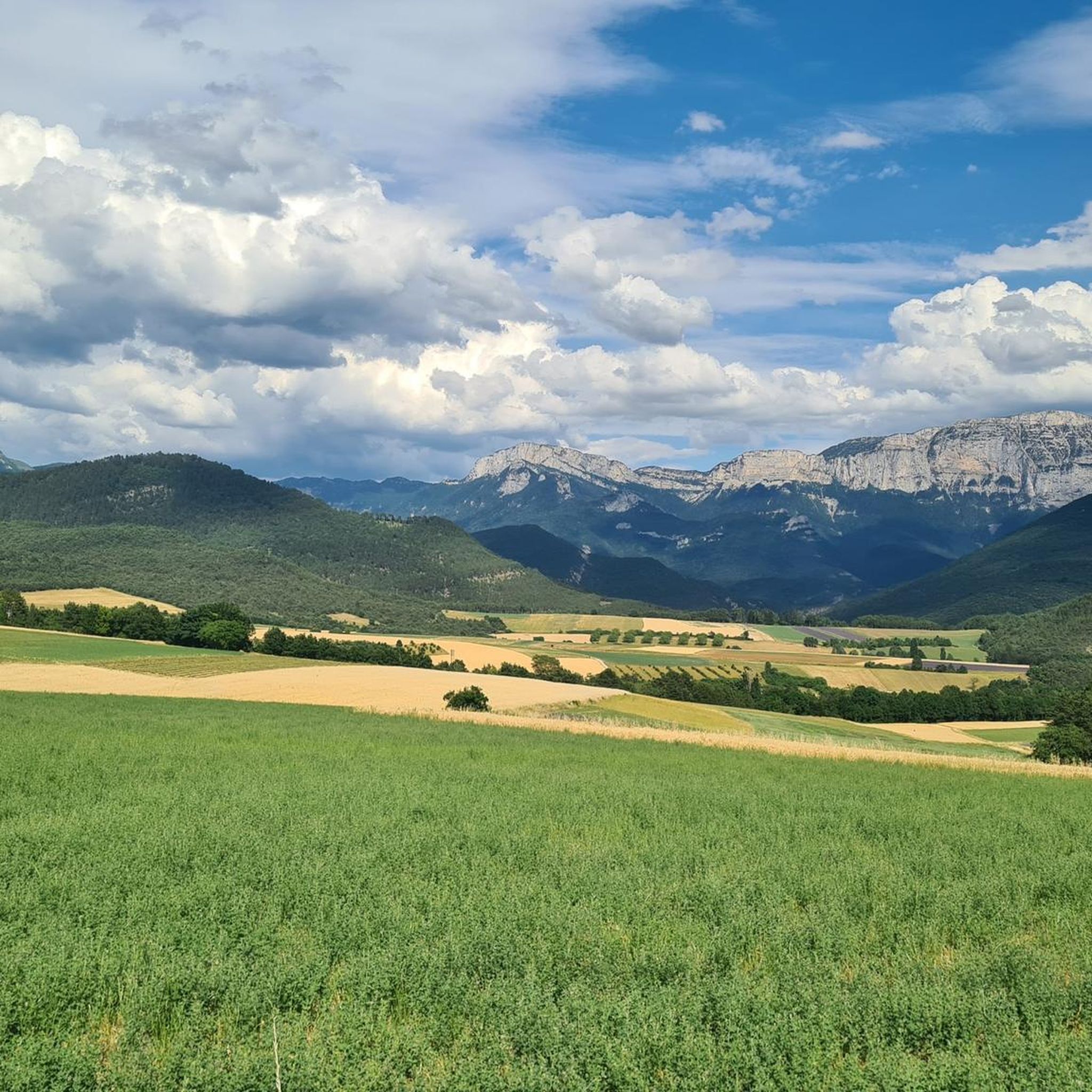
Mountaineering routes around Marignac-En-Diois are situated within the Drôme department of France's Auvergne Rhône-Alpes region, primarily within the Vercors Regional Natural Park. The landscape is characterized by rugged mountains, deep gorges, and expansive plateaus, featuring dramatic geological formations like limestone cliffs and karst features. This area offers diverse terrain for mountaineering, from multi-pitch climbing routes to challenging mountain ascents.
Best mountaineering routes around Marignac-En-Diois
- The most popular mountaineering route is Mountaineering loop from Point de Vue du Col du Rousset…
Last updated: May 25, 2026
8
hikers
2.07km
01:07
170m
170m
Hard mountaineering route. Great for any fitness level. Sure-footedness, sturdy shoes and alpine experience required.
5.0
(1)
4
hikers
11.5km
03:55
560m
560m
Moderate mountaineering route. Good fitness required. Easily-accessible paths. Suitable for all skill levels.

Sign up for free
4
hikers
20.0km
07:20
950m
950m
Hard mountaineering route. Very good fitness required. Sure-footedness, sturdy shoes and alpine experience required.
5.0
(1)
3
hikers
Moderate mountaineering route. Good fitness required. Easily-accessible paths. Suitable for all skill levels.
3
hikers
Moderate mountaineering route. Good fitness required. Mostly accessible paths. Sure-footedness required.
Get access to more routes and recommendations from other explorers.
Sign up for free
Already have an account?
Our route recommendations are based on thousands of hikes, rides, and runs completed by other people on komoot.
Start today with a free account
Your next adventure awaits.
Login or Signup

Tips from the Community

The museum is installed on the site of a late Neolithic flintknapping workshop abandoned 4,500 years ago by artisan knappers. Discovered in 1970, this exceptionally well-preserved workshop is the origin of the museum's creation. Through various themes, the different phases of occupation of the Vercors by prehistoric humans are highlighted.
0
0


As pretty at the top as at the bottom, lots of ways to get to the top, accessible for all levels (not technical but lots of elevation gain depending on your starting point) but it's worth it!
1
0
Great view! And those on all sides, some areas where it is easier to get your hands on (over 100 meters) but nothing insurmountable! No dangerous areas!
0
0


Path is 30 cm wide. Next to it an abyss. Stay away if you suffer from vertigo.
0
0

The highest peak of the Vercors is very easy to cross. A little more exposed from the north, but without any real climbing spots, and even easier terrain from the south. Great panoramic views and into the distance - but particularly impressive from some places directly into the almost vertical eastern flank, which stretches over the entire chain in a slight curve to the Grande Moucherolle (the second highest peak) and beyond. And there were plenty of ibexes on my tour too.
3
1

Frequently Asked Questions
How many mountaineering routes are available around Marignac-en-Diois?
There are currently 8 mountaineering routes documented around Marignac-en-Diois, offering a range of experiences from moderate ascents to more difficult multi-pitch climbing challenges.
What kind of mountaineering challenges can I expect in the Marignac-en-Diois region?
The Marignac-en-Diois region, nestled within the Vercors Regional Natural Park, offers a diverse range of mountaineering experiences. You'll find everything from moderate ascents on trails like Die – Pas de Gralatte loop from Die, which traverses varied terrain, to more difficult multi-pitch climbing routes. The area is known for its dramatic limestone cliffs and karst formations, providing a true mountain environment.
Are there options for beginner mountaineers in Marignac-en-Diois?
Yes, the Diois region offers routes suitable for those new to mountaineering, particularly in multi-pitch climbing. For instance, 'La grande slab du CLAPS' is a 250-meter route ideal for those starting multi-pitch climbing. Guides are also available locally to help you learn or improve your skills.
Where can I find more advanced climbing opportunities in the area?
For advanced climbers, the Diois region, situated between Vercors and Provence, is renowned for its 'grande voie' (multi-pitch climbing) routes. These allow climbers to ascend large cliffs over several rope lengths, covering hundreds of meters. Sites like Valcroissant and The Claps offer challenging routes, and local guides can assist with more demanding ascents. You can also explore difficult routes such as the Mountaineering loop from Point de Vue du Col du Rousset.
What natural landmarks or points of interest can I discover along the mountaineering routes?
The Marignac-en-Diois area is rich in natural beauty. You can encounter impressive peaks like But Sapiau and Puy de la Gagère. Don't miss the stunning Druise Waterfall or the unique Font d'Urle Ice Cave. Many routes also offer panoramic viewpoints, such as Justin's Cross.
Are there any circular mountaineering routes in Marignac-en-Diois?
Yes, several routes in the area are designed as loops, allowing you to start and finish at the same point. Examples include the Grand Veymont – Pas de la Ville loop from Grotte de la Luire, which offers a comprehensive experience of the Vercors Massif, and the Bells Sinkhole loop from Alpage de Font d'Urle.
What is the best time of year for mountaineering in Marignac-en-Diois?
The region offers diverse experiences throughout the year. While summer and autumn are generally ideal for mountaineering, with beautiful autumn colors on trails around Montagne de Nève, the Vercors Regional Natural Park also provides opportunities for winter sports. Always check local conditions and weather forecasts, especially for higher altitudes and during transitional seasons.
Is the Marignac-en-Diois region suitable for family-friendly mountaineering or hiking?
While some mountaineering routes can be challenging, the broader Pays Diois region offers a wide range of activities suitable for families, from gentle strolls to more moderate hikes. For specific family-friendly mountaineering, it's best to consult local guides or choose routes explicitly marked as easy or moderate, focusing on the hiking aspects rather than technical climbing.
What do other mountaineers enjoy most about the routes in Marignac-en-Diois?
The mountaineering routes around Marignac-en-Diois are highly rated by the komoot community, with an average score of 5.0 stars from 7 reviews. Mountaineers often praise the dramatic geological formations, the diverse terrain, and the stunning panoramic views of the Vercors Massif and Drôme Valley.
Are there any via ferrata routes available in the Marignac-en-Diois area?
Yes, for those seeking thrills with artificial protection, several via ferrata routes are available in the region. These allow participants to traverse cliffs with fixed cables and ladders. Equipment rental is typically available in nearby towns. You can find more information on climbing and via ferrata options on the Diois Tourisme website.
Can I access mountaineering routes in Marignac-en-Diois using public transport?
While specific public transport links directly to all trailheads might be limited, some routes may be accessible from larger towns like Die, which has public transport connections. For routes starting from more remote locations, such as the But Saint-Genix – Col de la Chau loop from Musée de la Préhistoire de Vassieux-en-Vercors, personal vehicle access is generally more convenient. It's advisable to check local transport schedules for specific starting points.
Where can I find information about the Vercors Regional Natural Park?
Marignac-en-Diois is located within the Vercors Regional Natural Park, a region known for its diverse landscapes, rich biodiversity, and unique geological features. You can learn more about the park's characteristics, including its alpine and Mediterranean flora and high mountain fauna, by visiting the Diois Tourisme website.
Most popular routes around Marignac-En-Diois
Most popular attractions around Marignac-En-Diois

Get inspired with the komoot mobile app


Explore more
Browse the best Mountain Hikes & Routes in other regions.
