The best mountain hikes around Saint-Julien-En-Quint
5.0
(7)
37
hikers
8
hikes
Mountaineering around Saint-Julien-En-Quint offers routes through varied mountainous terrain, characterized by significant elevation changes and natural landscapes. The region provides opportunities to explore valleys and higher elevations, suitable for those seeking challenging ascents. These routes often traverse diverse environments, from forested sections to more exposed mountain paths.
Best mountaineering routes around Saint-Julien-En-Quint
- The most popular mountaineering route is Mountaineering loop from Point de Vue du Col du Rousset, a difficult 1.3 miles (2.1 km) trail that takes 1 hour…
Last updated: August 29, 2026
9
hikers
2.07km
01:12
170m
170m
Hard mountaineering route. Great for any fitness level. Sure-footedness, sturdy shoes and alpine experience required.
5.0
(1)
4
hikers
11.5km
03:55
560m
560m
Moderate mountaineering route. Good fitness required. Easily-accessible paths. Suitable for all skill levels.

Sign up for free
4
hikers
20.0km
07:20
950m
950m
Hard mountaineering route. Very good fitness required. Sure-footedness, sturdy shoes and alpine experience required.
5.0
(1)
3
hikers
Moderate mountaineering route. Good fitness required. Easily-accessible paths. Suitable for all skill levels.
3
hikers
Moderate mountaineering route. Good fitness required. Mostly accessible paths. Sure-footedness required.
Get access to more routes and recommendations from other explorers.
Sign up for free
Already have an account?
Our route recommendations are based on thousands of hikes, rides, and runs completed by other people on komoot.
Start today with a free account
Your next adventure awaits.
Login or Signup
Tips from the Community

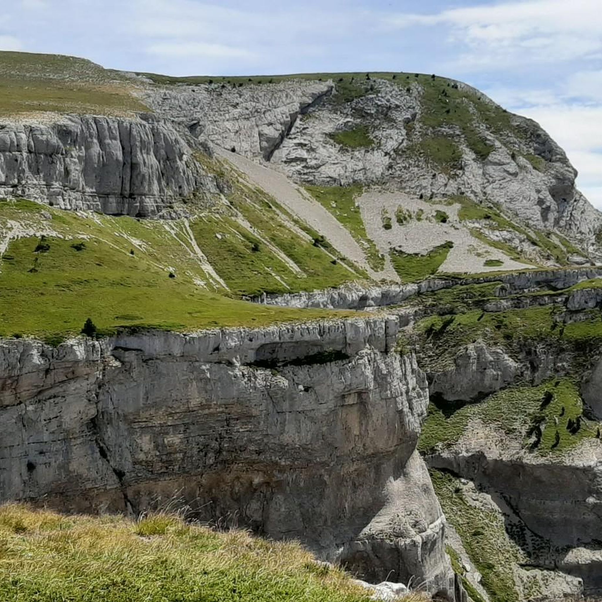
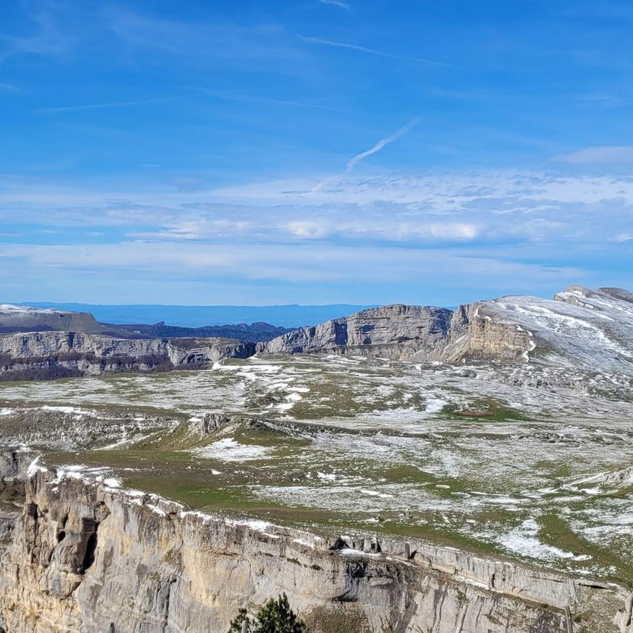
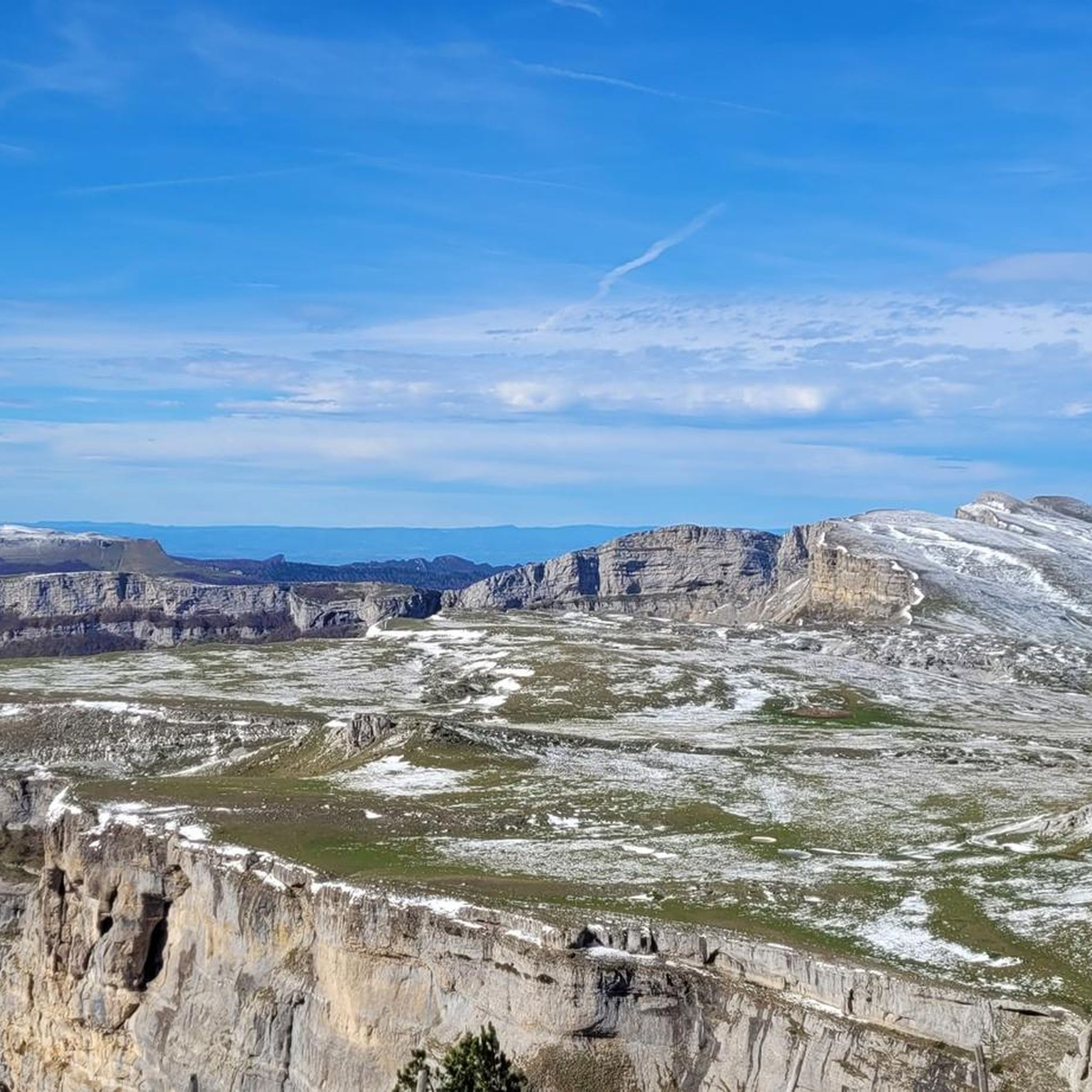
From here, a wide and evocative view opens up over the surrounding landscape, with valleys, mountains, and small villages that follow one another on the horizon.
8
0

Breathtaking view, you never get tired of it!
0
0
Stunning view and perfectly marked trail. Remember to bring water, there are no springs on the plateau.
0
0

Bring enough water... only one water source on the loop.
0
0

The museum is installed on the site of a late Neolithic flintknapping workshop abandoned 4,500 years ago by artisan knappers. Discovered in 1970, this exceptionally well-preserved workshop is the origin of the museum's creation. Through various themes, the different phases of occupation of the Vercors by prehistoric humans are highlighted.
0
0


As pretty at the top as at the bottom, lots of ways to get to the top, accessible for all levels (not technical but lots of elevation gain depending on your starting point) but it's worth it!
1
0
Great view! And those on all sides, some areas where it is easier to get your hands on (over 100 meters) but nothing insurmountable! No dangerous areas!
0
0
Frequently Asked Questions
How many mountaineering routes are available around Saint-Julien-En-Quint?
There are currently 9 mountaineering routes documented on komoot around Saint-Julien-En-Quint, offering a range of experiences for different skill levels.
What are the typical difficulty levels for mountaineering routes in this region?
The mountaineering routes around Saint-Julien-En-Quint primarily feature moderate and difficult grades. There are 6 moderate routes and 3 difficult routes, providing options for those seeking a challenge.
Are there any circular mountaineering routes in Saint-Julien-En-Quint?
Yes, several routes are designed as loops. For instance, you can explore the Mountaineering loop from Point de Vue du Col du Rousset, or the longer Die – Pas de Gralatte loop from Die. Another option is the challenging Grand Veymont – Pas de la Ville loop from Grotte de la Luire.
What kind of natural attractions can I expect to see along the mountaineering routes?
The region is rich in natural beauty. You might encounter stunning features like the Druise Waterfall, the impressive Combe Laval Cirque, or the intriguing Font d'Urle Ice Cave. Many routes offer views above the Omblèze gorges.
What do other mountaineers say about the routes in Saint-Julien-En-Quint?
The routes in Saint-Julien-En-Quint are highly regarded by the komoot community, holding an average rating of 5.0 stars from over 7 reviews. Mountaineers often praise the varied mountainous terrain and the significant elevation gains that provide rewarding experiences.
Are there any longer, more challenging mountaineering trails for experienced hikers?
Absolutely. For experienced mountaineers, the Grand Veymont – Pas de la Ville loop from Grotte de la Luire is a difficult 12.4-mile (20.0 km) trail that typically takes over 7 hours to complete, featuring high mountain passes and expansive views. Another challenging option is the Mountaineering loop from Point de Vue du Col du Rousset, though shorter, it is rated difficult.
What is the best time of year for mountaineering in Saint-Julien-En-Quint?
The best time for mountaineering in Saint-Julien-En-Quint is generally from late spring to early autumn (May to October) when the weather is most stable and trails are clear of snow. Always check local weather forecasts and trail conditions before heading out, especially at higher elevations.
Are there any moderate mountaineering routes suitable for a full day out?
Yes, for a substantial day out, consider the But Saint-Genix – Col de la Chau loop from Musée de la Préhistoire de Vassieux-en-Vercors, a moderate 7.6-mile (12.2 km) route. Another great option is the Bells Sinkhole loop from Alpage de Font d'Urle, which is 5.3 miles (8.5 km) and also rated moderate.
What kind of landscape defines mountaineering in Saint-Julien-En-Quint?
Mountaineering in Saint-Julien-En-Quint is characterized by varied mountainous terrain, significant elevation gains, and diverse landscapes. You'll traverse everything from forested sections to more exposed mountain paths, offering a rich and dynamic outdoor experience.
Are there any specific summits or viewpoints to aim for on these routes?
Many routes offer excellent viewpoints. The Mountaineering loop from Point de Vue du Col du Rousset provides panoramic views from the Col du Rousset. Additionally, the Tête de la Dame Summit is a notable peak in the vicinity that can be a goal for some mountaineering tours.
Most popular routes around Saint-Julien-En-Quint
Most popular attractions around Saint-Julien-En-Quint

Get inspired with the komoot mobile app


Explore more
Browse the best Mountain Hikes & Routes in other regions.
