The best mountain hikes around Santorso
5.0
(1)
24
hikers
3
hikes
Mountaineering around Santorso, a town at the foot of Monte Summano in the province of Vicenza, Italy, offers challenging routes through a mountainous landscape. The region is characterized by significant elevation changes, diverse trails, and panoramic views of the Vicenza Valley and surrounding areas. These routes often traverse varied terrain, including forested slopes and open ridges, providing a robust experience for outdoor enthusiasts.
Best mountaineering routes around Santorso
- The most popular mountaineering route is Cima Summano loop from Santorso,…
Last updated: October 7, 2026
13
hikers
Hard mountaineering route. Good fitness required. Sure-footedness, sturdy shoes and alpine experience required.
7
hikers
14.1km
05:11
770m
770m
Hard mountaineering route. Very good fitness required. Mostly accessible paths. Sure-footedness required.

5.0
(1)
2
hikers
11.4km
03:27
310m
310m
Moderate mountaineering route. Good fitness required. Mostly accessible paths. Sure-footedness required.
2
hikers
9.86km
03:05
250m
250m
Hard mountaineering route. Good fitness required. Sure-footedness, sturdy shoes and alpine experience required.
Our route recommendations are based on thousands of hikes, rides, and runs completed by other people on komoot.
Start today with a free account
Your next adventure awaits.
Tips from the Community

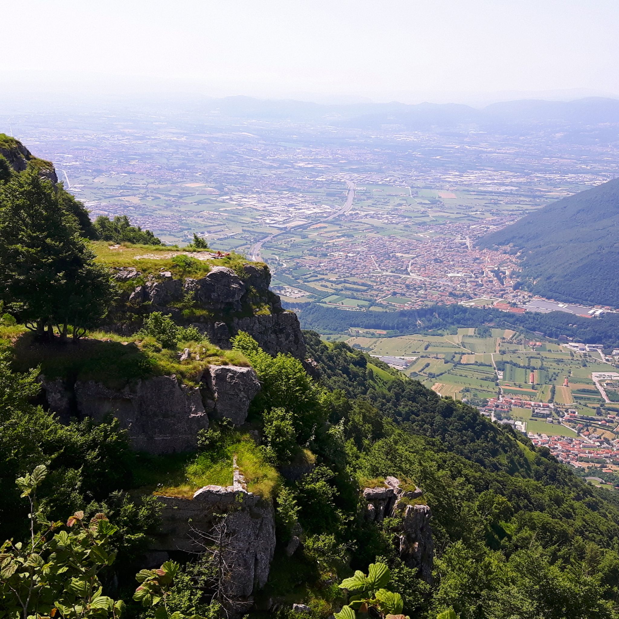
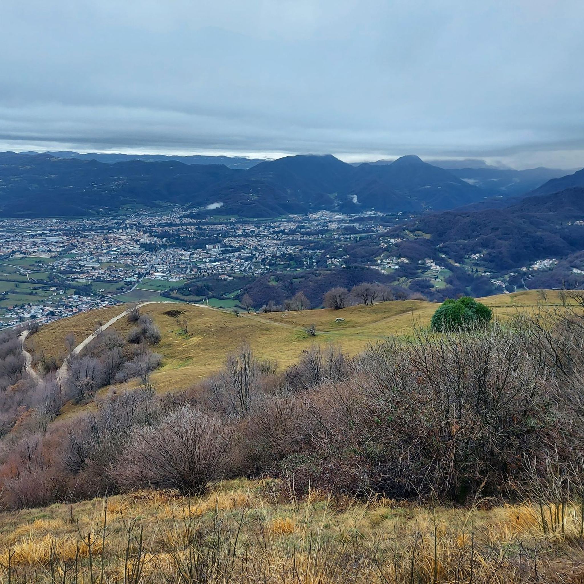
Beautiful view from this point and for a few km further
0
0

Also reachable by bike! Offers a nice view of Busa Novegno.
1
0

iconic refreshment point
0
0

Panorama of the Po Valley, the Pale di San Martino, the Vette Feltrine, Mount Grappa to the east and the Carega group, Piccole Dolomiti and Pasubio group to the west
0
0

The ancient history of this beautiful panoramic peak.
0
0


Panoramic view, breathtaking
2
1
Very nice view, must see
1
0
Frequently Asked Questions
What is the general difficulty level of mountaineering routes in Santorso?
Mountaineering routes around Santorso are primarily challenging. Out of the 5 routes listed, 4 are classified as difficult, and 1 is moderate. Many trails on Monte Summano involve significant elevation gains, steep sections, and varied terrain that can require good physical condition and sure-footedness.
Are there any moderate mountaineering routes in Santorso?
Yes, there are a couple of moderate options. For instance, the Monte Cengio – Osservatorio loop from Monte Cengio is a shorter route, approximately 3.8 km with about 200 meters of elevation gain. Another moderate option is the Bocchetta Paù Viewpoint – Carriola Mountain Hut loop from Fondi, which is longer at 11.4 km but has a more gradual elevation gain of around 309 meters.
What kind of views can I expect on mountaineering routes around Santorso?
The routes, especially those ascending Monte Summano, offer breathtaking panoramic views. From the summit, you can see across the Vicenza plain, the Val d'Astico, the Asiago Plateau, and on clear days, even the Dolomites and the Ötztal Alps. Trails like the Summano Ridge provide wide, unobstructed vistas.
Are there any circular mountaineering routes in the Santorso area?
Yes, several routes are designed as loops. Examples include the challenging Cima Summano loop from Santorso, which covers 10.7 km with over 1000 meters of elevation gain, and the Mardifaia Bench Viewpoint – Summano Summit Cross loop from Piovene Rocchette. There's also the longer Pozza Vaccaresse – Arco Priaforà loop from Vicentine Alps.
What natural features or landmarks can I see along the mountaineering routes?
The routes often lead to significant natural and historical landmarks. You can reach the Summano Summit Cross, offering expansive views. Other notable peaks in the vicinity include Mount Cengio. The region is also known for its historical elements, such as the Way of the Cross stations and remnants from the Great War.
Are there any waterfalls or gorges near the mountaineering trails?
While the primary focus of mountaineering in Santorso is on elevation and views, the region does feature picturesque aquatic paths. You can explore areas like Val dei Molini and Valle dell'Orco, which are known for their gorges and water features. The Acquasaliente is also a notable waterfall in the area.
What do other mountaineers enjoy most about the routes in Santorso?
The komoot community highly rates the mountaineering routes in Santorso, with an average score of 5.0 stars. Reviewers often praise the challenging ascents on Monte Summano, the diverse terrain, and the rewarding panoramic views of the Vicenza Valley and surrounding areas.
Is Santorso suitable for family-friendly mountaineering or easier hikes?
While many mountaineering routes are difficult, Santorso offers easier trails that are more suitable for families or those seeking less strenuous walks. The 'Itinerary of the Fountains' is an 8.5-kilometer loop trail linking historic fountains, and the 'Goji Gorlini Trail' is an easy hill loop traversing ancient hamlets and fresh woods. These provide accessible options amidst nature and history.
What is the best time of year for mountaineering in Santorso?
The best time for mountaineering in Santorso is generally from spring through autumn. During these seasons, the weather is more stable, and trails are typically free of snow, allowing for better conditions to tackle the significant elevation gains and varied terrain. Winter mountaineering is possible but requires checking snow conditions and being prepared for colder, potentially icy, environments.
Are dogs allowed on the mountaineering trails in Santorso?
Generally, dogs are permitted on most public hiking trails in Italy, including those around Santorso. However, it's always recommended to keep dogs on a leash, especially in nature protection areas or when encountering wildlife or other hikers. Be prepared to carry out any waste.
Are there any historical or cultural elements to discover along the trails?
Yes, the region is rich in history. The 'Way of the Cross Route - Girolimini' (CAI trail 459) ascends to the Sanctuary Madonna del Summano, featuring religious stations. Other historical sites include Great War tunnels and the 'Path of the Workers,' a historic 2-km path tracing the daily route of Lanerossi workers, adding a cultural dimension to your outdoor experience.
Most popular routes around Santorso
Most popular attractions around Santorso

Get inspired with the komoot mobile app


Explore more
Browse the best Mountain Hikes & Routes in other regions.
