The best MTB trails in Volcanic Tablelands Wilderness Study Area
20
riders
5
rides
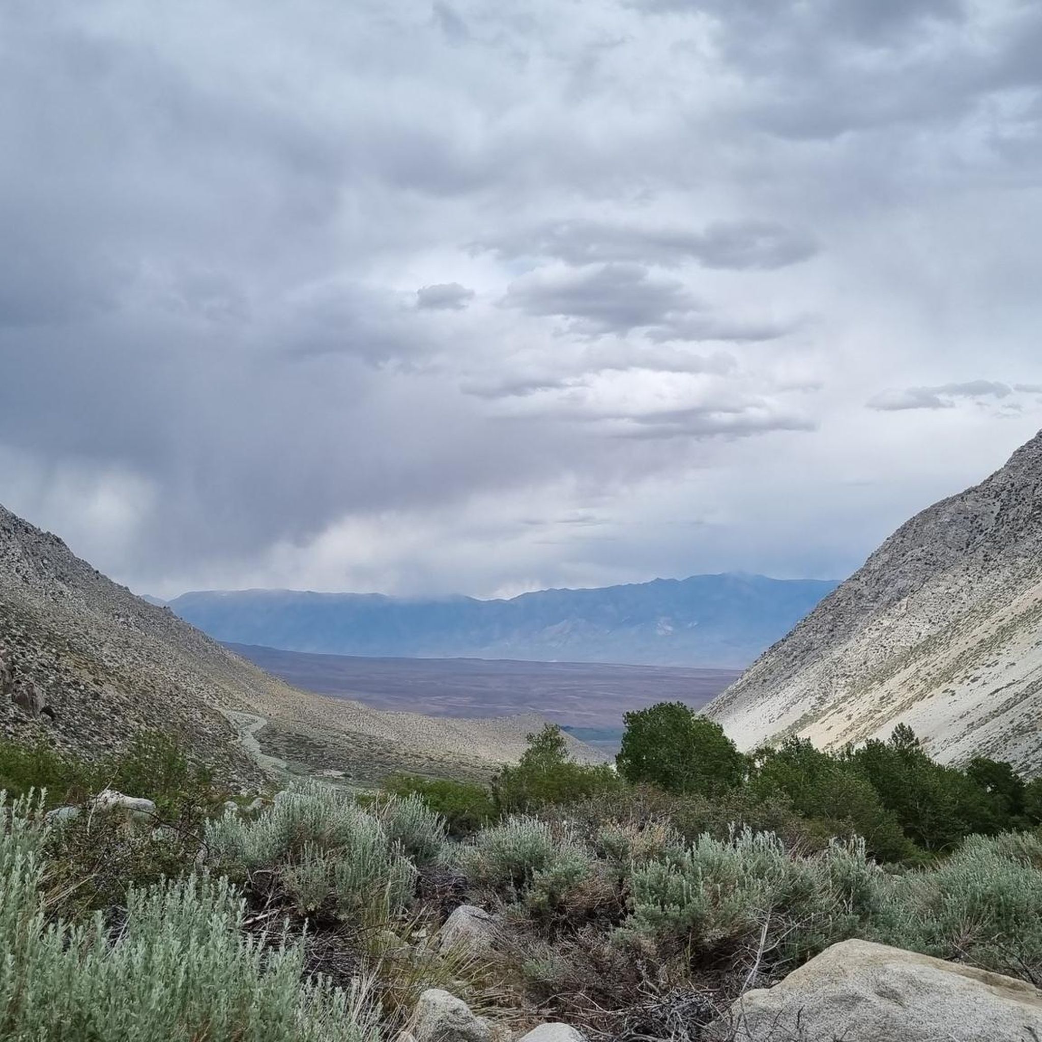
Mountain biking in Volcanic Tablelands Wilderness Study Area offers routes across a landscape shaped by ancient volcanic activity. The region features expansive tablelands, interspersed with hills and canyons, providing varied terrain for mountain bikers. Riders can expect to navigate through open desert-like environments and along trails that traverse the unique geological formations of the area.
Best mountain bike trails in Volcanic Tablelands Wilderness Study Area
- The most popular mountain bike trail is Volcanic Tablelands loop, a 22.7 miles (36.5 km) trail that takes 3 hours 13 minutes to complete. This moderate route offers a comprehensive tour of the tablelands' diverse terrain.
- Another top favourite among local mountain bikers is Between Two Hills, a moderate 12.6 miles (20.2 km) path. This route winds through the landscape, offering views as it navigates between elevated features.
- Local mountain bikers also love the Coyote Valley Road and Rawson Creek Trail Loop, a 18.2 miles (29.3 km) trail leading through a mix of valley roads and creek trails, often completed in about 3 hours 55 minutes.
- Mountain biking in Volcanic Tablelands Wilderness Study Area is defined by volcanic rock formations, open tablelands, and desert canyons. The network offers options for different ability levels, from moderate rides to more challenging routes.
- The guide includes highly-rated routes that showcase the best of the region's landscape. More than 10 mountain bikers have used komoot to explore Volcanic Tablelands Wilderness Study Area's varied terrain.
Last updated: July 8, 2026
36.5km
03:13
360m
360m
The Volcanic Tablelands loop offers a distinctive mountain biking adventure through an ancient volcanic landscape near Bishop. You'll navigate dirt roads and doubletrack across broad tuff plateaus, enjoying expansive views of the Owens Valley framed by the Sierra Nevada Mountains to the west and the White Mountains to the east. This moderate 22.7-mile (36.5 km) route involves 1185 feet (361 metres) of elevation gain, typically taking around 3 hours and 13 minutes to complete.
To plan your visit, note that the trail is easily accessible from Bishop, with parking available at spots like Happy Boulders Parking. Spring and fall are the best times to ride, offering comfortable temperatures for this exposed route. Always carry plenty of water, as services are limited once you're on the trail.
What truly sets this ride apart is its unique geological history, shaped by a massive volcanic eruption over 700,000 years ago, creating an almost alien landscape. Keep an eye out for ancient petroglyphs scattered throughout the Tablelands, adding a fascinating cultural dimension to your ride. The area is also a renowned bouldering destination, so you might spot climbers enjoying the eroded rock formations.
20.2km
02:12
570m
570m
The "Between Two Hills" mountain biking trail offers a dynamic ride through an undulating landscape, perfect for those who enjoy varied terrain. You'll encounter a mix of singletrack and wider paths, with rolling hills, dips, and turns that keep the 12.6 miles (20.2 km) interesting. The route provides amazing views, especially as you traverse the low, reddish formations of the Tungsten Hills and pass the historical View of Jackrabbit Mine. With 1855 feet (565 metres) of elevation gain and an estimated duration of 2 hours and 11 minutes, it's rated as moderate, suiting riders with some experience.
Planning your visit to this Inyo National Forest trail means being prepared for a self-supported adventure. While specific parking and permit information isn't always detailed for this particular route, it's always best to check local conditions, especially for weather and any seasonal access restrictions. Bringing ample water and sun protection is crucial, and starting earlier in the day can help you avoid the midday heat, particularly during warmer months.
This trail is notable for its blend of scenic beauty and historical significance, passing through an area rich in mining history. The varied experience, combining challenging features with smooth sections, makes it a great option for skill development. It's part of a larger network of trails that often provide opportunities to explore unique geological features and even discover semi-precious minerals, adding an extra layer of interest to your ride.

Sign up for free
1
riders
29.3km
03:55
1,390m
1,390m
Prepare for a demanding mountain biking experience on the Coyote Valley Road and Rawson Creek Trail Loop. This difficult route takes you through the rugged terrain of Inyo National Forest, offering significant elevation changes and expansive views of the surrounding mountains and valleys. You will cover 18.2 miles (29.3 km) and climb a substantial 4556 feet (1389 metres), making it a challenging ride best suited for experienced cyclists. Expect open sections with limited shade as you navigate this rewarding journey, which typically takes around 3 hours and 55 minutes to complete.
Since this trail is located in a remote area of Inyo National Forest, careful planning is essential before you head out. Ensure you carry enough water, sun protection, and emergency supplies for the duration of your ride. Always check local conditions for any potential road closures or seasonal considerations that might affect your visit, especially given the challenging nature of the terrain.
This loop offers a true test of endurance and skill within the Eastern Sierra landscape. While specific detailed scenic descriptions are not available, the route's character is defined by its demanding climbs and descents. It provides a unique opportunity to immerse yourself in the vast, untamed beauty of the national forest, far from more crowded areas.
15
riders
24.8km
02:34
600m
600m
The Lower Rock Creek Trail is a classic mountain biking route near Bishop, renowned for its challenging singletrack and evolving scenery. You'll start in a lush, forested canyon with abundant aspen trees, following the Rock Creek, before the landscape gradually shifts to a high desert environment. The 15.4-mile (24.8 km) trail features rocky terrain, twisty sections, and numerous wooden bridges, making it a dynamic ride that demands attention.
Planning your visit to this moderate trail, which typically takes 2 hours and 34 minutes, is straightforward, especially if you opt for a shuttle to enjoy the downhill focus. With 1955 feet (596 metres) of elevation gain, it's a significant descent, but be prepared for some uphill efforts too. The trail's lower elevation means it's often accessible and snow-free earlier and later in the season than other High Sierra trails, making spring a great time to visit. Remember, it's a shared-use trail, so be mindful of other users.
This trail holds a special place in mountain biking history, with some sections being among the original singletracks opened to riders by the Forest Service in the 1980s. Its design is well-suited for mountain biking, offering a technical and engaging experience that progresses from intermediate to advanced sections, particularly in the lower gorge. It's a must-do for those seeking a true mountain biking test in a beautiful canyon setting.
4
riders
15.6km
01:29
450m
450m
The Paradise – Lower Rock Creek Canyon Trail loop is a classic mountain biking adventure that takes you from lush aspen groves to high-desert terrain, all while closely following Rock Creek. This 9.7-mile (15.6 km) route is rated difficult, featuring a mix of flowing singletrack, technical rock gardens, and boulder steps, especially in its challenging lower sections. You'll experience a significant 1466 feet (447 metres) of elevation gain, making it a demanding ride for those seeking a true test of skill and endurance.
Planning your visit requires considering the loop's unique structure; you can ride it as a full loop from the Paradise trailhead or opt for a shuttle to enjoy a mostly downhill experience. Be aware that the trail is shared with hikers and anglers, so always ride considerately. E-bikes are prohibited on this USFS non-motorized trail. While the estimated duration is around 1 hours and 28 minutes, allow extra time for the technical sections and to soak in the scenery.
This trail is an old classic in the Eastern Sierra, known for its diverse character and stunning views. Situated above 5000 feet in elevation, it offers a longer riding season, typically from March to November, due to relatively snow-free lower sections. The contrast between the forested upper canyon and the more exposed high-desert lower sections provides a unique visual and riding experience that sets it apart from many other routes in the region.
Our route recommendations are based on thousands of hikes, rides, and runs completed by other people on komoot.
Start today with a free account
Your next adventure awaits.
Login or Signup
Popular around Volcanic Tablelands Wilderness Study Area

Tips from the Community


Bike through the Tungsten Hills, the low, reddish hills west of the town of Bishop. This area was once home to a major tungsten mining site until the late 1940s and still has numerous old mines and an open pit. Keep an eye out for shiny rocks; they could be semi-precious minerals like red garnet, epidote, and quartz crystals while riding.
0
0
Take a look into the old Jackrabbit Mine, but it is not recommended to go exploring here. This mine is a historic tungsten mine located along Deep Canyon. Sitting within the Deep Creek-Tungsten Hills Mining District of Inyo National Forest, the area features Mesozoic granitic rocks. This mine also has amazing views around it.
0
0

Coyote Valley Road is a fairly wide, sand and gravel road that heads south from West Bishop toward Peterson Mill. The road starts in a sandy wash, which can be challenging without fat/large tires. Once you reach the switchbacks, the terrain improves, though the incline can still be tough in places. At 8,000 feet, you arrive at the top of Chipmunk Canyon, which might also require hiking due to sand, but you're close to the top. After the sandy wash, you will soon see the first chance to turn left onto the Coyote Flat connector which links up with the popular Waganobe Trail. If continue right past this junction, you descend to the creek, and climb up to the summit of Coyote Flat, where you finally begin to descend.
0
0
Formerly known as the Druid Stones Trail, the Waganobe Trail has been renamed by the local Paiute Tribe. This challenging downhill trail can be reached a few different ways, but for folks looking for a very full day you can climb the Coyote Valley Road (7S10) with a 4,500-foot elevation gain. Alternatively, you can shuttle cars and complete a shorter 2,600-foot climb up Habegger Road to about 11,000 feet that offers stunning views and fun descents on dirt roads leading to the singletrack portion. The start of the Waganobe Trail is about half a mile south of where Coyote Valley Road (7S10) crosses the West Fork of Coyote Creek. After taking the Coyote Flat Connector to the Waganobe Trail, and after a brief climb, you descend along a doubletrack, and complete another climb. The road then transitions into a steep, overgrown singletrack that opens into a meadow. Cross the meadow and find the trail in a stand of aspen trees until you reach a road, turning right to an open meadow. From here, a faint trail heads east through sagebrush. Watch your pedals in this section. Eventually, a left-hand turn across a creek appears. If missed (which is easy to do), the trail dead-ends shortly after anyway, s you can just backtrack to find the faint path up the hill on your right. This segment is technical if overgrown. As the brush clears, the trail becomes loose, but still super fun. The descent includes a few short, steep climbs, leading to a saddle where another trail splits left. Continuing straight, the landscape changes to open desert with large boulders and you'll eventually encounter plenty of hikers (so be respectful) as the trail becomes increasingly steep and technical over rocks. You continue the steep descent until you reach the trailhead.
0
0
Chalk Bluff, for which the road is named for, is remarkably a straight, ~5-mile-long, escarpment that forms the south edge of the Volcanic Tableland. Named Chalk Bluff for its light tan-to-white colored, chalk-like rocks, they stand in contrast to the darker, volcanic Bishop tuff boulders that stand atop the escarpment and are popular with rock climbers. The Owens River flows below the Chalk Bluff with the gravel road running between, all making for a truly unique riding experience.
0
0
As you ride along Chalk Bluff Road, you get great views of the Owens River and surrounding area. This is a great spot to pause your ride, snap a few photos, or dip your feet in the cold waters after a long ride.
0
0
Casa Diablo Mine Road is a dirt, generally well-maintained 4x4 road that cuts through The Volcanic Tablelands. Although it is an easy, non-technical road, you get truly stunning views of the snow-capped High-Sierra mountains as you ride. Dispersed camping is also allowed, making it a great spot to know about if the campsites are full, or if you are looking for a little more solitude in the desert.
0
0
Frequently Asked Questions
What are the difficulty levels of mountain bike trails in Volcanic Tablelands Wilderness Study Area?
The trails in Volcanic Tablelands Wilderness Study Area range from moderate to difficult. There are 3 moderate routes and 2 difficult routes available for mountain biking. For example, Volcanic Tablelands loop is a moderate option, while Coyote Valley Road and Rawson Creek Trail Loop is considered difficult.
Are there any beginner-friendly mountain bike trails in Volcanic Tablelands Wilderness Study Area?
While there are no trails specifically rated as 'easy' in the Volcanic Tablelands Wilderness Study Area, riders with some experience can enjoy the moderate routes. Trails like Between Two Hills offer a good introduction to the area's terrain without being overly technical.
Which mountain bike trails offer a more challenging ride in the Volcanic Tablelands?
For a more challenging experience, consider routes like the Coyote Valley Road and Rawson Creek Trail Loop or the Paradise – Lower Rock Creek Canyon Trail loop from Paradise. These trails feature more significant elevation changes and varied terrain.
How long do mountain bike rides typically take in Volcanic Tablelands Wilderness Study Area?
Mountain bike rides in the Volcanic Tablelands Wilderness Study Area can vary in length and duration. For instance, the Between Two Hills route is about 12.6 miles (20.2 km) and takes around 2 hours 12 minutes, while the Volcanic Tablelands loop covers 22.7 miles (36.5 km) and typically takes 3 hours 13 minutes.
Are there mountain bike loop trails available in Volcanic Tablelands Wilderness Study Area?
Yes, several loop trails are available for mountain biking. Popular options include the Volcanic Tablelands loop and the Coyote Valley Road and Rawson Creek Trail Loop, allowing riders to start and end at the same point.
What is the best season for mountain biking in Volcanic Tablelands Wilderness Study Area?
The Volcanic Tablelands Wilderness Study Area is characterized by a high desert climate. Spring and fall generally offer the most pleasant conditions for mountain biking, with milder temperatures. Summer can be very hot, requiring early starts and ample water, while winter can bring cold temperatures and occasional snow at higher elevations.
What unique geological features can I expect to see while mountain biking in the Volcanic Tablelands?
The Volcanic Tablelands are defined by their ancient volcanic activity. Riders can expect to encounter expansive tablelands, basalt formations, and desert canyons. The trails often traverse areas shaped by lava flows and erosion, offering distinct geological scenery.
What should I bring for mountain biking in Volcanic Tablelands Wilderness Study Area, especially in summer?
Given the desert-like environment, especially in summer, it's crucial to bring plenty of water, sun protection (sunscreen, hat, sunglasses), and appropriate layers for temperature changes. A repair kit for your bike, snacks, and a map or GPS device are also highly recommended, as cell service can be spotty in remote areas.
Is family mountain biking possible in Volcanic Tablelands Wilderness Study Area?
While there are no easy-rated trails, families with older children or those with some mountain biking experience might find the moderate routes manageable. It's advisable to assess the specific route's profile and your family's skill level before heading out. The Lower Rock Creek Trail offers a moderate experience that could be suitable for more experienced families.
Are permits required for mountain biking in Volcanic Tablelands Wilderness Study Area?
Generally, permits are not required for day-use mountain biking in the Volcanic Tablelands Wilderness Study Area. However, it's always good practice to check the latest regulations from the Bureau of Land Management (BLM) or local authorities before your visit, especially if planning overnight trips or larger group activities.
Where can I find parking for mountain biking in Volcanic Tablelands Wilderness Study Area?
Parking availability varies by trailhead. Many routes, especially those starting near established roads or access points, will have informal parking areas. It's recommended to check the specific tour details on komoot for information on parking at the start of your chosen route, such as the Volcanic Tablelands loop.
Are there any scenic overlooks on the mountain bike trails?
The Volcanic Tablelands Wilderness Study Area offers expansive views across its unique landscape. While specific named overlooks may not be signposted on every trail, the open terrain and elevated sections of routes like Between Two Hills naturally provide numerous scenic vantage points to appreciate the volcanic formations and desert vistas.
Most popular routes in Volcanic Tablelands Wilderness Study Area

Get inspired with the komoot mobile app


Explore more
Browse the best MTB trails in other regions.
