The best running trails around Purcellville
77
runners
8
runs
Jogging routes around Purcellville offer a diverse landscape for runners, situated in rural Western Loudoun County. The region is characterized by farms, rolling hills, and distant views of the Blue Ridge Mountains. A prominent feature is the Washington & Old Dominion (W&OD) Trail, providing a relatively level, car-free path. Beyond this, the area includes more challenging terrains and local parks with well-maintained trails.
Best jogging routes around Purcellville
- The most popular jogging route is W&OD Trail — Leesburg section loop…
Last updated: October 1, 2026
1
runners
15.3km
02:05
470m
470m
Hard run. Very good fitness required. Mostly paved surfaces. Suitable for all skill levels.
16
runners
24.5km
02:33
170m
170m
Hard run. Very good fitness required. Mostly paved surfaces. Suitable for all skill levels.

10
runners
18.8km
01:57
110m
110m
Hard run. Very good fitness required. Mostly paved surfaces. Suitable for all skill levels.
9
runners
11.3km
01:10
60m
60m
Moderate run. Good fitness required. Mostly paved surfaces. Suitable for all skill levels.
4
runners
9.46km
00:59
70m
80m
Moderate run. Good fitness required. Mostly paved surfaces. Suitable for all skill levels.
Get access to more routes and recommendations from other explorers.
Already have an account?
Our route recommendations are based on thousands of hikes, rides, and runs completed by other people on komoot.
Start today with a free account
Your next adventure awaits.


Tips from the Community

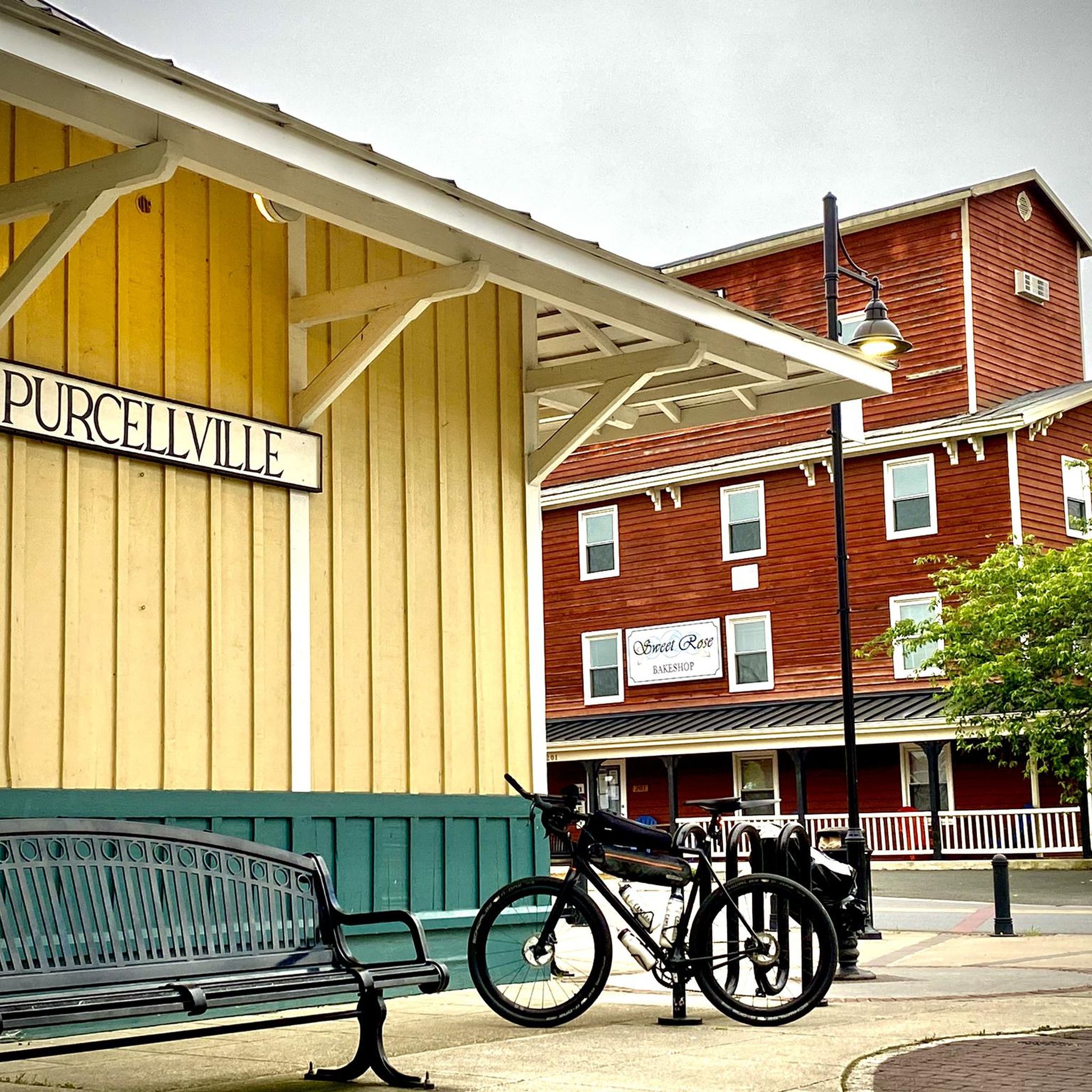
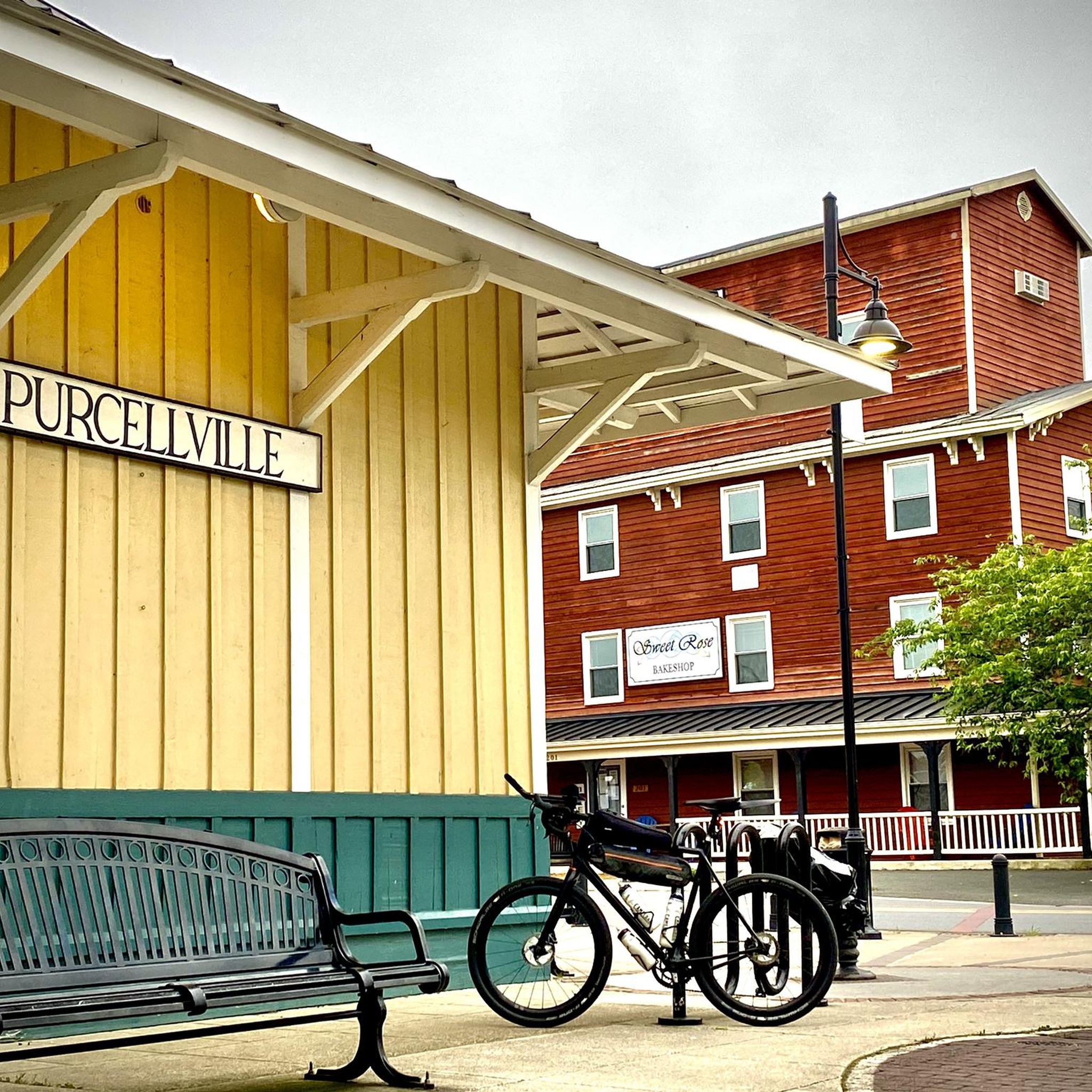
Purcellville, at the end of the rail line, has great places to stop. Monk's BBQ is fantastic and easy, and if you want to simply spend more time you can take the distillery tour at the Catoctin Creek Distilling Company (makers of great rye and other spirits). They town has also kept the old downtown shopping area straight out of the 1940s, which is great to see.
1
0

Goosecup is a coffee shop, located in Leesburg, VA. It is is a popular spot with locals and visitors alike and is known for its coffee and cozy atmosphere.
0
0
Picturesque gentle climb on the W&OD, a reminder that this was a railway for years and years
0
0

Blackburn Trail Center has a small parking area and is a great spot to hop on and off the Appalachian Trail via the Appalachian Trail Spur. Potomac Appalachian Trail Club (PATC) runs the cabins, and you are pretty likely to run into some long-distance hikers in the summer.
0
0
Wilson Gap, a short 0.1 mile from the Appalachian Trail, is is right on the border of West Virginia and Virginia. Wilson Gap used to be called Gregory's Gap, and is at an elevation of 1,444 feet above sea level.
0
0

The stretch of the W&OD from Leesburg to Purcellville (~10 miles) is by far the best section.
0
0
The Leesburg Quarry is a historical site right off the Washington & Old Dominion Trail. This paved multi-use trail is about 45 miles and is a great way to ride around the area free of cars. There is a historical marker right off the trail in front of the old quarry. In the 1860s, the railroad's arrival spawned businesses like the Leesburg Lime Company, operating here since 1868. Using dynamite, quarriers extracted limestone, later burned in kilns. The company supplied farmers with fertilizer and builders with plaster. Its decline came when bluestone from the eastern county proved more durable for roads.
0
0

At 582 feet, Clarkes Gap, was the highest point on the Washington & Old Dominion Railroad. The stone bridge dates from the 1870s, but instead of a railway line now going underneath, there is a recreational trail and this is a super trail for cycling.
0
0
Frequently Asked Questions
What types of running routes can I find around Purcellville?
Purcellville offers a diverse range of running routes. You'll find relatively flat, paved paths like sections of the Washington & Old Dominion (W&OD) Trail, which are great for easy jogs. For those seeking a challenge, there are difficult mountain paths with significant elevation gain, such as the Appalachian Trail to Raven Rocks. Additionally, local parks like Franklin Park and Chapman DeMary Trail Park provide well-maintained trails for a refreshing outdoor experience.
Are there any easy, beginner-friendly jogging paths in Purcellville?
Yes, for beginners or those looking for an easy run, the Washington & Old Dominion (W&OD) Trail is an excellent choice. It's a relatively level, car-free asphalt path. A good example is the W&OD Trail — Leesburg section loop from Leesburg, which is an easy 4.6 km (2.9 miles) route with minimal elevation gain, perfect for a relaxed jog.
Where can I find longer distance running trails near Purcellville?
For longer runs, consider routes that utilize the extensive Washington & Old Dominion (W&OD) Trail, which stretches for 45 miles. Another option is the Running loop from Purcellville, a challenging 20.6 km (12.8 miles) route that takes you through the local countryside. For a significant challenge with rewarding views, the Appalachian Trail to Raven Rocks offers a difficult 15.3 km (9.5 miles) path with considerable elevation.
Are there any running routes with scenic views or viewpoints?
Absolutely! The Appalachian Trail to Raven Rocks is renowned for its panoramic views of the Shenandoah Valley from the Raven Rocks Overlook. The rural setting of Western Loudoun County also means many routes offer picturesque views of farms, rolling hills, and the distant Blue Ridge Mountains.
Are there any loop jogging trails in the Purcellville area?
Yes, several loop options are available. The W&OD Trail — Leesburg section loop from Leesburg is a popular easy loop. For more moderate distances, you can explore the Running loop from Clarke's Gap or the Running loop from Hamilton. The challenging Running loop from Purcellville also provides a substantial circular route through the countryside.
Where can I find parking for jogging routes in Purcellville?
Parking for the Washington & Old Dominion (W&OD) Trail is conveniently available at several locations in Purcellville. You can find parking at Loudoun Valley High School (weekends only), along Hatcher Avenue, and in downtown Purcellville. The Purcellville Train Station also serves as a trailhead for the W&OD, likely offering parking nearby.
What interesting landmarks or attractions can I see along the running trails?
Along the Washington & Old Dominion (W&OD) Trail, you can encounter historical markers and points of interest like the Clarkes Gap Stone-Arch Bridge. The Purcellville Train Station is also a notable landmark at the W&OD trailhead. For those on the Appalachian Trail, the Raven Rocks Overlook provides a stunning natural attraction.
Are there any family-friendly jogging trails in Purcellville?
Yes, the relatively flat and paved sections of the Washington & Old Dominion (W&OD) Trail are ideal for families, offering a safe, car-free environment. Local parks such as Chapman DeMary Trail Park also provide serene, winding trails suitable for nature walks and light jogs with family, complete with informational signs.
Can I bring my dog on the running routes in Purcellville?
While specific regulations can vary by park, many outdoor trails in the Purcellville area, including sections of the Washington & Old Dominion (W&OD) Trail, are generally dog-friendly. It's always best to keep your dog on a leash and ensure you clean up after them. For specific park rules, checking the individual park's guidelines is recommended.
What is the best time of year for jogging in Purcellville?
Purcellville offers pleasant jogging conditions throughout much of the year. Spring and fall provide mild temperatures and beautiful scenery with changing foliage. Summer can be warm and humid, so early morning or late evening runs are preferable. Winter running is also possible, though conditions may vary, especially on unpaved trails.
What do other runners enjoy most about jogging in Purcellville?
Runners often praise Purcellville for its varied terrain, offering everything from the flat, accessible W&OD Trail to challenging mountain ascents like the Appalachian Trail to Raven Rocks. The tranquil, rural setting with views of farms and the Blue Ridge Mountains is frequently highlighted, providing a picturesque escape for outdoor enthusiasts.
Are there any parks in Purcellville with dedicated running trails?
Yes, several local parks offer excellent running opportunities. Franklin Park provides ample walking areas and open fields. Fireman's Field Park has lush greenery and well-maintained trails. Chapman DeMary Trail Park features winding trails ideal for nature walks and jogs, and Nell Boone Park also offers tranquil, well-maintained paths for running.
Most popular attractions around Purcellville

Get inspired with the komoot mobile app


Explore more
Browse the best Running Trails & Routes in other regions.
