The best running trails around Focicchia
5.0
(3)
102
runners
12
runs
Jogging routes Focicchia are set within a mountainous village in Corsica, characterized by dense forests of green oaks, cork oaks, and chestnut trees. The region features significant elevation changes, ranging from 179 meters to peaks over 1,000 meters, providing diverse running experiences. Lower areas offer more exposed, rocky terrain with maquis vegetation, while the northern parts border the extensive trail network of the Regional Natural Park of Corsica. This varied landscape offers a range of running surfaces and challenges for…
Last updated: June 29, 2026
43
runners
15.0km
03:02
1,180m
1,180m
Hard run. Very good fitness required. Sure-footedness, sturdy shoes and alpine experience required.
5.0
(2)
9
runners
5.38km
00:35
120m
120m
Moderate run. Good fitness required. Mostly paved surfaces. Suitable for all skill levels.

Sign up for free
13
runners
13.3km
01:49
510m
510m
Hard run. Very good fitness required. Mostly paved surfaces. Suitable for all skill levels.
9
runners
12.2km
01:32
380m
380m
Hard run. Very good fitness required. Mostly paved surfaces. Suitable for all skill levels.
9
runners
9.63km
01:16
350m
350m
Hard run. Very good fitness required. Mostly paved surfaces. Suitable for all skill levels.
Get access to more routes and recommendations from other explorers.
Sign up for free
Already have an account?
Our route recommendations are based on thousands of hikes, rides, and runs completed by other people on komoot.
Start today with a free account
Your next adventure awaits.
Login or Signup
Tips from the Community

The Vecchio rises on the Monte d'Oro and is initially called Agnone. This river is best known for its Cascades des Anglais, which attract hundreds of tourists every day in high season. From the hamlet of Vizzavona onwards, the river is called Vecchio and you only meet very few people. Shortly after entering Canaglia, it joins the Manganello. Here the Vecchio valley becomes very lonely. On the right-hand side, far above the riverbed, the railway line winds its way along the hills, barely visible. You don't notice the busy T20, which lies behind the hills. You only see it when you get off at the Ponte Vecchio. High above us, it crosses the Vecchio valley on the new bridge. Later, the Vecchio flows into the Tavignano, which reaches the sea near Aléria.
1
0


The Nuceta bridge spans Le Vecchio. This river reveals an idyllic setting, ideal for a swim. It is not uncommon to come across families and children with their feet in the water in this little corner of paradise!
0
1

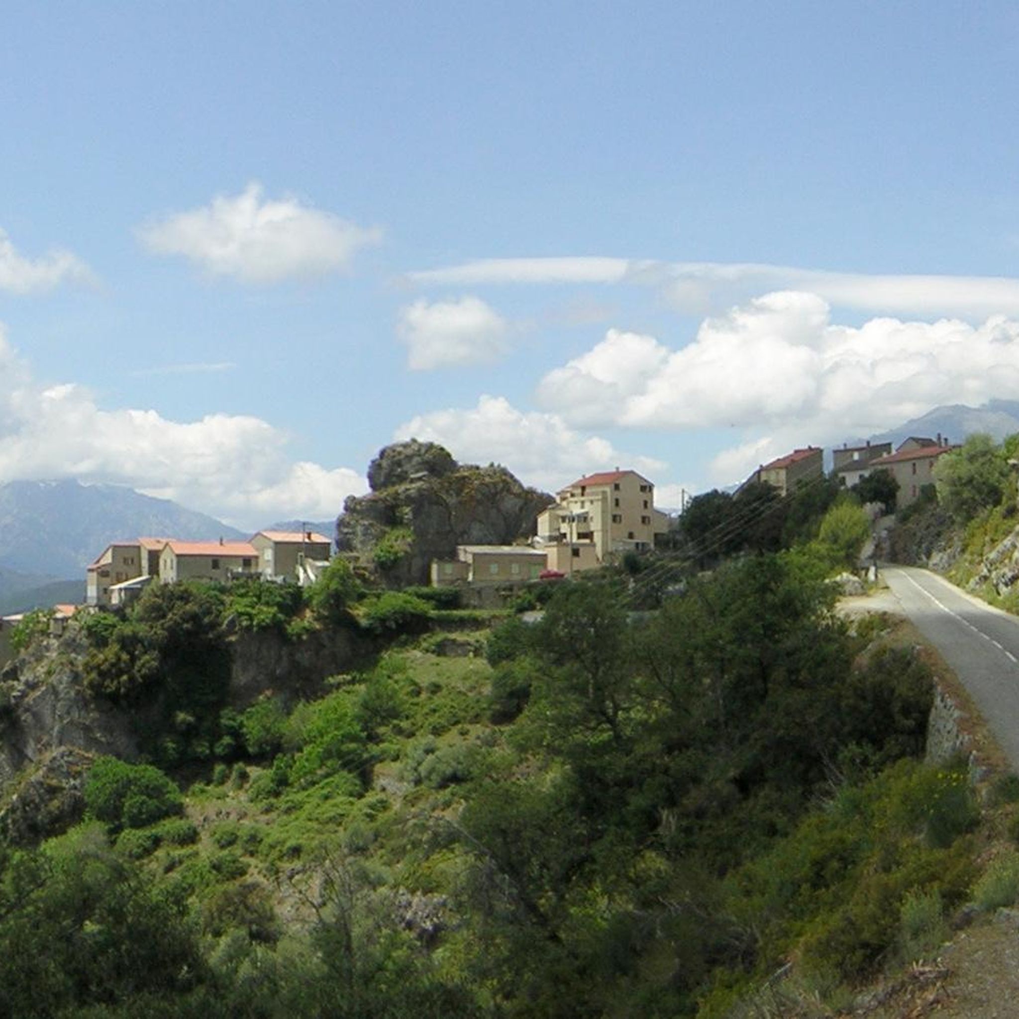
Surrounded by mountains, this small, atypical village offers beautiful panoramas of the surrounding area. Note that the Mara a Mare stopover lodge is located on the heights of the village.
1
0

At this bridge, the Le Vecchio river invites you to swim. So don’t hesitate!
1
0

Frequently Asked Questions
How many running routes are available around Focicchia?
There are over 9 dedicated running routes around Focicchia listed in this guide. These trails offer a variety of experiences, from moderate to difficult, showcasing the region's diverse landscapes.
What kind of terrain can I expect on the running trails in Focicchia?
The trails around Focicchia are characterized by mountainous terrain with significant elevation changes, ranging from 179 meters to over 1,000 meters. You'll often find yourself running through dense forests of green oaks, cork oaks, and chestnut trees, offering shaded paths. Lower areas may feature more exposed, rocky terrain with maquis vegetation, providing a varied running surface.
Are there any easy running routes suitable for beginners or families in Focicchia?
While many routes in Focicchia are challenging, there is at least one easy route and two moderate routes available. These offer less strenuous options for those new to trail running or looking for a more relaxed jog with family. Always check the route details for specific difficulty levels.
Are there circular running routes available in Focicchia?
Yes, several popular running routes around Focicchia are circular. For example, the challenging Sermano loop from Sermano and the Nuceta Bridge loop from Venaco are both excellent circular options, allowing you to start and finish at the same point.
What are some notable natural attractions or viewpoints I can see along the running routes?
The region offers stunning natural beauty. While jogging, you might encounter highlights such as the Vecchio River Swimming Spot or the historic Nuceta Bridge. The mountainous terrain also provides numerous opportunities for panoramic views, like those found along the High-altitude route between Bustanico and Sermano, offering vistas over ridges and valleys.
What is the best time of year for trail running in Focicchia?
Focicchia's climate makes it suitable for running for much of the year. Spring and autumn generally offer pleasant temperatures and vibrant scenery. In early summer, the Spanish gorses add splashes of yellow to the landscape. Due to the varied elevation, higher routes might be cooler in summer, while lower, forested paths provide shade. Winter running is possible, but be prepared for colder conditions and potential snow at higher altitudes.
Are there any running routes that feature water elements like rivers or waterfalls?
Yes, you can find routes that incorporate water features. The Nuceta Bridge loop from Venaco passes by the Nuceta Bridge, which spans a river. Additionally, the Vecchio River Swimming Spot and the Manganello River Cascade are nearby attractions that could be incorporated into longer runs or visited after your jog.
What do other runners enjoy most about jogging in Focicchia?
The komoot community highly values the diverse and challenging terrain around Focicchia. Runners often praise the stunning natural landscapes, the dense forests providing shade, and the significant elevation changes that offer a rewarding workout. The proximity to the Regional Natural Park of Corsica also means access to extensive, untouched natural beauty.
Is Focicchia a good base for exploring other running areas in Corsica?
Absolutely. Focicchia's location in the heart of Corsica makes it an excellent starting point for exploring wider areas. It's within easy reach of the renowned Restonica Valley (21 km away) and the picturesque Lac de Melo (23 km) and Lac de Nino (29 km), which offer extensive trail running opportunities. The town of Corte, about 13 km away, also serves as a hub for accessing additional trails.
Are there any specific mountain passes or high-altitude points accessible via running trails?
Yes, Focicchia is situated in a mountainous region with several passes. While running, you might encounter areas near passes such as Towards Col d'Erbajo, San Gavinu Pass, and Perelli Pass. These areas often provide challenging ascents and rewarding views.
What are the typical distances and durations for running routes in this area?
The running routes around Focicchia vary significantly in length and duration. You can find trails ranging from moderate 5.5 km routes like the Col de Belle Granaje loop from Venaco (taking about 40 minutes) to more challenging 15 km paths such as the Venaco loop from Venaco, which can take over 3 hours to complete due to significant elevation gain.
Most popular attractions around Focicchia

Get inspired with the komoot mobile app


Explore more
Browse the best Running Trails & Routes in other regions.
