The best walks and hikes around Saint-Créac
4.5
(45)
320
hikers
16
hikes
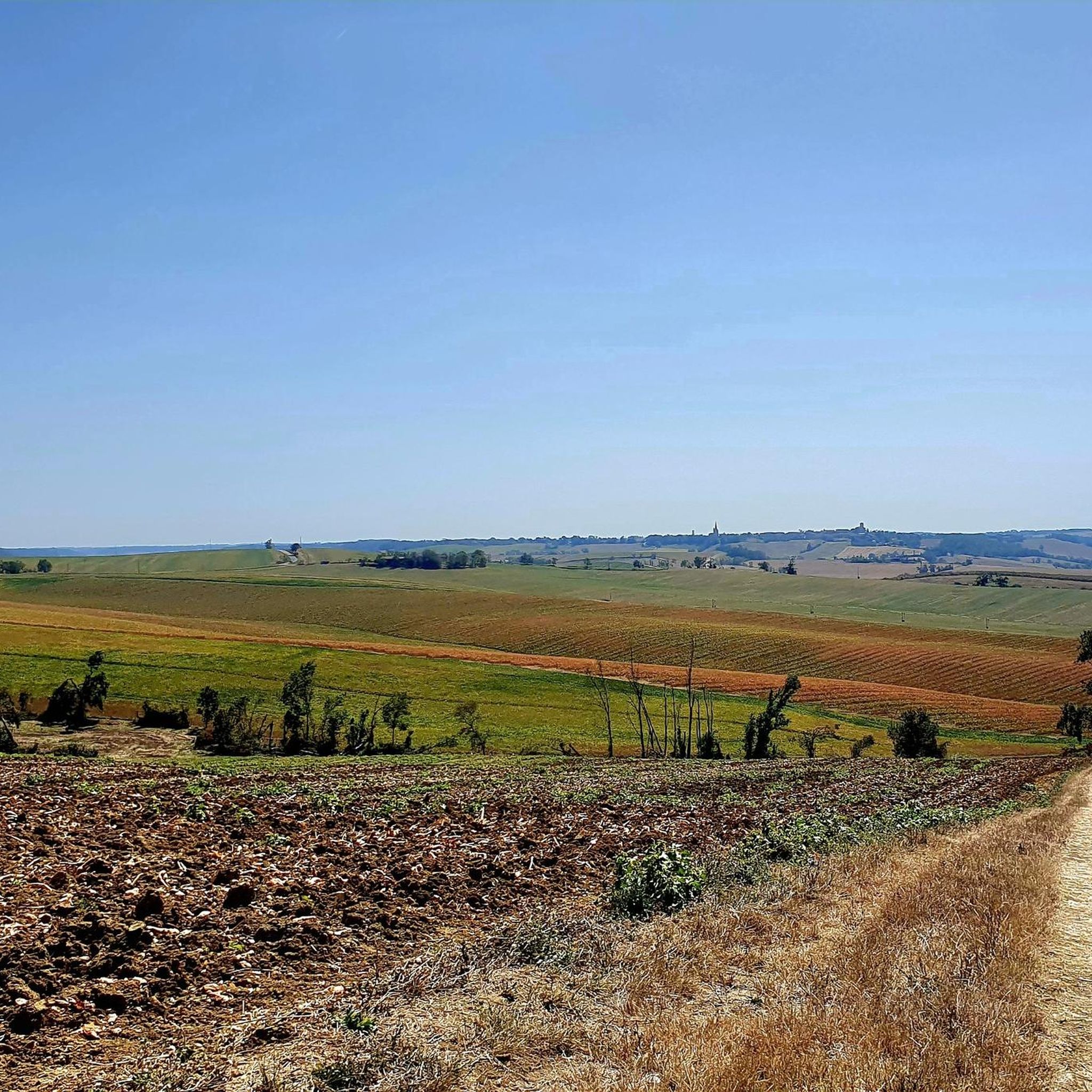
Hiking around Saint-Créac reveals a landscape characterized by rolling hills, agricultural valleys, and forests of chestnut and oak. The region, part of the Lomagne, offers pleasant walks with occasional distant views of the Pyrenees on clear days. Hikers can explore circuits that pass through collinar lakes and historical paths, including sections of the Camino de Compostela.
Best hiking trails around Saint-Créac
- The most popular hiking route is Gachepouy Castle – Saint Blandine Church loop from Castet-Arrouy, a 16.9 miles…
Last updated: June 29, 2026
4.5
(31)
204
hikers
27.5km
07:32
430m
430m
Hard hike. Very good fitness required. Easily-accessible paths. Suitable for all skill levels.
4.0
(4)
16
hikers
8.53km
02:19
120m
120m
Moderate hike. Good fitness required. Easily-accessible paths. Suitable for all skill levels.

Sign up for free
5.0
(1)
9
hikers
11.2km
03:06
190m
190m
Moderate hike. Good fitness required. Easily-accessible paths. Suitable for all skill levels.
5.0
(1)
9
hikers
15.1km
04:09
250m
250m
Moderate hike. Good fitness required. Easily-accessible paths. Suitable for all skill levels.
4.0
(2)
21
hikers
21.7km
06:07
460m
460m
Hard hike. Very good fitness required. Easily-accessible paths. Suitable for all skill levels.
Get access to more routes and recommendations from other explorers.
Sign up for free
Already have an account?
Our route recommendations are based on thousands of hikes, rides, and runs completed by other people on komoot.
Start today with a free account
Your next adventure awaits.
Login or Signup


Tips from the Community

Very beautiful, richly decorated church from the 14th/15th century. There is a pilgrim stamp in front of the entrance gate!
1
0

Camping Lac des 3 Vallées highlights 140 hectares of wooded land in Lectoure, to the delight of campers. It is close to Castéra-Lectourois (11 km), Lagarde (11 km) and Terraube (12 km). In a hilly landscape with a lake, this campsite offers a water park, privileged locations and top services.
3
0
South of Lectoure, the Lac des 3 Vallées is a body of water located in the heart of the agricultural valleys of the Gers. It is fed by the Petit current. A nautical recreation center will be set up on the banks. You can practice all kinds of sporting activities and take walks on the lake. You can go around it and discover the surroundings via a 14 km walk.
3
0

Coming from Mossiac, the town of Saint-Antoine is the 18th stage of the Camino de Santiago (Chemin de Saint-Jaques) if you follow the VIA PODIENSIS (from Le Puy-en-Velay to the Pyrenees).
2
1
On the Via Podiensis, pilgrims pass through many towns and can visit many churches. On the 19th stage (counting according to "Rother"), which leads from Saint-Antoine to Lectoure, this church is passed.
1
1
Saint-Antoine is a commune in the Gers department of France and has 174 inhabitants. The place is part of the district of Condom.
3
0
The small village of Flamarens is located in the department of Gers, in the Midi-Pyrénées region. The inhabitants are called the Flamalingois and the Flamalingoises. Surrounded by the municipalities of Miradoux, Saint-Antoine and Peyrecave, Flamarens is located 25 km southeast of Agen. The Métau and Montret streams on the one hand, tributaries of the Auroue and the Pourchet, Mouron and Teulère streams, tributaries of the Arratz on the other, are the main rivers that cross the city.
4
0
The surface of Flamarens is 14.5 km², so the population density is 8.2 inhabitants per km².
3
0
Frequently Asked Questions
How many hiking trails are available around Saint-Créac?
There are over 20 hiking routes around Saint-Créac, offering a variety of experiences through rolling hills, agricultural valleys, and forests. These include 6 easy, 10 moderate, and 4 difficult trails.
What kind of terrain can I expect on hikes in Saint-Créac?
Hiking around Saint-Créac, located in the Lomagne region, is characterized by rolling hills, agricultural valleys, and forests of chestnut and oak. You'll find pleasant walks, often passing by collinar lakes, and on clear days, you might even catch distant views of the Pyrenees.
Are there any easy or beginner-friendly hiking trails in Saint-Créac?
Yes, Saint-Créac offers 6 easy hiking trails suitable for beginners or those looking for a relaxed walk. These routes typically feature gentle gradients through the region's characteristic rolling landscapes.
Are there any circular walks available around Saint-Créac?
Many of the trails around Saint-Créac are circular, allowing you to start and end at the same point. Examples include the moderate Lake of the Three Valleys loop from Mességué, which offers scenic views, or the Château d'Avezan loop from Tournecoupe, leading through rural landscapes.
What historical landmarks or points of interest can I see while hiking?
The region around Saint-Créac is rich in history. Some trails, like the difficult Gachepouy Castle – Saint Blandine Church loop from Castet-Arrouy, feature historical landmarks. You can also visit highlights such as the Saint-Saturnin Church or the impressive Flamarens Castle.
Are there any trails that pass by lakes or natural water features?
Yes, several routes incorporate the region's collinar lakes. A popular option is the moderate Lake of the Three Valleys loop from Mességué, which provides scenic views of the Lake of the Three Valleys and its surrounding natural areas.
What do other hikers say about the trails in Saint-Créac?
The routes in Saint-Créac are highly rated by the komoot community, with an average score of 4.7 stars from over 40 reviews. Hikers often praise the peaceful rural landscapes, the charming villages, and the well-maintained paths that offer a pleasant outdoor experience.
Are there any long-distance or challenging hikes in the area?
For those seeking a challenge, Saint-Créac offers 4 difficult routes. An example is the Gachepouy Castle – Saint Blandine Church loop from Castet-Arrouy, a 27.2 km trail that takes over 7 hours to complete and features significant elevation changes.
Can I find trails that offer panoramic views?
Yes, the rolling hills of the Lomagne region provide numerous vantage points. On clear days, some routes offer magnificent views over the Gersois Lomagne and even distant glimpses of the Pyrenees mountain range.
What is the best time of year to go hiking in Saint-Créac?
The region's pleasant climate makes hiking enjoyable for much of the year. Spring and autumn offer comfortable temperatures and beautiful scenery, while summer provides warm conditions, ideal for exploring the agricultural valleys and forests.
Are there any trails that pass through villages or offer opportunities to explore local culture?
Many routes weave through the rural landscapes and past charming villages. You can explore the Saint-Clar Village Center or discover historical churches like Saint-Orens and Saint-Louis Church, adding a cultural dimension to your hike.
Most popular attractions around Saint-Créac

Get inspired with the komoot mobile app


Explore more
Browse the best Hikes in other regions.
