The best running trails around Saint-Izaire
4.0
(4)
181
runners
29
runs
Jogging around Saint-Izaire offers routes through diverse landscapes in the Aveyron department of Occitanie, France. The region is characterized by the Dourdou river meander, the red-hued terrain of the Rougier de Camarès, and the gentle hills of southern Aveyron. Trails often traverse a mosaic of agricultural land and wooded areas, providing varied terrain for running. The village itself is situated at 265 meters altitude, with paths offering views of the historic Château de Saint-Izaire and remnants of ancient vineyards.
Best…
Last updated: June 29, 2026
33
runners
16.7km
02:18
630m
630m
Hard run. Very good fitness required. Mostly paved surfaces. Suitable for all skill levels.
32
runners
10.4km
01:07
60m
60m
Moderate run. Good fitness required. Mostly paved surfaces. Suitable for all skill levels.

Sign up for free
23
runners
10.5km
01:25
350m
350m
Hard run. Very good fitness required. Mostly paved surfaces. Suitable for all skill levels.
3.0
(1)
9
runners
Hard run. Very good fitness required. Mostly paved surfaces. Suitable for all skill levels.
8
runners
16.2km
01:57
330m
330m
Hard run. Very good fitness required. Mostly paved surfaces. Suitable for all skill levels.
Get access to more routes and recommendations from other explorers.
Sign up for free
Already have an account?
Our route recommendations are based on thousands of hikes, rides, and runs completed by other people on komoot.
Start today with a free account
Your next adventure awaits.
Login or Signup
Tips from the Community

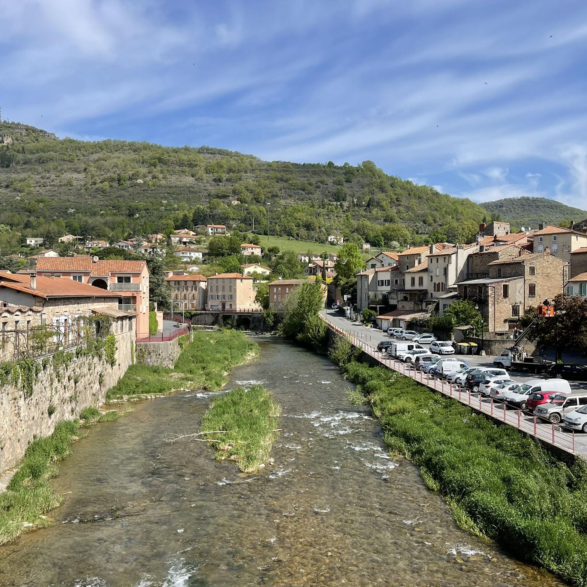
Great route. No surprises. Long time along the Sorgues. Passage on a cycle path along the road. Narrow tunnel but not very busy. Very nice!
1
0

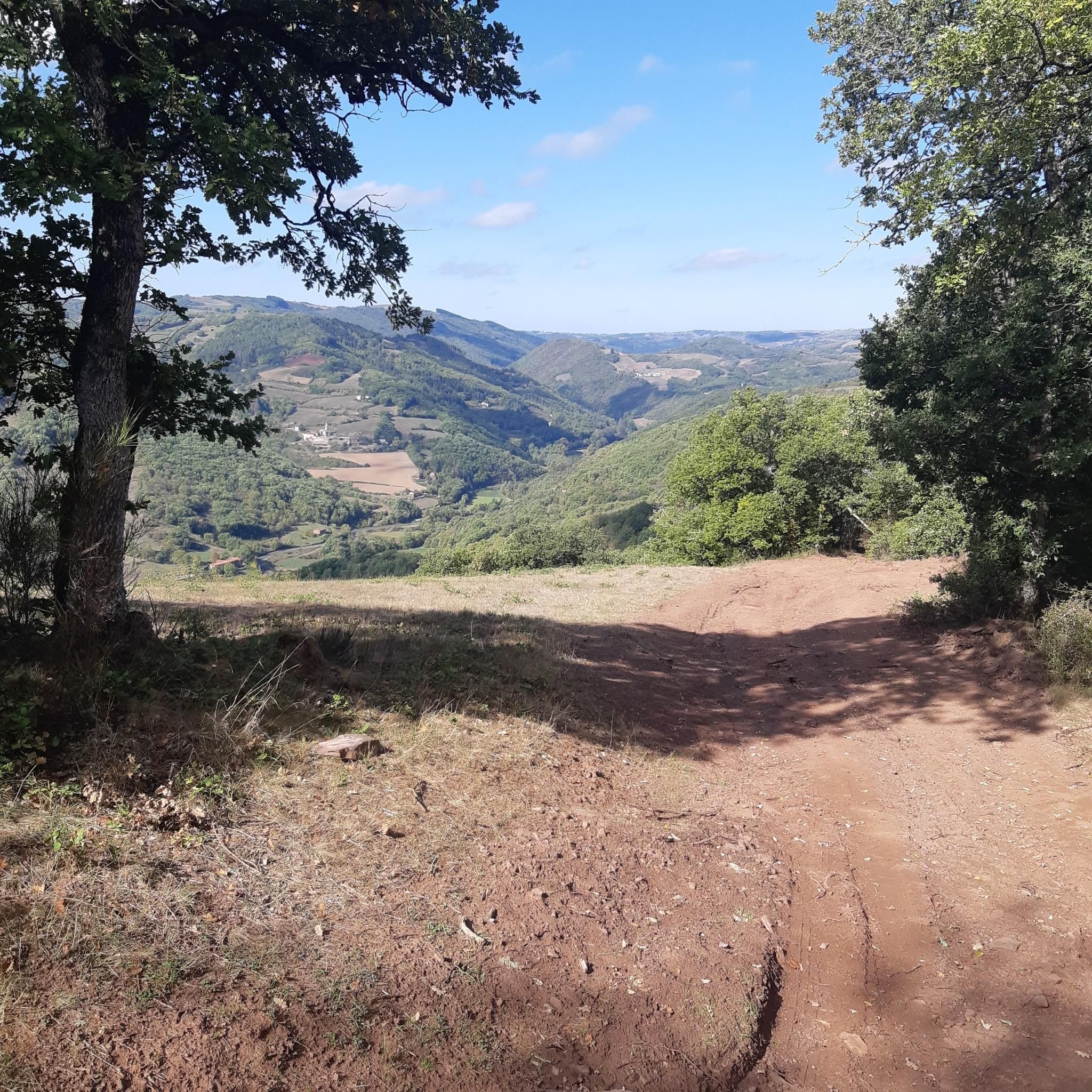
Group of tombs dating from the High Middle Ages (5th and 6th centuries) located to the west of the plateau overlooking Vabres l'Abbaye (village itself important since 863 and the foundation of a Benedictine monastery).
0
0

Imposing mass of red sandstone which reminds us of the proximity of the Rougiers de Camarès. It can be visited and is classified as a Historic Monument. A small path, just behind the castle, leads to the valley between the Gos and the Dourdou, with its many red earth paths.
1
0
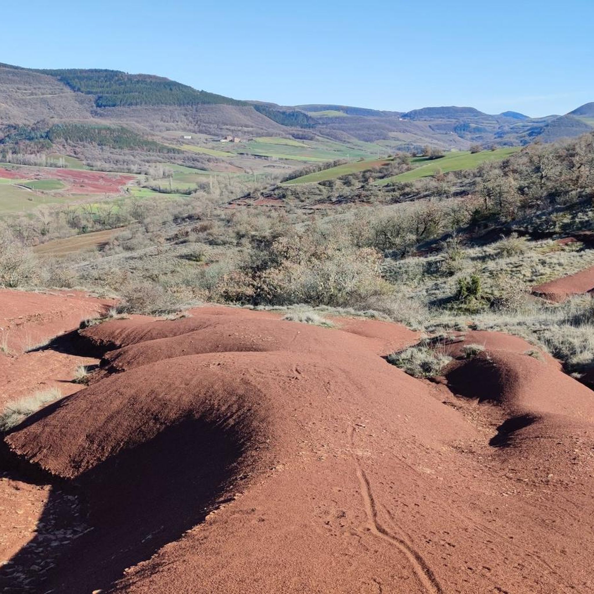
Small trail in red earth, in the heights of Saint-Izaire and reminiscent of the Rougiers de Camarès, which are not very far.
1
0
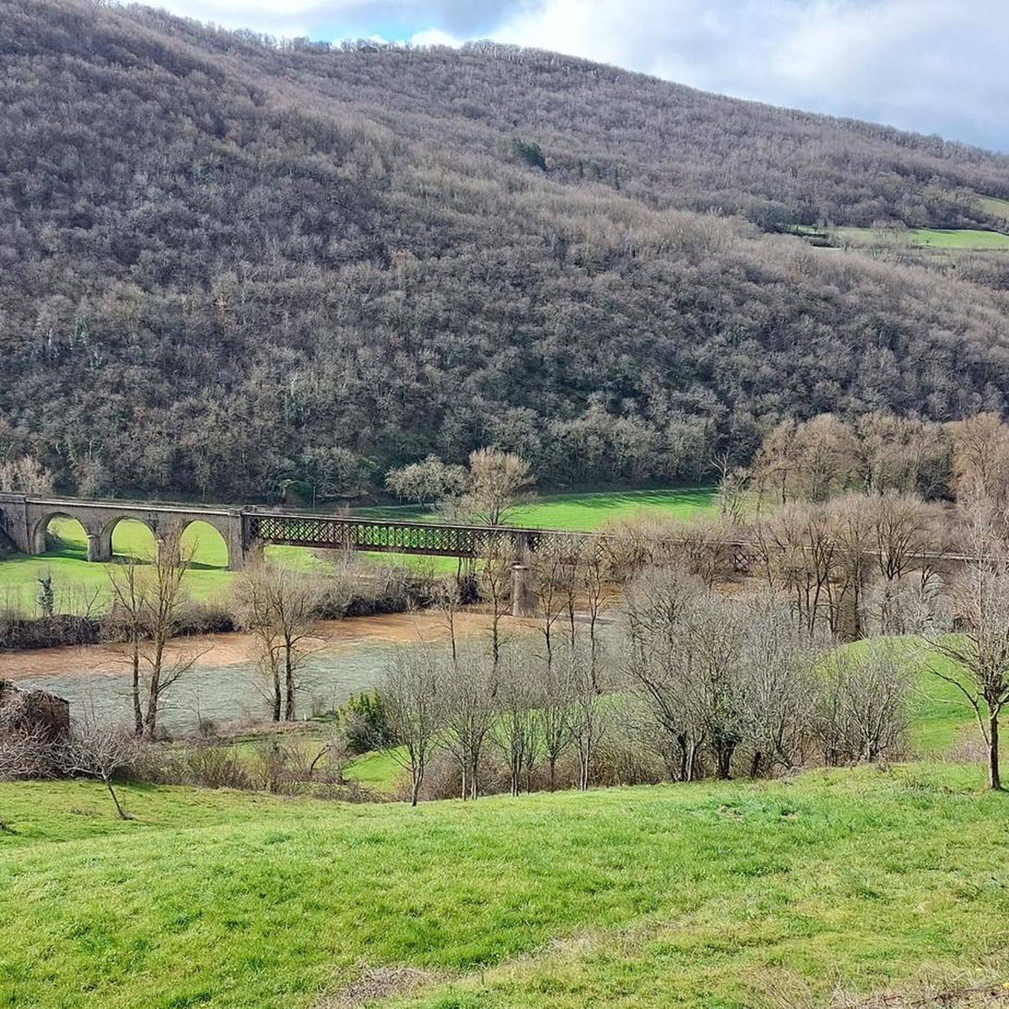
View under the arcaded bridge, at the confluence of the Tarn and the Dourdou, on the Saint-Affricain greenway which avoids the departmental road.
1
0
Frequently Asked Questions
How many running routes are available around Saint-Izaire?
There are over 30 running routes around Saint-Izaire, offering a variety of options for exploring the diverse landscapes of the Aveyron department. These routes range from moderate to difficult in terms of challenge.
What kind of terrain can I expect on the jogging trails in Saint-Izaire?
The jogging trails in Saint-Izaire traverse a varied landscape, including paths along the Dourdou river, gentle hills, and routes through former vineyards. You'll encounter a mosaic of agricultural land and wooded areas, often with panoramic views of the village and its red sandstone architecture.
Are there any easy running routes for beginners in Saint-Izaire?
While many routes in Saint-Izaire present a challenge, with 18 moderate and 13 difficult trails, there are no routes specifically classified as easy. Runners should be prepared for varied terrain and elevation changes.
What historical landmarks or natural features can I see while running in Saint-Izaire?
Jogging routes often offer views of the historic Château de Saint-Izaire, a 14th-century fortified castle. You can also explore paths that follow ancient vineyard tracks, offering panoramic views of the village. The Dourdou River meanders through the area, adding to the natural beauty. Some routes also pass by historical features like the Vaxergues Tunnel or Visigothic Tombs, such as the Vaxergues Tunnel – Visigothic Tombs loop from Vabres-l'Abbaye.
Are there any circular running routes in the Saint-Izaire area?
Yes, many of the running routes around Saint-Izaire are circular. For example, you can try the Descent to Vabres loop from Vabres-l'Abbaye or the Our lady of the desert loop from Le Truel, both offering scenic circular paths.
What do other runners say about the trails in Saint-Izaire?
The running routes in Saint-Izaire are highly rated by the komoot community, with an average score of 4.0 stars. Over 180 runners have used komoot to explore the varied terrain, often appreciating the quiet, natural environment and the blend of historical and scenic views.
Are there any long-distance running options near Saint-Izaire?
Yes, Saint-Izaire offers several longer running routes. For instance, the Vaxergues Tunnel – Visigothic Tombs loop from Vabres-l'Abbaye is a challenging 16.7 km (10.4 miles) trail, and the Sentier des rougiers – Bridge over the Tarn loop from Saint-Izaire covers 16.2 km (10.1 miles).
Can I find routes that offer viewpoints or scenic overlooks?
Absolutely. The region is known for its scenic beauty. Many paths, particularly those following ancient vineyards, offer panoramic views of Saint-Izaire village. You can also find viewpoints like Brousse-le-Château and the Roc Saint-Jean lookout, which provide stunning vistas of the surrounding Rance Valley and the red-hued Rougier de Camarès.
What is the best time of year for running in Saint-Izaire?
Saint-Izaire, located in Occitanie, France, offers pleasant conditions for outdoor activities for much of the year. Spring and autumn generally provide mild temperatures ideal for running. Summer can be warm, but the varied landscapes with wooded areas can offer some shade. The rural charm and tranquil environment make it appealing outside of peak tourist seasons.
Are there any routes that pass by bridges or river features?
Yes, the Dourdou River is a prominent natural feature in Saint-Izaire. Some routes, like the Sentier des rougiers – Bridge over the Tarn loop from Saint-Izaire, specifically incorporate bridges. You can also find other notable bridges in the area, such as the Verdalle Bridge and the Bridge over the Tarn at Lincou.
Is Saint-Izaire close to any larger natural parks for extended running adventures?
Yes, Saint-Izaire is situated near the Parc naturel régional des Grands Causses. This proximity suggests access to a wider network of trails and natural beauty for those looking to extend their outdoor adventures beyond the immediate village area.
Most popular attractions around Saint-Izaire

Get inspired with the komoot mobile app


Explore more
Browse the best Running Trails & Routes in other regions.
