The best gravel rides in Plenty Gorge Park
4.5
(6)
176
riders
22
rides
Gravel biking in Plenty Gorge Park offers diverse landscapes, characterized by the Plenty River carving a spectacular gorge and varied geological formations including basalt plains and undulating hills. The park features an extensive network of trails, ranging from fire trails to single tracks, suitable for gravel bikes. These routes traverse woodlands, wetlands, and parklands, providing a mix of natural habitats and terrain. The varied topography ensures options for different skill levels, from flat sections to areas with significant elevation changes.
Best gravel bike trails in Plenty Gorge Park
- The most popular gravel bike trail is Eucalyptus Pathway loop from South Morang, a 36.3 miles (58.4 km) trail that takes 3 hours 55 minutes to complete. This difficult path winds through diverse ecosystems with significant elevation gain.
- Another top favourite among local gravel bikers is Rapids Lookout – Yarra River Lookout loop from Greensborough, a moderate 14.1 miles (22.6 km) path. This route offers varied terrain and views of the Yarra River.
- Local gravel bikers also love the View of the Yarra River – Pond loop from Montmorency, a 13.4 miles (21.6 km) trail leading through varied landscapes, often completed in about 1 hour 23 minutes.
- Gravel biking in Plenty Gorge Park is defined by the Plenty River gorge, diverse ecosystems, and undulating hills. The network offers options for different ability levels, from moderate to difficult.
- The routes in Plenty Gorge Park are highly rated by the komoot community with an average score of 4.4 stars from over 5 reviews. More than 180 gravel bikers have used komoot to explore Plenty Gorge Park's varied terrain.
Last updated: July 3, 2026
8
riders
60.1km
04:00
570m
580m
Hard gravel ride. Very good fitness required. You may need to push your bike for some segments of this route.
10
riders
24.2km
01:36
280m
280m
Hard gravel ride. Good fitness required. You may need to push your bike for some segments of this route.

Sign up for free
5.0
(3)
37
riders
40.2km
02:31
390m
390m
Moderate gravel ride. Good fitness required. Mostly paved surfaces. Suitable for all skill levels.
4.0
(1)
12
riders
22.5km
01:24
180m
180m
Moderate gravel ride. Good fitness required. Mostly paved surfaces. Suitable for all skill levels.
4
riders
78.8km
06:04
1,280m
1,280m
Hard gravel ride. Very good fitness required. Mostly paved surfaces. Suitable for all skill levels.
Get access to more routes and recommendations from other explorers.
Sign up for free
Already have an account?
Our route recommendations are based on thousands of hikes, rides, and runs completed by other people on komoot.
Start today with a free account
Your next adventure awaits.
Login or Signup
Tips from the Community

An accessible pedestrian truss bridge takes you over the stone-lined creek. Trees and bush hug the water from its bank. There are some benches by the waterside and the trail winds in between sports fields and the creek on either bank.
0
0

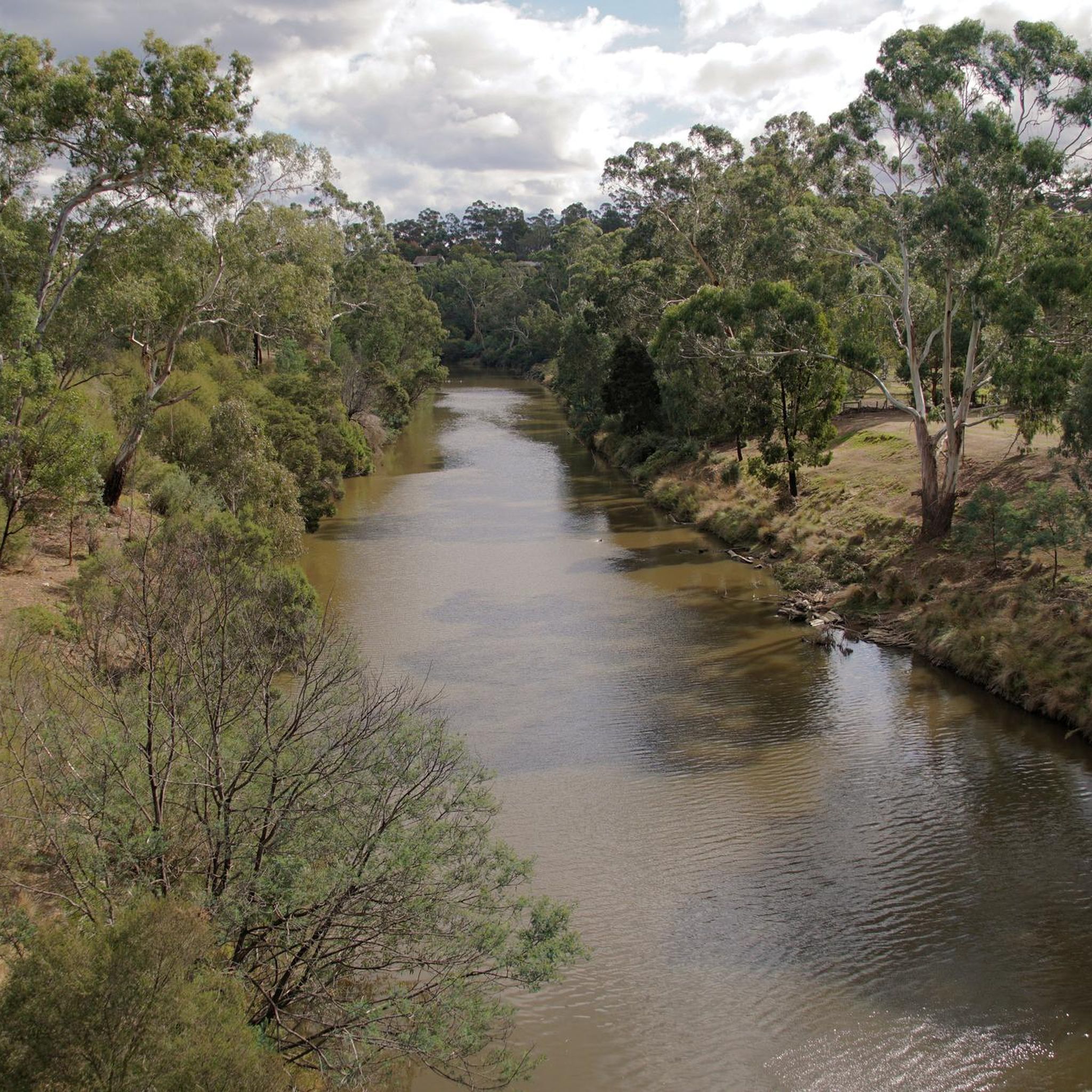
Yarra Valley Parklands follows the Yarra River through wetlands, floodplains, billabongs, and remnant bushland across Melbourne’s north-east. Around Banyule Flats and Willsmere Park, the parklands protect some of the last remaining river floodplain habitat in the lower Yarra corridor, including old River Red Gums, seasonal wetlands, and important bird habitat beside the river.
0
0

The Banyule Swamp and the Yarra River were originally occupied by the Wurundjeri people until 1838 during the earliest rural allotments. Today you can explore the area and see old farm equipment as well as exotic historic vegetation, swamps, billabongs, and parklands.
1
0

Mullum Mullum Creek Trail is a shared walking and cycling path that follows Mullum Mullum Creek through beautiful bushland, wetlands, and open parks. The trail is mostly paved, with a gentle slope and includes boardwalk sections and well-kept paths along the water. It connects to other trails, including the Main Yarra Trail, making it a great option for a relaxing walk, run, or bike ride.
0
0
Tikalara Park is a beautiful bushland area at the confluence of Mullum Mullum Creek and the Yarra River within the Yarra Valley Parklands. Walking tracks provide access to the river’s edge, with connections to the nearby Main Yarra Trail. With its natural setting, open bushland, and quieter atmosphere, it's a peaceful spot for walking and exploring away from the busier nearby trails.
0
0
This junction marks where the Maroondah Aqueduct Trail meets the Diamond Creek Trail, and is a convenient connection between the aqueduct corridor and the creekside trail that follows Diamond Creek. From here, you can extend your route by continuing along the Diamond Creek Trail through bushland and open park areas.
0
0
This small riverside lookout overlooks a fast-moving section of the Yarra River. From the viewing area, you can watch the water flow over rocks as the river narrows through this part of the valley. It is a short stop along the park’s walking paths and the Main Yarra Trail, making it an ideal spot for a break to enjoy the river scenery.
0
0
Main Yarra Trail is a primary shared walking and cycling route that follows the Yarra River for more than 30 kilometres through Melbourne’s eastern suburbs. In Westerfolds Park, the trail runs through open parkland and quiet stretches of riverside bushland, forming a scenic section of the wider route. This part of the trail is mostly flat and sealed, making it popular with walkers, runners, and cyclists travelling along the Yarra River corridor.
0
0
Frequently Asked Questions
How many gravel bike trails are available in Plenty Gorge Park?
Plenty Gorge Park offers nearly 30 gravel biking routes, providing a wide range of options for different skill levels, from moderate to difficult.
What kind of terrain can I expect on the gravel bike trails in Plenty Gorge Park?
You'll encounter a diverse landscape, from flat basalt plains to undulating hills and ridges. The trails feature a mix of surfaces, including wide gravel roads, fire trails, and some fun flowing single tracks, winding through woodlands, wetlands, and parklands. The Plenty River gorge itself provides dramatic scenery and varied topography.
Are there any family-friendly gravel bike trails in Plenty Gorge Park?
While many routes in Plenty Gorge Park are rated moderate to difficult due to elevation changes and varied terrain, some sections are suitable for families. For a generally accessible experience, look for routes that stick to flatter, wider paths. Always check the route details for specific difficulty ratings and elevation profiles to ensure it suits your family's abilities.
What are some notable natural features or landmarks to look out for while cycling?
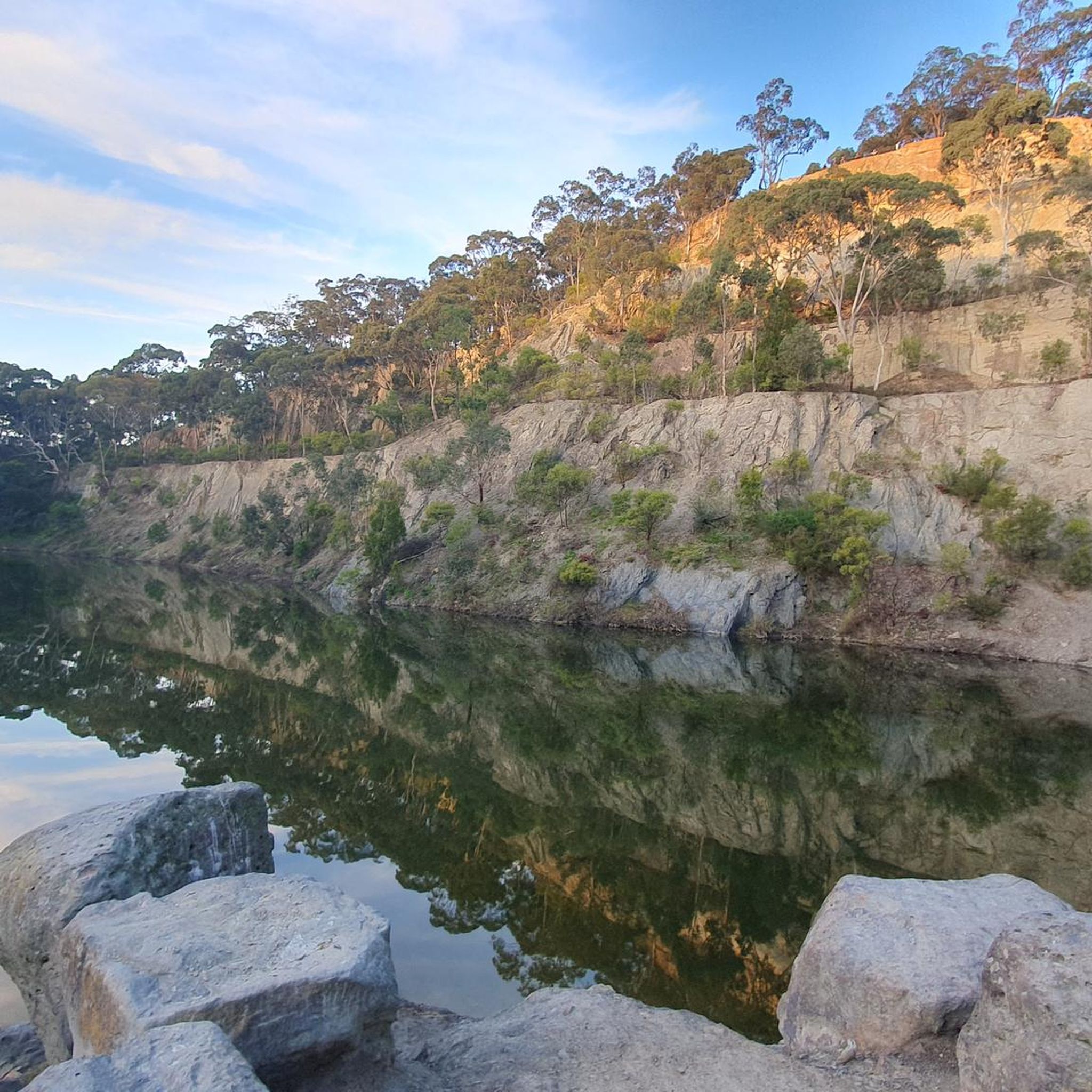
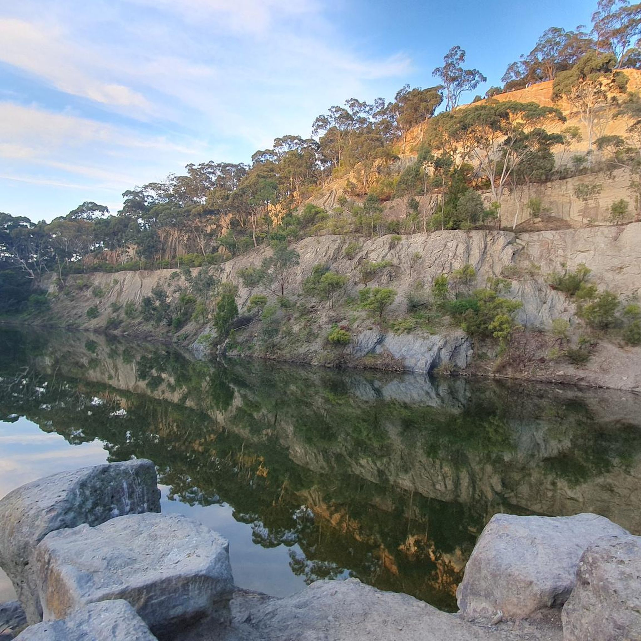
The park is rich in natural beauty and historical sites. You can expect to see the spectacular Plenty River gorge, diverse ecosystems, and the picturesque Blue Lake, which offers panoramic views from a nearby lookout. Historic sites like the Le Page Homestead and its restored orchard also provide a glimpse into the park's past. Middle Gorge offers spectacular views of the gorge and river from its viewing platform.
What do other gravel bikers enjoy most about cycling in Plenty Gorge Park?
The komoot community highly rates the gravel biking experience in Plenty Gorge Park, with an average score of 4.7 stars. Riders often praise the diverse landscapes, the challenging yet rewarding terrain, and the opportunity to explore varied ecosystems. The extensive trail network, offering both fire trails and single tracks, is also a popular highlight.
Are there any loop routes for gravel biking in Plenty Gorge Park?
Yes, many of the gravel bike trails in Plenty Gorge Park are designed as loops, allowing you to start and finish at the same point. For example, the Darebin Parklands – Darebin Creek loop from Greensborough is a popular option that offers varied terrain along the creek.
What is the best season for gravel biking in Plenty Gorge Park?
Plenty Gorge Park can be enjoyed year-round, but the best seasons for gravel biking are typically autumn and spring when the weather is milder. Summers can be hot, and some trails might be dusty, while winters can bring cooler temperatures and potentially muddy conditions after rain. Always check local weather forecasts and trail conditions before heading out.
Where can I find parking for gravel biking in Plenty Gorge Park?
Plenty Gorge Park offers several well-equipped picnic and recreation areas that typically have parking facilities. These include Hawkstowe Picnic Area, Red Gum Picnic Area, Middle Gorge, and Yellow Gum Recreation Area. These spots serve as convenient starting points for many trails.
Can I access Plenty Gorge Park by public transport with my bike?
While the park is accessible from Melbourne's CBD, public transport options for bringing bikes directly into the park can be limited. It's advisable to check the specific public transport provider's rules regarding bikes during peak hours. Many visitors choose to drive to one of the park's designated parking areas and start their ride from there.
Are there any cafes or amenities near the gravel trails in Plenty Gorge Park?
The park itself features several picnic and recreation areas like Hawkstowe and Yellow Gum, which offer facilities for barbecuing and open spaces. While there aren't many cafes directly within the park's trail network, you'll find amenities and cafes in the surrounding suburbs of Melbourne, which are easily accessible before or after your ride.
What is a challenging gravel biking route in Plenty Gorge Park?
For those seeking a more challenging ride, the Eucalyptus Pathway loop from South Morang is a difficult route that winds through diverse ecosystems and features significant elevation gain, testing your endurance and skill.
Are dogs allowed on the gravel bike trails in Plenty Gorge Park?
Plenty Gorge Park has specific regulations regarding dogs to protect its abundant wildlife. Dogs are generally permitted in designated picnic areas and on-leash in some parts of the park, but restrictions may apply to certain trails and conservation zones. It's best to check the official Parks Victoria website for the most current information on dog access before your visit.
What kind of wildlife might I see while gravel biking in Plenty Gorge Park?
Plenty Gorge Park is an important refuge for native fauna. You might spot kangaroos, echidnas, possums, and various bird species, including wood ducks, grebes, swans, and even Wedge-tailed Eagles. The park's diverse habitats support over 200 bird species and several reptiles, making it an excellent spot for wildlife observation.
Is there a moderate gravel biking option that explores the Yarra River area?
Yes, the View of the Yarra River – Pond loop from Macleod offers a moderate gravel biking experience, allowing you to explore the scenic Yarra River area with manageable elevation changes.
Most popular routes in Plenty Gorge Park
Most popular attractions in Plenty Gorge Park

Get inspired with the komoot mobile app


Explore more
Browse the best Gravel rides in other regions.
