The best gravel rides around New Preston
58
riders
4
rides
Gravel biking around New Preston offers routes through a landscape shaped by the East Aspetuck River and its historical significance. The region features varied terrain, including areas near Lake Waramaug and the Litchfield Hills. Riders can expect a mix of forested paths and open sections, reflecting the area's natural beauty and past industrial use. The presence of rivers and historical sites suggests a diverse environment for exploration.
Best gravel bike trails around New Preston
- The most popular gravel bike trail…
Last updated: June 25, 2026
13
riders
98.8km
05:33
1,110m
1,110m
Hard gravel ride. Very good fitness required. Mostly paved surfaces. Suitable for all skill levels.
11
riders
Hard gravel ride. Very good fitness required. Mostly paved surfaces. Suitable for all skill levels.

Sign up for free
5
riders
63.5km
03:52
820m
820m
Hard gravel ride. Very good fitness required. Mostly paved surfaces. Suitable for all skill levels.
3
riders
40.3km
02:35
500m
500m
Hard gravel ride. Very good fitness required. Mostly paved surfaces. Suitable for all skill levels.
2
riders
38.6km
02:36
730m
730m
Hard gravel ride. Very good fitness required. You may need to push your bike for some segments of this route.
Our route recommendations are based on thousands of hikes, rides, and runs completed by other people on komoot.
Start today with a free account
Your next adventure awaits.
Login or Signup


Tips from the Community

This well-maintained dirt road is great for biking, especially int he autumn when the fall leaves transform the trail. The road takes you right up to the water with excellent views of the Housatonic River.
0
0
This is a tiny but highly scenic little park. The roads that circumnavigate Lake Warmaug are partially shaded and go right up to the water's edge, and the views out across the water are especially beautiful in the autumn. There is also camping, hiking, and kayaking here, as well as a couple small beaches for swimming.
0
0

The Mine Hill Preserve covers 360 acres and include the remnants of a 19th century iron making facility, which is now on the National Register of Historical Places. A series of signs along the paths give you the details of iron making process from mining the ore to processing steel.
1
0

This part of Upper Grassy Hill Road runs parallel to this small grass airstrip with its old hangar, where you might catch sight of a plane.
1
0

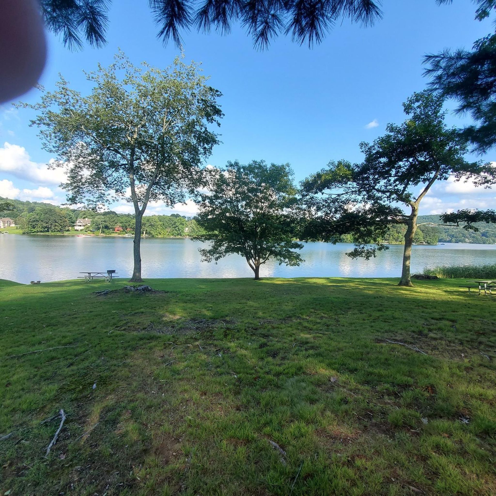
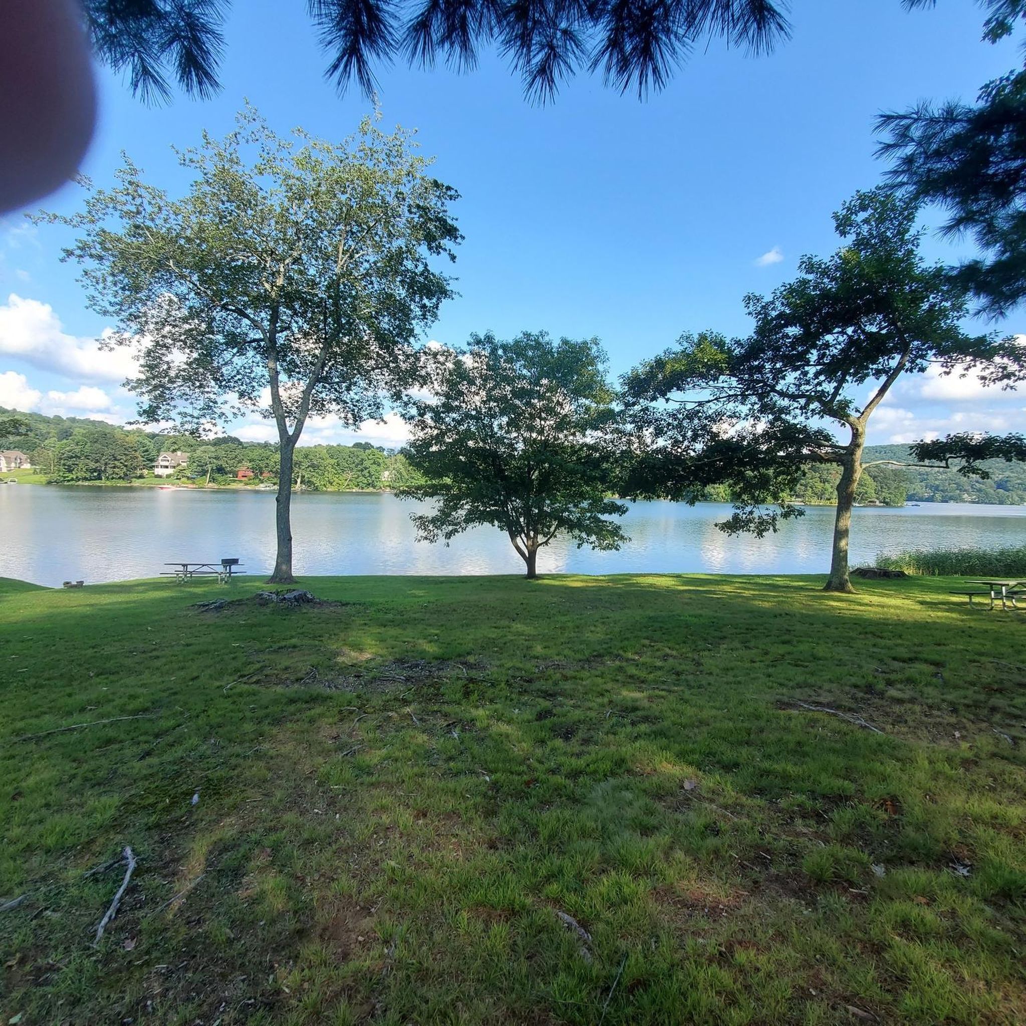
This small lake-side park comes equipped with picnic benches and plenty of trees to provide shade on a summers day. A great spot to take a break.
0
0
The Natalie White Preserve is one of many such preserves overseen by the Roxbury Land Trust. Though small there is a short trail leading to a hilltop that affords nice views of the areas and makes for a good picnic spot.
0
0

With its spring in Massachusetts the Housatonic River flows for 149 miles to southern Connecticut into Long Island Sound. The Appalachian Trail follows the river from the covered wooden Bulls Bridge to Falls Village. The river is also a popular whitewater paddling destination with mostly Class I to Class III rapids.
1
0

The Wigwam Brook Audubon Wildlife Sanctuary follows along Connecticut's picturesque Route 254. The landscape was made with both human help and natural forces. Former farmlands are now open fields. An old Christmas tree farm became was reclaimed by nature and is now a bird haven.
0
0
Frequently Asked Questions
How many gravel bike trails are available around New Preston?
There are 5 gravel bike routes documented around New Preston, offering a range of experiences from moderate to difficult. These routes showcase the region's diverse terrain, including river valleys, forested sections, and rolling hills.
What kind of terrain can I expect on gravel bike trails near New Preston?
The gravel bike trails around New Preston feature varied terrain, often shaped by the East Aspetuck River and its historical significance. You can expect a mix of forested paths, open sections, and rolling hills, with routes near areas like Lake Waramaug and the Litchfield Hills. The landscape provides a diverse environment for exploration.
Are there any easy gravel bike trails suitable for beginners or families?
The routes currently documented around New Preston are rated as moderate to difficult, with no easy trails specifically listed. For families or beginners, it's advisable to review the route details carefully, paying attention to distance and elevation gain, or consider exploring other local paths that might be less formally designated for gravel biking.
What are some challenging gravel routes for experienced riders?
Experienced riders looking for a challenge will find several difficult routes. The River Trail – Bulls Bridge loop from New Milford is a demanding 70.1-mile path with significant elevation, following river trails through scenic areas. Another difficult option is the Topsmead State Forest – Bantam Swamp loop from Litchfield Town Beach, which covers 25.0 miles through varied forest and swamp landscapes.
Are there any scenic viewpoints or natural attractions along the gravel routes?
Yes, the New Preston area is rich in natural beauty. You can find routes that pass by Lake Waramaug State Park, offering picturesque lake views. The Lake Waramaug State Park – River Trail loop from New Milford is a great option for this. Additionally, the region is home to the New Preston Falls on the East Aspetuck River, a notable natural feature with historical significance, though not directly on a documented gravel route, it's a short detour from the village.
Can I find circular gravel bike routes in the New Preston area?
Yes, all the documented gravel bike routes around New Preston are circular loops. For example, the Scenic route - Walker Brook Road – Steep Rock Tunnel loop from Raven Rock Preserve is a moderate 27.4-mile circular route that includes the interesting Steep Rock Tunnel.
Where can I find parking for gravel bike trails in New Preston?
Parking availability varies by trailhead. For routes starting near state parks like Lake Waramaug, designated parking areas are typically available. For other routes, you might find parking in nearby towns like New Milford or Kent, depending on the specific starting point of your chosen trail. Always check local regulations and signage before parking.
Is public transport an option to reach the trails?
Public transportation options directly to trailheads in the New Preston area are limited. It is generally recommended to use a personal vehicle to access the starting points of most gravel bike routes in this region.
Are the gravel bike trails around New Preston dog-friendly?
While many outdoor areas in Connecticut allow dogs, specific regulations can vary by park or land trust. For example, the White Memorial Conservation Center, a popular outdoor destination in the wider Litchfield Hills area, generally permits dogs on trails. Always check the specific rules for each trail or park you plan to visit regarding leashes and waste disposal.
What is the best time of year for gravel biking in the New Preston area?
The Litchfield Hills region, including New Preston, offers beautiful gravel biking opportunities in spring, summer, and fall. Spring brings lush greenery, while fall showcases vibrant foliage. Summers are generally pleasant, but be mindful of humidity. Winter riding can be challenging due to snow and ice, and some trails may experience 'mud season' conditions in early spring, so checking local conditions is always recommended.
Are there cafes or places to eat near the gravel bike trails in New Preston?
New Preston village itself offers a charming selection of local businesses, including cafes and restaurants, many housed in original historic structures. These can be excellent spots for a post-ride meal or coffee. Depending on your chosen route, you might also find amenities in nearby towns like New Milford or Kent.
What can I expect when gravel biking near Lake Waramaug State Park?
Gravel biking near Lake Waramaug State Park offers scenic views of the lake and surrounding natural areas. The Lake Waramaug State Park – River Trail loop from New Milford is a 39.5-mile route that takes you through areas near the lake and along river corridors, providing a moderately challenging ride with beautiful scenery.
Most popular attractions around New Preston

Get inspired with the komoot mobile app


Explore more
Browse the best Gravel rides in other regions.
