The best gravel rides in Richmond city
4.0
(1)
65
riders
6
rides
Gravel biking in Richmond city offers a diverse landscape, blending urban environments with extensive natural areas. The region is characterized by the James River, which carves through the city, creating varied terrain from flat river paths to more challenging routes with elevation changes. Riders encounter a mix of paved and unpaved surfaces, including hard-packed clay and gravel sections, within its numerous park systems and trail networks. These features provide a range of experiences suitable for different skill levels.
Best gravel bike trails in Richmond city
- The most popular gravel bike trail is Robert Lee Bridge – River in Pocahontas State Park loop from Richmond Main Street, a 61.5 miles (98.9 km) trail that takes 7 hours 39 minutes to complete. This difficult route explores the expansive Pocahontas State Park and follows sections along the James River.
- Another top favourite among local gravel bikers is Pump House Park – LOVE Sign on Brown's Island loop from City Stadium, a moderate 18.5 miles (29.8 km) path. This route navigates through urban parks and along the James River, offering a blend of city views and natural scenery.
- Local gravel bikers also love the LOVE Sign on Brown's Island – Belle Island loop from Virginia Commonwealth University, an 11.8 miles (19.0 km) trail leading through the James River Park System, often completed in about 1 hour 29 minutes.
- Gravel biking in Richmond city is defined by its urban riverfront trails, extensive state park networks, and mixed-surface paths that combine paved and unpaved sections. The network offers options for various ability levels, from easy loops to more challenging rides with significant elevation gains.
- The routes in Richmond are highly rated by the komoot community with an average score of 4.5 stars from a few reviews. More than 60 gravel bikers have used komoot to explore Richmond's varied terrain.
Last updated: October 1, 2026
4.0
(1)
19
riders
Moderate gravel ride. Good fitness required. Mostly paved surfaces. Suitable for all skill levels.
19
riders
25.2km
01:37
200m
200m
Moderate gravel ride. Good fitness required. Mostly paved surfaces. Suitable for all skill levels.

4
riders
13.5km
00:47
90m
90m
Easy gravel ride. Great for any fitness level. Mostly paved surfaces. Suitable for all skill levels.
5
riders
19.9km
01:14
170m
170m
Moderate gravel ride. Good fitness required. Mostly paved surfaces. Suitable for all skill levels.
5
riders
98.2km
05:40
710m
710m
Hard gravel ride. Very good fitness required. Mostly paved surfaces. Suitable for all skill levels.
5
riders
Moderate gravel ride. Good fitness required. Mostly paved surfaces. Suitable for all skill levels.
5
riders
Easy gravel ride. Great for any fitness level. Mostly paved surfaces. Suitable for all skill levels.
Our route recommendations are based on thousands of hikes, rides, and runs completed by other people on komoot.
Start today with a free account
Your next adventure awaits.


Other adventures in Richmond city

Tips from the Community

SMALL CRISP CLIMBS AND FAST DOWNS
0
0


As you follow the trail, you'll reach a spiral staircase leading to a bridge over the railroad tracks, connecting the Buttermilk Trail with the High Water, Low Water, and JRPS Maintenance Trails.
0
0


There is a wet (no bridge) stream crossing at the far end of Swift Creek Lake, but this end of the lake has a bridge. This is a great spot to watch for birds and other wildlife.
1
0

Take a quick detour off the North Bank Trail to the Oregon Hill Overlook, where there are stellar views of the James River. This scenic viewpoint is a perfect photo spot and a local favorite in Richmond.
0
0
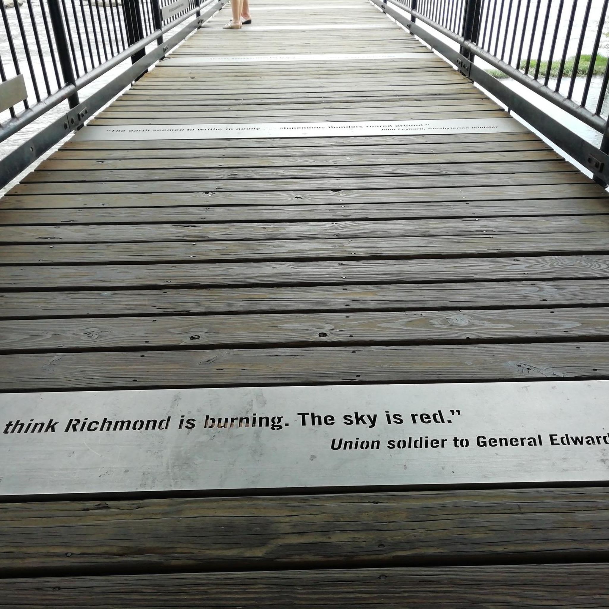
The Robert E. Lee Memorial Bridge takes U.S. Route 1 and U.S. Route 301 across the James River. It offers great views and includes a separate bicycle lane for safe bike crossing separate from cars.
0
0

Spanning 600 acres, this park is the only urban area in the country with Class IV white water rapids located in the middle of downtown, making it a popular destination for white water rafting. This particular section of the park provides breathtaking views of the Old Manchester Bridge and the James River.
0
0
Frequently Asked Questions
How many gravel bike trails are available in Richmond city?
Richmond city offers a selection of 7 gravel bike trails, catering to various skill levels. These routes blend urban environments with extensive natural areas, providing diverse experiences for riders.
Are there easy gravel bike trails suitable for beginners or families in Richmond?
Yes, Richmond has several options for easy gravel biking, perfect for beginners or families. For instance, the Pocahontas State Park – Gravel Road loop from Loop Forest Parking Lot is an easy route within the expansive Pocahontas State Park. Additionally, Pony Pasture Rapids Park offers beginner-friendly, largely flat gravel paths ideal for a relaxed ride.
What are some longer distance gravel cycling routes in Richmond?
For those seeking a longer challenge, the Robert Lee Bridge – River in Pocahontas State Park loop from Richmond Main Street is a difficult 61.5-mile (98.9 km) route. This extensive trail explores Pocahontas State Park and follows sections along the James River, offering a significant ride for experienced gravel bikers.
Are there any gravel bike routes that form a loop in Richmond?
Many of Richmond's gravel bike routes are designed as loops, allowing you to start and end at the same point. An example is the Pump House Park – LOVE Sign on Brown's Island loop from Virginia Commonwealth University, a moderate 26.9-mile (43.4 km) path that navigates through urban parks and along the James River.
What kind of terrain can I expect on Richmond's gravel bike trails?
Richmond's gravel bike trails offer a diverse mix of terrain. You'll encounter everything from flat river paths and hard-packed clay sections to more challenging routes with significant elevation changes. Many routes feature a blend of paved and unpaved surfaces, characteristic of gravel riding, often within urban parks and along the James River.
What can I see along the gravel bike trails in Richmond?
Richmond's gravel trails offer a blend of natural beauty and historical significance. Along your rides, you might encounter natural features like Forest Hill Park, Flooded Quarry Pond, or the scenic Belle Isle. The Virginia Capital Trail, while mostly paved, also offers scenic views along the James River and access to historical sites.
Are there any interesting landmarks or viewpoints along Richmond's gravel routes?
Yes, several routes offer access to notable landmarks and viewpoints. You can find scenic spots like Libby Hill Park, which provides excellent views. The T. Tyler Potterfield Memorial Bridge is also a prominent feature along some riverfront routes, offering unique perspectives of the James River.
What do other gravel bikers enjoy most about gravel biking in Richmond?
The gravel biking experience in Richmond is highly rated by the komoot community, with an average score of 4.7 stars. Reviewers often praise the unique blend of urban accessibility with extensive natural trail networks, the varied terrain along the James River, and the ability to combine city exploration with outdoor adventure.
Is it possible to access gravel trails in Richmond using public transport?
Richmond's urban trail systems, particularly those within the James River Park System, are often accessible from various points within the city, which may be reachable via public transport. For routes starting further afield, such as those in Pocahontas State Park, personal transport is generally more convenient.
Where can I find parking for gravel bike trails in Richmond?
Many of Richmond's parks and trailheads offer designated parking areas. For routes within the James River Park System, you can often find parking near access points along the river. For trails in Pocahontas State Park, there are multiple parking lots available within the park itself, such as the Loop Forest Parking Lot.
Are there any gravel routes that pass by cafes or places to stop for refreshments?
Given Richmond's blend of urban and natural settings, many routes that navigate through city parks or along the James River will bring you close to urban areas where cafes and refreshment stops are available. Routes like the Belle Island – LOVE Sign on Brown's Island loop from Oak Grove, which passes through the James River Park System, are likely to have amenities nearby.
What is the best time of year for gravel biking in Richmond?
Richmond offers good gravel biking conditions for much of the year. Spring and fall generally provide the most pleasant temperatures and vibrant scenery. While winter conditions can occur, the region typically experiences milder winters compared to more northern areas, making year-round riding possible, though some trails might be affected by rain or occasional snow.
Most popular routes in Richmond city
Most popular attractions in Richmond city

Get inspired with the komoot mobile app


Explore more
Browse the best Gravel rides in other regions.
