The best gravel rides around Le Landin
4.5
(2)
25
riders
26
rides
Gravel biking around Le Landin offers varied terrain within the Norman Seine River Meanders Regional Nature Park. The landscape features a mix of hilly sections, extensive forests, and paths alongside the Seine River. Cyclists can expect diverse surfaces, from packed gravel to rugged doubletrack, catering to different skill levels. This region provides a blend of natural beauty and historical points of interest for gravel biking.
Best gravel bike trails around Le Landin
- The most popular gravel bike trail is Jumièges…
Last updated: May 21, 2026
4.7
(3)
9
riders
57.5km
03:39
360m
360m
Moderate gravel ride. Good fitness required. Mostly paved surfaces. Suitable for all skill levels.
5.0
(1)
10
riders
49.2km
03:34
420m
420m
Moderate gravel ride. Good fitness required. Mostly paved surfaces. Suitable for all skill levels.

Sign up for free
5
riders
Moderate gravel ride. Good fitness required. Mostly paved surfaces. Suitable for all skill levels.
5
riders
Hard gravel ride. Good fitness required. You may need to push your bike for some segments of this route.
5
riders
25.9km
01:57
200m
200m
Moderate gravel ride. Good fitness required. Mostly paved surfaces. Suitable for all skill levels.
Get access to more routes and recommendations from other explorers.
Sign up for free
Already have an account?
Our route recommendations are based on thousands of hikes, rides, and runs completed by other people on komoot.
Start today with a free account
Your next adventure awaits.
Login or Signup

Tips from the Community

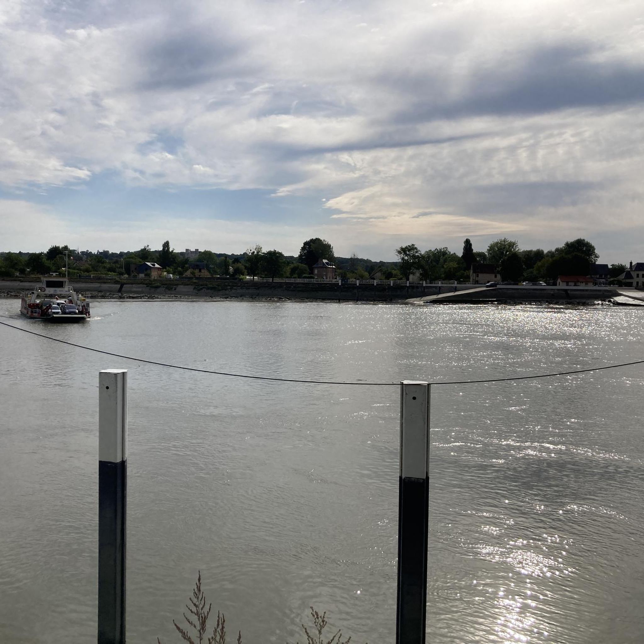
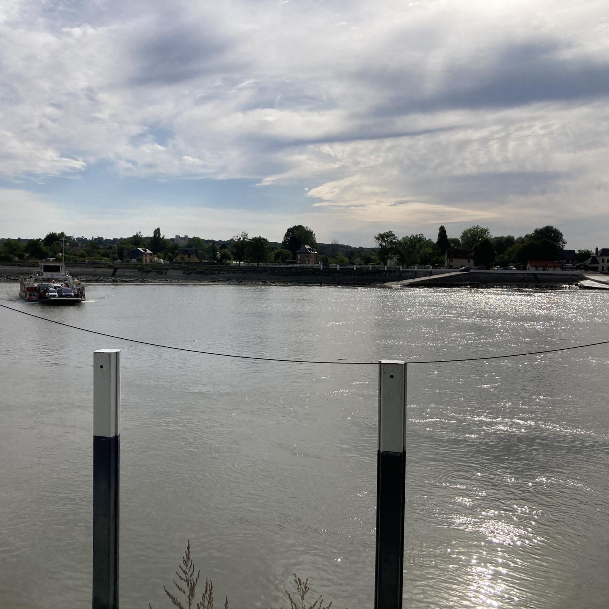
The 3 bridges between Le Havre and Rouen (Normandy, Tancarville and Brotonne (the latter quite dangerous for bicycles) are very high because they have to allow passage of large tonnage boats intended to supply Paris, the Seine being an important component. These boats are then unloaded in Rouen onto smaller tonnage boats which go to Paris. This system of ferries, surprisingly free, is therefore there to compensate for this lack of possible crossings. Do not hesitate to use them, it is really a very nice plus.
0
0

Please note that this route uses private roads and is therefore prohibited!!
0
0

To avoid the extremely high bridges over the Seine, we chose the ferry. We enjoyed the crossing – completely uncomplicated and pleasant. I took photos of the departure times.
1
0

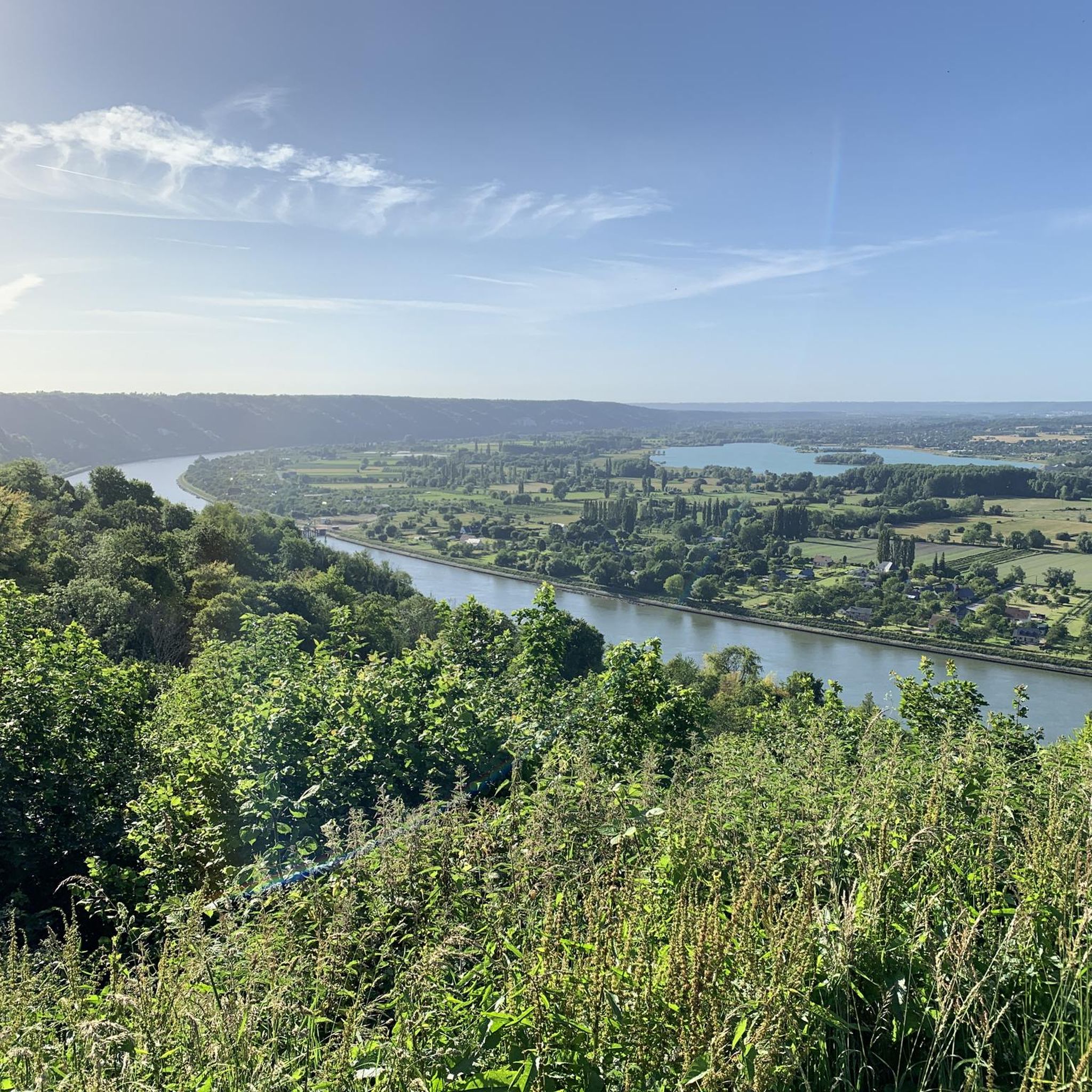
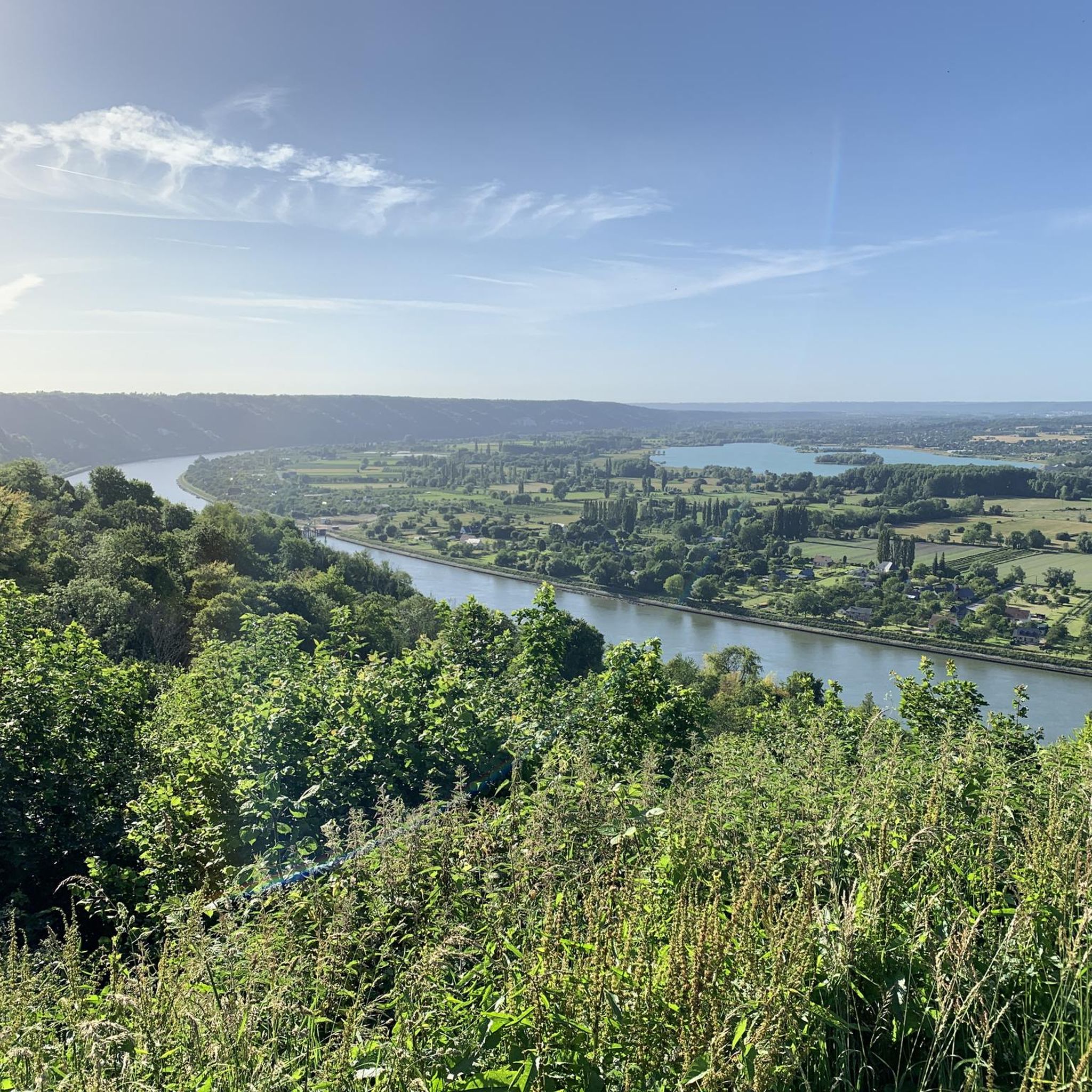
The bridge itself is magnificent and it is also the only one in the region with a large cycle path and light traffic.
0
0


Pay attention to the new bridge sector junctions
0
0

I've safely crossed the bike-tractor lane in the center of the road several times in both directions. I'm prone to vertigo, however, so I don't hesitate to cross it. (5 minutes for 2 km) However, in even moderately windy weather, I absolutely avoid it. The view is magnificent from every angle, both from the top and the side. On the other hand, my wife crosses it without any problem and appreciates the width of the very wide bike path (2.50 m), which is much safer than the Tancarville Bridge or the Normandy Bridge. (The path is almost nonexistent and strongly discouraged on this bridge: take the bus to cross it!)
0
0

Superb gravel and mountain bike trail through the pine forest
0
0
Frequently Asked Questions
What kind of terrain can I expect on gravel bike trails around Le Landin?
The gravel biking terrain around Le Landin is quite varied, ranging from packed and loose gravel to rugged doubletrack and bare dirt. You'll find a mix of hilly sections, extensive forests, and paths alongside the Seine River, especially within the Norman Seine River Meanders Regional Nature Park. This diversity caters to various skill levels, offering both challenging ascents and scenic, relaxed rides.
Are there gravel bike routes suitable for beginners or those looking for an easier ride?
Yes, Le Landin offers several easier gravel bike routes. For example, the La Douillère Nature Reserve – Bac Heurteauville loop from Tourbière d'Heurteauville is an easy 13.8 km (8.6 miles) route with minimal elevation gain, perfect for a relaxed ride. Overall, there are 4 easy routes out of 28 available in the area.
What are some notable landmarks or attractions I can see while gravel biking in Le Landin?
Le Landin and its surroundings are rich in history and natural beauty. You can cycle past the impressive Ruins of Jumièges Abbey, often called the 'most beautiful ruin in France', which is just 4 km from Le Landin. The picturesque village of La Bouille along the Seine River is also a charming stop. Many routes, like the Ruins of Jumièges Abbey – Jumièges Abbey loop from Duclair, incorporate these historical sites.
Are there any circular gravel bike routes in the Le Landin area?
Yes, many of the gravel bike routes around Le Landin are circular, allowing you to start and end at the same point. Examples include the Ruins of Jumièges Abbey – Jumièges Abbey loop from Duclair and the Trail Above the Towpath – Chapel of the Mother of God loop from Le Mesnil-sous-Jumièges, both offering scenic loops through the region's diverse landscapes.
What do other gravel bikers say about the trails in Le Landin?
The gravel biking routes in Le Landin are highly rated by the komoot community, with an average score of 4.2 stars from over 7 reviews. More than 50 gravel bikers have used komoot to explore the varied terrain, often praising the blend of natural beauty, historical points of interest, and diverse surfaces.
Can I find routes that include a ferry crossing?
Yes, some routes in the area incorporate the local ferry services across the Seine River, which can add a unique element to your ride. The Jumièges Abbey – The Jumièges ferry loop from Yainville is a prime example, featuring a ferry crossing near Jumièges Abbey as part of its 52.9 km (32.8 miles) journey.
What is the best time of year to go gravel biking in Le Landin?
The Norman Seine River Meanders Regional Nature Park, where Le Landin is located, offers pleasant conditions for cycling during spring, summer, and early autumn. These seasons generally provide milder weather, making it ideal for exploring the picturesque roads, forests, and river paths. Always check local weather forecasts before heading out.
Are there any challenging gravel bike routes for experienced riders?
Yes, for more experienced riders, there are challenging routes with significant elevation gain. The Abbey of Jumièges – The Jumièges ferry loop from Le Mesnil-sous-Jumièges, for instance, is a difficult 42.6 km (26.5 miles) route with nearly 500 meters of elevation gain, offering a robust workout amidst scenic landscapes. Overall, 5 of the 28 routes are classified as difficult.
Is public transport available to reach the gravel biking areas around Le Landin?
While Le Landin itself is a small commune, the broader Normandy region has some public transport options. For specific routes and connections to trailheads, it's advisable to research local bus services or regional trains that might connect to nearby towns like Duclair or Yainville, which are common starting points for tours.
Where can I park my car when starting a gravel bike tour in Le Landin?
Many of the gravel bike routes around Le Landin start from villages or towns that offer public parking. For example, routes often begin in places like Yainville, Duclair, or Le Mesnil-sous-Jumièges, where you can typically find designated parking areas. It's recommended to check the specific starting point of your chosen route for the most convenient parking options.
Are there any family-friendly gravel bike trails in the area?
While specific 'family-friendly' designations aren't always explicit, the easier gravel routes with less elevation and smoother surfaces would be most suitable for families. Consider routes like the La Douillère Nature Reserve – Bac Heurteauville loop from Tourbière d'Heurteauville, which is an easy ride, offering a pleasant experience for families.
Are there opportunities to stop for food or drinks along the gravel trails?
The villages and towns along the Seine River, such as La Bouille or Duclair, which are often part of or near gravel biking routes, offer cafes and pubs where you can stop for refreshments. Planning your route to pass through these settlements will provide opportunities for breaks and local culinary experiences.
Most popular attractions around Le Landin

Get inspired with the komoot mobile app


Explore more
Browse the best Gravel rides in other regions.
