The best gravel rides around Saint-Guilhem-Le-Désert
4.1
(5)
59
riders
13
rides
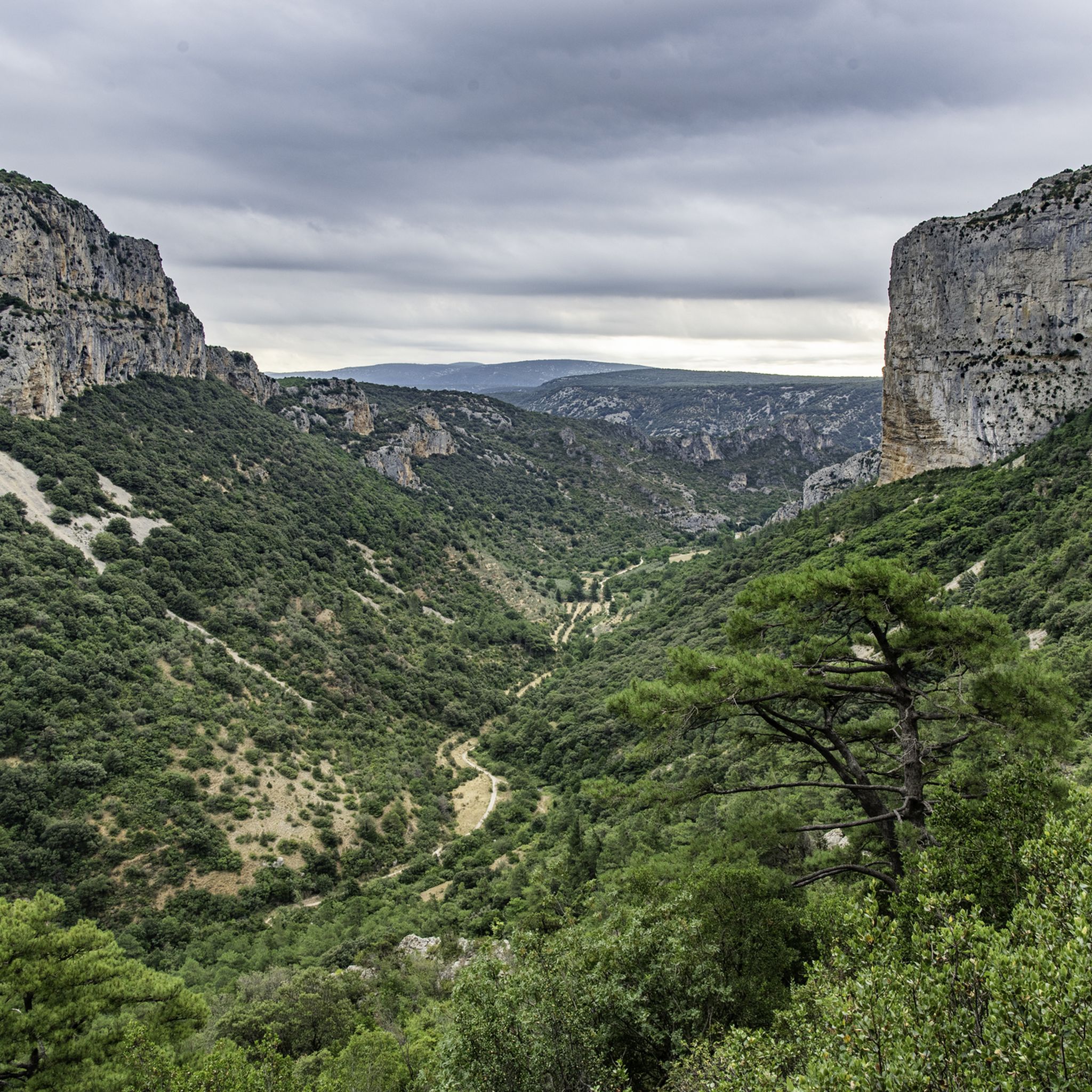
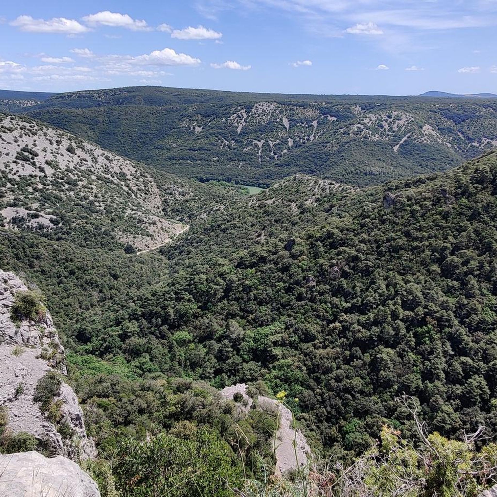
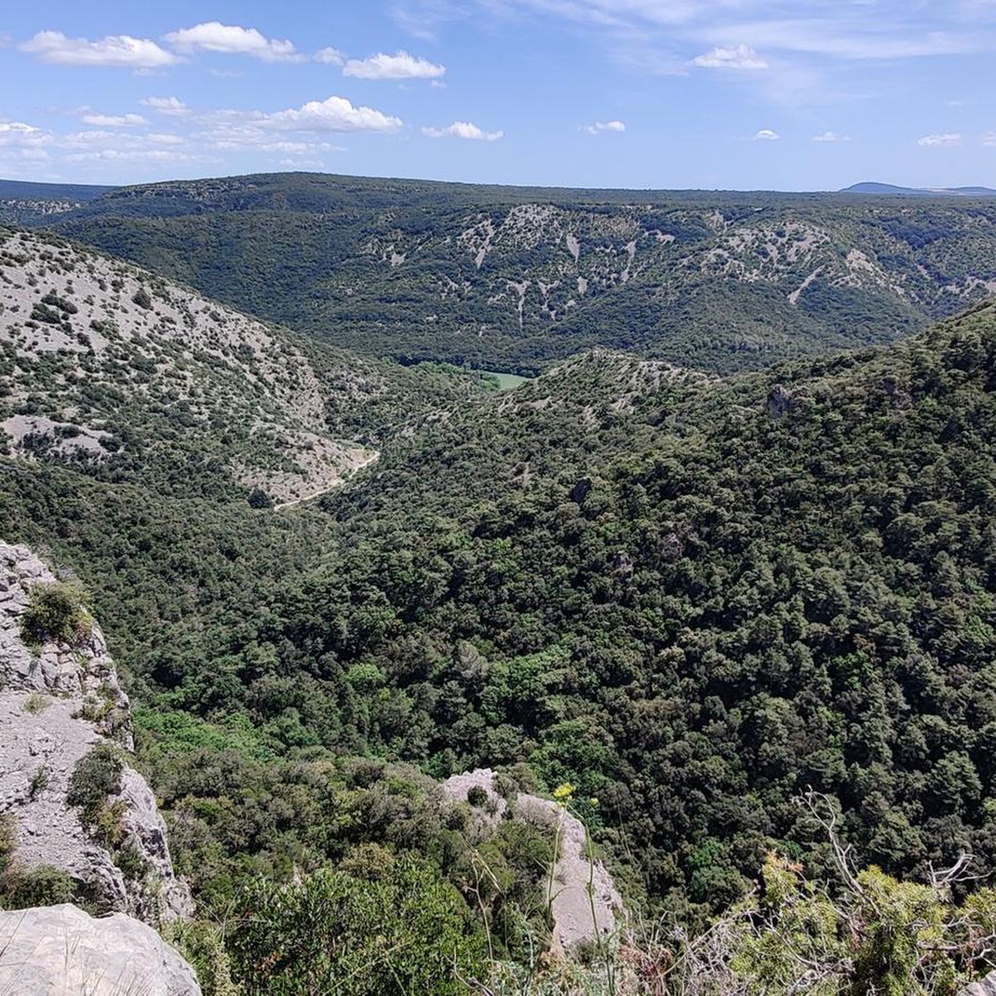
Gravel biking around Saint-Guilhem-Le-Désert offers routes through varied terrain, characterized by the Hérault river valley, limestone ridges, and the foothills of the Cévennes. The region features a mix of open scrubland, dense Mediterranean forests, and significant elevation changes. Gravel bike routes in Saint-Guilhem-Le-Désert often include climbs to panoramic viewpoints and descents into river gorges.
Best gravel bike trails around Saint-Guilhem-Le-Désert
- The most popular gravel bike trail is Devil's Bridge – Ridges of the Rocher des Vierges loop from Gignac,…
Last updated: May 22, 2026
3.5
(2)
22
riders
66.2km
04:56
1,180m
1,180m
Hard gravel ride. Very good fitness required. Mostly paved surfaces. Suitable for all skill levels.
4.0
(1)
13
riders
Hard gravel ride. Very good fitness required. You may need to push your bike for some segments of this route.

Sign up for free
4
riders
Moderate gravel ride. Good fitness required. Mostly paved surfaces. Suitable for all skill levels.
2
riders
43.1km
03:53
1,010m
1,010m
Hard gravel ride. Very good fitness required. Mostly paved surfaces. Suitable for all skill levels.
4
riders
43.1km
03:03
650m
650m
Hard gravel ride. Very good fitness required. Mostly paved surfaces. Suitable for all skill levels.
Get access to more routes and recommendations from other explorers.
Sign up for free
Already have an account?
Our route recommendations are based on thousands of hikes, rides, and runs completed by other people on komoot.
Start today with a free account
Your next adventure awaits.
Login or Signup
Tips from the Community

Beautiful views on both sides of the path.
0
0

From Mont Saint-Baudille, the view is breathtaking! Enjoy the panorama of the Hérault plain, the Mediterranean, Pic Saint Loup, and Canigou!
0
0

The mountain bike climb up the north face is very steep and stony, and we did most of it on foot. The descent to the northeast to Mas d'Aubert is easy.
0
0

a fairly challenging single track, especially in its northern section. I recommend doing it in a south-to-north direction (easier in my opinion).
0
0

Beware of the wind and the cold once at the top
0
0
Don't hesitate to take a little wool 😅
0
0

Terrific hike, although I would classify it as 'difficult' rather than intermediate. The trail is a mix of uneven surfaces; rocks, water washouts, and roots. Beautiful panoramic views throughout the hike.
1
0

superb little pass lost in the middle of nowhere, still worth it, slopes can be formidable 😁
0
0
Frequently Asked Questions
How many gravel bike trails are available in Saint-Guilhem-Le-Désert?
There are over 20 gravel bike routes in the Saint-Guilhem-Le-Désert region, catering to various skill levels. You'll find a mix of moderate and difficult trails to explore.
What is the best time of year for gravel biking in Saint-Guilhem-Le-Désert?
The region experiences a Mediterranean climate. Spring and autumn generally offer the most pleasant conditions for gravel biking, with milder temperatures. Summers can be hot, making early morning or late afternoon rides preferable, while winters are typically mild but can have occasional rain.
Are there any easy or beginner-friendly gravel bike trails in Saint-Guilhem-Le-Désert?
While the area is known for its moderate to difficult terrain, some routes offer less extreme elevation changes. For a moderate option, consider the Ridges of the Rocher des Vierges – The ridges of St Guiraud loop from Saint-André-de-Sangonis, which covers 18.2 miles (29.2 km) with manageable climbs.
What kind of terrain can I expect on gravel bike routes around Saint-Guilhem-Le-Désert?
Gravel biking in this region is characterized by varied terrain, including the Hérault river valley, limestone ridges, and the foothills of the Cévennes. You'll encounter a mix of open scrubland, dense Mediterranean forests, and significant elevation changes, often leading to panoramic viewpoints.
Are there challenging gravel bike routes for experienced riders?
Yes, Saint-Guilhem-Le-Désert offers several challenging routes. The Mont Saint-Baudille Summit – Col du Vent (703 m) loop from Saint-Jean-de-Fos is a difficult 26.7 miles (43.0 km) path with a substantial climb to Mont Saint-Baudille Summit, providing expansive views. Another demanding option is The monks' descent – Col de Lavagne loop from Montpeyroux, which features over 1000 meters of elevation gain.
What are some notable landmarks or attractions I can see along the gravel bike trails?
Many routes pass by or offer views of significant local attractions. You can cycle near the historic Devil's Bridge, explore the charming village of Saint-Guilhem-le-Désert itself, or climb to Mont Saint-Baudille Summit for incredible panoramic vistas.
Are there any circular gravel bike routes in the area?
Most of the gravel bike routes in Saint-Guilhem-Le-Désert are designed as loops, allowing you to start and finish at the same point. Examples include the Devil's Bridge – Ridges of the Rocher des Vierges loop from Gignac and The monks' descent – The Castellas of Montpeyroux loop from Montpeyroux.
What do other gravel bikers enjoy most about the trails in Saint-Guilhem-Le-Désert?
The area is highly rated by the komoot community, with an average score of 4.2 stars. Reviewers often praise the diverse landscapes, from river valleys to limestone ridges, and the challenging climbs that reward with spectacular views. The mix of open scrubland and Mediterranean forests also contributes to a varied and engaging riding experience.
Are there places to stop for refreshments or cafes along the gravel routes?
While specific cafes directly on every trail might be limited, many routes start or pass through villages like Saint-Guilhem-Le-Désert, Gignac, or Montpeyroux, where you can find local establishments for refreshments and meals. Planning your route with these villages in mind is recommended.
Can I find wild swimming spots near the gravel bike routes?
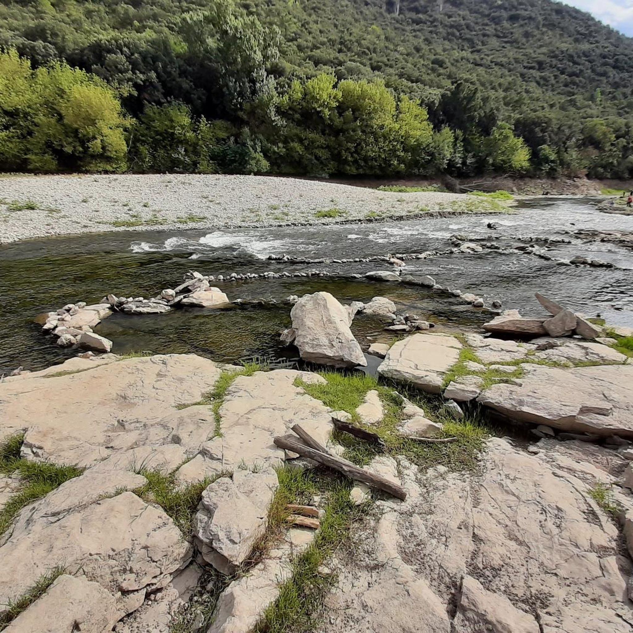
The Hérault river, which flows through the region, offers several spots for wild swimming, particularly near the Devil's Bridge. Many gravel routes traverse the river valley, making it possible to combine a ride with a refreshing dip during warmer months.
What is the typical elevation gain on gravel bike trails in Saint-Guilhem-Le-Désert?
The region is characterized by significant elevation changes. Even moderate routes can have several hundred meters of ascent, while difficult trails often feature climbs exceeding 1000 meters. For instance, the Devil's Bridge – Ridges of the Rocher des Vierges loop from Gignac includes over 1180 meters of elevation gain.
Most popular routes around Saint-Guilhem-Le-Désert
Most popular attractions around Saint-Guilhem-Le-Désert

Get inspired with the komoot mobile app


Explore more
Browse the best Gravel rides in other regions.
