The best gravel rides around Charbonnières-Les-Vieilles
4.2
(4)
22
riders
32
rides
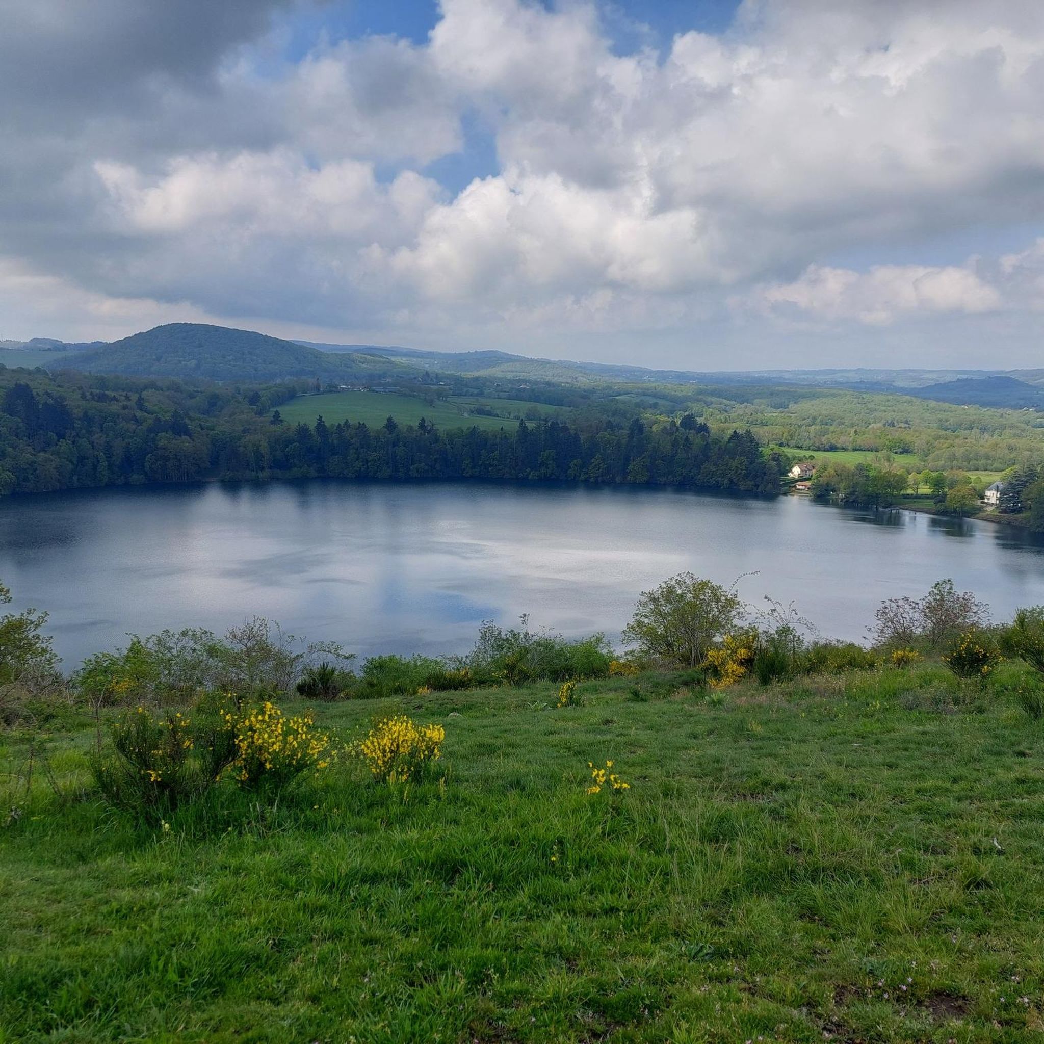
Gravel biking around Charbonnières-Les-Vieilles offers a diverse landscape characterized by rolling hills, agricultural plains, and forested sections. The region features a network of unpaved roads and paths, often passing by historical churches and tranquil river valleys. Elevation gains are generally moderate, providing varied terrain suitable for gravel cyclists.
Best gravel bike trails around Charbonnières-Les-Vieilles
- The most popular gravel bike trail is Super chemin gravel – Beauregard Vendon church loop from Châtel-Guyon, a 13.6 miles (21.8 km) trail that takes…
Last updated: November 2, 2026
4.0
(1)
5
riders
20.2km
01:27
320m
320m
Moderate gravel ride. Good fitness required. Mostly paved surfaces.
4.3
(3)
4
riders
23.0km
01:41
250m
250m
Moderate gravel ride. Good fitness required. Mostly paved surfaces.

5
riders
31.2km
01:54
360m
370m
Moderate gravel ride. Good fitness required. Mostly paved surfaces.
3
riders
25.1km
01:48
350m
350m
Moderate gravel ride. Good fitness required. Mostly paved surfaces.
3.0
(1)
2
riders
Moderate gravel ride. Good fitness required. Mostly paved surfaces.
Get access to more routes and recommendations from other explorers.
Already have an account?
Our route recommendations are based on thousands of hikes, rides, and runs completed by other people on komoot.
Start today with a free account
Your next adventure awaits.
Tips from the Community

The Montcel bridges and the Gaudon bridge, spanning the Morge, were once toll bridges, established by royal decree on August 15, 1778. At that time, any crossing was subject to a passage fee, the rate of which varied depending on the type of vehicle and the load carried. For example, a four-wheeled cart loaded with firewood had to pay a tax of four deniers. These infrastructures, essential for local trade and exchange, still bear witness today to the economic and social history of Montcel during the Ancien Régime.
0
0
The castle is located in a park on the southwestern edge of the town of Jozerand, west of the main street which separates it from the town center (church, town hall). It overlooks the valley of the Coinches stream, a tributary of the Morge. From the castle, situated on the first heights of the Auvergne Combraille, the view extends widely to the south, from the Chaîne des Puys on the right to the Limagne plain on the left.
0
0

55 km but very cool . did not feel like I only did 34km.
0
0

Thank you for sharing places that are unknown to most of us but are of definite interest.
0
0
Each sculpture tells its own story, primarily that of women who show us how strong and resilient they are in the face of illness, discrimination, and humiliation.
0
0

Calvaries are often found at crossroads; they guide the traveler and protect him from the unknown and bad encounters.
0
0

The Sep dam is a 41-metre high structure. It is possible to admire its entire height since a road provides access to it.
2
0
The lava stone crucifixes are very finely chiseled
0
0
Frequently Asked Questions
How many gravel bike trails are available around Charbonnières-Les-Vieilles?
There are nearly 30 gravel bike trails to explore around Charbonnières-Les-Vieilles, offering a diverse range of experiences for cyclists. The majority of these routes are rated as moderate, with a good selection of more challenging options as well.
Are there any easy gravel bike trails suitable for beginners in Charbonnières-Les-Vieilles?
While most routes are moderate, the region's terrain of rolling hills and agricultural plains means many trails offer manageable gradients. For a good introduction, consider routes like the Super chemin gravel – Beauregard Vendon church loop from Châtel-Guyon, which provides a mix of gravel paths and rural roads without excessive climbing.
What are the typical distances for gravel bike routes in this area?
Gravel bike routes around Charbonnières-Les-Vieilles vary in length, with many falling between 20 km and 40 km. For example, the Volvic – Wooden Bridge Over the Mirabel loop from Châtel-Guyon is about 31 km, while the Roman Bridge over the Morge – Small Dam on the Morge loop from Aubiat extends to over 41 km, offering longer rides for those seeking more distance.
Are there any family-friendly gravel biking options in Charbonnières-Les-Vieilles?
The region's moderate elevation gains and network of unpaved roads can be suitable for families with some cycling experience. Look for routes that stick to quieter rural roads and well-maintained gravel paths. Always check the route details for specific difficulty and terrain before heading out with children.
What kind of scenery can I expect on gravel bike trails around Charbonnières-Les-Vieilles?
You can expect diverse scenery, including rolling hills, agricultural plains, and forested sections. Many routes pass by historical churches, tranquil river valleys, and offer views of the surrounding landscape. The Barrage de la Sep – Forest trail loop from Champs, for instance, takes you through scenic forested areas.
Are there any notable landmarks or attractions along the gravel bike routes?
Yes, several routes pass by interesting landmarks. You might encounter historical sites like the Château-Rocher or the Château de Tournoël. Some trails also offer scenic viewpoints, such as the Gour de Tazenat Viewpoint / Chaîne des Puys, providing stunning vistas.
Can I find any waterfalls or natural monuments on these gravel bike trails?
Yes, the region features natural highlights. The Ambène Waterfall is a notable natural monument you might encounter or find nearby while exploring the area's gravel routes. Keep an eye out for viewpoints like Queuille Viewpoint for impressive natural panoramas.
What is the best time of year for gravel biking in Charbonnières-Les-Vieilles?
The region is generally pleasant for gravel biking from spring through autumn. Spring brings lush greenery, while autumn offers beautiful foliage. Summers are typically warm, but it's always wise to check local weather forecasts, especially for potential thunderstorms, and plan your rides accordingly.
Are there many loop routes available for gravel biking?
Most of the gravel bike trails in Charbonnières-Les-Vieilles are designed as convenient loop routes, allowing you to start and finish at the same point. Examples include the Beauregard Vendon church loop and the Church of the Holy Cross, Gannat loop, making planning straightforward.
What do other gravel bikers say about the trails in Charbonnières-Les-Vieilles?
The gravel biking routes around Charbonnières-Les-Vieilles are highly regarded by the komoot community, holding an average rating of 4.25 stars. Cyclists often praise the varied terrain, the mix of gravel paths and rural roads, and the opportunity to discover historical sites and tranquil landscapes.
Are there any advanced or challenging gravel bike trails in the area?
Yes, for more experienced riders seeking a challenge, there are 15 routes rated as difficult. These trails typically feature greater elevation gains and potentially more technical sections, offering a robust workout amidst the region's varied landscape. Always review the route profile for specific details on difficulty.
Is there public transport access to the starting points of these gravel bike trails?
While Charbonnières-Les-Vieilles is a rural area, some larger nearby towns like Châtel-Guyon or Gannat, which serve as starting points for several routes, may have limited public transport connections. It's advisable to check local bus schedules or regional train services if you plan to rely on public transport to reach a trailhead.
Most popular routes around Charbonnières-Les-Vieilles
Most popular attractions around Charbonnières-Les-Vieilles

Get inspired with the komoot mobile app


Explore more
Browse the best Gravel rides in other regions.
