The best gravel rides around L'Éguille
4.2
(10)
111
riders
7
rides
Gravel biking around L'Éguille offers routes through a landscape defined by salt marshes, oyster beds, and the Seudre River estuary. The terrain is generally flat to gently undulating, providing accessible paths for various skill levels. Cyclists can explore coastal and countryside paths that often transition between paved and unpaved surfaces. This region in Charente-Maritime, France, provides a unique setting for exploring local ecology and traditional oyster farming.
Best gravel bike trails around L'Éguille
- The most popular gravel bike trail is…
Last updated: July 2, 2026
4.2
(5)
33
riders
52.4km
03:13
380m
380m
Moderate gravel ride. Good fitness required. Mostly paved surfaces. Suitable for all skill levels.
5.0
(2)
23
riders
Moderate gravel ride. Good fitness required. Mostly paved surfaces. Suitable for all skill levels.

Sign up for free
6
riders
66.1km
03:43
260m
260m
Hard gravel ride. Good fitness required. You may need to push your bike for some segments of this route.
4.0
(1)
6
riders
73.5km
04:27
370m
370m
Moderate gravel ride. Good fitness required. Mostly paved surfaces. Suitable for all skill levels.
4.0
(1)
8
riders
21.9km
01:16
30m
30m
Easy gravel ride. Great for any fitness level. Mostly paved surfaces. Suitable for all skill levels.
Get access to more routes and recommendations from other explorers.
Sign up for free
Already have an account?
Our route recommendations are based on thousands of hikes, rides, and runs completed by other people on komoot.
Start today with a free account
Your next adventure awaits.
Login or Signup
Tips from the Community

For this nature and its church
0
0
Very nice walk or bike ride
0
0

The port of Ribérou is a major heritage site in Saujon, bearing witness to a prosperous maritime past linked to the salt and wine trade. Transformed in the 19th century by ambitious works, it has now been reinvented as a place for living, relaxation, and preserving local history. 🛶 Origins and the Middle Ages The port of Ribérou takes its name from the Latin word ripa ("riverbank") or the Occitan word ribèira ("river"). It is located at the head of the Seudre estuary. It existed as early as the 11th century and became an important river and sea port thanks to its strategic position at the head of the estuary, used particularly for the salt trade—then called "white gold"—a highly sought-after product for preserving food. 🚢 Medieval Period and International Trade With the opening of British markets during the reigns of Eleanor of Aquitaine and Henry II Plantagenet, ships laden with wool, salt, wine, and other goods flocked to Ribérou. In the 16th century, the port exported local wines (such as cognac and pineau) throughout Europe. In 1577, during the Wars of Religion, the port was a strategic site: troops were stationed there, and battles took place. 🏗️ Decline, Reconstruction, and the 19th Century The estuary gradually silted up, making navigation difficult. By 1691, only smaller vessels could dock there. During the French Revolution, the sale of the tidal mill, which helped remove sediment, worsened the silting, leading to the port's decline. A modernization project began in 1822, but it wasn't until 1839 that an ambitious program was launched under the impetus of Jules Dufaure—a native of Saujon and Minister of Public Works—with the construction of sturdy quays, slipways, a lock bridge (marking the boundary between fresh and salt water), and reception facilities. In 1842, the work was completed, and the main quay was named Quai Dufaure in honor of this political support. 📉 Gradual Decline and Modernization The arrival of the railway in 1876 and the persistent problems of silting led to a decline in the port's traditional commercial activity, already facing competition from other transport networks. In the 20th century, the port gradually lost its economic importance but remained active for traditional fishing and became a place for pleasure boating, leisure, and local culture. Urban and tourism development projects (particularly in 2011–2012) modernized the port while preserving its historical charm. 🌊 Today The port of Ribérou is now a small fishing and pleasure port, much appreciated for its walks along the Seudre River, water sports (canoeing, kayaking, paddleboarding, etc.), and seasonal events.
0
0


beautiful passages along the Charente with pretty monuments and small waterfront cafés in Port d’Envaux and Saintes.
0
0
The port of Ribérou is a fishing and pleasure port located at the end of the Seudre estuary, in Saujon. It is one of the two ports in the city, along with that of Breuil, a little downstream. Active since the 11th century, it took on its current appearance from 1842, under the impetus of the Minister of Public Works at the time, Jules Dufaure, a "local boy", who thus attempted to revive maritime trade and fishing activities, which were then in decline. Ideally located, on the edge of the city center, the La Lande leisure center and the preserved areas of the Seudre marshes (towpaths transformed into walking trails), it has become one of the major tourist attractions in Saujon, where theme evenings and the July 14 fireworks are organized. In 2011, the municipality began a renovation program for the port site, entrusted to the architect-urban planner Sophie Blanchet. It consists of transforming the old car parks into a pedestrian esplanade, a real meeting place with modern street furniture and, in the long term, green spaces. From the quays, lined with bourgeois buildings, small picturesque streets lined with hollyhocks allow you to crisscross the district and reach the city centre. The Ribérou lock bridge, known as the "bridge of opposing waters", was renovated in 2010. It marks the separation between the waters of the estuary (port side: brackish water) and the waters of the river (retention basin side: fresh water). Ribérou is a starting point for certain water sports (canoeing and kayaking). It is approximately 250 metres long and 40 metres wide. From Ribérou, it is possible to reach successively the ports of Breuil (Saujon), L'Éguille, Mornac, Chaillevette, Chatressac (Chaillevette), Grandes Roches and Orivol (Étaules), La Grève in Duret and Coux (Arvert), La Grève (La Tremblade) and La Cayenne (Marennes).
0
0
Frequently Asked Questions
What kind of terrain can I expect on gravel bike trails around L'Éguille?
The L'Éguille region is characterized by generally flat to gently undulating terrain, making it accessible for various fitness levels. You'll find paths winding through extensive salt marshes, along the Seudre River estuary, and connecting charming coastal villages. Routes often transition between paved and unpaved surfaces, offering a varied gravel biking experience.
Are there any easy gravel bike routes suitable for beginners or families?
Yes, L'Éguille offers several easier routes. The region's flat topography is ideal for less strenuous rides. While specific 'easy' routes aren't detailed in the top recommendations, the overall terrain lends itself to accessible cycling, allowing you to focus on sightseeing rather than challenging climbs. There are 2 easy tours out of 13 total tours available.
What are some scenic highlights or natural features I can see while gravel biking in L'Éguille?
Gravel biking around L'Éguille offers unique scenery. You can explore extensive salt marshes and active oyster farms, providing a distinctive backdrop. Paths also follow the Seudre River estuary, offering views of the water and traditional fishing boats. Don't miss the chance to visit picturesque spots like Chay Beach or the Port of Royan, which are popular nearby attractions.
What do other gravel bikers enjoy most about the trails in L'Éguille?
The gravel biking routes around L'Éguille are highly rated by the komoot community, with an average score of 4.3 stars from over 15 reviews. Cyclists often praise the unique landscape, particularly the routes through salt marshes and along the estuary, as well as the opportunity to explore charming villages and coastal areas.
When is the best time of year to go gravel biking in L'Éguille?
The Charente-Maritime coast, where L'Éguille is located, enjoys exceptional sunshine and a mild climate for much of the year. This makes it pleasant for outdoor activities like gravel biking across many seasons. Spring and autumn generally offer comfortable temperatures and fewer crowds, while summer is also popular, though potentially warmer.
Are there any circular gravel bike routes around L'Éguille?
Yes, many of the gravel bike routes in the L'Éguille area are designed as loops, allowing you to start and finish at the same point. For example, the Wild Coast of La Tremblade – Ronce-les-Bains mountain bike circuit loop from Saint-Augustin is a popular circular route that takes you through coastal areas.
Can I find places to eat or drink along the gravel bike trails?
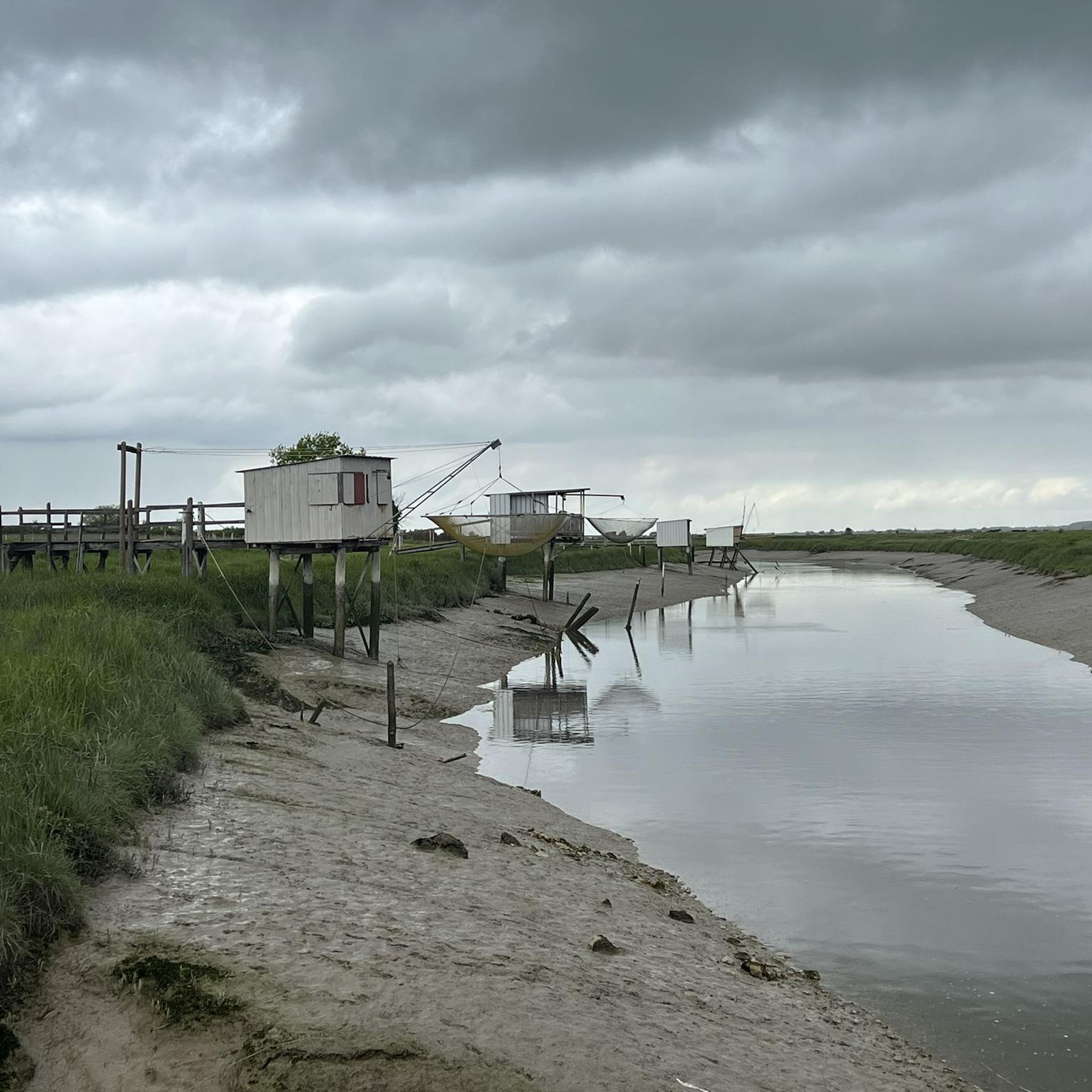
The region around L'Éguille is dotted with picturesque villages and ports, including L'Éguille itself with its traditional fishing port and oyster cabins. You'll find opportunities to stop and sample local seafood or enjoy refreshments in these charming settlements, such as Mornac-sur-Seudre, which are often connected by gravel paths.
Are there any historical sites or cultural points of interest accessible by gravel bike?
Absolutely. The region is rich in local culture, particularly its oyster farming heritage. You can cycle through areas that offer an authentic glimpse into this way of life. Additionally, historical sites like Fort du Chay are accessible and provide interesting points to explore during your ride.
How many gravel bike trails are there in total around L'Éguille?
There are 13 gravel bike trails available around L'Éguille, catering to various skill levels from easy to difficult. This network provides ample opportunities to explore the diverse landscapes of the region.
What is a challenging gravel bike route in the L'Éguille area?
For those seeking a more challenging ride, the Rochefort Transporter Bridge – The Transporter Bridge loop from La Gripperie-Saint-Symphorien is a difficult route covering over 134 km (83 miles) with significant elevation gain. It offers a demanding experience for advanced gravel bikers.
Are there any routes that offer views of the ocean or coastline?
Many routes in the L'Éguille area provide stunning coastal views. For example, the Promenade des Deux Phares – Côte sauvage loop from Vaux-sur-Mer takes you along the 'wild coast' and offers picturesque vistas of the sea and lighthouses.
Most popular attractions around L'Éguille

Get inspired with the komoot mobile app


Explore more
Browse the best Gravel rides in other regions.
