The best gravel rides around Maiweiler
3.0
(1)
17
riders
3
rides
Gravel biking around Maiweiler offers diverse landscapes at the edge of the North Palatine Uplands, within the broader Hunsrück-Nahe bike region. The terrain features rolling hills, shaded forests, and open fields, with routes often traversing gravel paths and forest roads. Cyclists can expect varied topography, including stretches along the Nahe river and occasional climbs. The region provides a mix of challenges and scenic beauty for gravel biking.
Best gravel bike trails around Maiweiler
- The most popular gravel bike trail is…
Last updated: July 2, 2026
3
riders
Moderate gravel ride. Good fitness required. Mostly paved surfaces. Suitable for all skill levels.
4
riders
39.4km
02:47
440m
440m
Hard gravel ride. Good fitness required. You may need to push your bike for some segments of this route.

Sign up for free
3
riders
36.6km
02:46
490m
490m
Hard gravel ride. Very good fitness required. Mostly paved surfaces. Suitable for all skill levels.
3.0
(1)
3
riders
39.5km
02:32
440m
440m
Moderate gravel ride. Good fitness required. Mostly paved surfaces. Suitable for all skill levels.
2
riders
41.5km
02:43
520m
520m
Hard gravel ride. Very good fitness required. Mostly paved surfaces. Suitable for all skill levels.
Our route recommendations are based on thousands of hikes, rides, and runs completed by other people on komoot.
Start today with a free account
Your next adventure awaits.
Login or Signup



Tips from the Community

The Maginot Line: The French Wall | ARTE https://youtu.be/Bvtxa08ysgc For those who would like to know more about the Maginot Line: de.wikipedia.org/wiki/Liste_der_Ouvrages_der_Maginot-Linie
1
0

Excellent playground with many forest paths. Not far away, the Hussards hill has several mountain bike trails.
0
0

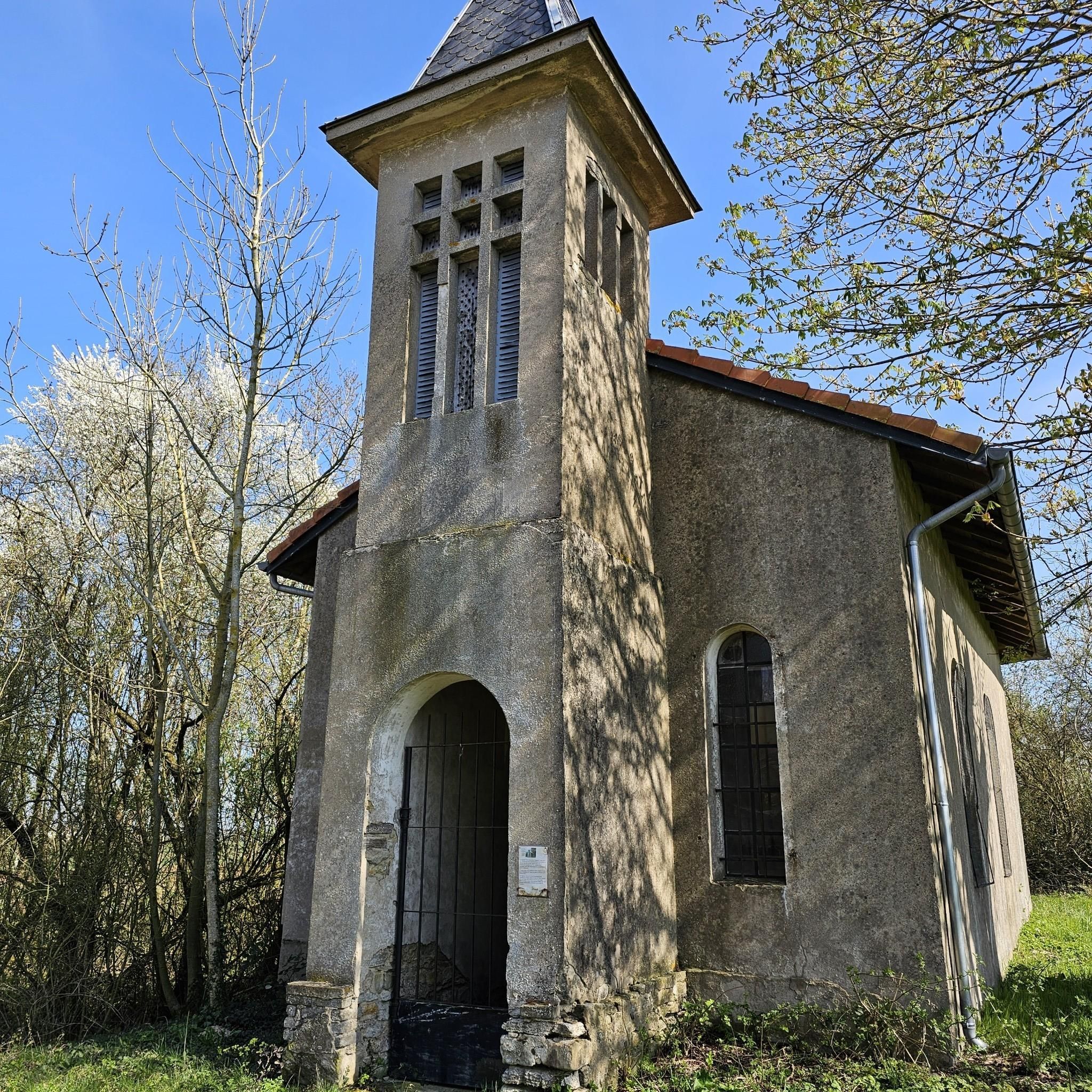
Chapel with a good break area and two benches
0
0

Entering the buildings prohibited 🚫
0
0

This work is part of the fortifications of the infamous Maginot line. It is made up of three combat blocks, one of which serves as the entrance. It is possible to visit the interior two Sundays a month. The opening dates are available on the book's website: https://www.lebambesch.com/visiter-le-bambesch/.
3
0

Quiet road but with lots of potholes
0
0
open from 9 a.m. to 5 p.m.
0
0
Frequently Asked Questions
What kind of terrain can I expect on gravel bike trails around Maiweiler?
The gravel bike trails around Maiweiler, situated at the edge of the North Palatine Uplands within the Hunsrück-Nahe bike region, feature diverse terrain. You'll encounter rolling hills, shaded forests, open fields, and picturesque stretches along the Nahe river. Routes often traverse gravel paths, forest roads, and some single trails, offering a mix of challenges and scenic beauty.
Are there routes suitable for different skill levels?
Yes, the Maiweiler area offers gravel biking options for various skill levels. You can find moderate paths, such as the Maginot Line Kerfent Outpost 1 – Crossroads Oderfang loop from Bambiderstroff, which winds through forested areas and open landscapes. For those seeking more challenge, there are difficult routes like the Ouvrage de l'Einseling – Silcence Zone loop from Teting, featuring varied terrain and occasional 'crunchy' climbs.
What are some notable natural features or landscapes to see while gravel biking in the region?
The region around Maiweiler is characterized by its natural beauty. You'll experience the rolling hills and diverse topography of the Hunsrück and Nahe region. Many routes immerse riders in natural settings away from busy roads, with shaded forests, open fields, and scenic stretches along the Nahe river. Rhineland-Palatinate, where Maiweiler is located, is known for its gorgeous stream landscapes and vineyards.
Are there any historical or cultural attractions near the gravel bike routes?
Yes, beyond the natural beauty, the surroundings of Maiweiler offer several historical and cultural attractions. You could explore the Historic Old Town of Herrstein with its medieval ambiance, or visit castles like Schloss Dhaun, which offers impressive architecture and views of the Kellenbachtal valley, or Kyrburg Castle, which also houses a whiskey museum. While not directly on the routes, these are notable points of interest in the broader region.
What do other gravel bikers say about the routes in Maiweiler?
The gravel biking routes in Maiweiler are generally well-regarded by the komoot community, with an average rating of 3.3 stars from over 3 reviews. More than 19 gravel bikers have used komoot to explore the varied terrain, often praising the mix of challenges and scenic beauty found in the rolling hills, shaded forests, and river valleys.
Are there any circular gravel bike routes available?
Yes, many of the gravel bike routes in the Maiweiler area are designed as loops. For example, you can explore the Silcence Zone – Ouvrage de l'Einseling loop from Teting, which leads through rolling hills and woodlands, or the Ouvrage de l'Einseling – Crossroads Oderfang loop from Faulquemont, offering another circular option.
What is the best time of year for gravel biking around Maiweiler?
While specific seasonal conditions are not detailed, the region's diverse landscapes with shaded forests and open fields suggest that spring and autumn would offer pleasant temperatures and beautiful scenery. Summer can also be enjoyable, especially on routes with good tree cover. Winter conditions would depend on snow and ice, which could make some gravel paths challenging.
Are there options for longer gravel bike routes or multi-day adventures?
The Hunsrück-Nahe bike region, which encompasses Maiweiler, is renowned for its extensive network of gravel trails, providing opportunities for both day tours and multi-day adventures. While individual routes listed in this guide are typically day trips, the broader region supports longer bikepacking experiences, with options for overnight stays in trekking camps within the Hunsrück Hochwald National Park or the Soonwald-Nahe Nature Park.
Can I find routes that are suitable for families?
While specific 'family-friendly' designations are not provided for all routes, the region offers a range of difficulty levels. Moderate paths that traverse open landscapes and forest roads, avoiding overly technical sections or steep climbs, would generally be more suitable for families. Always check the route details for elevation and terrain before setting out with children.
Are there any viewpoints along the gravel bike trails in Maiweiler?
The region's rolling hills and diverse topography often lead to scenic vistas. While specific viewpoints are not detailed for every route, the 'crunchy' climbs mentioned in the region research often lead to panoramic views. For instance, from Schloss Dhaun, a nearby attraction, visitors can enjoy wonderful views of the Kellenbachtal valley, which might be accessible or visible from some routes.
How many gravel bike routes are available in the Maiweiler area on komoot?
There are several gravel bike routes available on komoot for the Maiweiler area. This guide highlights five popular options, including the Ouvrage de l'Einseling – Silcence Zone loop from Teting and the Harprich's storks – War Memorial and Clock Tower loop from Adelange, offering a good starting point for exploration.

Get inspired with the komoot mobile app


Explore more
Browse the best Gravel rides in other regions.
