The best gravel rides around Tscha
4.8
(8)
142
riders
44
rides
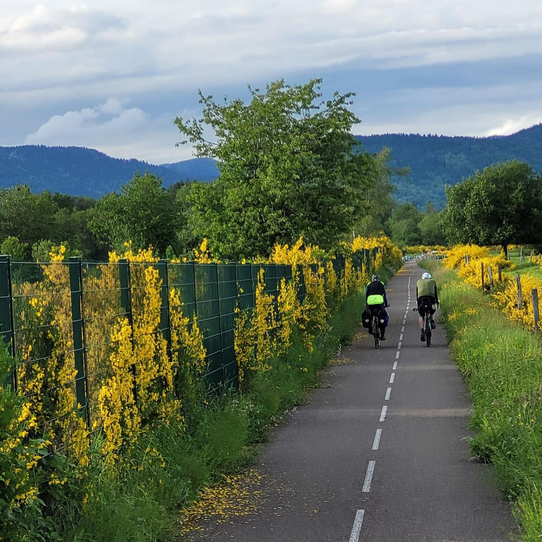
Gravel biking around Tscha offers a diverse landscape characterized by rolling hills, dense forests, and historical fortifications. The region features significant elevation changes, particularly around peaks like Ballon d'Alsace and La Planche des Belles Filles. Numerous lakes and ponds, such as Lac du Malsaucy, also contribute to the varied terrain. This area provides a mix of challenging climbs and scenic routes suitable for gravel cyclists.
Best gravel bike trails around Tscha
- The most popular gravel bike trail is Ballon d'Alsace…
Last updated: May 22, 2026
4.0
(1)
18
riders
55.9km
04:06
1,390m
1,390m
Hard gravel ride. Very good fitness required. You may need to push your bike for some segments of this route.
5.0
(4)
28
riders
Hard gravel ride. Very good fitness required. Mostly paved surfaces. Suitable for all skill levels.

Sign up for free
5.0
(3)
11
riders
Hard gravel ride. Good fitness required. You may need to push your bike for some segments of this route.
5.0
(2)
57
riders
88.9km
06:18
2,060m
2,060m
Hard gravel ride. Very good fitness required. You may need to push your bike for some segments of this route.
4.0
(1)
16
riders
64.6km
03:54
520m
520m
Hard gravel ride. Very good fitness required. Mostly paved surfaces. Suitable for all skill levels.
Get access to more routes and recommendations from other explorers.
Sign up for free
Already have an account?
Our route recommendations are based on thousands of hikes, rides, and runs completed by other people on komoot.
Start today with a free account
Your next adventure awaits.
Login or Signup
Tips from the Community

very beautiful route!!! drive slowly!! watch out for pedestrians
0
0

The Church of St. Christopher was designed by the engineer Philippe Mareschal and built from 1727 to replace the Saint-Denis Collegiate Church. It opened for worship in 1750. Its façade, in the classical style with superimposed Doric and Ionic colonnades, is decorated with a triangular pediment bearing the king's coat of arms and religious motifs. This ornamentation was partially altered after the siege of 1870-1871. The towers were built between 1784 and 1788 (north tower) and in 1845 (south tower). The large organ is the work of the postman J.-C. Valtrin and has been restored and modified several times, notably in 1971 by François and Joseph Calinet and Kurt Schwenkedel. It was declared a historic monument by decree of 28 January 1930, erected as a basilica in 1952, and became a cathedral in 1979 following the creation of the Diocese of Belfort-Montbéliard.
1
0

impressive Vauban work , free access except for the museum
0
0

Beautiful sculpture and coat of arms of Belfort, below the fortress.
0
0

A "chemin de halage", in German "treidelpfad", which runs alongside the waterway right next to the bed of the river or canal, was an indispensable part of the transport infrastructure in earlier times. Before ships could move using motor power, horses ran along the bank and pulled the ship against the current. This was called "treideln", and this is how the "treidelpfads" got their name, which has been passed down to this day. Where these paths directly on the bank have been preserved, they are often used by hikers and cyclists.
0
1
The name of Saint-CHRISTOPHE, to whom this cathedral (bishop's church) in Belfort is dedicated, means "Christ-bearer". According to the legend of the saint, he was a gigantic man and carried people across a river. One day a small child called to him and he carried it on his shoulders to the other bank. Amazingly, the child became heavier and he said he felt as if the weight of the whole world was on his shoulders. Then the child revealed himself to him as Jesus Christ, Savior and Redeemer of the world.
1
0

I noticed this highlight during my search. However, it is not on the Haute Saône Canal but on an independent river, the Savoureuse. According to Wikipedia: The Savoureuse is a right tributary of the Allan, around 41 kilometers long, in the French department of Territoire de Belfort in the Bourgogne-Franche-Comté region. It flows through the city of Belfort and drains the western part of the department to the Mediterranean via the Allan, Doubs, Saône and Rhône water system. The Savoureuse catchment area covers an area of around 225 km². The river name comes from the Patois expression savour (saw). https://de.m.wikipedia.org/wiki/Savoureuse
2
0

In the north of Belfort, this bridge allows you to cross the Savoureuse. You can see the river descending in steps.
1
0
Frequently Asked Questions
What is the general difficulty level of gravel biking trails in Tscha?
Tscha offers a diverse range of gravel biking trails. While there are 3 easy routes, the majority of the 46 available tours are either moderate (21 routes) or difficult (22 routes). The region is known for significant elevation changes, especially around peaks like Ballon d'Alsace and La Planche des Belles Filles, providing challenging climbs for experienced riders.
Are there options for longer gravel bike rides in Tscha?
Yes, Tscha features several longer gravel bike routes for those seeking an extended adventure. For example, the La Planche des Belles Filles – Ballon de Servance loop from Giromagny spans nearly 89 km, leading through challenging mountain passes. Another substantial option is the Ballon d'Alsace – Col du Ballon d'Alsace loop from Giromagny, which is about 56 km long.
Is parking readily available near the gravel bike trails in Tscha?
While specific parking details vary by trailhead, many popular starting points for gravel bike routes in Tscha, particularly those near towns like Giromagny or Belfort, offer designated parking areas. It's advisable to check the individual tour descriptions on komoot for precise parking information for your chosen route.
Are there beginner-friendly or family-friendly gravel bike routes in Tscha?
Tscha has a few routes suitable for beginners, with 3 easy trails available. For families or those new to gravel biking, routes with less elevation gain and smoother surfaces are recommended. The region's varied terrain means careful selection is key; look for routes described as 'easy' or 'moderate' with lower elevation profiles.
Can I bring my dog on the gravel bike routes in Tscha?
Many outdoor trails in Tscha are dog-friendly, especially those through forests and open fields. However, regulations can vary, particularly in protected natural areas or private lands. It's always best to keep your dog on a leash and check local signage or specific tour details for any restrictions before heading out.
When is the best time of year to go gravel biking in Tscha, and what are winter conditions like?
The best time for gravel biking in Tscha is typically from spring through autumn, when the weather is milder and trails are dry. Summer offers warm conditions, while spring and autumn provide pleasant temperatures and beautiful scenery. Winter conditions can be challenging due to snow and ice, especially at higher elevations and mountain passes, making many trails less accessible or requiring specialized equipment.
Are there places to stop for refreshments or food along the gravel bike trails?
Many gravel bike routes in Tscha pass through or near charming villages and towns where you can find cafes, bakeries, and restaurants. For example, routes starting or passing through Giromagny or Belfort offer various options. It's a good idea to plan your route and check for refreshment stops in advance, especially on longer or more remote trails.
What kind of scenic viewpoints or hidden gems can I discover on Tscha's gravel trails?
Tscha's gravel trails offer numerous scenic viewpoints, particularly from the rolling hills and mountain passes. You can enjoy panoramic views of the dense forests and diverse landscapes. Highlights include the View of the Belfort citadel and various mountain passes like Chevrères Pass. The region's historical fortifications, such as Fort de Giromagny, also serve as interesting points of discovery.
Are there many circular gravel bike routes available in Tscha?
Yes, Tscha offers a good selection of circular gravel bike routes, allowing you to start and end your ride in the same location. Many of the region's popular tours, such as the Lac du Malsaucy – Véronne Pond loop from Belfort, are designed as loops, providing convenient exploration of the diverse landscape.
What historical sites or natural landmarks can I see while gravel biking in Tscha?
Tscha is rich in both historical sites and natural beauty. Along the gravel trails, you can encounter impressive fortifications like the Citadel of Belfort and Fort de Giromagny. The region also features numerous lakes and ponds, such as Lac du Malsaucy, and scenic mountain passes like Col du Mont Jean, offering varied landscapes to explore.
How many gravel bike trails are available in Tscha?
There are over 45 gravel bike trails available for exploration in Tscha. These routes cater to various skill levels, ranging from easy rides to challenging mountain passes, ensuring there's something for every gravel biking enthusiast.
What do other gravel bikers say about the trails in Tscha?
The gravel biking experience in Tscha is highly regarded by the komoot community, with an average rating of 4.3 stars from over 10 reviews. More than 100 gravel bikers have used komoot to explore the region, often praising the diverse landscape, challenging climbs, and the mix of forested hills and historical sites.
Most popular attractions around Tscha

Get inspired with the komoot mobile app


Explore more
Browse the best Gravel rides in other regions.
