The best gravel rides around Romeyer
4.8
(48)
311
riders
35
rides
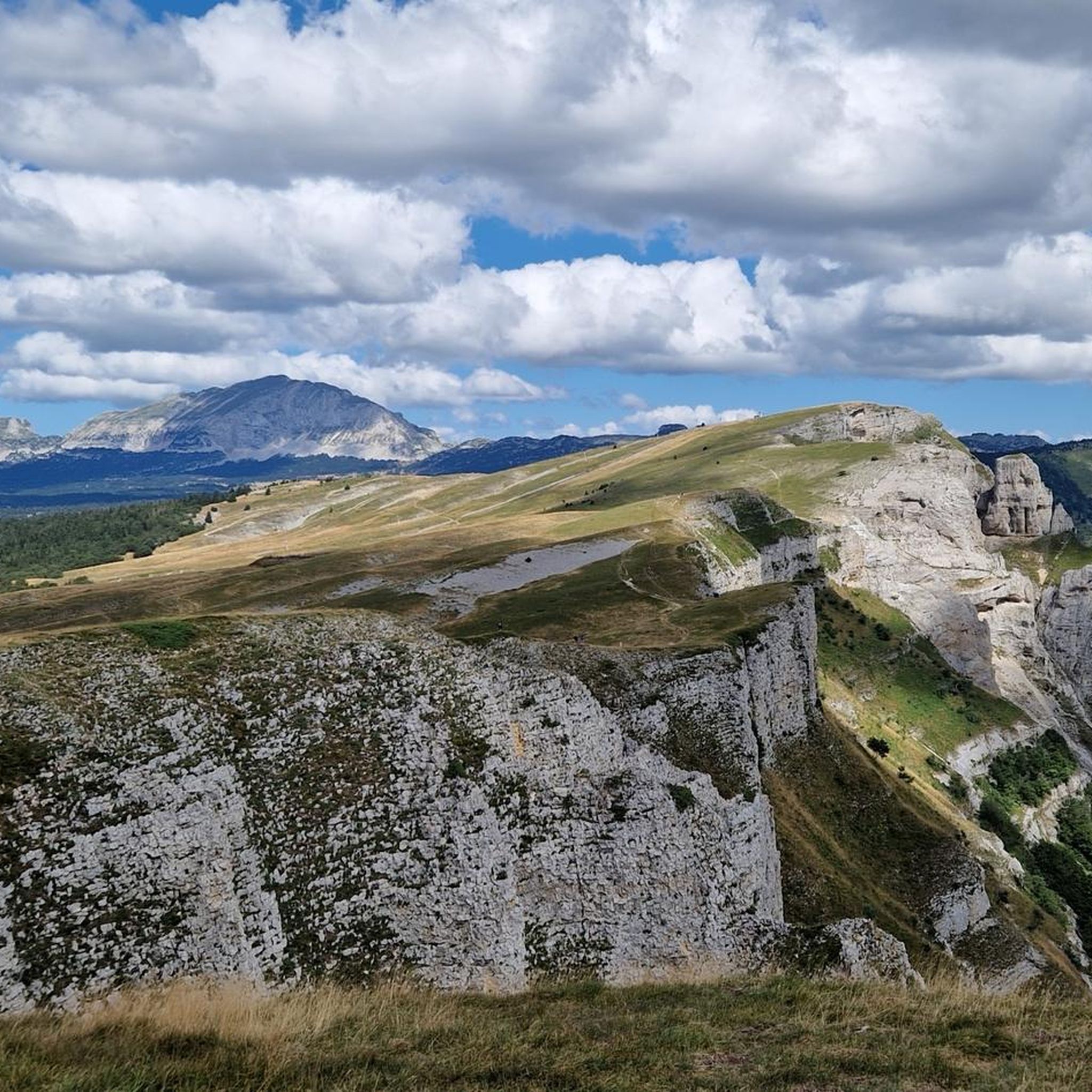
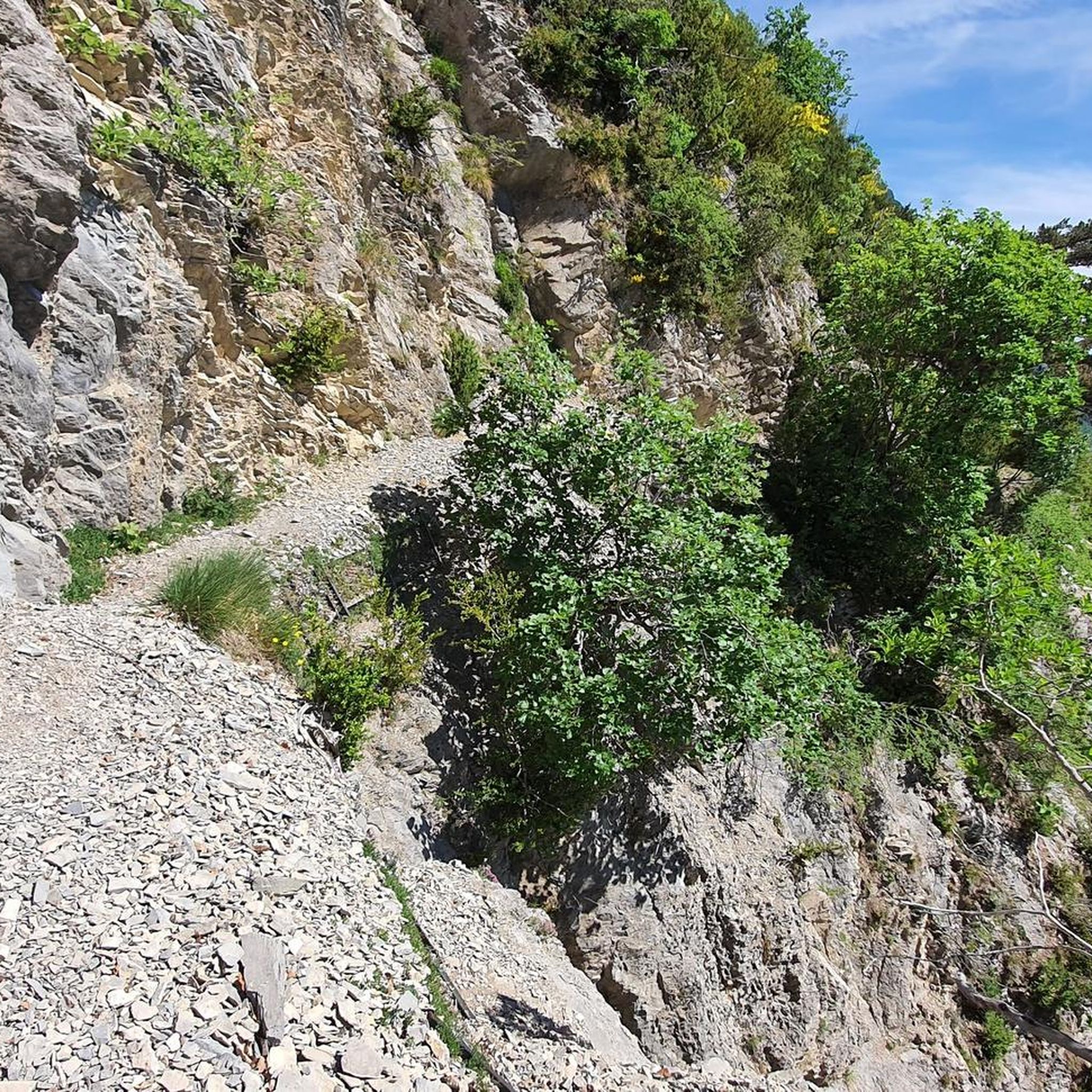
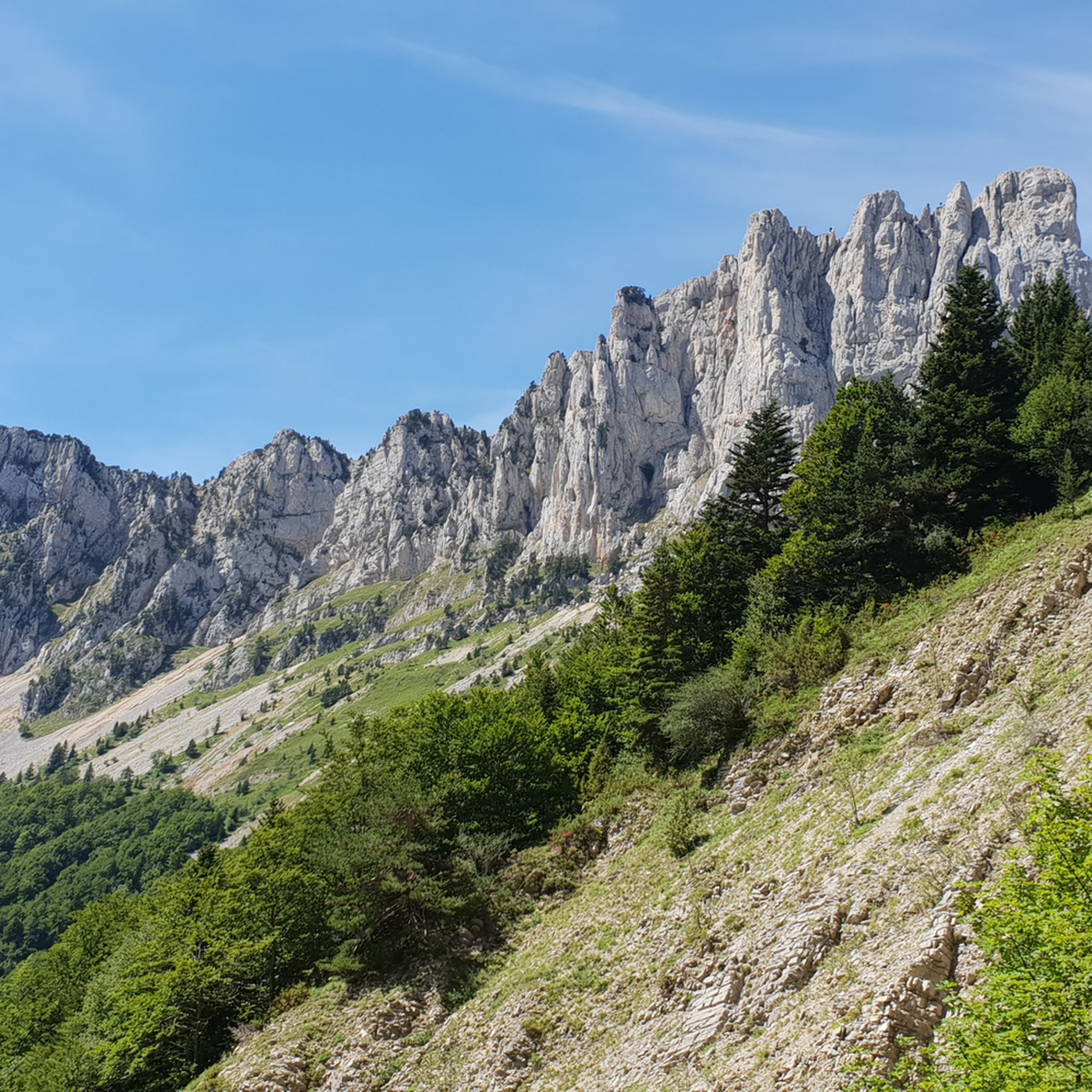
Gravel biking around Romeyer offers exploration within the Drôme department, nestled in the Auvergne-Rhône-Alpes region of France. The area is characterized by dramatic mountainous terrain, including the Montagne du Glandasse and Dent de Die, and is situated within the Vercors Regional Natural Park. Extensive forests cover much of the commune, providing numerous unpaved roads and tracks suitable for gravel cycling. The landscape features valleys like Meyrosse and a "mountain fringe climate."
Best gravel bike trails around Romeyer
- The most popular gravel bike trail is Justin's Cross – Old Town of Die loop from Die, a 12.2 miles (19.7 km) trail that takes 1 hour 56 minutes to complete. This route features significant elevation gain through varied terrain.
- Another top favourite among local gravel bikers is Die – The town center loop from Die, a difficult 35.6 miles (57.3 km) path. This route offers a challenging experience with over 3,500 feet of climbing.
- Local gravel bikers also love the View of the La Sure Valley – Route des Bouanes loop from Die, an 18.2 miles (29.3 km) trail leading through the scenic La Sure Valley, often completed in about 2 hours 17 minutes.
- Gravel biking around Romeyer is defined by mountainous landscapes, dense forests, and quiet rural roads. The network provides options for different ability levels, from demanding routes to more accessible paths.
- The routes in Romeyer are highly rated by the komoot community with an average score of 4.8 stars from over 30 reviews. More than 250 gravel bikers have used komoot to explore Romeyer's varied terrain.
Last updated: July 3, 2026
4.5
(4)
17
riders
31.1km
02:55
820m
820m
Hard gravel ride. Very good fitness required. Mostly paved surfaces. Suitable for all skill levels.
5.0
(1)
37
riders
57.2km
04:07
1,080m
1,080m
Hard gravel ride. Very good fitness required. Mostly paved surfaces. Suitable for all skill levels.

Sign up for free
4.9
(10)
28
riders
36.7km
02:33
650m
650m
Hard gravel ride. Very good fitness required. Mostly paved surfaces. Suitable for all skill levels.
4.6
(7)
25
riders
45.8km
03:10
820m
820m
Hard gravel ride. Very good fitness required. Mostly paved surfaces. Suitable for all skill levels.
5.0
(2)
13
riders
29.3km
02:17
590m
590m
Hard gravel ride. Very good fitness required. Mostly paved surfaces. Suitable for all skill levels.
Get access to more routes and recommendations from other explorers.
Sign up for free
Already have an account?
Our route recommendations are based on thousands of hikes, rides, and runs completed by other people on komoot.
Start today with a free account
Your next adventure awaits.
Login or Signup
Tips from the Community

Very well signposted, dozens of kilometers possible on foot, gravel, mountain biking, trail running, an exceptional mountain range to discover.
0
0
magnificent panorama, very pleasant walk
0
0
hours of walking in the vineyards
0
0
nice little walk to do with the family
0
0
Short walk from Die les fond-eaux
0
0
A beautiful page of history
0
0
Frequently Asked Questions
What kind of gravel biking experience can I expect around Romeyer?
Gravel biking around Romeyer offers a diverse experience within the Drôme department, characterized by dramatic mountainous terrain, dense forests, and quiet rural roads. Located within the Vercors Regional Natural Park, you'll find a mix of challenging climbs and scenic descents, with routes often featuring significant elevation gain. The area is ideal for those seeking a tranquil and scenically rich experience away from major traffic.
How many gravel bike trails are available in Romeyer?
There are over 30 gravel bike routes available around Romeyer, offering a wide range of options for exploration. The komoot community has extensively mapped and reviewed these trails, ensuring a variety of choices for different skill levels.
Are there gravel bike trails suitable for beginners in Romeyer?
While many routes around Romeyer are quite challenging, there is at least one easier gravel bike trail available. The region's diverse network also includes paths that are more accessible, though most routes feature notable elevation changes. It's always recommended to check the route details on komoot for specific difficulty ratings before heading out.
How challenging are the gravel bike routes in Romeyer?
The majority of gravel bike routes around Romeyer are classified as difficult, with 28 out of 32 routes falling into this category. These trails often involve significant climbing, such as the Die – The town center loop from Die which features over 3,500 feet of climbing. Riders should be prepared for varied terrain, including forest paths, winding country roads, and technical sections.
What is the best time of year for gravel biking in Romeyer?
Romeyer experiences a 'mountain fringe climate,' which means varied conditions throughout the year. Spring and autumn generally offer pleasant temperatures and vibrant scenery, making them ideal for gravel biking. Summer can be warm, especially at lower elevations, while winter may bring snow to higher mountain passes, potentially limiting access to some routes. Always check local weather forecasts before your ride.
Are there any loop trails for gravel biking near Romeyer?
Yes, many gravel bike routes around Romeyer are designed as loops, allowing you to start and finish in the same location. For example, the popular Die – Justin's Cross loop from Place de l'Horloge is a great option, covering nearly 19 miles (30 km) with significant elevation gain. Another option is the Col de Marignac – Route des Bouanes loop from Romeyer, a longer route offering diverse landscapes.
What do other gravel bikers enjoy the most about gravel biking in Romeyer?
The gravel biking experience in Romeyer is highly rated by the komoot community, with an average score of 4.7 stars from over 30 reviews. Riders often praise the stunning mountainous landscapes, the tranquility of the Vercors Regional Natural Park, and the challenging yet rewarding nature of the trails. The extensive network of unpaved roads and tracks, away from traffic, is also a frequently highlighted positive aspect.
What natural features or landmarks can I see along the gravel bike trails around Romeyer?
The routes around Romeyer offer breathtaking views of the Montagne du Glandasse and Dent de Die. You can also explore the serene Valley of Meyrosse and pass by the source of the Rays river. For specific points of interest, consider routes that take you near mountain passes like Col de Marignac or Col de l'Allimas, which offer panoramic vistas. The region's extensive forests and rural character provide a constant backdrop of natural beauty.
Are there any family-friendly gravel biking options near Romeyer?
While many routes in the immediate Romeyer area are quite demanding, the broader Vercors Regional Natural Park offers a range of options, including the 55 km Via Vercors, which is designed as a 'gentle travel' path. This route connects various villages and provides a secure and accessible way to experience the region's nature and heritage, potentially offering more family-friendly sections. Always check individual route details for suitability.
Is there parking available for gravel bikers in Romeyer?
As a rural commune, Romeyer and nearby towns like Die typically offer various parking options, especially in village centers or near trailheads. Given the dispersed nature of housing and the focus on outdoor activities, you should be able to find suitable parking. It's advisable to check local signage or use navigation apps for specific parking locations when planning your ride.
Can I access Romeyer's gravel trails using public transport?
Public transport access to Romeyer itself might be limited due to its rural location. However, nearby larger towns like Die, which serve as starting points for several gravel routes, are generally better connected by regional transport services. From Die, you can often cycle to the trailheads. For detailed public transport information, it's best to consult regional bus or train schedules for the Drôme department.
Can I bring my dog on the gravel bike trails around Romeyer?
The Vercors Regional Natural Park, where Romeyer is located, generally welcomes dogs on trails, provided they are kept on a leash to protect wildlife and ensure the safety of other users. Always be mindful of local regulations, especially in protected areas or near livestock. Ensure your dog is fit enough for the terrain and distance, and always carry enough water for both of you.
Are there cafes or accommodation options near the gravel bike trails in Romeyer?
Romeyer is a small, rural commune, so amenities like cafes and dedicated accommodation might be limited directly within the village. However, the nearby town of Die, which is a common starting point for many gravel routes, offers a wider range of cafes, restaurants, and accommodation options. You can plan your rides to pass through or end in Die for refreshment and lodging.
Most popular routes around Romeyer
Most popular attractions around Romeyer

Get inspired with the komoot mobile app


Explore more
Browse the best Gravel rides in other regions.
