Brington and Molesworth
Brington and Molesworth
The best gravel rides around Brington and Molesworth
4.7
(6)
25
riders
3
rides
Gravel biking around Brington and Molesworth offers a network of trails through the gently rolling landscapes of the English countryside. The region is characterized by river valleys, open fields, and woodlands, providing varied terrain for gravel cyclists. Routes often follow established paths and bridleways, connecting rural villages and natural features. The area's topography includes minor elevation changes, making it accessible for a range of abilities.
Best gravel bike trails around Brington and Molesworth
- The most popular gravel bike trail is…
Last updated: May 22, 2026
4.4
(5)
16
riders
24.9km
01:18
100m
100m
Easy gravel ride. Great for any fitness level. Mostly paved surfaces. Suitable for all skill levels.
4
riders
34.5km
02:12
180m
180m
Moderate gravel ride. Good fitness required. Mostly paved surfaces. Suitable for all skill levels.

Sign up for free
3
riders
18.4km
01:19
130m
130m
Easy gravel ride. Great for any fitness level. Mostly paved surfaces. Suitable for all skill levels.
5.0
(1)
2
riders
23.5km
01:33
110m
110m
Easy gravel ride. Great for any fitness level. Mostly paved surfaces. Suitable for all skill levels.
Our route recommendations are based on thousands of hikes, rides, and runs completed by other people on komoot.
Start today with a free account
Your next adventure awaits.
Login or Signup



Tips from the Community

Tea and coffee also available as well as usual beers. Toilets excellent and outside tables and safe places for bikes.
0
0

A well stocked shop and pub which is the perfect place for a cycle pitstop. No worries about queues, locking up bike etc.... Bench seating outside the pub with some shade from the trees. Minimal detour even if you're on the lap of the reservoir
1
0

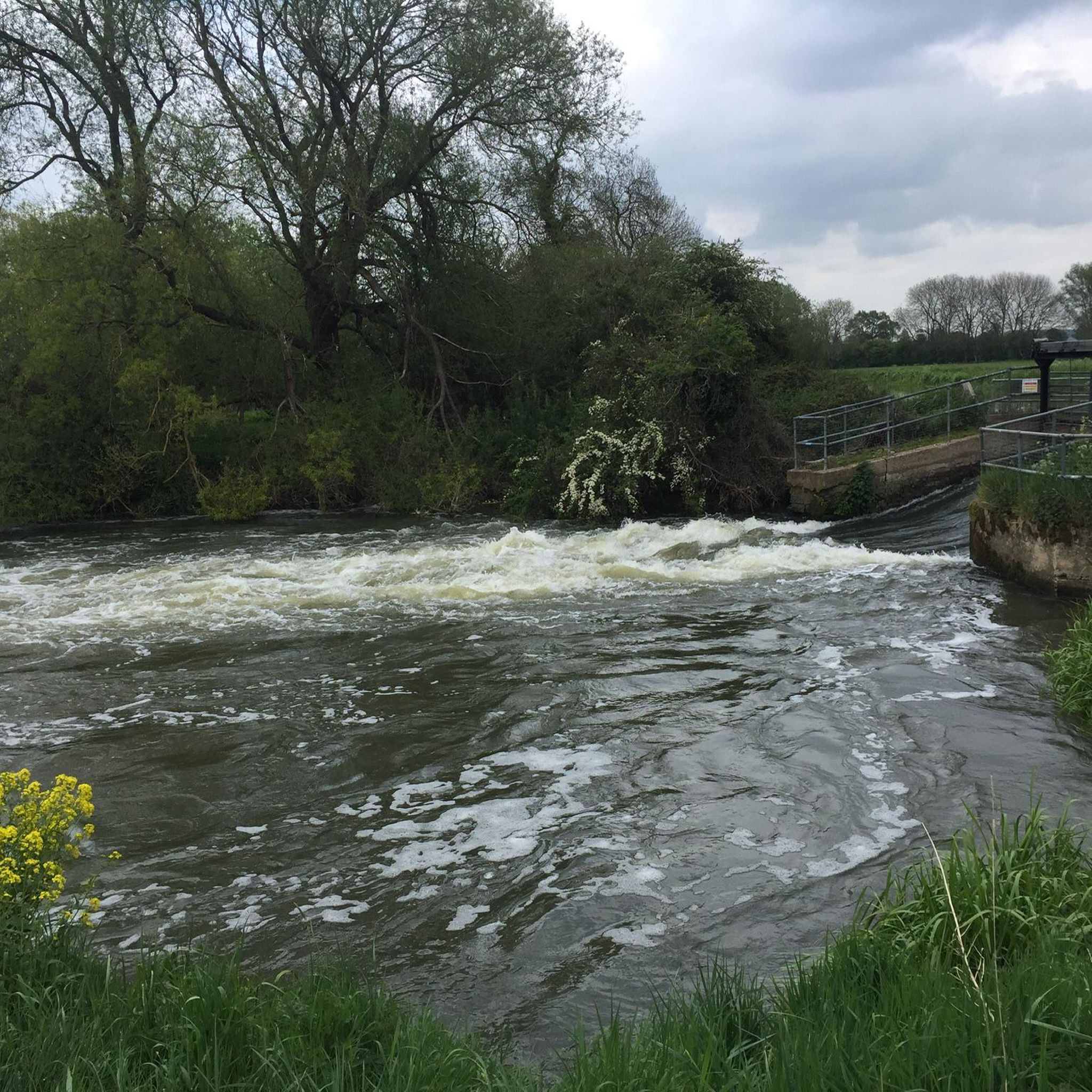
Woodford Lock is located on the River Nene in Northamptonshire. The lock is set in a picturesque rural landscape surrounded by lush countryside. It's one of several locks along the River Nene, allowing boats to navigate the varying water levels of the river.
1
0

Don't follow Komoot strictly (like I did) 😉 - obey the signs from farmer/landowner & NCN signs - small mistakes can be forgiven, I suppose, when we new to the area.
0
0

The cycle path along the top of the dam is wide and flat and gives great views across the reservoir. Reach it from the Visitor Centre at the northern end although access at the southern end is trickier as you have to squeeze through a narrow gap next to a locked gate by the main road.
0
0
Pub-in-a-shed. There’s a community-run village shop next to it.
0
0
Excellent ride not to be missed. Advice. Take care can be a bit slidey but should be no problems for most experience levels
0
0
Great off road section good surfaces although take it easy if not experienced as there are a few pot holes.
0
0
Frequently Asked Questions
How many gravel bike trails are there in Brington and Molesworth?
The Brington and Molesworth area offers a selection of gravel bike trails. Our guide currently features 4 routes, ranging from easy to moderate difficulty, providing options for various skill levels.
What is the best time of year for gravel biking in Brington and Molesworth?
The English countryside around Brington and Molesworth is generally pleasant for gravel biking from spring through autumn. During these seasons, you can expect milder weather and drier trails. Winter conditions can make some paths muddy or slippery, so it's advisable to check local weather and trail conditions before heading out.
Are there easy gravel bike routes suitable for beginners or families?
Yes, there are several easy gravel bike routes perfect for beginners or families. For instance, the River Nene Path – View of Woodford Lock loop from Thrapston is an easy 15.5-mile trail that follows the scenic River Nene, offering gentle terrain suitable for a relaxed ride. Another easy option is the Grafham Water – Grafham Water loop from Grafham, which is 14.6 miles long.
Are there more challenging gravel routes for experienced riders?
While the Brington and Molesworth area is characterized by gently rolling landscapes, offering mostly easy to moderate routes, experienced riders can find longer excursions. The Hail Weston Ford – Grafham Water loop from Easton is a moderate 21.4-mile path that explores the area around Grafham Water, providing a good distance and varied terrain.
What kind of terrain can I expect on the gravel bike trails in Brington and Molesworth?
The terrain in Brington and Molesworth is diverse, featuring river valleys, open fields, and woodlands. Routes often follow established paths and bridleways, with minor elevation changes. You'll encounter a mix of surfaces typical for gravel biking, including unpaved tracks, compacted earth, and some paved sections connecting rural villages.
What interesting places can I see along the gravel bike trails?
Many routes pass by or near interesting local spots. For example, you might encounter Stanwick Lakes, a nature reserve with walking trails and wildlife, or the charming Kimbolton High Street. The area also features picturesque villages and views of the River Nene.
Are there any cafes or shops along the routes for refreshments?
Yes, some routes offer opportunities for refreshments. For instance, you might find local cafes like Beans, Oundle or the Titchmarsh Village Shop, which can be convenient stops during your ride. It's always a good idea to check opening times before you set out.
Can I find circular gravel bike routes in the area?
Yes, many of the gravel bike routes in Brington and Molesworth are designed as loops, allowing you to start and finish at the same point. Examples include the Lavender Field Path – Fermyn Woods loop from Titchmarsh NR and the Hail Weston Ford – Grafham Water loop from Easton.
What are the typical distances and durations for gravel rides here?
Gravel rides in Brington and Molesworth vary in length and duration. You can find routes like the Lavender Field Path – Fermyn Woods loop from Titchmarsh NR, which is about 11.5 miles (18.4 km) and takes around 1 hour 18 minutes. Longer options, such as the Hail Weston Ford – Grafham Water loop from Easton, cover 21.4 miles (34.5 km) and can take over 2 hours.
What do other gravel bikers say about the trails in Brington and Molesworth?
The gravel bike trails in Brington and Molesworth are highly regarded by the komoot community, with an average rating of 4.7 stars from over 6 reviews. Many of the 25+ gravel bikers who have explored the area praise the scenic river paths, open fields, and tranquil woodlands that define the region's cycling experience.
Are there gravel cycling routes with parking available?
Many gravel cycling routes in the Brington and Molesworth area start from or pass through villages and towns where public parking is typically available. For specific routes, it's recommended to check the tour details on komoot for suggested starting points and parking information.
Most popular routes around Brington and Molesworth
Most popular attractions around Brington and Molesworth

Get inspired with the komoot mobile app


Explore more
Browse the best Gravel rides in other regions.
