The best gravel rides around Calusco D'Adda
4.3
(212)
1,815
riders
61
rides
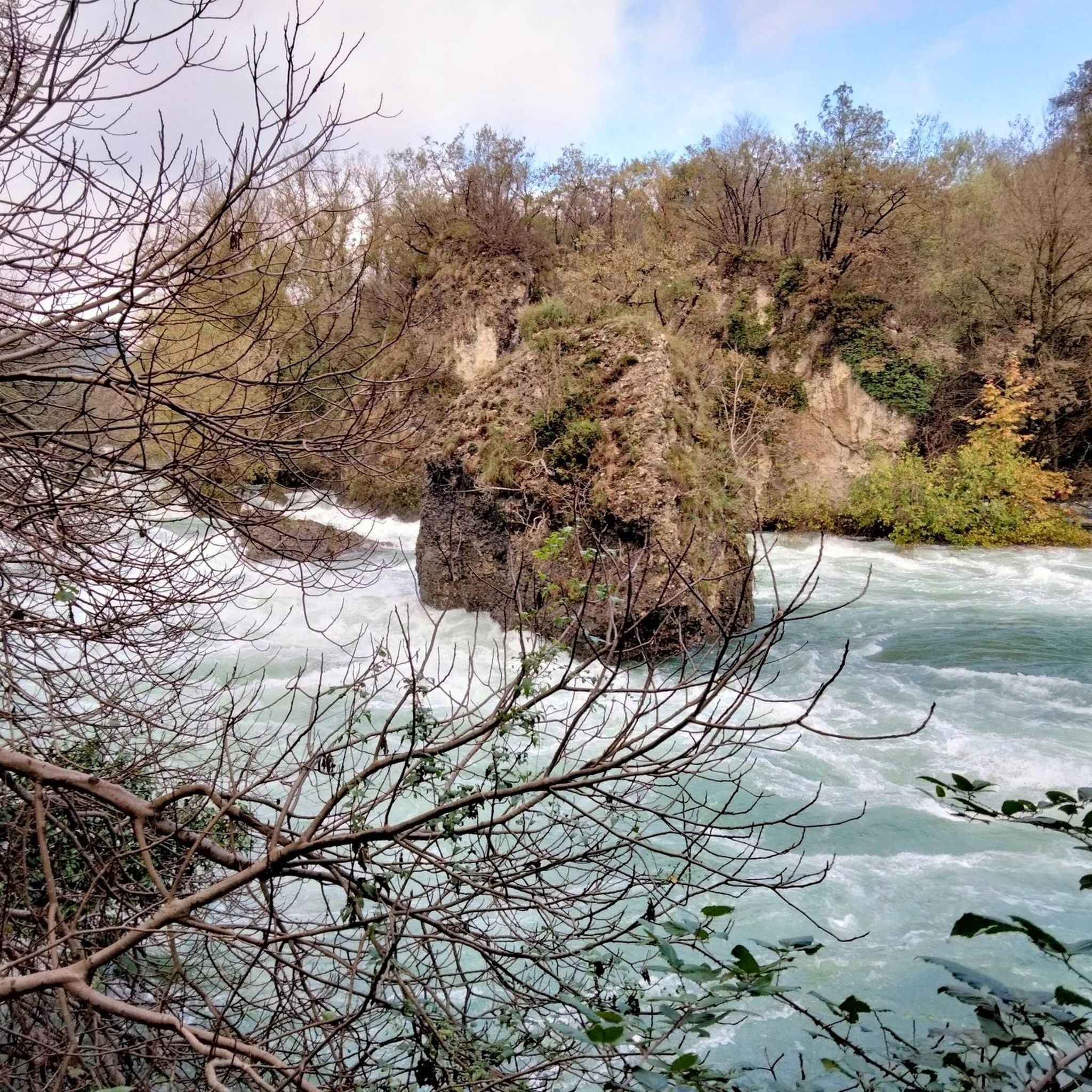
Gravel biking around Calusco D'Adda features routes along the Adda River and various canals, including the Martesana and Muzza. The terrain primarily consists of riverside paths and cycle routes, offering a mix of flat sections and gradual ascents. The region is characterized by its waterways, agricultural landscapes, and occasional historical points like water wheels and castles.
Best gravel bike trails around Calusco D'Adda
- The most popular gravel bike trail is View of the Adda River – Lecco Lakeside Promenade loop from Paderno-Robbiate, a 31.8 miles (51.2 km) trail that takes 4 hours 8 minutes to complete. This moderate route offers views of the Adda River and follows the Lecco Lakeside Promenade.
- Another top favourite among local gravel bikers is Martesana Canal – Muzza Canal Riverside Path loop from Paderno-Robbiate, a difficult 74.3 miles (119.6 km) path. This extensive route explores the riverside paths along the Martesana and Muzza Canals.
- Local gravel bikers also love the Groppello Water Wheel – Martesana Cycle Path loop from Paderno-Robbiate, a 50.4 miles (81.1 km) trail leading through canal-side landscapes and past the Groppello Water Wheel, often completed in about 5 hours 28 minutes.
- Gravel biking around Calusco D'Adda is defined by riverbanks, canal paths, and cycle routes. The network offers options for various ability levels, from moderate to more challenging routes.
- The routes in Calusco D'Adda are highly rated by the komoot community with an average score of 4.4 stars from over 250 reviews. More than 2,400 gravel bikers have used komoot to explore Calusco D'Adda's varied terrain.
Last updated: May 28, 2026
4.3
(40)
252
riders
54.6km
03:12
430m
430m
Moderate gravel ride. Good fitness required. Mostly paved surfaces. Suitable for all skill levels.
4.6
(22)
222
riders
54.5km
03:35
400m
400m
Moderate gravel ride. Good fitness required. Mostly paved surfaces. Suitable for all skill levels.

Sign up for free
4.5
(68)
355
riders
Moderate gravel ride. Good fitness required. Mostly paved surfaces. Suitable for all skill levels.
3.0
(1)
34
riders
119km
07:13
420m
420m
Hard gravel ride. Very good fitness required. Mostly paved surfaces. Suitable for all skill levels.
4.3
(3)
25
riders
73.6km
05:19
990m
990m
Hard gravel ride. Very good fitness required. Mostly paved surfaces. Suitable for all skill levels.
Get access to more routes and recommendations from other explorers.
Sign up for free
Already have an account?
Our route recommendations are based on thousands of hikes, rides, and runs completed by other people on komoot.
Start today with a free account
Your next adventure awaits.
Login or Signup
Tips from the Community

Sirtori is a charming hilltop village located in the heart of the alta Brianza lecchese, famous for its historic views, its paths immersed in greenery, and the majestic Church of Saints Nabore and Felice, which dominates the settlement from its elevated position. The territory offers a perfect blend of sacred architecture, ancient noble residences, and a dense network of hiking and cycling trails.
0
0

The Naviglio della Martesana, definitively completed in 1496 under the leadership of Ludovico il Moro, flows from Trezzo sull’Adda to Milan for a total length of 38 km. The route runs alongside the ancient Roman road (the current SS 11 padana superiore) which crossed the Adda with two branches: at Vaprio and Cassano. The irrigation of the lands located above the spring belt was for a long time the predominant use of the canal, so much so that initially navigation was limited to two days a week; concurrently with the improvement of the agricultural structure thanks to irrigation, a notable flourishing of stately homes occurred in the Baroque era, aimed at enjoying the convenience of travel on water and controlling the owned lands.
0
0
The Naviglio della Martesana, definitively completed in 1496 under the guidance of Ludovico il Moro, flows from Trezzo sull’Adda to Milan for a total length of 38 km. The route runs alongside the ancient Roman road (the current SS 11 padana superiore) which crossed the Adda with two branches: at Vaprio and Cassano. Irrigation of the land located above the spring belt was for a long time the predominant use of the canal, so much so that initially navigation was limited to two days a week; concurrently with the improvement of the agricultural structure thanks to irrigation, a notable flourishing of stately villas occurred in the Baroque era, intended to enjoy the convenience of travel on water and to control owned lands.
1
0
The Naviglio della Martesana, definitively completed in 1496 under the guidance of Ludovico il Moro, flows from Trezzo sull’Adda to Milan for a total length of 38 km. The route runs alongside the ancient Roman road (the current SS 11 padana superiore) which crossed the Adda with two branches: at Vaprio and at Cassano. The irrigation of the lands located above the spring belt was for a long time the prevalent use of the canal, so much so that initially navigation was limited to two days a week; concurrently with the improvement of the agrarian structure thanks to irrigation, a notable flourishing of stately villas emerged in the Baroque era, aimed at enjoying the convenience of travel on water and controlling the lands of property.
1
0
Naviglio della Martesana is perhaps the least known of the ancient artificial canals connecting Milan to the great Lombard rivers. It originates from the Adda in Concesa, a hamlet of Trezzo d’Adda, crosses the Martesana sub-region, northeast of the provincial capital, and once in the city, it plunges underground beneath Via Melchiorre Gioia, at the height of Cassina de’ Pomm. It measures approximately 38 km in length, with a width varying from 9 to 18 meters. However, once upon a time, the Naviglio della Martesana continued in the open air all the way to the center, where a lock system centered on the Conca dell’Incoronata connected it to the short Naviglio di S. Marco and the urban network of the Navigli. The lock was inaugurated in 1496, utilizing lock gates designed by Leonardo da Vinci. The canal had been opened in 1471, under Francesco Sforza. By connecting it to the other Navigli, Leonardo laid the foundations for realizing a dream of the Sforzas: to travel by water from the Ticino, and therefore from Lake Maggiore, all the way to the Adda.
1
0
The route runs alongside the Naviglio della Martesana, perhaps the least known among the ancient artificial canals connecting Milan to the great Lombard rivers. It originates from the Adda river in Concesa, a hamlet of Trezzo d’Adda, crosses the Martesana sub-region, north-east of the provincial capital, and once in the city, it plunges underground beneath via Melchiorre Gioia, near Cassina de’ Pomm. It measures approximately 38 km in length, with a width varying from 9 to 18 meters. However, at one time, the Naviglio della Martesana continued in the open air right into the center, where a system of locks centered on the Conca dell’Incoronata connected it to the short Naviglio di S. Marco and the urban ring of the Navigli. The lock was inaugurated in 1496, utilizing lock gates designed by Leonardo da Vinci. The canal had been opened in 1471, under Francesco Sforza. By connecting it to the other Navigli,
3
0
The Naviglio della Martesana, initially known as Naviglio Piccolo, is one of the Milanese canals that connects Milan with the course of the Adda river through the municipalities of Martesana. Commissioned in the 15th century by Francesco Sforza, it was used for irrigating the countryside but also represented the ambitious project of connecting Milan with Lake Como and thus with the Alps and Ticino. The Naviglio della Martesana is a place rich in history and beauty, a heritage for everyone that, however, today is still little known and protected. Along the Naviglio runs a rather busy cycle path, which allows you to admire the landscape and cultural beauties, such as the rich flora, fauna, or the numerous historic villas, including the Renaissance Villa Melzi d’Eril in Vaprio d’Adda.
1
0
The Naviglio Martesana cycle path is a 30-35 km cycle and pedestrian route that connects Milan (Cassina de' Pomm/via Melchiorre Gioia area) to Trezzo sull'Adda, running alongside the homonymous canal. It is a predominantly asphalted, flat, easy route suitable for everyone, passing through parks, rural areas, and historic noble villas from the 17th-18th centuries.
0
0
Frequently Asked Questions
How many gravel bike trails are available around Calusco D'Adda?
There are over 90 gravel bike trails available around Calusco D'Adda, offering a wide range of options for different skill levels and preferences.
What is the best time of year for gravel biking in Calusco D'Adda?
The best time for gravel biking in Calusco D'Adda is generally from spring through autumn. The mild weather during these seasons makes for pleasant riding conditions along the riverside paths and canals. Winter can be ridden, but be prepared for cooler temperatures and potentially wet or muddy sections, especially after rain.
Are there easy gravel bike trails suitable for beginners in Calusco D'Adda?
Yes, Calusco D'Adda offers several easy gravel bike trails perfect for beginners. These routes typically follow flat riverside paths and cycle routes. One good option is the View of the Adda River – Brivio Castle loop from Terno, which is a moderate 34.8 km route with gentle elevation changes.
Are there challenging gravel bike routes for experienced riders?
Absolutely. For experienced riders seeking a challenge, there are several difficult routes. The Martesana Canal – Muzza Canal Riverside Path loop from Paderno-Robbiate is a demanding 119.6 km route that explores extensive riverside paths, offering a significant endurance test.
What are the typical distances and elevations of gravel bike trails near Calusco D'Adda?
Gravel bike trails near Calusco D'Adda vary significantly in length and elevation. You can find routes ranging from around 30 km to over 100 km. Elevation gains are generally moderate, often staying below 500 meters, as many routes follow riverbanks and canals, providing a mix of flat sections and gradual ascents.
What kind of scenery can I expect on gravel bike trails around Calusco D'Adda?
The gravel bike trails around Calusco D'Adda primarily feature picturesque riverside landscapes along the Adda River and various canals like the Martesana and Muzza. You'll pass through agricultural areas, charming villages, and occasionally historical points such as water wheels. Many routes offer pleasant views of the waterways and surrounding nature.
Are there circular gravel bike routes available?
Yes, many of the gravel bike routes in the area are designed as loops, allowing you to start and end at the same point. For example, the Groppello Water Wheel – Martesana Cycle Path loop from Paderno-Robbiate is an 81.1 km circular trail that takes you past interesting canal-side features.
What interesting landmarks or natural attractions can I see along the gravel bike trails?
Along the gravel bike trails, you can discover several interesting points. The Brivio Bridge – Brivio Castle loop from Terno passes by the historic Brivio Castle. You might also encounter natural highlights such as Lake Sartirana or the Aberone Oasis, which are part of the region's diverse landscape.
What do other gravel bikers enjoy most about gravel biking in Calusco D'Adda?
The area is highly rated by the komoot community, with an average score of 4.4 stars from over 250 reviews. Reviewers often praise the well-maintained riverside paths, the diverse scenery, and the variety of routes suitable for different skill levels, making it a popular destination for gravel biking.
Are there any viewpoints along the gravel bike trails in Calusco D'Adda?
While the terrain is generally gentle, many routes offer scenic viewpoints, particularly along the Adda River. For broader panoramic views, you might consider routes that venture slightly towards the nearby hills, where highlights like Cypress Peak or Monte Linzone Summit offer elevated perspectives of the region.
Is public transport available to access gravel bike trails in Calusco D'Adda?
Calusco D'Adda is accessible by regional train services, which can be a convenient way to reach the starting points of many trails. Check local train schedules for stations in or near Calusco D'Adda, keeping in mind that bike transport policies may vary.
Are there cafes or refreshment stops along the gravel bike trails?
Many of the gravel bike trails pass through or near small towns and villages along the Adda River and canals. These often provide opportunities to stop at local cafes, bakeries, or restaurants for refreshments and a break during your ride. It's always a good idea to check your route in advance for specific amenities.
Most popular routes around Calusco D'Adda
Most popular attractions around Calusco D'Adda

Get inspired with the komoot mobile app


Explore more
Browse the best Gravel rides in other regions.
