The best gravel rides around Scaldasole
4.0
(5)
19
riders
9
rides
Gravel biking around Scaldasole offers routes through the agricultural plains of Lomellina, characterized by rice fields, corn, and poplar trees. The terrain is generally flat or gently rolling, providing unpaved roads and pathways suitable for gravel cycling. North of Scaldasole, a natural reserve features one of Lomellina's few forested areas, offering diverse natural paths through black locusts, oaks, and white poplars. This network of trails provides a blend of rural landscapes and natural environments for gravel bikers.
Best gravel bike…
Last updated: July 5, 2026
5.0
(1)
3
riders
Moderate gravel ride. Good fitness required. Mostly paved surfaces. Suitable for all skill levels.
2
riders
Moderate gravel ride. Good fitness required. Mostly paved surfaces. Suitable for all skill levels.

Sign up for free
3
riders
Easy gravel ride. Great for any fitness level. Mostly paved surfaces. Suitable for all skill levels.
3.0
(1)
2
riders
38.0km
02:19
70m
70m
Moderate gravel ride. Good fitness required. Mostly paved surfaces. Suitable for all skill levels.
2
riders
95.6km
05:49
230m
230m
Hard gravel ride. Very good fitness required. Mostly paved surfaces. Suitable for all skill levels.
Get access to more routes and recommendations from other explorers.
Sign up for free
Already have an account?
Our route recommendations are based on thousands of hikes, rides, and runs completed by other people on komoot.
Start today with a free account
Your next adventure awaits.
Login or Signup

Tips from the Community

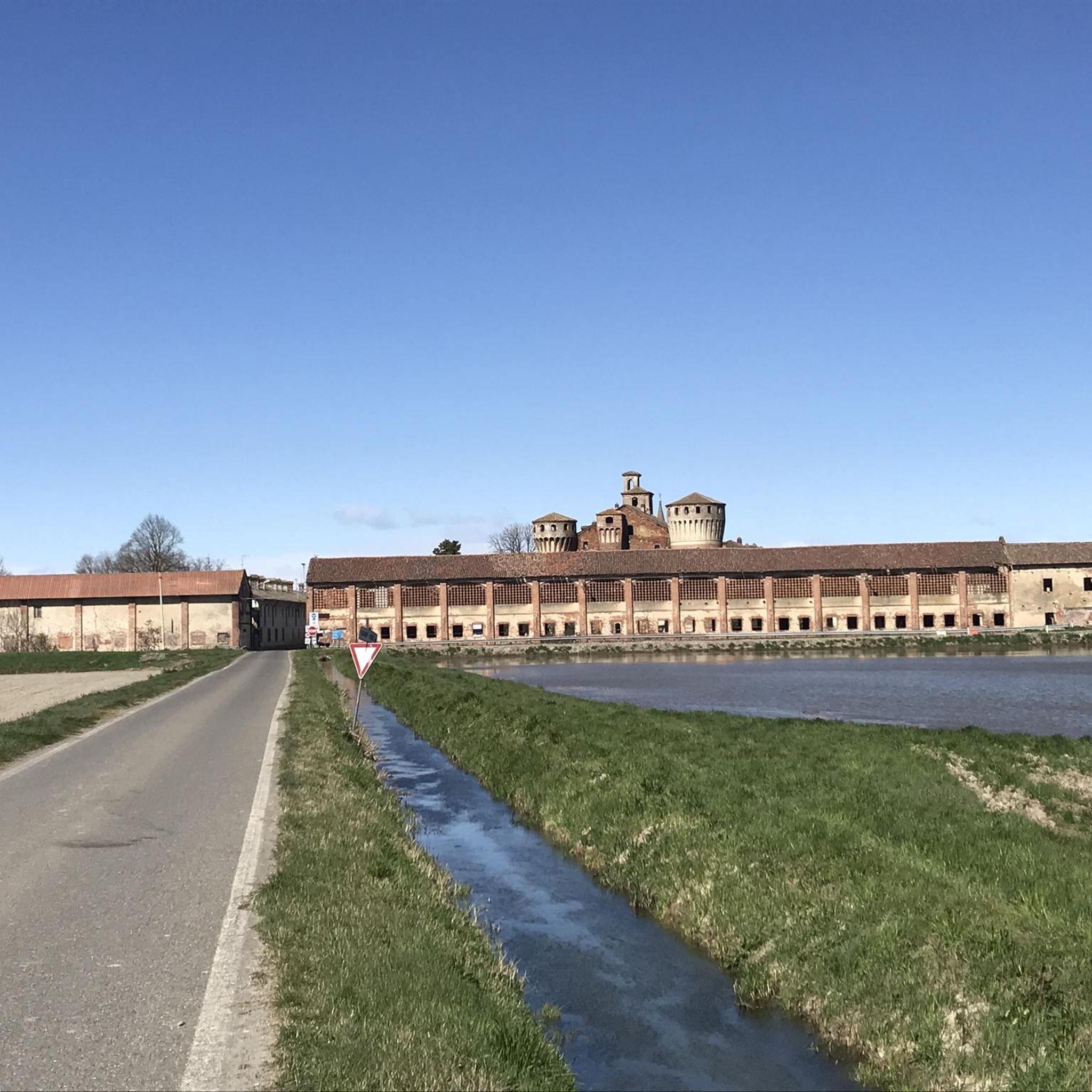
The Church of San Siro is the main place of worship in the municipality of the same name in the province of Pavia, belonging to the Diocese of Vigevano. Built between 1729 and 1732 on the remains of a 13th-century chapel, it features an elegant Greek cross plan in the late Baroque style, enriched by 18th-century canvases by the painter Carlo Antonio Bianchi from Pavia.
0
0

The Covered Bridge of Pavia (also known as Ponte Vecchio) is the city's symbolic monument. It crosses the Ticino River and directly connects the historic center with the picturesque district of Borgo Ticino, famous for its historic colorful houses and the ancient tradition of washerwomen and fishermen.
0
0
How nice a fountain in a shady area. The cyclist's delight.
0
0

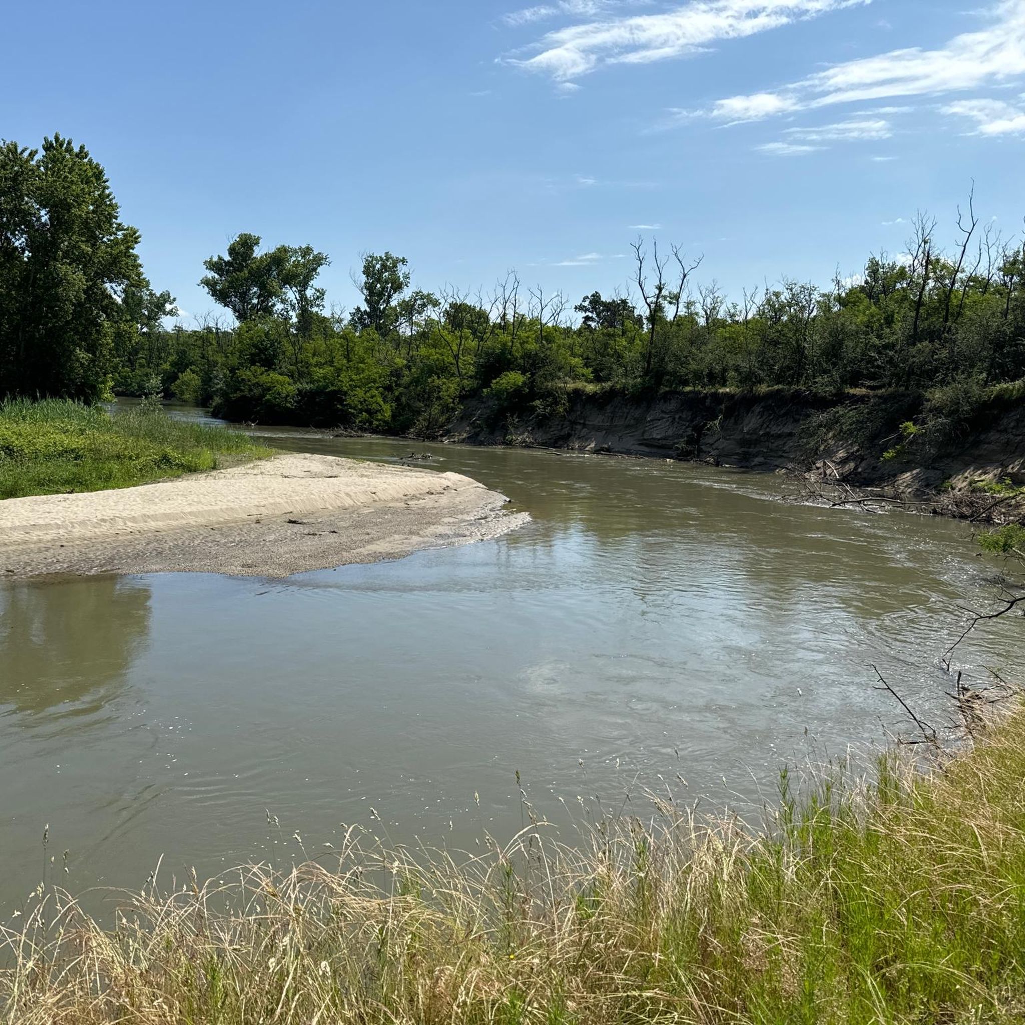
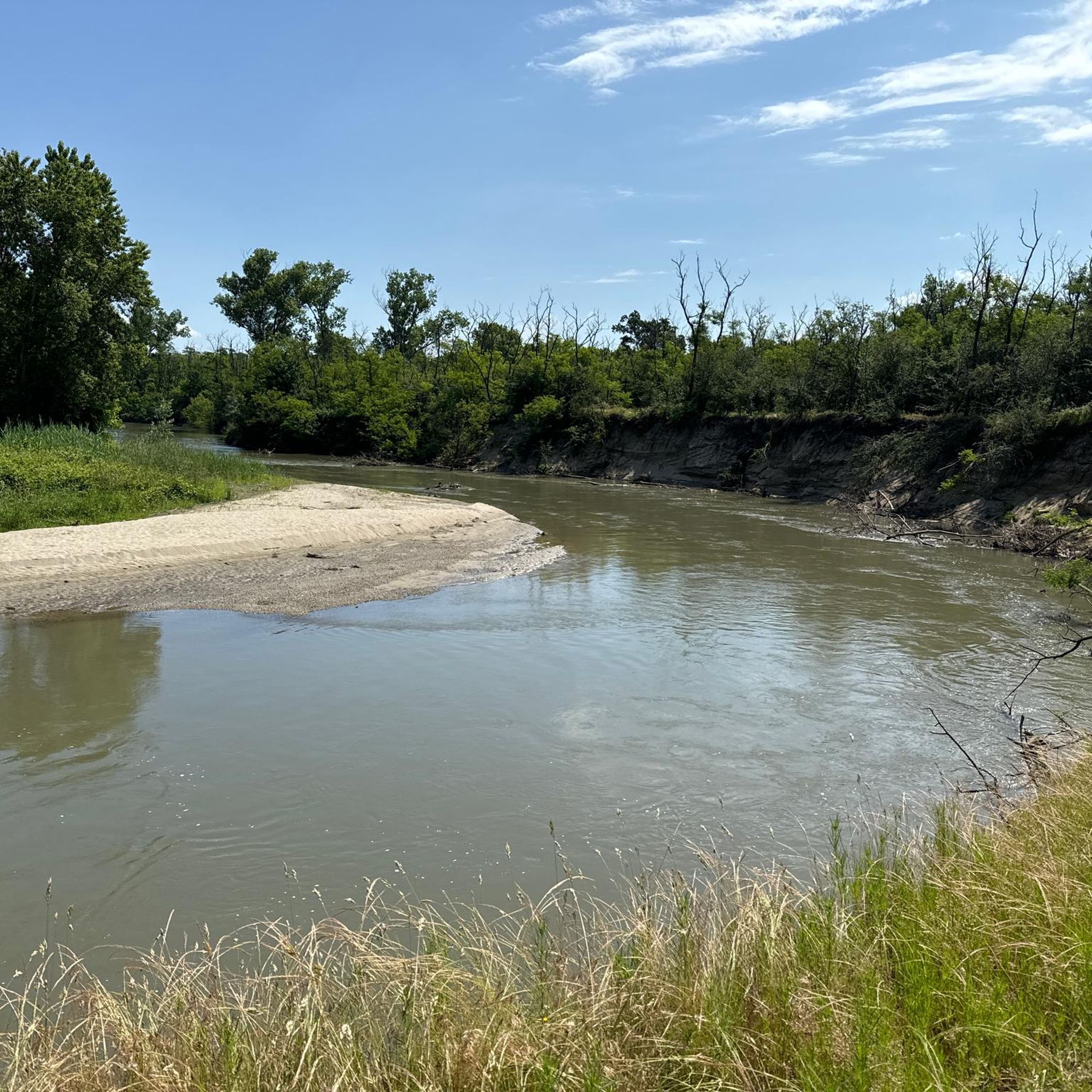
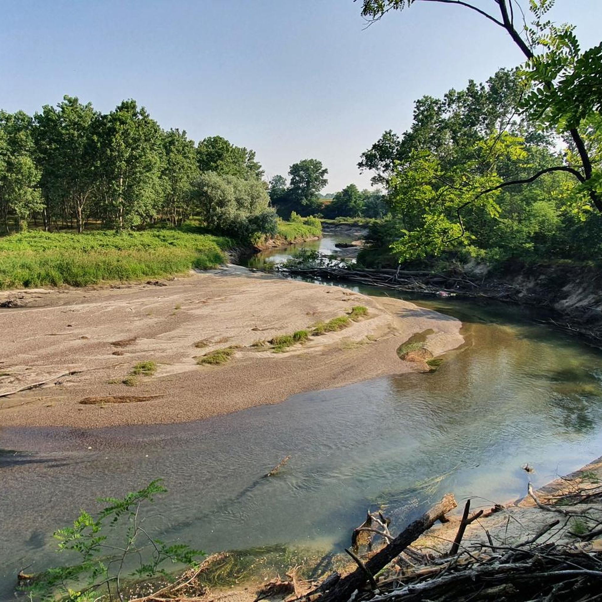
The trail runs in a very elevated position, on the edge of a plain that surrounds the outer part of a large bend of the Ticino River. The plain ends abruptly in a steep overhanging cliff caused by the erosion of the water at its base. The trail runs through greenery and flowers, in a panoramic position from which you can admire the branch from which it comes, and the one from which the water flows into the bend that flows at your feet. The large gravelly esplanades on the opposite bank inside the bend of the river are also veiled.
0
0

Madonna della Bozzola, sanctuary on the Via Francigena
1
0

This beautiful square is simply called Piazza Grande by the locals: it is the lively centre of the city and a shopping district. It is surrounded by arcades full of cafés and shops. On the south side, towards the Duomo, stands the Broletto, the 12th century former town hall; behind one of the windows of the old building watches over the beloved statue of the Madonna di Piazza Grande (1604)
5
0

It would be a spectacular route but unfortunately lately, given the adverse weather, it is practically impassable along certain sections, and above all both the bridges and the fords are missing, which are now impassable. A big shame!
0
0

Frequently Asked Questions
How many gravel bike trails are available around Scaldasole?
There are currently 13 gravel bike routes documented around Scaldasole on komoot. These routes offer a mix of moderate and difficult options, catering to various skill levels.
What kind of terrain can I expect on gravel bike trails in Scaldasole?
The gravel bike trails around Scaldasole primarily traverse the agricultural plains of Lomellina, featuring extensive rice fields, corn, and poplar trees. You'll find numerous unpaved roads and pathways through rural settings. North of Scaldasole, a natural reserve offers more diverse natural paths through forested areas with black locusts, oaks, and white poplars.
Are there any family-friendly gravel biking options in Scaldasole?
While most routes are rated moderate to difficult, the generally flat or gently rolling terrain of the agricultural plains can be suitable for families with some cycling experience. For a moderate option, consider the Bereguardo Pontoon Bridge – Bereguardo Pontoon Bridge loop from Sairano, which is 48.5 km long and leads through agricultural plains.
What are some notable landmarks or attractions I can see while gravel biking near Scaldasole?
Beyond the scenic agricultural landscapes, you can encounter historical and natural points of interest. The historic Castello di Scaldasole is a prominent attraction. Other highlights in the broader area include the Sanctuary of Madonna della Bozzola, the Naviglio Langosco, and the Via Francigena Path Near Pavia. You might also spot Stork Nests in Cascina Venara, Zerbolò, or cross the Ponte della Gerola.
Are there any circular gravel bike routes around Scaldasole?
Yes, many of the gravel routes around Scaldasole are designed as loops. For example, the View of the bend in the Ticino River – Ponte della Conca loop from Garlasco is a challenging 110.5 km circular route exploring the river landscape. Another option is the Bereguardo Pontoon Bridge – Bereguardo Pontoon Bridge loop from Garlasco, a difficult 71.2 km path featuring the notable pontoon bridge.
What is the difficulty level of gravel biking trails in Scaldasole?
The gravel biking trails in Scaldasole are predominantly rated as moderate to difficult. There are 9 moderate routes and 4 difficult routes, offering challenges for experienced gravel bikers. The terrain is generally flat or gently rolling, but longer distances and varied surfaces contribute to the difficulty ratings.
What do other gravel bikers say about the trails in Scaldasole?
The routes in Scaldasole are highly rated by the komoot community, with an average score of 4.0 stars from several reviews. More than 40 gravel bikers have used komoot to explore the varied terrain, often praising the blend of rural landscapes and natural environments.
Are there any routes that feature river views or water bodies?
Yes, several routes incorporate river landscapes. The View of the bend in the Ticino River – Ponte della Conca loop from Garlasco specifically highlights a bend in the Ticino River. Additionally, the region's natural environment includes 'Emilio' Lake, which adds to the serene natural setting, though it's not directly a biking feature.
Can I find routes that go through forested areas?
Yes, north of Scaldasole, towards Valeggio, there is a natural reserve that is one of the few forested areas in Lomellina. This reserve features diverse natural paths through black locusts, pedunculate oaks, white poplars, and other shrubs, offering a different cycling experience compared to the open fields.
What is the longest gravel bike route available in the Scaldasole area?
The longest gravel bike route in the area is the View of the bend in the Ticino River – Ponte della Conca loop from Garlasco, which spans 110.5 km (68.7 miles) and typically takes around 6 hours and 51 minutes to complete.
Are there any gravel routes that feature bridges or unique crossings?
Yes, the area is known for routes that include interesting bridge crossings. The Bereguardo Pontoon Bridge – Bereguardo Pontoon Bridge loop from Garlasco and the Wooden Bridge over the Ticino – Bereguardo Pontoon Bridge loop from Garlasco both feature notable bridges, offering unique points of interest along your ride.
What are the typical durations for gravel bike rides in Scaldasole?
The durations vary significantly based on the route's length and difficulty. For instance, a moderate route like the Bereguardo Pontoon Bridge – Bereguardo Pontoon Bridge loop from Sairano can be completed in about 3 hours 17 minutes, while a difficult, longer route such as the Bereguardo Pontoon Bridge – Bereguardo Pontoon Bridge loop from Tromello might take around 4 hours 28 minutes.
Most popular routes around Scaldasole
Most popular attractions around Scaldasole

Get inspired with the komoot mobile app


Explore more
Browse the best Gravel rides in other regions.
