The best gravel rides around Temù
4.7
(24)
282
riders
14
rides
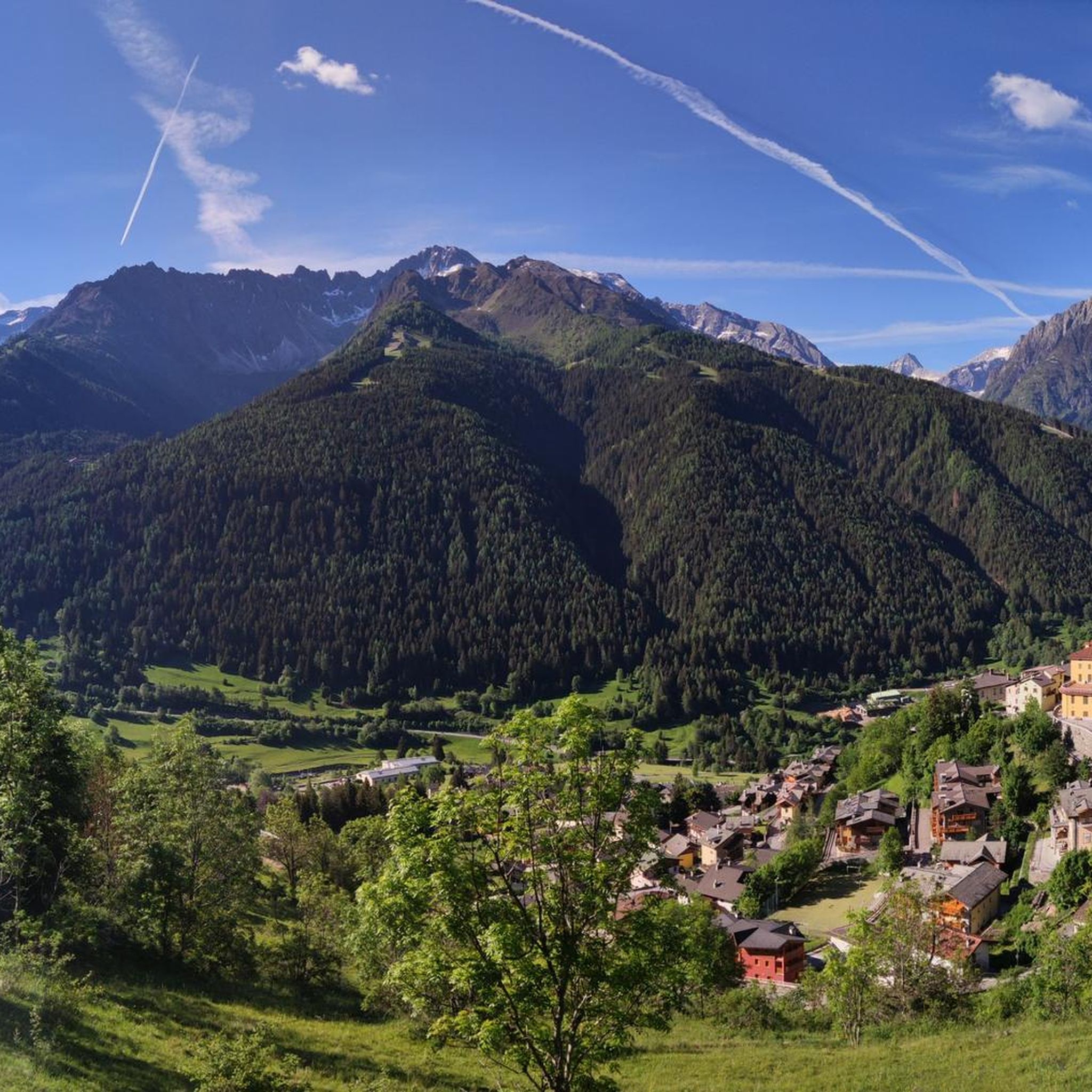
Gravel biking around Temù offers routes through the mountainous terrain of Lombardy, Italy, characterized by the Val Camonica Valley and the Adamello massif. The region features significant alpine passes, including the Passo dell'Alpe, which transitions from paved roads to dirt tracks. Riders can expect diverse landscapes, from lush valleys to serene alpine lakes like Lago Benedetto, providing varied terrain for gravel cycling.
Best gravel bike trails around Temù
- The most popular gravel bike trail is Case di Viso Alpine Village – Angelo Bozzi Hut loop from Ponte di Legno, a 19.2 miles (30.8 km) trail that takes 3 hours 47 minutes to complete. This difficult route explores the Ortles-Cevedale group within Stelvio Park.
- Another top favourite among local gravel bikers is Forte Mero – Tonale Pass loop from Passo Tonale, a difficult 25.3 miles (40.7 km) path. This route features significant elevation changes around the Tonale Pass.
- Local gravel bikers also love the Valle Camonica Cycle Path – Ciclovia dell'Oglio loop from Malga Caldea, a 39.0 miles (62.7 km) trail leading through the Valle Camonica, often completed in about 5 hours 56 minutes.
- Gravel biking around Temù is defined by mountainous terrain, alpine passes, and serene lakes. The network offers options for challenging rides requiring good fitness and advanced skills.
- The routes in Temù are highly rated by the komoot community with an average score of 4.5 stars from more than 10 reviews. More than 140 gravel bikers have used komoot to explore Temù's varied terrain.
Last updated: October 7, 2026
5.0
(5)
35
riders
30.8km
02:51
1,250m
1,260m
Hard gravel ride. Very good fitness required. Mostly paved surfaces. Suitable for all skill levels.
4.5
(2)
14
riders
40.7km
04:13
1,470m
1,470m
Hard gravel ride. Very good fitness required. Mostly paved surfaces. Suitable for all skill levels.

5.0
(3)
61
riders
28.0km
02:29
1,110m
1,110m
Hard gravel ride. Very good fitness required. Mostly paved surfaces. Suitable for all skill levels.
4.5
(2)
37
riders
100km
07:30
2,500m
2,500m
Hard gravel ride. Very good fitness required. You may need to push your bike for some segments of this route.
5.0
(1)
9
riders
20.2km
01:58
930m
930m
Hard gravel ride. Very good fitness required. Mostly paved surfaces. Suitable for all skill levels.
Get access to more routes and recommendations from other explorers.
Already have an account?
Our route recommendations are based on thousands of hikes, rides, and runs completed by other people on komoot.
Start today with a free account
Your next adventure awaits.




Tips from the Community


The Military Shrine of Passo del Tonale is a monumental ossuary monument located at 1,884 meters above sea level on the geographical border between Lombardy and Trentino-Alto Adige. It commemorates the fallen of the so-called "White War", the extremely harsh high-altitude battles fought on the Adamello and Ortles massifs during World War I.
0
0

The fort was built between 1911 and 1913 and represented the connecting work between Forte Saccarana and Forte Presanella. It was a medium-sized fortification, made of compressed concrete and iron beams. Specifically, the fort was intended to block the road leading to the Tonale Pass. It was designed by Lieutenant Hugo Hartmann of the Engineers, at a cost of 500,000 crowns.[1] The fortified structure had a short lifespan as Italian artillery hit and demolished it in 1916. What remained was arranged to house a field hospital for the Tonale line.
0
0

There's brand new tarmac laid on this old road, access is now permitted on foot or bicycle. Inauguration took place on July 4th 2026.
0
0

They made a cycle path on the side, very beautiful, with a monument to the alpine troops.
0
0

There's strength in calmness; the climb is tough. Remember to look over your shoulder every now and then; the view is magnificent.
0
0

it is the military shrine dedicated to the Italian and Austrian fallen in various wars, in some cases found due to the melting of glaciers
1
0

from Vezza d'Oglio onwards, it is very reminiscent of the Sentiero Valtellina - Approved !!!
0
0
Frequently Asked Questions
How challenging are the gravel bike trails around Temù?
The gravel bike trails in Temù are generally considered difficult, requiring good fitness and advanced skills. The terrain is mountainous, featuring significant elevation gains and alpine passes. For example, the Ponte di Legno – Case di Viso Alpine Village loop involves over 1,100 meters of ascent.
Are there any circular gravel bike routes in Temù?
Yes, many of the gravel bike routes in Temù are designed as loops. A notable option is the Valle Camonica Cycle Path – Ciclovia dell'Oglio loop from Malga Caldea, which offers a substantial 62.7 km ride through the scenic Valle Camonica.
What kind of landscapes can I expect to see while gravel biking in Temù?
Gravel biking in Temù offers diverse landscapes, from the lush Val Camonica Valley and the serene Oglio River to dramatic alpine scenery. You'll encounter significant mountain passes like the Passo dell'Alpe (2461 m), charming alpine villages such as Case di Viso, and views of the Adamello massif.
Are there any historical or cultural landmarks along the gravel bike routes?
Yes, the region is rich in history. The broader Valcamonica is a UNESCO World Heritage site known for its prehistoric rock carvings. Along the trails, you might pass through charming settlements like Vezza d'Oglio and Precasaglio, or see historical structures such as the Church of San Bartolomeo.
When is the best time of year to go gravel biking in Temù?
The best time for gravel biking in Temù is typically from late spring to early autumn (May to October), when the alpine passes are clear of snow and the weather is most favorable. Winter conditions can make many routes inaccessible due to snow and ice.
Are the gravel bike trails in Temù suitable for families?
Given that all listed gravel bike routes in Temù are rated as difficult with significant elevation changes, they are generally not recommended for young children or families seeking easy, flat rides. These trails are better suited for experienced riders.
Can I bring my dog on the gravel bike trails in Temù?
While specific regulations for dogs on gravel bike trails in Temù are not detailed, it's generally advisable to keep dogs on a leash, especially in protected areas like Stelvio Park, and to ensure they are fit enough for challenging, long-distance rides. Always carry water for your pet.
What do other gravel bikers enjoy most about gravel biking in Temù?
The komoot community highly rates the gravel biking experience in Temù, with an average score of 4.25 stars. Riders often praise the breathtaking alpine scenery, the challenging nature of the routes, and the diverse terrain that ranges from riverside paths to high mountain passes.
Are there any amenities like cafes or places to stop for refreshments along the routes?
Yes, many routes pass through or near charming villages like Vezza d'Oglio and Precasaglio, where you can find cafes and local eateries. Mountain refuges such as the Malga Stain Hut also provide resting points and refreshments on more demanding trails.
Is parking available at the trailheads in Temù?
Yes, parking is generally available in the villages and towns that serve as starting points for these routes, such as Ponte di Legno, Passo Tonale, and Vione. It's advisable to check local signage for specific parking regulations and fees.
Can I reach the gravel bike trails in Temù using public transport?
Temù and the surrounding Alta Valcamonica region are accessible by public transport, though options might be limited for reaching specific remote trailheads. Buses connect the main towns and villages, which can serve as starting points for many routes. It's recommended to check local bus schedules in advance.
What is the longest gravel bike route available in Temù?
One of the longest gravel bike routes in the area is the Valle Camonica Cycle Path – Picnic Area in Vezza d'Oglio loop from Vione, covering approximately 71.4 km with significant elevation changes.
Most popular attractions around Temù

Get inspired with the komoot mobile app


Explore more
Browse the best Gravel rides in other regions.
