The best gravel rides around Döllstädt
3.7
(5)
38
riders
3
rides
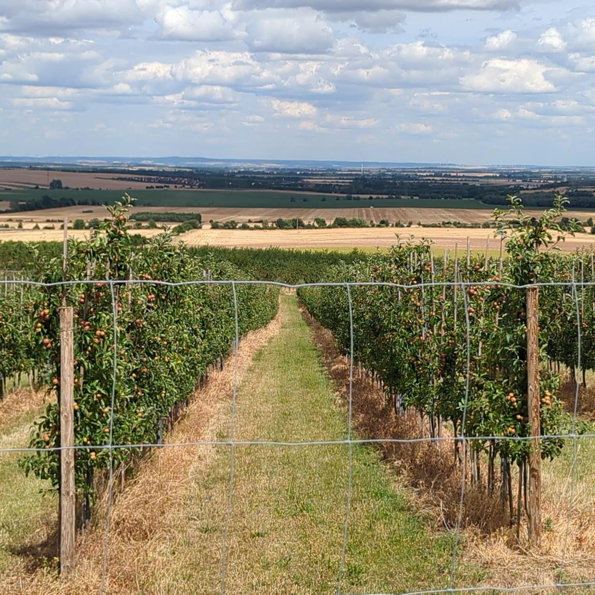
Gravel biking around Döllstädt offers diverse landscapes characterized by gentle hills, expansive meadows, and dense forests at the foot of the Thuringian Forest. The region features the Unstrut Valley with its meandering river and pollarded willows, providing varied terrain for cycling. Elevated areas like the Fahner Höhe offer expansive views, while agricultural landscapes with extensive orchards contribute to the scenic routes.
Best gravel bike trails around Döllstädt
- The most popular gravel bike trail is Fahner Höhe Forest Trails loop from…
Last updated: July 2, 2026
11
riders
48.1km
03:29
630m
630m
Hard gravel ride. Very good fitness required. You may need to push your bike for some segments of this route.
5.0
(3)
17
riders
39.2km
02:10
350m
350m
Moderate gravel ride. Good fitness required. Mostly paved surfaces. Suitable for all skill levels.

Sign up for free
3.0
(1)
5
riders
37.9km
02:25
430m
430m
Moderate gravel ride. Good fitness required. Mostly paved surfaces. Suitable for all skill levels.
3.0
(1)
4
riders
35.2km
01:51
270m
270m
Moderate gravel ride. Good fitness required. Mostly paved surfaces. Suitable for all skill levels.
1
riders
34.3km
01:56
200m
200m
Moderate gravel ride. Good fitness required. Mostly paved surfaces. Suitable for all skill levels.
Our route recommendations are based on thousands of hikes, rides, and runs completed by other people on komoot.
Start today with a free account
Your next adventure awaits.
Login or Signup
Tips from the Community

Secret tip for the 🐻🌱 time, mega. Nice hut, rightly there is a stamp here.
8
0
Refreshing is the spring on hot days.
8
0

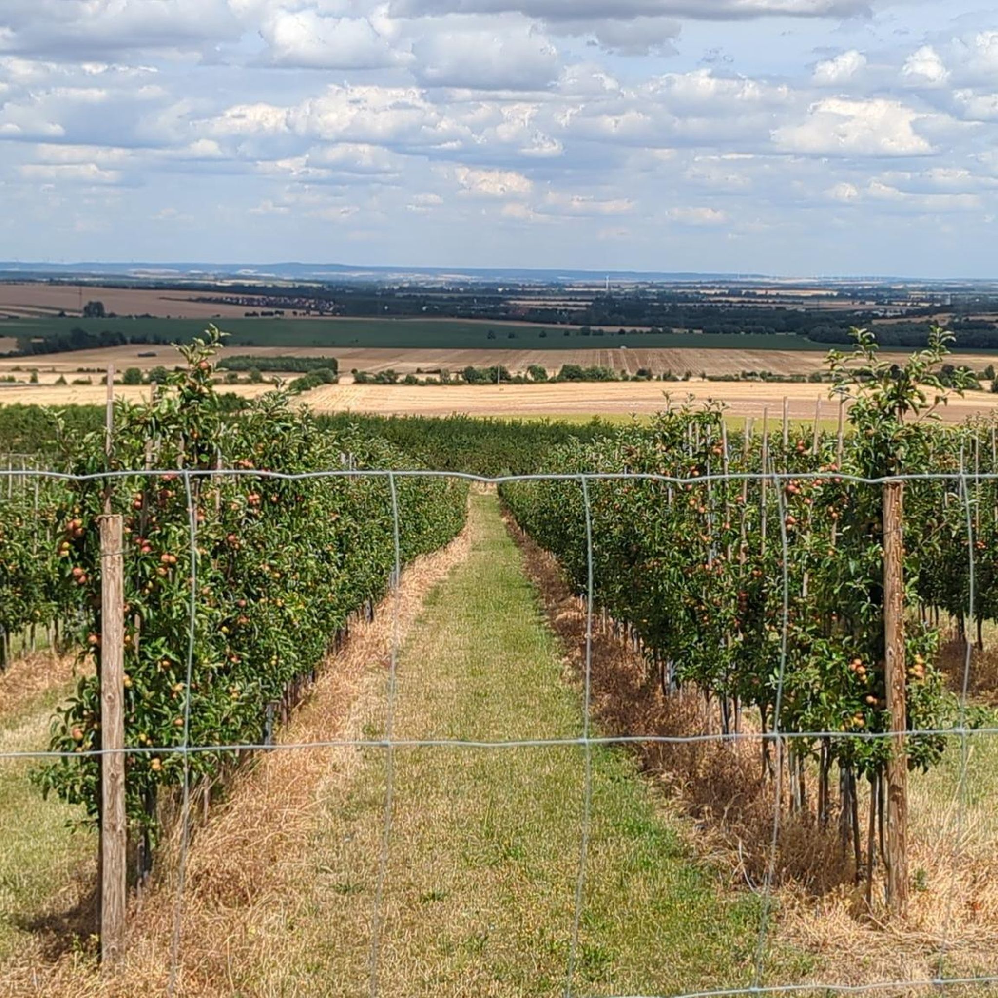
When the fruit trees bloom .......
1
0

The Nesseltal Cycle Path runs, among other things, along a former railway line between Eisenach and Nessetal, then continues towards Erfurt, offering a particularly pleasant and well-developed route. Largely paved, with gentle inclines and plenty of natural surroundings, it's perfect for leisurely cyclists, families, and touring cyclists. Along the way, there are numerous beautiful views and small villages that invite you to take a break.
2
0

a great rest and refreshment stop for cyclists
0
0


Located directly on the bike path and looks very nice.
0
0
Nice and relaxing rest area with a view.
0
0
Frequently Asked Questions
What kind of terrain can I expect on gravel bike trails around Döllstädt?
The region around Döllstädt offers diverse landscapes, characterized by gentle hills and verdant meadows at the foot of the Thuringian Forest. You'll encounter varied terrain, including stretches along the meandering Unstrut River, elevated areas like the Fahner Höhe with expansive views, and agricultural landscapes with extensive orchards. Routes can range from moderate to more challenging with significant elevation changes.
Are there any easy or family-friendly gravel bike routes in Döllstädt?
While the guide focuses on moderate to difficult routes, the region's network of cycling paths includes options suitable for different ability levels. For a route with less elevation, consider the Gera Cycle Path – Terrace Bank Erfurt loop from Walschleben, which follows the Unstrut Valley and has minimal elevation gain, making it potentially more accessible for families or beginners.
What natural features or landmarks can I see along the gravel bike trails?
You can explore several natural highlights and points of interest. The Unstrut Valley Nature Reserve offers a beautiful stretch along the Unstrut River, known for its pollarded willows and diverse birdlife. The Fahner Höhe provides expansive views of nearby villages and the Thuringian Forest. You might also encounter the Spring at the Weiße Hütte or the Weiße Hütte itself, which is a Thuringia Stamp Point.
What do other gravel bikers enjoy most about gravel biking in Döllstädt?
The area is highly rated by the komoot community, with an average score of 4.9 stars from over 8 reviews. Reviewers often praise the varied terrain, the scenic views from elevated points like the Fahner Höhe, and the tranquility of routes through nature reserves and agricultural landscapes.
Are there any circular gravel bike routes around Döllstädt?
Yes, many of the gravel routes in the Döllstädt area are designed as loops. For example, the challenging Fahner Höhe Forest Trails – Seven Graves Memorial loop from Elxleben and the moderate Gierstädt Observation Tower – Lohmühle Watermill loop from Gierstädt are both excellent circular options.
When is the best time of year to go gravel biking in Döllstädt?
The region is enjoyable for gravel biking through spring, summer, and autumn. Spring brings blooming orchards, while summer offers lush green landscapes. Autumn provides beautiful foliage. Winter conditions can vary, so it's best to check local weather forecasts for snow or ice before planning a ride during colder months.
Can I bring my dog on the gravel bike trails around Döllstädt?
Many natural areas and trails around Döllstädt are generally dog-friendly, especially if your dog is accustomed to cycling alongside you. However, always keep your dog on a leash, especially in nature reserves like the Unstrut Valley, and be mindful of local regulations, wildlife, and other trail users. Ensure your dog is well-behaved and doesn't disturb livestock in agricultural areas.
Where can I find parking for gravel biking trails near Döllstädt?
Many routes start from nearby towns or villages, which typically offer public parking options. For instance, routes like the Fahner Höhe Forest Trails loop starts from Elxleben, and the Gierstädt Observation Tower loop begins in Gierstädt. Look for designated parking areas in these starting locations.
Are there cafes or restaurants near the gravel bike paths in Döllstädt?
The villages and towns surrounding Döllstädt, such as Gierstädt, Elxleben, or Walschleben, offer various local cafes and restaurants where you can refuel after your ride. While specific establishments directly on the trails might be limited, you'll find options within a short distance of the route starting and ending points.
What is the elevation profile like on Döllstädt's gravel routes?
The gravel routes around Döllstädt feature a mix of rolling hills and flatter sections. You can expect moderate elevation changes, with some routes like the Fahner Höhe Forest Trails loop including significant climbs and descents, reaching over 600 meters of elevation gain. Other routes, such as those along the Unstrut Valley, are relatively flatter.
Are there any nature reserves I can cycle through in the Döllstädt area?
Yes, the Unstrut Valley Nature Reserve is a prominent natural area where you can cycle. It features a beautiful stretch along the Unstrut River with its original, meandering riverbed, providing a habitat for numerous insects and birds. The banks are lined with pollarded willows and dense vegetation, offering a tranquil cycling experience.
Is public transport available to reach the gravel biking areas, and can I bring my bike?
Döllstädt and surrounding communities are connected by local public transport. Availability for bringing bikes can vary depending on the specific bus or train service and time of day. It's advisable to check the local public transport provider's website for their bike carriage policies and schedules before planning your trip.
Most popular attractions around Döllstädt

Get inspired with the komoot mobile app


Explore more
Browse the best Gravel rides in other regions.
