The best gravel rides around Weilen unter den Rinnen
3.9
(14)
63
riders
11
rides
Gravel biking around Weilen unter den Rinnen offers diverse terrain within the Southwest Albvorland and the High Swabian Alb. The region is characterized by its position at the Albtrauf, the edge of the Swabian Alb, with elevations ranging from 672 meters in the valley to 872 meters in the southeast. This varied topography includes dramatic gorges and waterfalls, providing a mix of inclines and descents suitable for gravel exploration. The area is also part of the Upper Danube Nature Park,…
Last updated: July 2, 2026
5.0
(3)
10
riders
37.9km
02:32
570m
570m
Hard gravel ride. Very good fitness required. Mostly paved surfaces. Suitable for all skill levels.
3.0
(1)
8
riders
46.7km
02:58
720m
720m
Hard gravel ride. Very good fitness required. Mostly paved surfaces. Suitable for all skill levels.

Sign up for free
4.0
(1)
7
riders
24.6km
01:40
480m
480m
Hard gravel ride. Very good fitness required. Mostly paved surfaces. Suitable for all skill levels.
4.0
(1)
6
riders
31.9km
02:07
580m
580m
Hard gravel ride. Very good fitness required. Mostly paved surfaces. Suitable for all skill levels.
5.0
(1)
8
riders
48.5km
03:05
790m
790m
Hard gravel ride. Very good fitness required. Mostly paved surfaces. Suitable for all skill levels.
Get access to more routes and recommendations from other explorers.
Sign up for free
Already have an account?
Our route recommendations are based on thousands of hikes, rides, and runs completed by other people on komoot.
Start today with a free account
Your next adventure awaits.
Login or Signup
Tips from the Community


History of the Parish Church of St. Martin The church, built in the early Gothic style, was constructed in 1885/86 according to the plans of architect Joseph Cades. After completing his training, Cades joined the construction workshop of Ulm Minster, where he was primarily entrusted with the design of the two choir towers. His first church building as an independent architect was the Catholic Parish Church of St. Martin in Dotternhausen. The Dotternhausen St. Martinus Church is an early Gothic pillar basilica, meaning a three-nave, longitudinally oriented church. Its elevated central nave is illuminated by a window zone in the upper part (a so-called clerestory). A triumphal arch separates the slightly elevated choir area. The central nave is separated from the side naves by arcades on pillars. The ratio of the width of the central nave to the width of the side naves is 2:1, which is typical for the construction methods of that time. In 1986, the St. Martinus parish community in Dotternhausen celebrated the 100th anniversary of the consecration of their parish church. The entire population was invited to the festive service and the subsequent community celebration. Considerations for the interior renovation became concrete after the 100-year celebration. After a year of interior renovation, the reopening of our parish church St. Martinus could be celebrated on Sunday, April 10, 1994. The innovations: In the choir, the altar, ambo, baptismal font, stele, sedilia, and the color-coordinated windows. The two side altars, in the right side aisle the crucifixion group with tabernacle, in the left the veneration of the Mother of God. In the front choir area hangs the restored painting of St. Martin of Tours, which still dates from the old baroque church, i.e., from before 1885. It also shows the Resurrection of Christ and should have an effect on the entire church from its place. The modern art on the walls in a church built in the neo-Gothic style is an example of temporal change and development in our church, which constantly needs change and renewal. This gem should be preserved. Source: http://kirche-dotternhausen.de/foerderverein/pfarrkirche.html
1
0
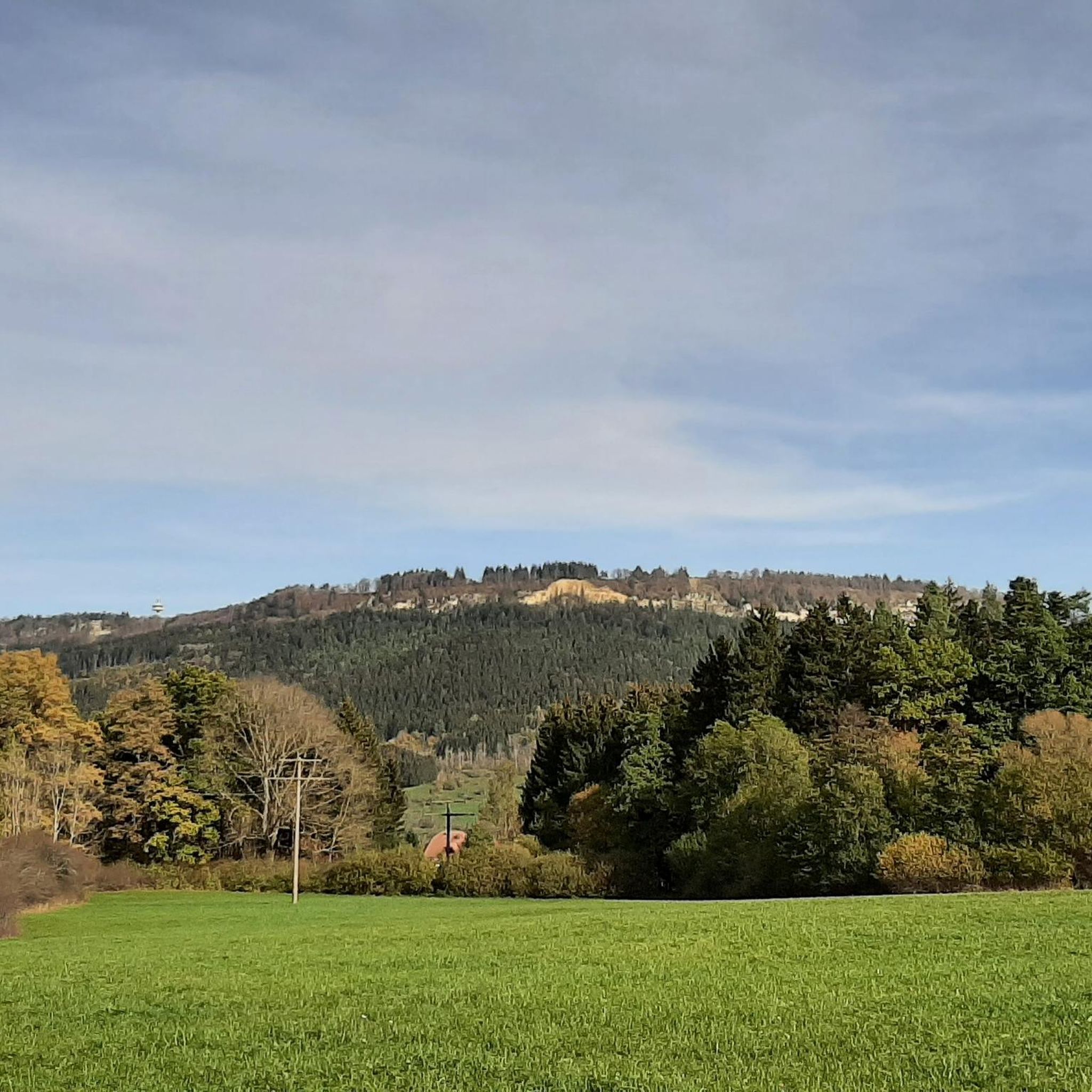
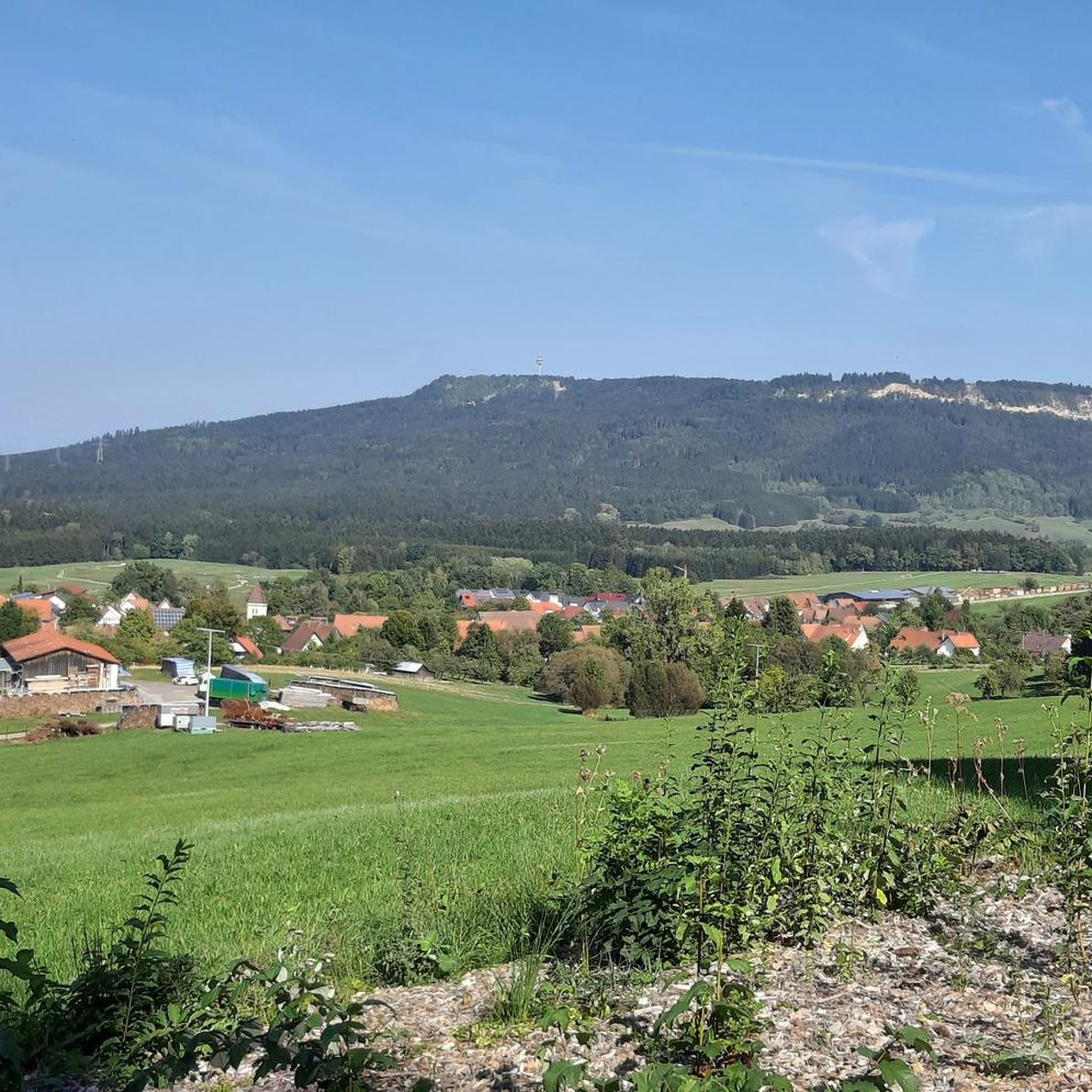
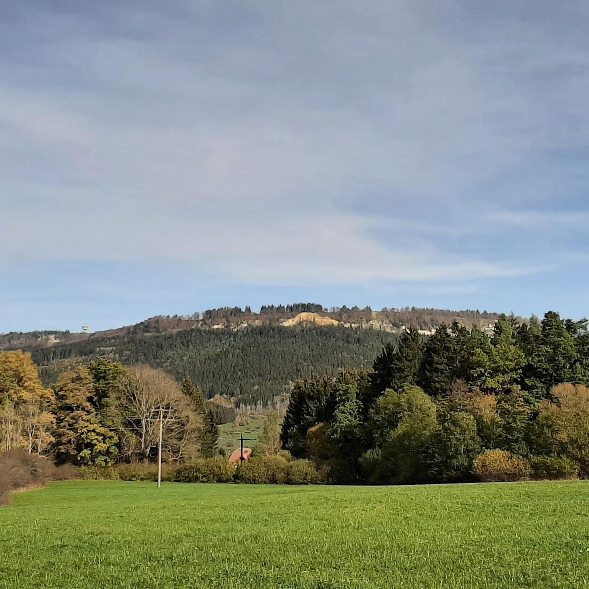
Beautiful view of the Plettenberg with its tower
0
0
The Schlichemtalsperre (also Schömberger Stausee, usually just called Stausee locally) east of Schömberg in Baden-Württemberg dams the Schlichem, a tributary of the Neckar coming from the Swabian Jura. The 90.6-hectare Schömberger Stausee mit Palmbühl landscape protection area surrounds the Schlichemtalsperre. The approximately 1.35 km long and initially narrow reservoir, which widens to about 175 m towards the end, with an area of 10.4 hectares at 643.8 m above sea level, begins at the hamlet of Untere Säge and extends to the old town center of Schömberg. It has a catchment area of approximately 33.5 km², to which the Schlichem, which is already over 11 km long at the inflow, contributes almost 90%. The Hölzlegraben from the forest to the right of the lake and the Scheubühlgraben and Räßentälebach from the left flow into it. From the Vorsee forebay near the Untere Säge, a fish ladder leads to the reservoir. There is also the only bridge over the lake that can be walked and driven on. The Schlichem Viaduct can only be used by the railway. The Schlichemtalsperre was built between 1940 and 1944. The Portlandzementwerk Rudolf Rohrbach KG (today Holcim (Süddeutschland) GmbH) based in neighboring Dotternhausen, which was the client for the dam, initially used it for cooling water and electricity generation. An outdoor swimming pool built in 1935 was flooded. After the Second World War, the facility was taken over by the state of Württemberg-Hohenzollern in 1948. The reservoir was renovated from 1975 to 1983. The dam is an earth dam, and the hydropower plant within it has a capacity of 60 kW. There is a forebay, the Vorsee, which was built from 1975 to 1977. Source: https://de.wikipedia.org/wiki/Schlichemtalsperre
3
0

Chapel on the Ortenberg
7
0
The Roman Catholic parish church of St. Afra stands in Obernheim, a municipality in the Zollernalb district of Baden-Württemberg. The parish belongs to the Diocese of Rottenburg-Stuttgart. The building is listed as a historical monument by the State Office for the Preservation of Monuments in Baden-Württemberg. The hall church, originally built between 1753 and 1755 according to plans by Johann Caspar Bagnato, was incorporated into a new building in 1924 as a transept, based on a design by Wilhelm Friedrich Laur. The former nave, spanned by a barrel vault, and the chancel are decorated with frescoes by Giuseppe Appiani. The Assumption of Mary is depicted in the nave, and the Trinity in the chancel. Four Church Fathers are depicted on the pulpit parapet, and Saint Wendelin on the sounding board. The organ on the gallery was built in 1973 as Opus 149 by Stehle Orgelbau. Source: https://de.wikipedia.org/wiki/St._Afra_(Obernheim)
1
0
A suspension bridge is being built near the EKS Tower in Rottweil's old town, and it is scheduled to be inaugurated next year!
3
0

Frequently Asked Questions
How many gravel bike trails are available around Weilen unter den Rinnen?
There are over 30 gravel bike routes to explore in the Weilen unter den Rinnen area. These routes offer a diverse range of experiences, from moderate to challenging, catering to various skill levels.
What is the general difficulty level of gravel biking routes in this region?
The gravel biking routes around Weilen unter den Rinnen are primarily categorized as moderate to difficult. You'll find 10 moderate routes and 20 difficult routes, offering plenty of challenges for experienced riders.
Are there any circular gravel bike routes in Weilen unter den Rinnen?
Yes, many of the gravel routes in the area are circular, allowing you to start and end at the same point. For example, the challenging Sebastian Chapel Balgheim – Car tunnel loop from Wehingen is a popular circular option covering 37.9 km.
What kind of landscapes can I expect on the gravel bike trails?
The region offers a varied topography, transitioning from the Alb foothills to the High Swabian Alb. You can expect a mix of inclines and descents, dramatic gorges, and scenic areas within the Upper Danube Nature Park. Routes like the Rottweil Old Town – View of Rottweil loop from Wehingen provide expansive views and challenging sections through this diverse landscape.
Are there any scenic viewpoints along the gravel routes?
Absolutely. Given the region's position at the Albtrauf and its varied elevations, many routes offer excellent scenic viewpoints. The View from Klippeneck – Klippeneck Plateau loop from Schömberg is specifically known for its stunning vistas from the Klippeneck plateau.
Can I find routes that pass by waterfalls or other natural features?
Yes, the area is known for its natural features, including the 'Schluchten der Rinnen am Albtrauf mit den Wasserfällen'. You can explore highlights such as the Eyach Waterfall at Balingen Castle or the Schlichem Waterfall (Hausen am Tann), which are accessible via dedicated komoot guides for waterfalls in the region.
What do other gravel bikers say about the routes in Weilen unter den Rinnen?
The routes in Weilen unter den Rinnen are highly rated by the komoot community, with an average score of 4.1 stars from 8 reviews. Over 40 gravel bikers have used komoot to explore the varied terrain, often praising the challenging sections and scenic beauty.
Are there any routes that explore valleys or specific natural areas?
Yes, for example, the Beeramühle – Bära Valley loop from Wehingen is a popular 50.4 km route that leads directly through the picturesque Bära Valley, offering a distinct natural experience.
What is the best season for gravel biking in Weilen unter den Rinnen?
While specific seasonal recommendations depend on weather, the diverse terrain and natural park setting make it enjoyable across multiple seasons. Spring and autumn often offer pleasant temperatures and vibrant scenery. Winter conditions can vary, so checking local forecasts is always advised.
Are there any lakes or reservoirs near the gravel biking trails?
Yes, the region features several beautiful lakes and reservoirs. You can find highlights such as the Schömberg Reservoir, Oberdigisheim Reservoir, and the Heuberg Lakes, which are often part of or accessible from nearby routes.
Are there any routes that pass through unique natural areas like juniper heaths?
Yes, you can find routes that traverse distinct natural landscapes. The Juniper Heath Lochen – View of Plettenberg loop from Weilstetten is an excellent example, taking you through a juniper heath with views of Plettenberg.
Most popular routes around Weilen unter den Rinnen
Most popular attractions around Weilen unter den Rinnen

Get inspired with the komoot mobile app


Explore more
Browse the best Gravel rides in other regions.
