The best gravel rides around Frammersbacher Forst
4.4
(46)
189
riders
25
rides
Gravel biking around Frammersbacher Forst offers a diverse landscape characterized by rolling hills, dense forests, and scenic river valleys within the Spessart Mountains. This middle mountain range provides a mix of challenging climbs and rewarding descents, alongside flatter sections found along river valleys. The extensive network of forest and field paths makes the region highly suitable for gravel bikes, catering to various fitness levels. The area's varied topography includes the Eichenberg, reaching 544 meters above sea level, offering diverse terrain…
Last updated: October 2, 2026
5.0
(4)
24
riders
48.1km
03:02
520m
510m
Hard gravel ride. Very good fitness required. Mostly paved surfaces. Suitable for all skill levels.
5.0
(2)
25
riders
91.3km
05:18
890m
890m
Hard gravel ride. Very good fitness required. Mostly paved surfaces. Suitable for all skill levels.

4.7
(3)
15
riders
45.2km
03:14
720m
720m
Hard gravel ride. Very good fitness required. Mostly paved surfaces. Suitable for all skill levels.
3.3
(3)
8
riders
24.6km
01:41
310m
310m
Moderate gravel ride. Good fitness required. Mostly paved surfaces. Suitable for all skill levels.
3
riders
41.6km
03:08
700m
700m
Hard gravel ride. Very good fitness required. Mostly paved surfaces. Suitable for all skill levels.
Get access to more routes and recommendations from other explorers.
Already have an account?
Our route recommendations are based on thousands of hikes, rides, and runs completed by other people on komoot.
Start today with a free account
Your next adventure awaits.
Popular around Frammersbacher Forst
Tips from the Community

The village of Wiesthal is located in the relatively narrow valley along the Aubach stream. The Catholic church stands slightly elevated approximately in the center of the village.
2
0
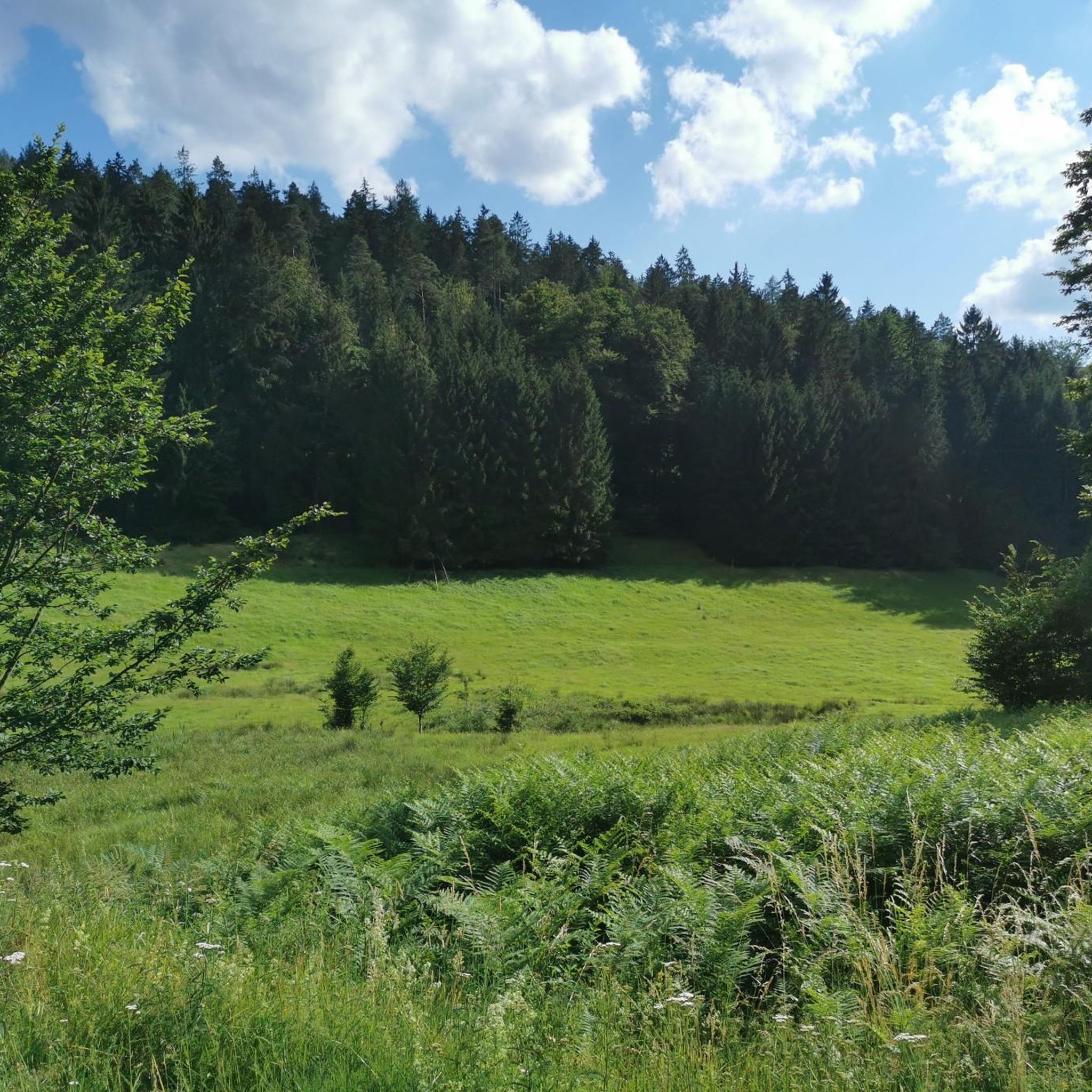
With a bit of luck, you might also see deer in the meadow.
2
0
After heavy downpours, the Lohr becomes a raging river.
1
0
The Aubach is a small stream/river that meanders gently through the idyllic Aubach valley in its upper reaches. After more than 20 km, the Aubach flows into the Lohr,
2
0
It's a fantastic and well-maintained water treading facility. Here, you're practically standing/walking in the riverbed—greatly done. A table and benches are provided for resting.
2
0

Lake Wiesbütt (formerly Lake Hanauer See) is a forest lake in the Main-Kinzig district of Hesse, in the Spessart region. Lake Wiesbütt is located in the municipality of Flörsbach in the municipality of Flörsbachtal, directly on the state border with Bavaria. The Bavarian/Hessian border runs along the western shore, at the foot of the dam. To the west lies the unincorporated area of Wiesener Forst in the Bavarian district of Aschaffenburg. To the north lies the Spessart High Road (L 2905) and the two old trade routes: Birkenhainer Straße and Eselsweg. To the southwest lies the village of Wiesen in Lower Franconia, to the southeast Mosborn, a district of the municipality of Flörsbachtal, and to the north Bieber, a district of the municipality of Biebergemünd. The artificial lake, created for energy generation and ventilation of the Bieber mines, is now located on the edge of the Wiesbüttmoor nature reserve. The lake has no surface inlet; it is fed underground from the Wiesbüttmoor. A natural overflow drains the water into the Aubachtal valley via the Wiesbüttgraben. The Wiesbüttsee, with its diverse flora, some of which is already threatened with extinction, is part of one of the last raised bogs in Germany. It was created in 1765 by Bieber miners according to plans by mining master Johann Philipp Cancrinus to ventilate and drain the Lochborntalgrund silver, copper, and lead mine tunnels in the summer. It was also intended to provide sufficient water for the Bieber ironworks and the hammer mill. Due to the exceptional ore deposits in the area around Bieber, extensive mining was carried out during this period. The Wiesbüttsee served as a water source for the hydropowered mining machines used to drain and ventilate the tunnels. The water power powered the conveyor system of the ironworks in the Lochhütte until 1925. The former customs house (later a restaurant) commemorates the Bavarian border that was once controlled here. Source: https://de.wikipedia.org/wiki/Wiesbüttsee
4
0


Frequently Asked Questions
What kind of terrain can I expect on gravel bike trails in Frammersbacher Forst?
The Frammersbacher Forst region, part of the Spessart Mountains, features a diverse landscape of rolling hills, dense forests, and scenic river valleys. You'll primarily encounter extensive networks of forest and field paths. The terrain can vary from smooth, well-maintained dirt roads to those with potholes, washboards, and loose corners, offering a mix of challenges for gravel enthusiasts.
Are there any easy or moderate gravel bike routes suitable for beginners?
Yes, while many routes are challenging, there are options for varying fitness levels. For a moderate ride, consider the Cycle Path Along the Lohr – Ruhm Mill, Wiesthal loop from Frammersbach, which is 15.3 miles (24.6 km) long and takes about 2 hours 15 minutes. The region's river valleys also offer flatter sections.
What natural attractions or viewpoints can I discover along the gravel trails?
The area is rich in natural beauty. You can find several lakes, such as Wiesbüttsee and Middle Aubachsee, which are popular destinations. The Spessartwiesen Nature Reserve – Habichsthal and Wiesbüttmoor Nature Reserve offer unique natural experiences. For panoramic views, the Himmeldunkberg lookout point near Frammersbach is highly recommended, especially at sunset.
Are there any historical landmarks or cultural sites accessible by gravel bike?
Absolutely. While not directly on every gravel route, the impressive 15th-century Mespelbrunn Castle is just 20 minutes from Frammersbach and makes for a wonderful cultural stop. The charming town of Lohr am Main, with its fairytale-like old town and the Spessart Museum, is also accessible and offers insights into local history.
What is the best time of year for gravel biking in Frammersbacher Forst?
The region is beautiful year-round, but spring and autumn are particularly rewarding. Spring brings lush greenery and blooming landscapes, while autumn offers vibrant colors in the extensive deciduous and mixed forests. Summer provides shade from the dense forests, and the undulating hills ensure engaging rides.
Are there any long-distance gravel routes in the area?
Yes, Frammersbacher Forst is part of the broader Spessart region, which boasts a well-developed network of routes. For a longer ride, consider the Karlstadt Old Town – Stettener Stein Vineyards loop from Partenstein, which spans 67.4 miles (108.4 km) and explores varied terrain including vineyards and forest paths.
Can I find circular gravel bike routes in Frammersbacher Forst?
Many of the gravel routes in Frammersbacher Forst are designed as loops, allowing you to start and finish at the same point. Examples include the Three Rivers Viewpoint – Sinn River loop from Partenstein and the Aubach Lakes – Habichsthal Fisherman's Hut loop from Frammersbach.
What do other gravel bikers enjoy most about Frammersbacher Forst?
The area is highly rated by the komoot community, with an average score of 4.3 stars from over 40 reviews. Cyclists often praise the diverse landscapes, the extensive network of forest and field paths, and the mix of challenging climbs and rewarding descents. The serene and immersive experience of cycling through dense forests is also frequently highlighted.
Are there options for parking when visiting Frammersbacher Forst for gravel biking?
Yes, Frammersbach and surrounding towns offer various parking options. Many trailheads and starting points for routes will have designated parking areas. It's advisable to check specific route details on komoot for recommended parking spots near your chosen starting point.
Is public transport available to reach Frammersbacher Forst with a bike?
Public transport options, including regional trains and buses, serve the Spessart region. Some services may allow bikes, often with specific restrictions or additional fees. It's recommended to check the local public transport provider's website for current regulations and schedules regarding bike transport to Frammersbach or nearby towns like Partenstein and Lohr am Main.
Are there any family-friendly gravel routes in Frammersbacher Forst?
While many routes involve significant elevation, the region does offer sections suitable for families, particularly along the river valleys. The Cycle Path Along the Lohr – Ruhm Mill, Wiesthal loop from Frammersbach, being a moderate route, could be a good option for families looking for a less strenuous ride.
Are there any cafes or places to stop for refreshments along the gravel trails?
Yes, towns and villages within and around Frammersbacher Forst, such as Frammersbach, Lohr am Main, and Wiesthal, offer cafes, pubs, and restaurants where you can stop for refreshments. Planning your route to pass through these locations can provide convenient breaks and opportunities to experience local hospitality.
Most popular routes around Frammersbacher Forst
Most popular attractions around Frammersbacher Forst

Get inspired with the komoot mobile app


Explore more
Browse the best Gravel rides in other regions.
